States with National Monuments
Home
Travel
Main NPS
New Mexico National Monuments
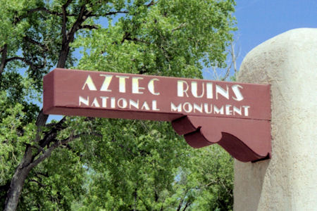
Aztec Ruins National Monument
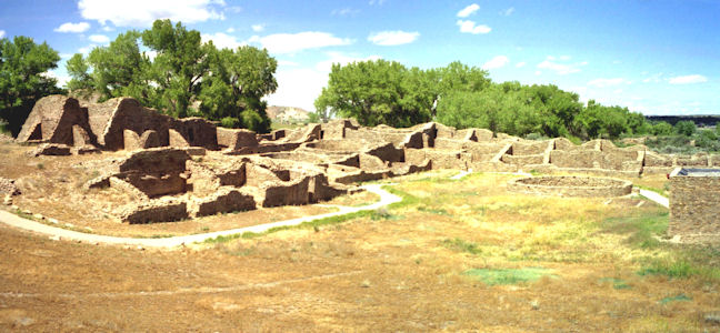
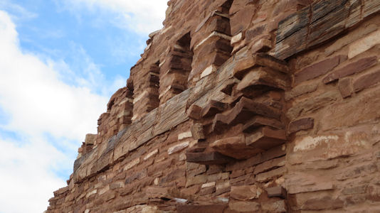
5/27/1997 Drove … to Aztec Ruins NM. This pueblo also built by the Anasazi (ancestral Pueblos) very similar to
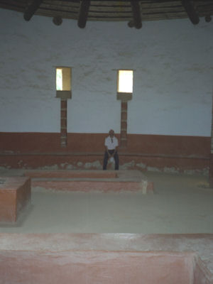
Chaco. Here though, there are some intact ceilings showing the wood construction. The Great Kiva is completely reconstructed giving a
great idea of the feeling of ceremonies long ago, in this huge space.
The park sign
|
A panorama of the ruins
|
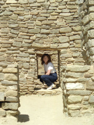
Maureen in a passageway
|
Inside the Great Kiva
|
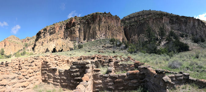
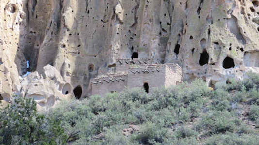
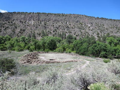
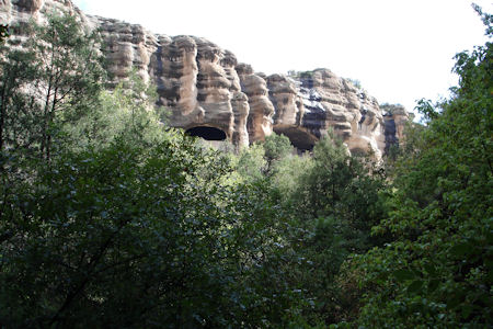
Bandelier National Monument
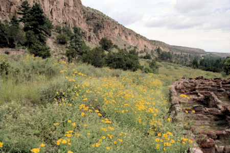
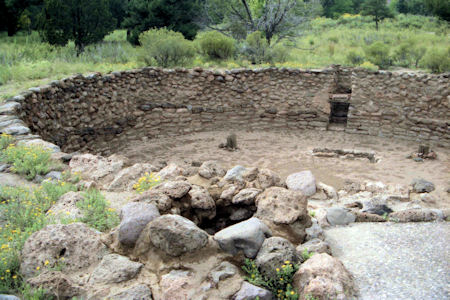
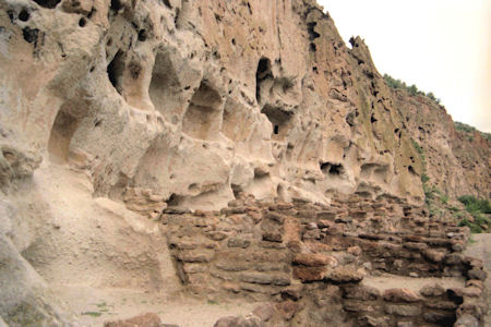
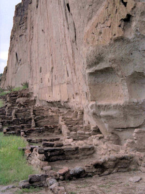
8/29/1988 Drove to Bandelier National Monument (about 2 hours) - saw cliff dwellings.
An overview with pretty flowers
|
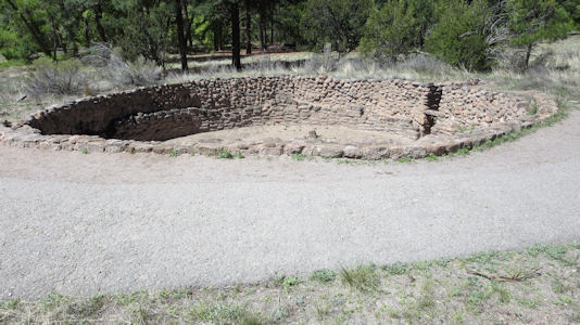
The Big Kiva
|
Cool construction on the cliffs ...
|
... and ground
|
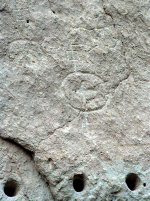
One of many petrglyphs
|
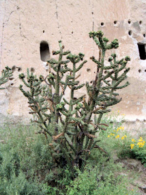
A cactus by the ruins
|
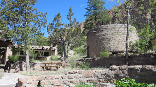
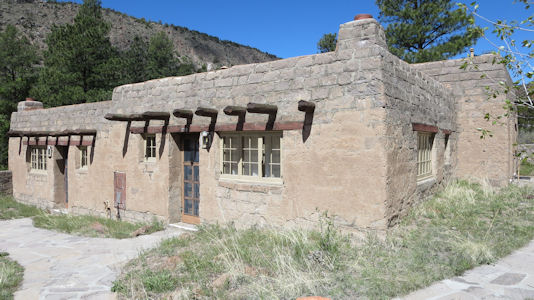
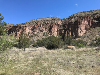
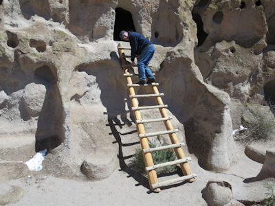
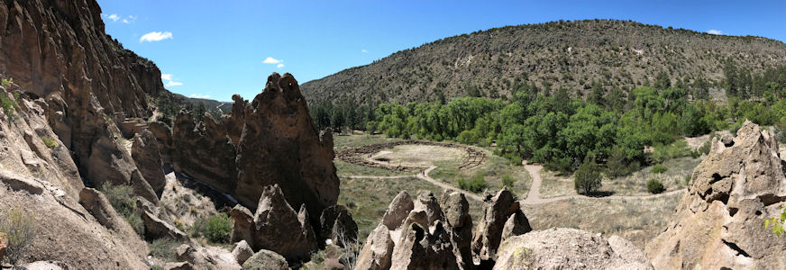
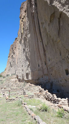
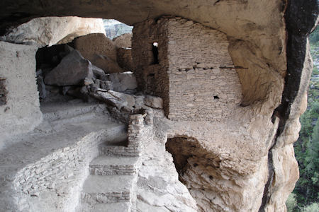
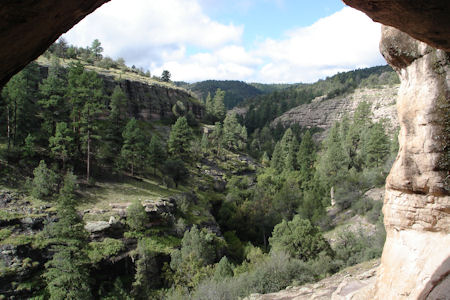
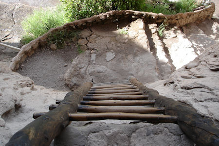
4/30/2017 We went a ways along the mountain roads to Bandelier NM. I have also been here, but many years ago and could only remember it a little. We parked at the VC area and strolled around there a little since the buildings actually comprise the Bandelier CCC NHL District. The 31 buildings built during the Depression by the Civilian Conservation Corps illustrate the guiding principles of National Park Service Rustic architecture, being based on local materials and styles. We picked up a trail map in the VC and got on the Main Loop trail. After passing some of the pueblo ruins on level ground, we started climbing ramps and stairs up to the cliff dwelling area. We were able to climb ladders up into little dwellings rooms that housed a surprising number of people. With the alternation of cool breeze and a little exercise, we were either hot with a jacket on or cool with it off. We completed the loop walk, and back at the VC we had a sandwich lunch in the snack bar.
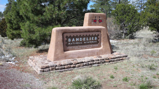
The park sign
|
Buildings in ...
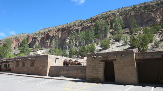
|
... the Bandelier CCC ...
|
... NHL District
|
A long view of the dwellings
|
The kiva
|
The cliffs over some ruins
|
Cool lodging
|
A look back at the kiva
|
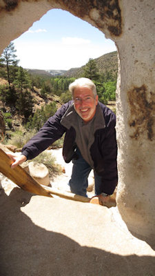
Me heading for a cave dwelling ...
|
... followed by Ken
|
A nice panorama from up high
|
Tall cliffs!
|
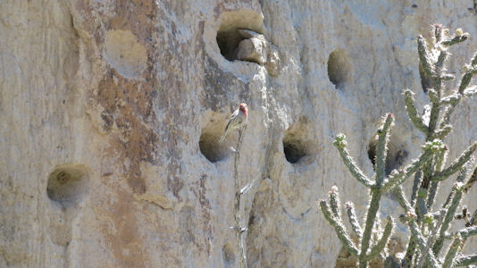
Local fauna
|
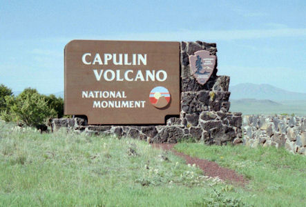
Capulin Volcano National Monument
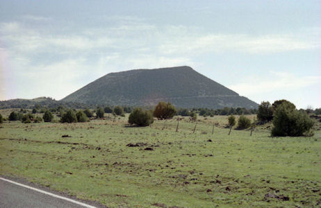
6/4/1995 Drove east of Raton to Capulin Mountain National Monument. This is an almost perfect volcanic cinder cone.
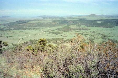
Drove around the cone to the top for a great view, and hiked down into the cone to the plug that formed when the volcano stopped.
The park sign
|
What an obvious cinder cone!
|
A great view from up on top
|
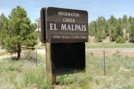
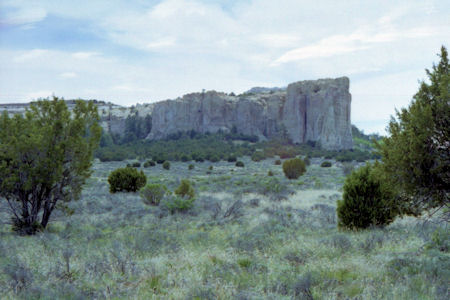
El Malpais National Monument
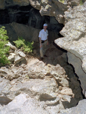
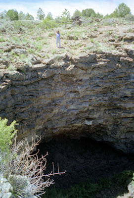
5/26/1997 … headed south to El Malpais NM. Also a volcanic area, here we took about a 2 mile trail seeing large
lava tubes and the cinder cone. There were lava tubes where you could go down in one and out the other. Really beautiful weather - cool,
breezy, warm sun, clear skies.
The park sign
|
Me in a tube cave ...
|
... and Maureen above a huge one
|
A view across the area
|
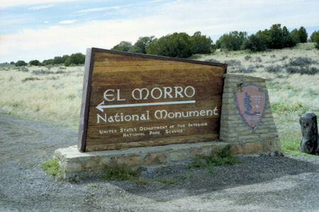
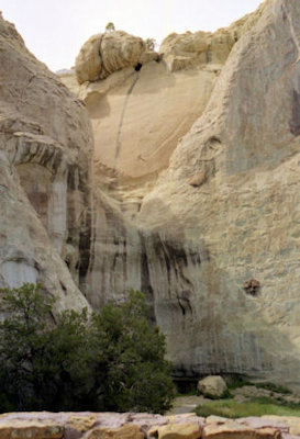
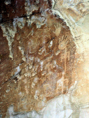
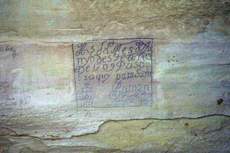
El Morro National Monument
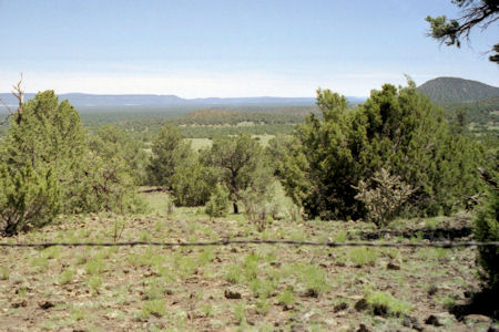
5/26/1997 Continued over the continental divide to El Morro NM. This is a huge stone mesa/cliff, at the base of
which is a huge pool of water. Many people - ancient Spaniards, explorers, 1800s military people, etc. have come here and carved names,
symbols and sayings into the rock. Quite fascinating hike through the pines viewing the carvings[, on the El Morro NRT].
The park sign
|
A view of the mesa
|
Anasazi ruins
|
Interesting petroglyphs
|
Spanish inscriptions
|
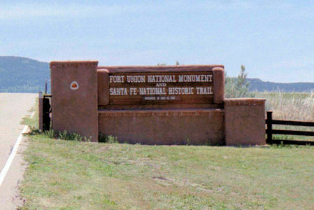
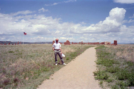
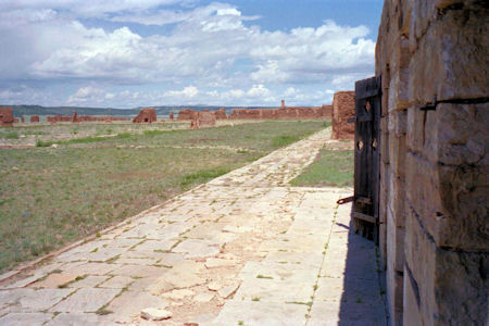
Fort Union National Monument
6/4/1995 South on I-25 to Fort Union National Monument - the ruins of an old Indian/Civil War/Santa Fe Trail [NHT in NM] fort.
The park sign
|
Me with the fort in the distance
|
Along a wall of the fort
|
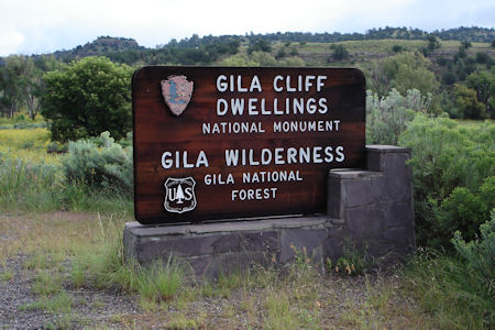
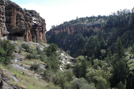
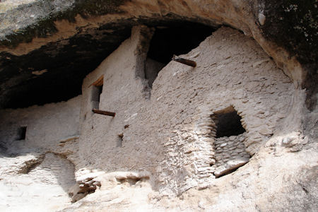
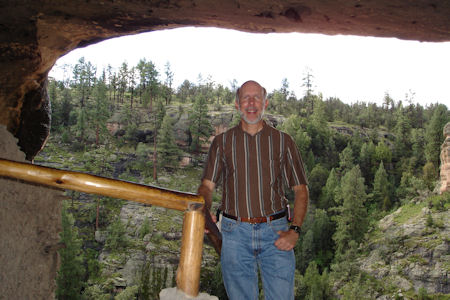
Gila Cliff Dwellings National Monument
9/12/2008 Due to the rain, decided to take the longer way to Gila Cliff Dwelling NM – glad I did when I later saw what I
avoided. Still had plenty of tight mountain roads to negotiate. [Both this way in and the alternate way out were on the Trail of the Mountain
Spirits Scenic Byway] As I neared the Monument the sun came out for some beautiful views of the mountains. Checked out the visitor center, then
drove the short ways to the trailhead. Took a beautiful trail climbing steeply at the end (steps) to the Mogollon cliff dwelling. Chatted for a
long time with a ranger (all by myself here) then went into the dwellings, and back on the trail (1 mile total) to the parking area.
The park sign
|
A long the trail, looking at the cliff dwellings
|
Getting closer ...
|
Amazing construction on the cliffs
|
Me from the inside
|
Another view of the dwellings
|
A view across the canyon
|
My way back
|
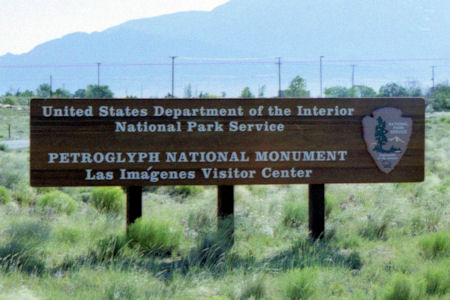
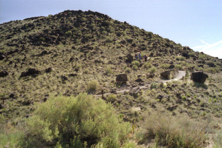
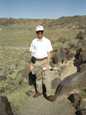
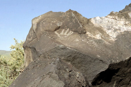
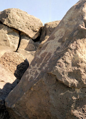
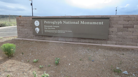
Petroglyph National Monument
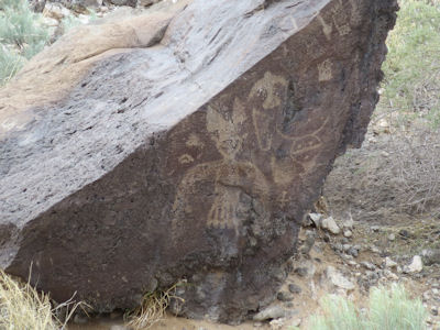
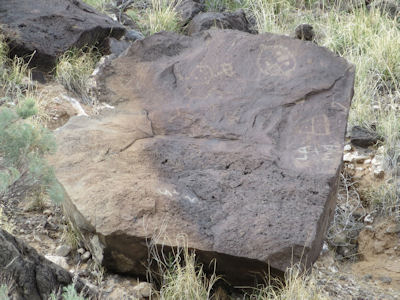
5/26/1997 Drove to Indian Petroglyph NM. After seeing the interim visitor center for orientation went to the Boca Negra area
to climb the lava escarpment. Thousands of petroglyphs in this area, and the trail afforded nice views of many, and of Albuquerque in the valley below.
The park sign
|
The Boca Ngra area
|
Me on the trail
|
Two of the many ..
|
... cool petroglyphs
|
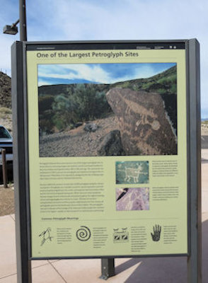
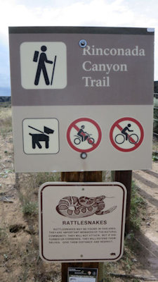
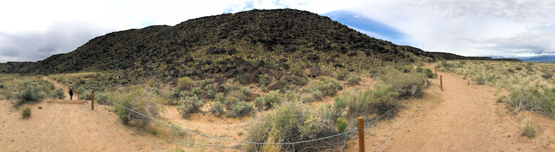
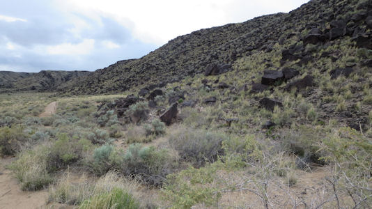
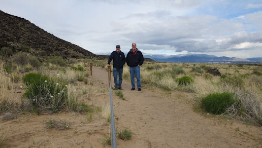
4/29/2017 ... we went west and parked at the Rinconada area of the Petroglyph NM. We got on the 2+ mile
trail and at first expected it was taking us to a prime viewing area. We then realized that there were glyphs all along the way,
but more scattered and requiring us to really look for them. Since it was getting late, we headed black on the trail, spotting
more glyphs we had missed before.
The park sign ...
|
... informative sign ...
|
... and trail sign
|
A panorama of the petroglyph area and trail
|
The volcanic field
|
A nice petroglyph
|
Another glyph
|
Me and Ken on the trail
|
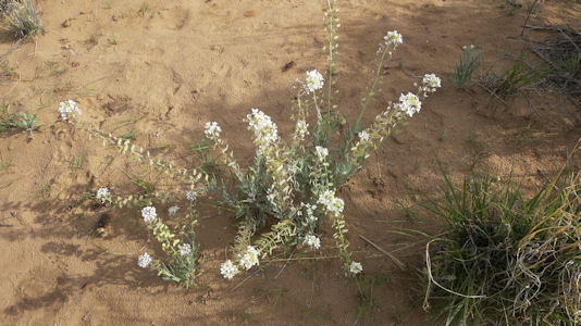
Trail flora
|
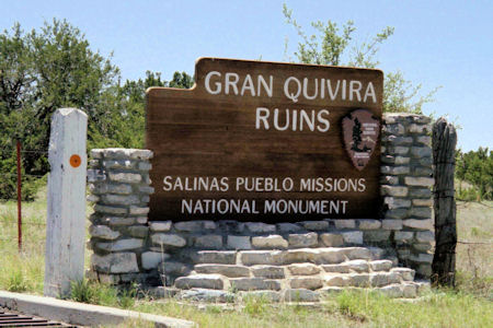
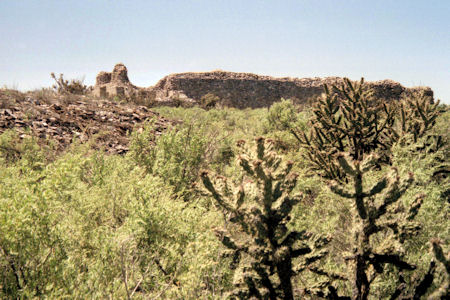
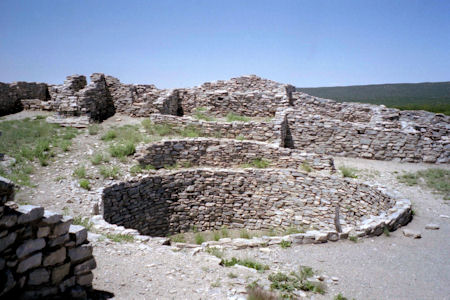
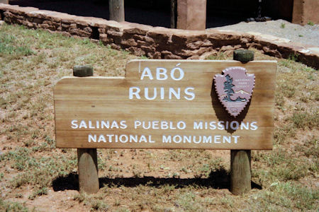
Salinas Pueblo Missions National Monument
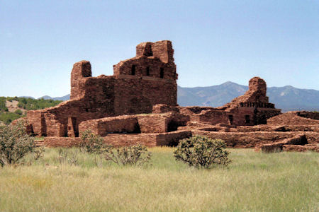
5/21/2001 … then drove to Mountainair and the visitor center for Salinas Pueblos NM. Saw a nice film ... Drove a ways to the
Grand Quivira Pueblo. Took a nice walk around the ruins of the pueblo and the Spanish church.
One park area sign
|
A view of the ruins from afar
|
Wall and Kiva ruins
|
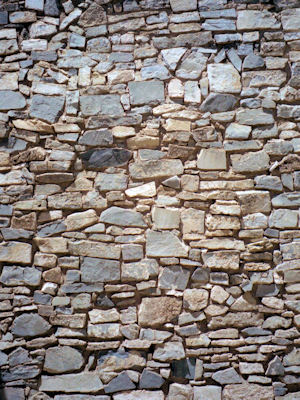
Detail of the construction
|
Great view out from the ruins
|
Another area sign
|
A pretty view across the ruins
|
A wide view of the ruins
|
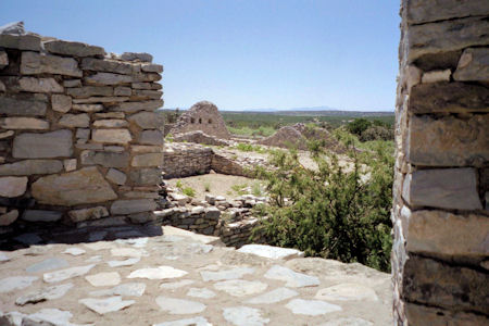
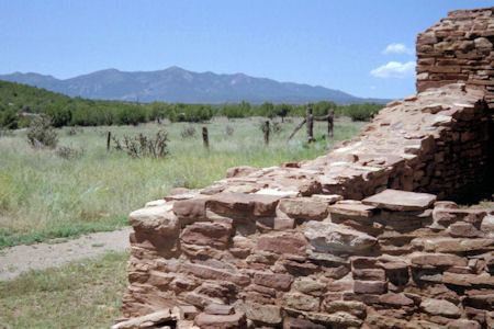
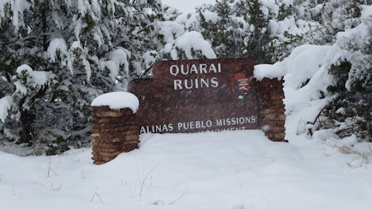
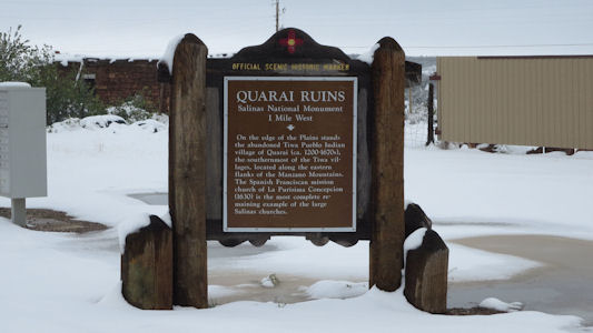
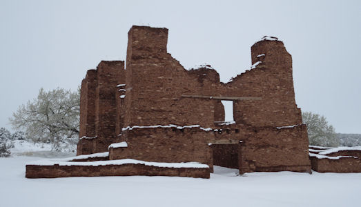
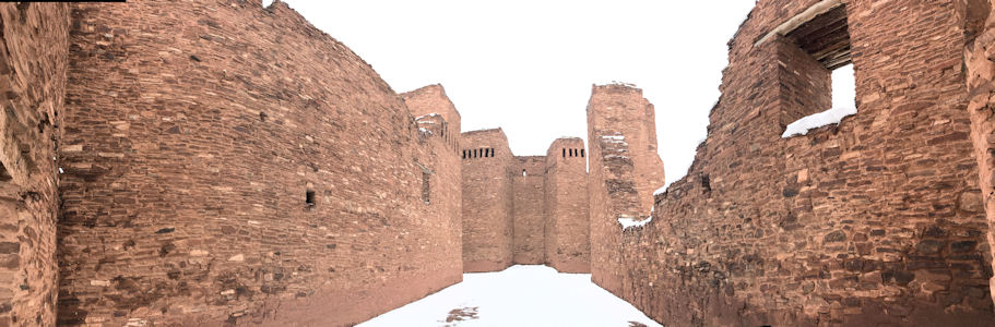
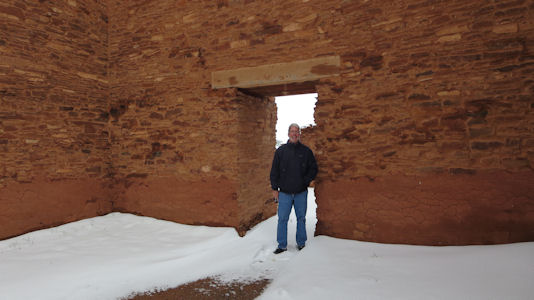
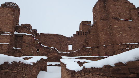
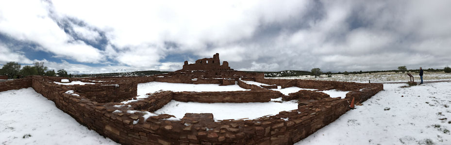
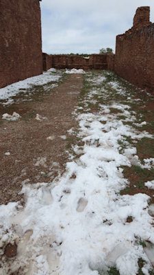
4/29/2017 As we pulled into the final stretch to Quarai, the pavement disappeared and snow was falling again. Not to be thwarted, we parked on a rise near the VC (parking lot was gated, and we were concerned about getting up the hill later). Quarai is an element of the Salinas Pueblo Missions NM and also an NHL District. The site encompasses the archaeological remains of prehistoric Native American settlements, historic remains of a pueblo that was abandoned in the 1670s during the Spanish colonial period, the ruins of a 17th-century Spanish mission compound, and 19th-century Spanish ranching artifacts. We donned our warm clothes and started walking to the ruins area. We couldn't see any pathway, and were often way over our shoe tops in snow. However, the snow stopped, it wasn't too windy, and by the time we got to the ruins we were just enjoying the situation, much different that we planned. We wandered around the ruins taking many unique photos that the snowfall offered. Finally we trudged back to the car with wet feet but having enjoyed it thoroughly. We headed back into town (roads better due to warming temperatures and plows coming through) and stopped at the VC, but it was closed so we continued to the Abo Pueblo as weather continued to improve. Also in the NM and an NHL, this is a pueblo ruin that is said to date back to the 1300s and a major trading station during its time. We walked around here on clean paths, noting the area where they actually built a new large church around the old functioning small one before finally taking down the old one.
The Quarai park sign ...
|
... and the state sign
|
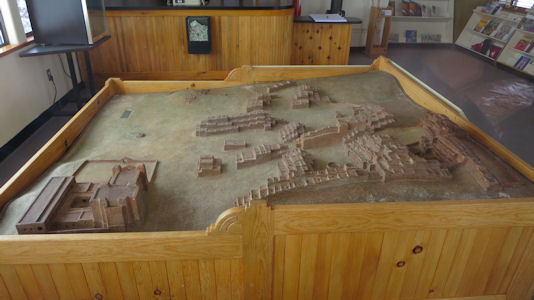
Diorama in the VC
|
Setting up for ...
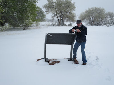
|
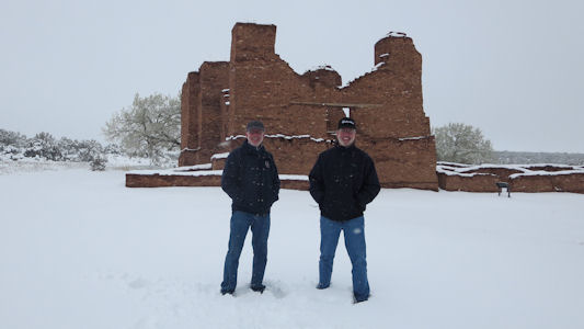
A photo of us both
|
The ruins
|
At the entrance
|
Me among the ruins ...
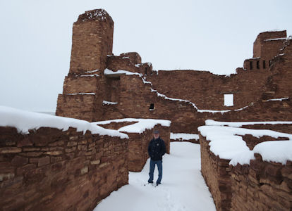
|
... and Ken
|
Me and Ken ...
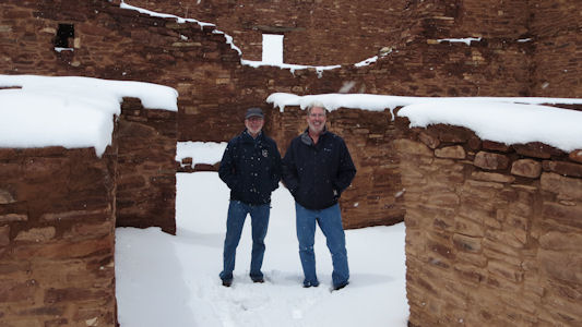
|
... in the ruins
|
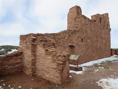
The Abo park sign ...
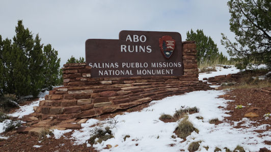
|
... and the state sign
|
Cool panorama of Abo
|
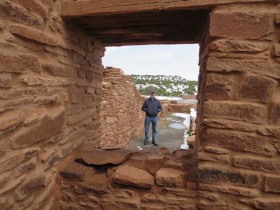
Ken through a window ...
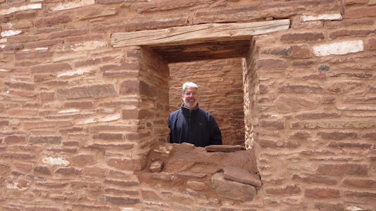
|
... and me
|
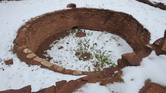
A kiva
|
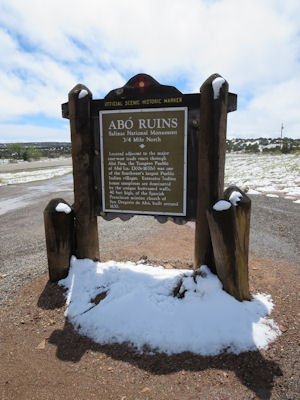
Signage near ...
|
... the church area
|
Wall details
|
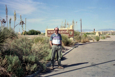
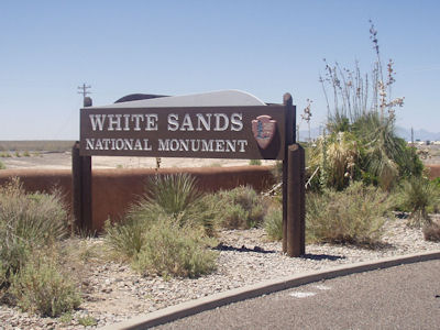
White Sands National Monument
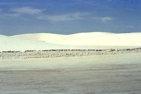
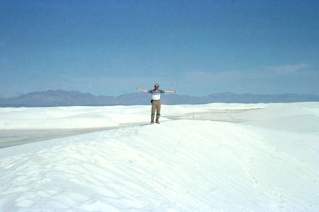
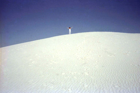
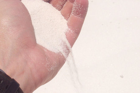
5/28/1994 Drove to White Sands National Monument. Huge pure white sand dunes (gypsum) for 10s of thousands of acres. Could
drive right up to dunes and walk on them. Park road had to be plowed to keep it open. Also walked on dunes, nature trail - saw Darkling beetles,
lizards, rabbit.
Me by the park sign
|
The dunes in the distance
|
The view on top
|
The view of me
|
Maureen gives a good sense of scale
|
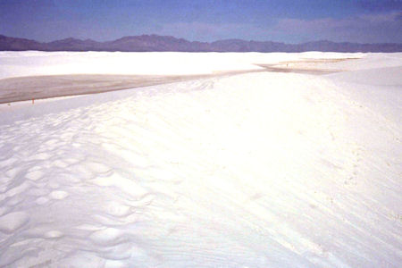
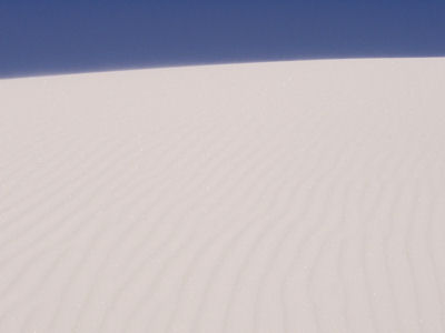
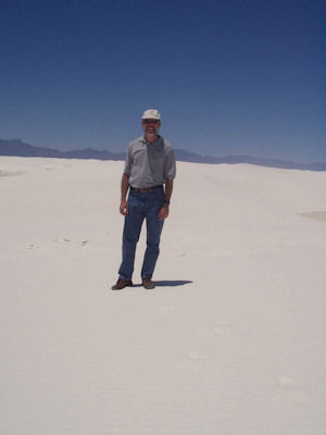
5/21/2004 On to White Sands NM. Saw a film at the visitor center then drove out to the dunes and took a walk on them.
The park sign
|
Sand blowing over the dune rim
|
Pours like sugar
|
Me on the dunes
|
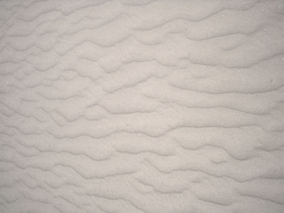
Patterns in the sand
|
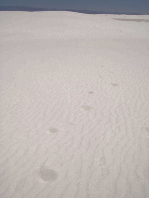
Footprints into the distance
|