Home
Travel
NPS States
NPS Types
National Monuments - California
Cabrillo National Monument
5/26/1996 Drove to Pt. Loma to Cabrillo National Monument. We were so early the road (on a military base) was closed
so we circled around for a while. At the monument, first went to the visitor center for beautiful views of North Island, Harbor Island, etc.
Down to the ocean to explore the tidepool area and more great views.
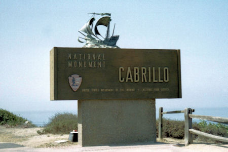
The park sign
|
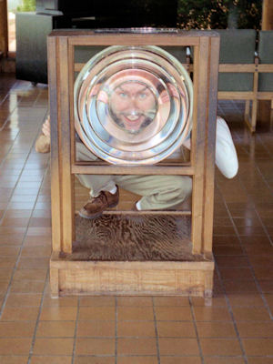
Me being silly with a lens
|
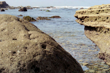
A tidepool
|
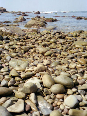
The rocky beach
|
Castle Mountains National Monument
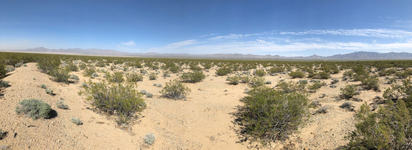
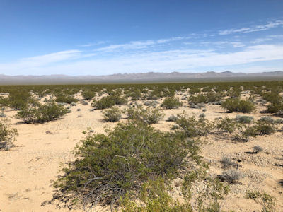
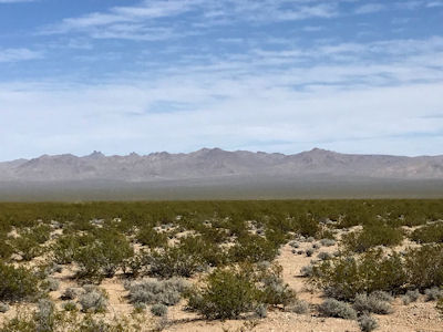
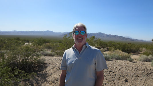
4/9/2019 We then set our sights on Castle Mountains National Monument. The park unit protects a section of the Castle Mountains,
a range located in San Bernardino County and Clark County, Nevada. It is surrounded on three sides by the Mojave National Preserve, and it in turn
surrounds the Castle Mountain Mine Area, an open pit gold mine. We got off on a side road east from the interstate with a plan of then heading down
south from that road on a dirt road into the NM. However, as we looked at the time the GPS was giving us, plus the travel up to Las Vegas, we got
quite concerned about when we’d get into town, especially considering we had planned stops there. We then decided to go with my Plan B which was
to head down another earlier southerly road as far as we could go for views of the mountains; we noted that at this point we entered back into the
Mojave Preserve. I thought we would get to an area where high clearance 4WD was needed, but even before the pavement ended there was a road closed sign.
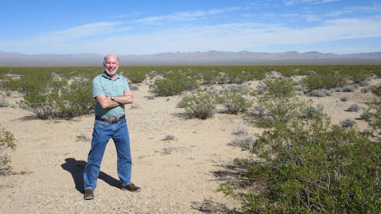
We pulled off there and stepped out for our photos, only to get blasted with the 30+ gusting to 60 mph winds that we were warned about. It was even
hard to hold the cameras steady, especially for panoramas.
A panorama of the area
|
The Castle Mountains ...
|
... and a closer view
|
Me ...
|
... and Ken
|
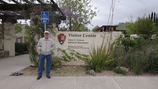
Cesar E. Chavez National Monument
4/9/2019 then arrived at the César Chávez National Monument in Keene, a relatively new unit tucked in the mountains (and ironically
after two full days, the impetus for what was supposed to be a simple NPS Unit check-off trip for me). It is also the Nuestra Señora Reina de la Paz NHL.
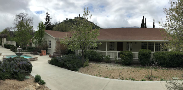
The property was the headquarters of the United Farm Workers (UFW), and home to César Chávez from the early 1970s until his death in 1993. We took a stroll
through the museum, learning about the strikes of the workers that ultimately led to the UFW and workers rights. The NPS building was actually used by Chávez,
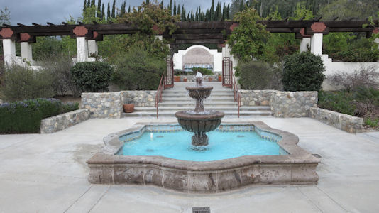
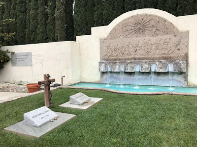
and the museum included his original office area staged the way he used it. Heading outside we walked through the very attractive gardens and saw the graves
of Chávez and his wife near a pretty water cascade wall and fountain.
The park sign on the road ...
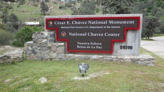
|
... and at the site with me
|
Home and headquarters
|
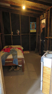
Farmworker cabin
|
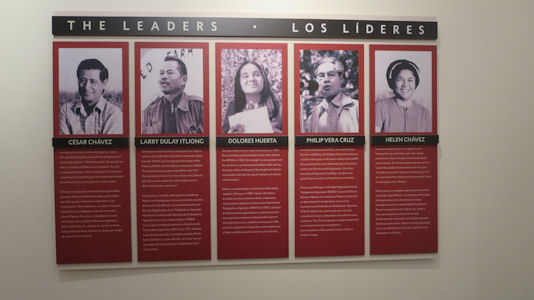
Early leaders
|
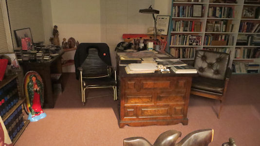
Chavez's office
|
The memorial area ...
|
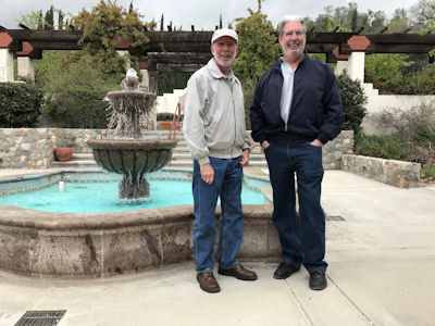
... with me and Ken
|
Chavez graves
|
Pretty garden area
|
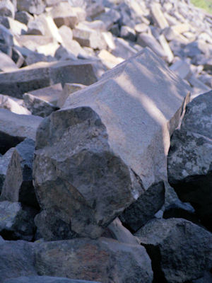
Devils Postpile National Monument
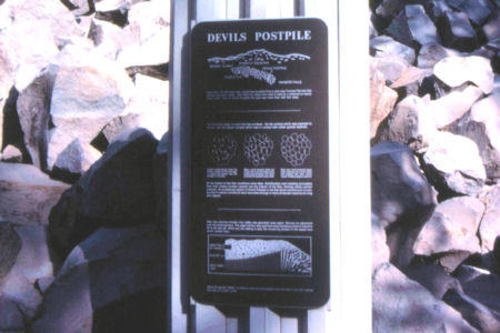
9/12/1988 Drove to and hiked into Devil's Postpile
[National Monument] - similar to Devil's Tower, WY only smaller.
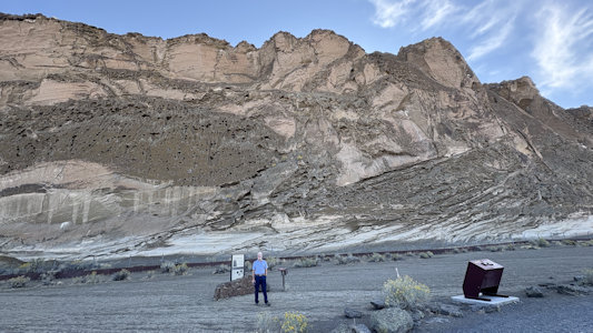
An informative sign
|
Cool extrusions
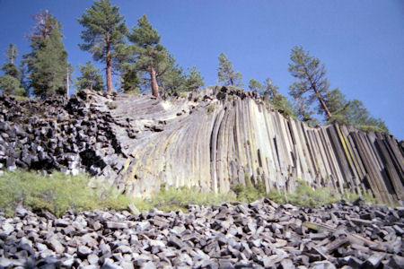
|
A close-up of a pillar
|
Another view
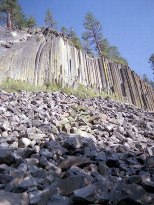
|
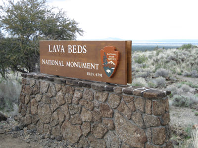
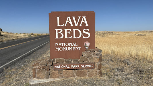
Lava Beds National Monument
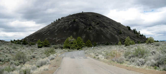
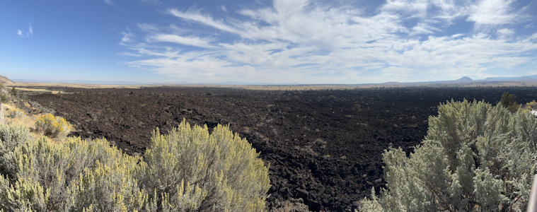
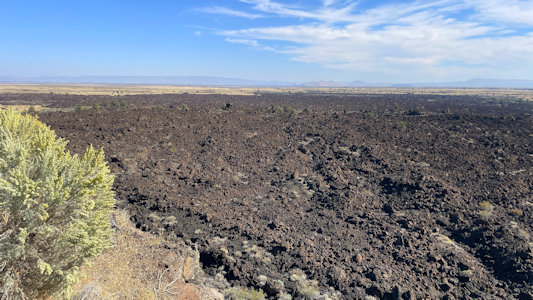
5/13/2009 Arrived at Lava Beds NM around 3:30 and headed down to the visitor center, stopping at many cool pull-offs.
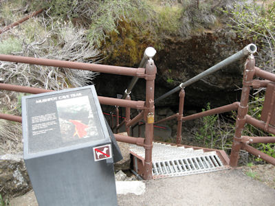
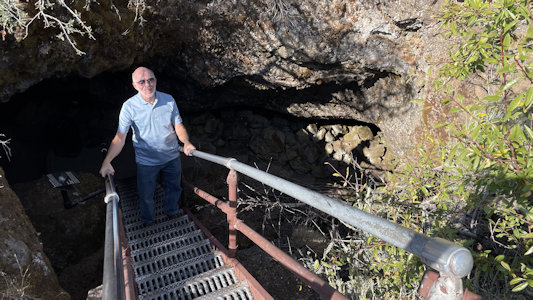
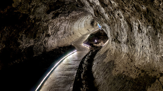
The cinder cones all around were obvious, as were the extensive lava flow fields. At the VC, went on a trail to the Mushpot Cave. Down a
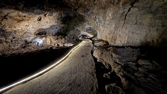
ladder into a cool lava tube cave. The park has made a path lined with small red lights and a few information signs, so I could just see to
walk. Unfortunately, while filming I whacked my headed on the low ceiling and got a cut through my hat – ow!
The park sign
|
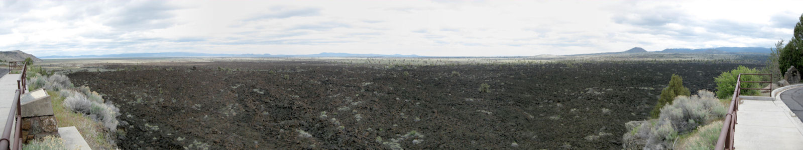
A good panorama of the lava field
|
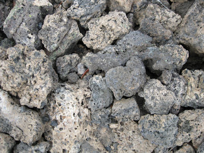
Close-up of the lava
|
A cinder cone
|
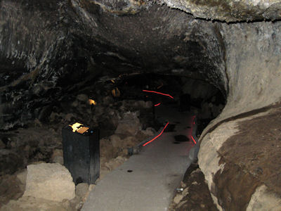
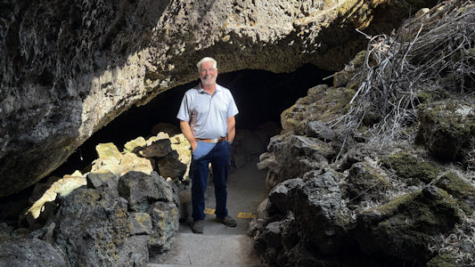
Mushpot Cave outside ...
|
... and inside
|
9/25/2025 Moving on south we headed for Lava Beds National Monument. This “is a land of turmoil, both geological and historical.
Over the last half-million years, volcanic eruptions on the Medicine Lake shield volcano have created a rugged landscape dotted with diverse volcanic
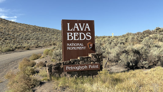
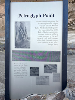
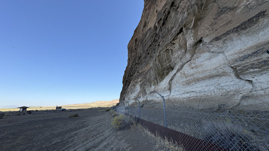
features.” Our plan was to hit the main VC area where I had already been, but as luck would have it our route took us past Petroglyph Point. This
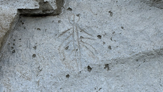
was pretty cool, with a massive vertical rock wall looming over us in the quiet of the morning. We spotted a number of the petroglyphs from the Modocs
peoples that, while hard to date, could be over 6000 years old. Continuing to the main park area we passed some cool lava beds on each side of the
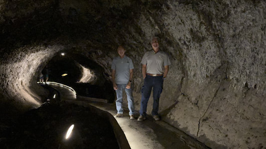
road, then arrived at the VC where we picked up a cave pass. Although there is a range of visitable caves with various degrees of challenge, we elected
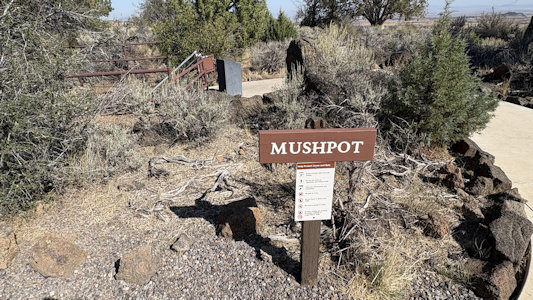
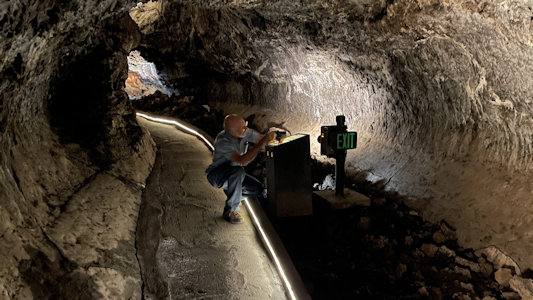
to visit the Mushpot Cave near the VC, which has a concrete floor and strip lighting. It was still very cool walking through the lava tube, and I
managed not to repeat my experience from last time I was here of bloodying my head on a low section. Heading back north out of the park, we stopped
at the main lava flow section for photos that we regretted not hitting on the way in.
Petroglyph Point park sign ...
|
... and interpretive signage
|
A panorama of the huge wall ...
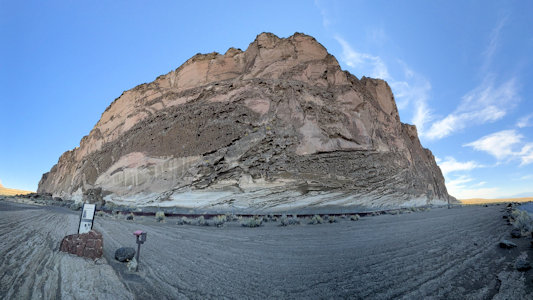
|
... and a look down one side
|
Indication of what to look for ...
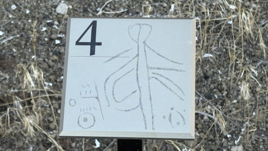
|
... and we found it on the wall
|
Me in the shot for scale ...
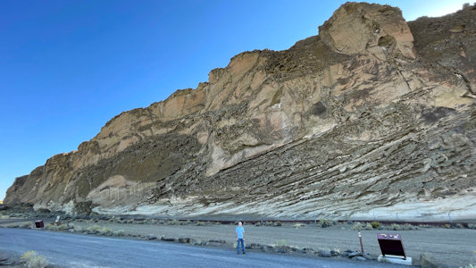
|
... and one with Ken
|
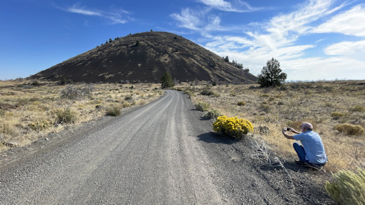
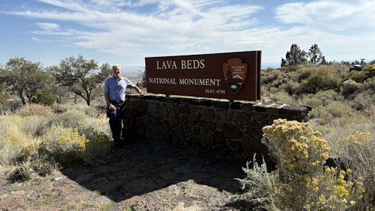
Park sign approaching the main area
|
I photo ...
|
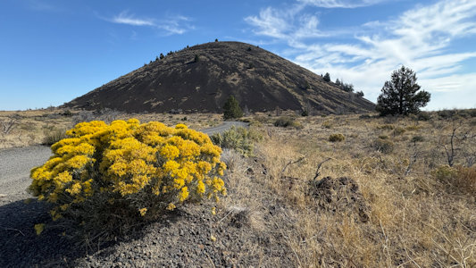
... Schonchin Butte cinder cone
|
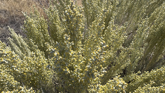
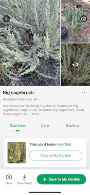
We confirmed that this is ...
|
... Sagebrush
|
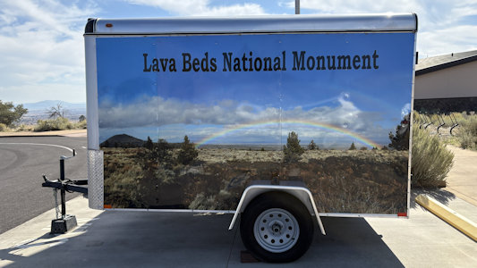
Nice trailer painting ...
|
... and Ken at the VC sign
|
At Mushpot cave ...
|
... with me on the way down ...
|
... and Ken on the trail
|
Nicely done, easy trail
|
I set up for ...
|
... a photo of us
|
Another trail shot
|
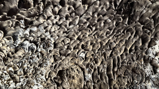
Cool closeup of the cave wall
|
A couple of panoramas ...
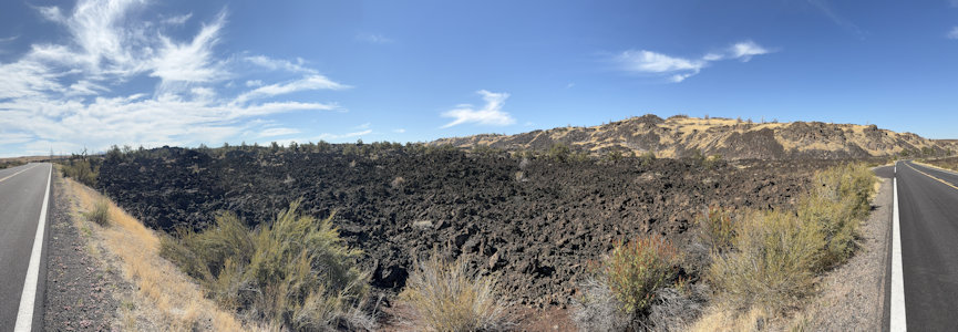
|
... of the lava field
|
Another view closer up
|
Ken and our ride
|
Muir Woods National Monument
7/1972 Drove back to San Francisco, stopping at Travis Air Force Base and Muir Woods National Monument,
and over the Golden Gate Bridge.
Ken on a bridge along the trail
|
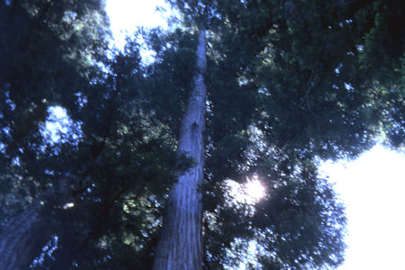
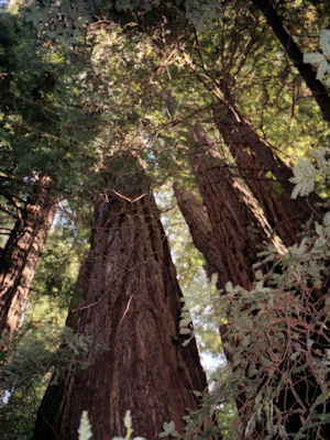
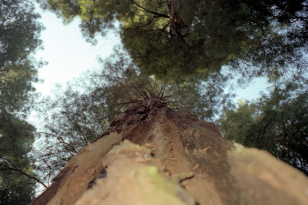
A look skyward
|
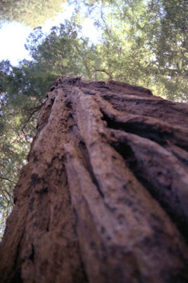
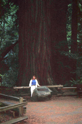
5/1984 Drove to San Francisco, toured Muir Woods
[National Monument], walked down to Muir Beach - very cold, lots of jellyfish.
A look at the deeply creviced bark
|
Friends Todd and Jim on the trail
|
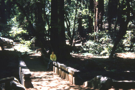
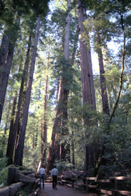
10/28/1991 Drove across Golden Gate to vista point, then on to Muir Woods
[National Monument]. Beautiful sunny, cool day to
walk around woods - saw some deer close up.
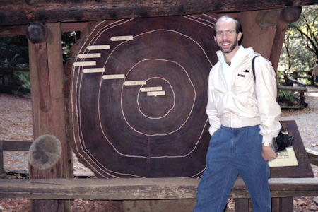
Me by a cross-section of a tree
|
Some of the giants
|
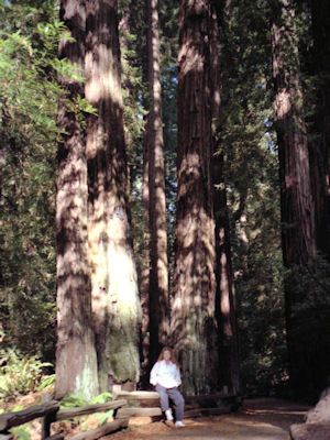
Maureen showing the scale
|
A look up a tree
|
11/5/1993 Drove down to Muir Woods [National Monument], had lunch and walked around.
Maureen in front of a big one
|
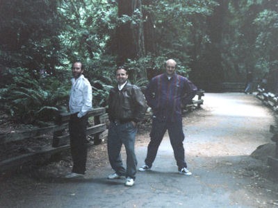
8/25/1994 ... drove down to Muir Woods [National
Monument] (had lunch right before getting there). Nice walk through forest,
even took Hillside trail up on hill at mid-tree level.
Me, George and Marty on the path
|
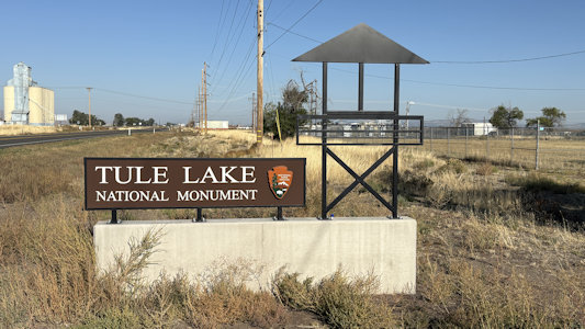
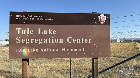
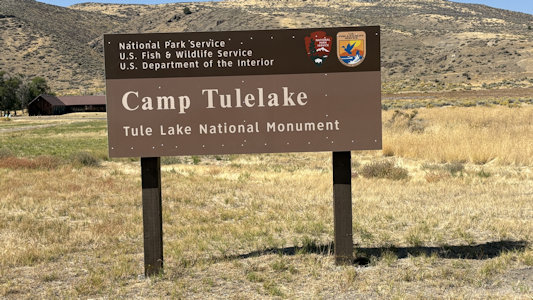
Tule Lake National Monument
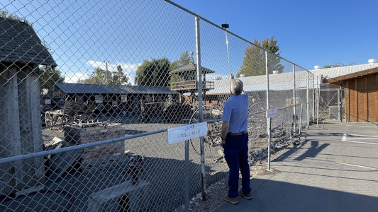
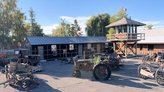
9/25/2025 In Tulelake we hit what was listed as an RA, but also had meaning for the NPS - at the Tulelake-Butte Valley Fairgrounds
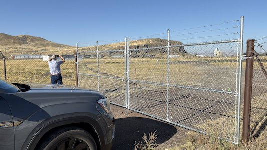
there was an original guard tower and barracks from the Tule Lake Concentration Center. They were set back behind a tall chain link and barbed wire fence,
making for poor photography, but Ken’s extension pole and my remote shutter made it all happen. A short distance away we came to the camp area managed by
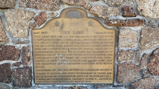
the NPS, Tule Lake National Monument. This part of the park unit is also Tule Lake Concentration Center NHL. The largest and most historically significant
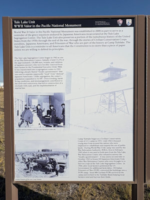
of the WWII Japanese internment camps, Tule Lake housed over 18,000 internees, many of whom were considered “disloyal” due to attempts to protest their
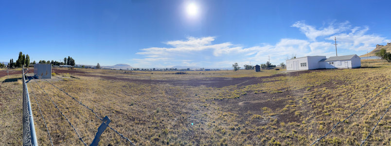
incarceration. We knew the VC was closed, and the area was fenced in, but it didn’t matter too much as there was little left of the buildings and other
features, and we just photoed the general grounds. Along the main road there is a CA marker/monument. On another side of the fence area there was a little
interpretive signage, and we could just see the NHL plaque on a distant little pillar, making for one of our worst plaque photos ever. ... Back west of
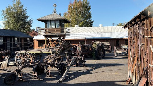
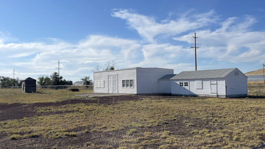
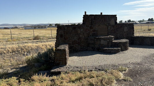
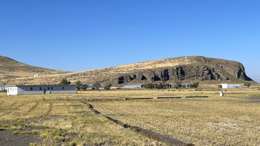
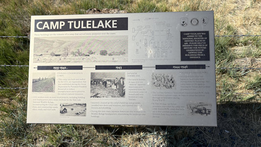
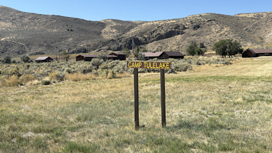
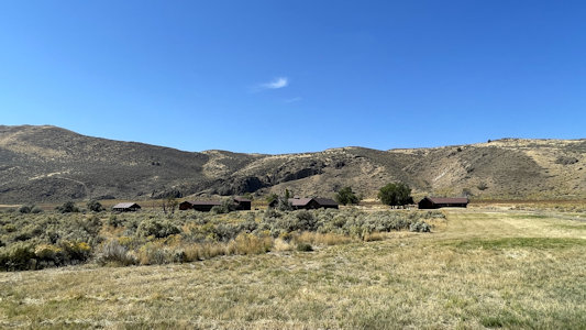
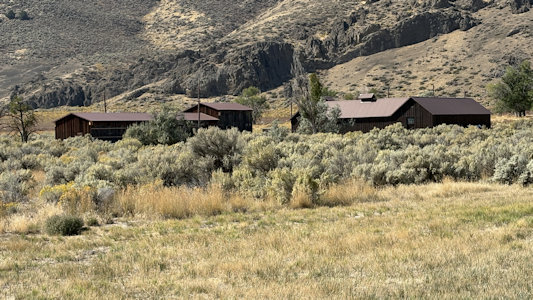
the Tulelake area we had visited earlier we hit another unit of the Tule Lake NM at Camp Tulelake. This was a federal work facility and War Relocation
Authority isolation center established by the U.S. States government in 1935 for vocational training and work relief for young men, in the CCC program.
During World War II, the Tule Lake War Relocation Center was built nearby. This facility was adapted in the wartime years to shelter Japanese-American
strikebreakers used against resisters at the main segregation camp, imprison Japanese-American dissidents, and house Italian and German prisoners of war
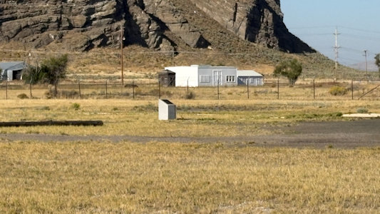
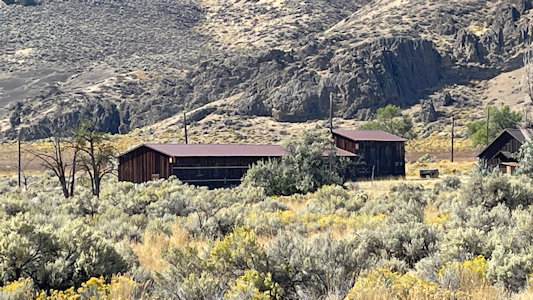
(POWs) who were assigned to work as farm laborers in the region. Much better photos here as there were a bunch of original buildings and much closer to us.
Guard tower through the fence ...
|
... while Ken goes ...
|
... over the top
|
Concentration Center area park sign
|
Panorama of the northwest side ...
|
... with one of the remaining buildings
|
The California monument ...
|
... with plaque
|
Park sign on the southeast side
|
Interpretive signage
|
Ken photos ...
|
Some of the buildings on this side ...
|
... and distant
NHL plaque
|
Park sign at the Camp ,,,
|
... and more interpretive signage
|
Some distant views ...
|
... of the buildings ...
|
... as well as ...
|
... some zoomed in
|