Home
Travel
State Parks
Oregon State Parks
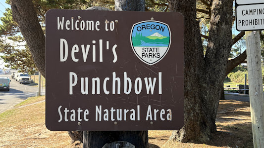
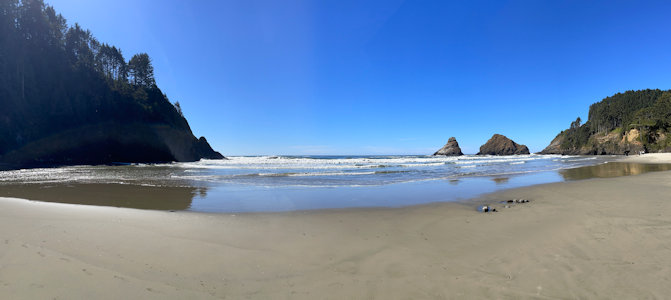
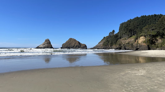
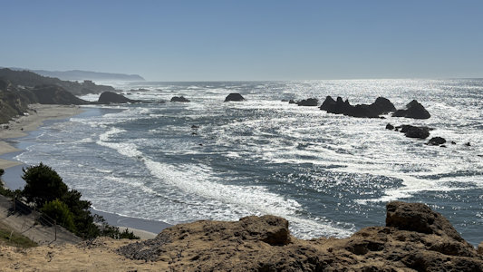
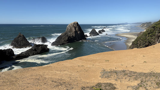
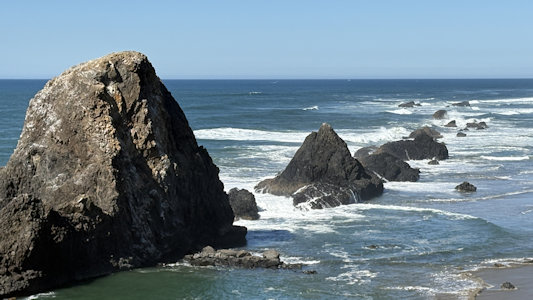
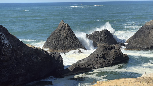
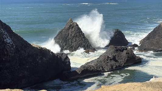
Devil’s Punchbowl State Natural Area
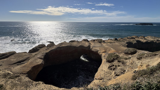
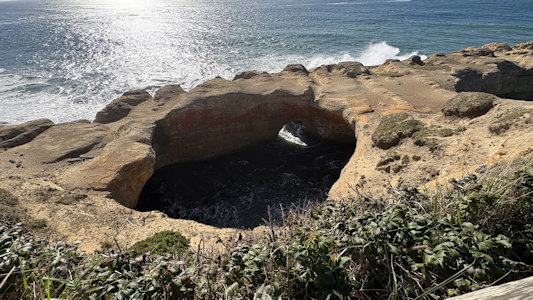
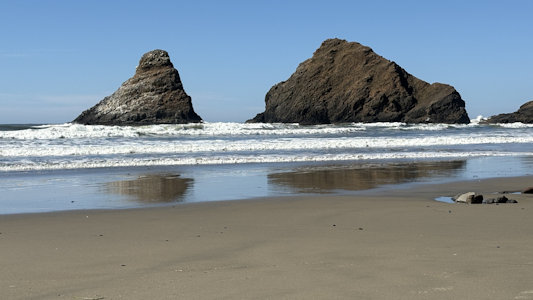
9/26/2025 The State Natural Area is centered on a large bowl naturally carved in a rock headland which is partially open to the
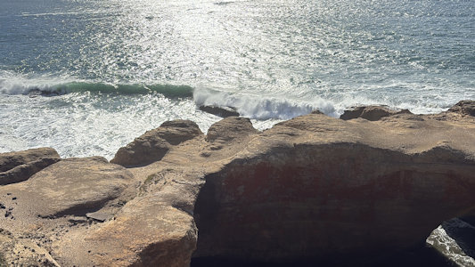
Pacific Ocean. Waves enter the bowl and often violently churn, swirl, and foam. Outside the bowl, ocean conditions are attractive to surfers near a
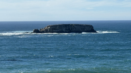
large offshore rock pinnacle named Gull Rock, located about 1⁄2 mile west-northwest of Devils Punch Bowl, which funnels and concentrates waves easily
seen from the park. There are at least seventeen large rocks, part of Oregon Islands National Wildlife Refuge, which provide interesting wave viewing,
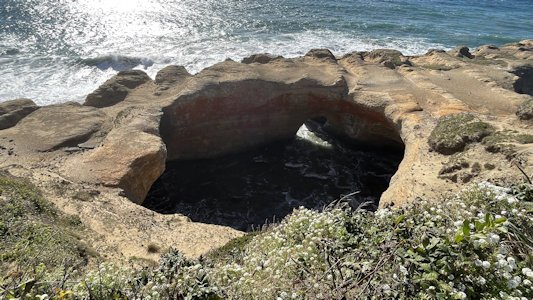
and attract and provide a home for wildlife. The bowl is thought to have been created when two caves carved by the ocean collapsed. After walking down
the stairs all the way to the beach, we realized we were only seeing the surfers, no punchbowl. Climbing back up, we found the view up on the bluff.
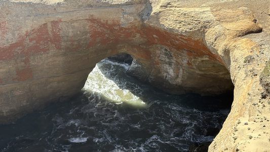
Although at times the ocean waves blow up through a hole in the bowl-shaped rock feature, it appeared that today’s waves were coming in at an angle not
conducive to making that happen.
The park sign
|
The punchbowl ...
|
... a little closer ...
|
... and waves entering it
|
Offshore island
|
Wave crashing outside, nothing inside
|
Some more nice wave action
|
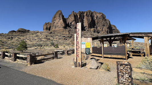
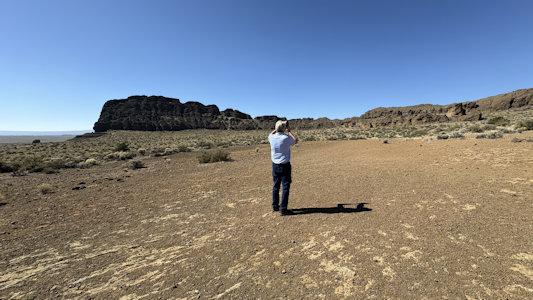
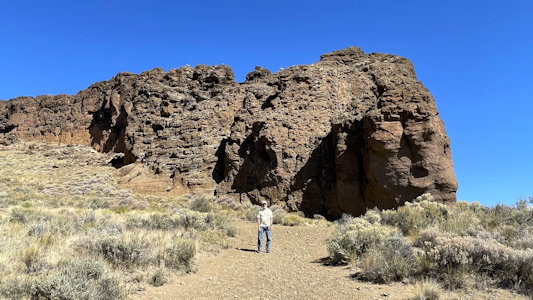
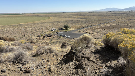
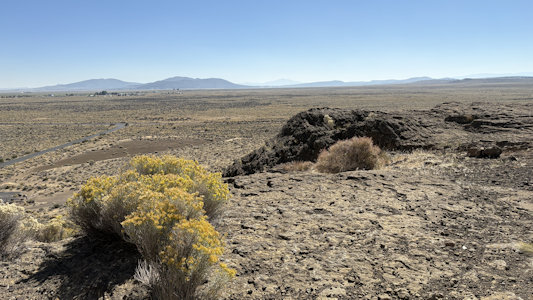
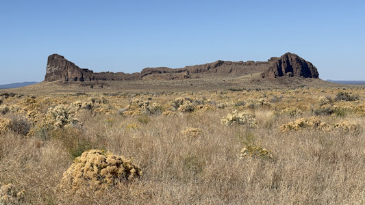
Fort Rock State Natural Area
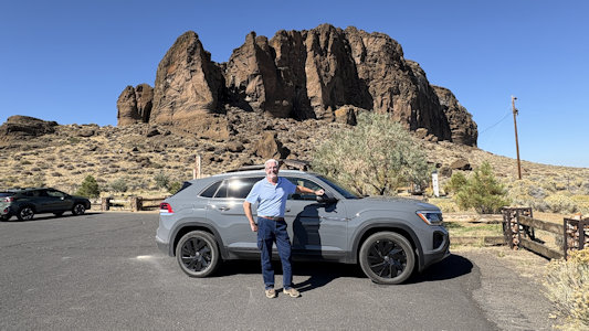
9/24/2025 Our goal was Fort Rock State Monument NNL, right near the town of Fort Rock, which we could spot in the distance well
before we got there. This is a tuff ring located on an ice age lakebed created when basalt magma rose to the surface and encountered the wet muds of a
lake bottom, the name being derived from the tall, straight sides that resemble the palisades of a fort. This is also the location of the Fort Rock Cave
NHL, both in the Fort Rock State Natural Area. This was the site of the earliest evidence of human habitation in Oregon before the excavation of the
Paisley Caves, featuring numerous well-preserved sagebrush sandals, ranging from 9,000 to 13,000 years old. We parked at the little state info area
and walked a trail (noting that a lot of the walking/hiking we are doing is at altitude, leading to some out of breath situations) to inside the
semicircular rock formation. We convinced ourselves that we were seeing candidates for the actual NHL cave, although there is no information about the
location, no doubt to protect it.
Ken and our ride
|
The park entrance ...
|
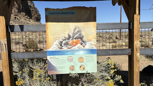
... with interpretive signage
|
Ken photos ...
|
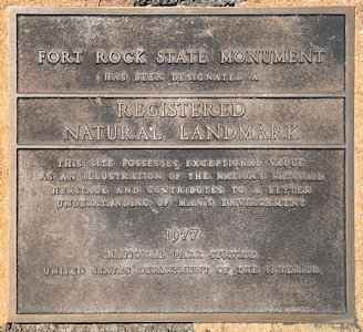
... the NNL plaque
|
Ken takes ...
|
... a nice panorama
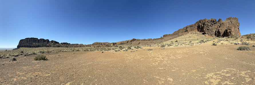
|
Me and the view east
|
Great vistas ...
|
... looking south
|
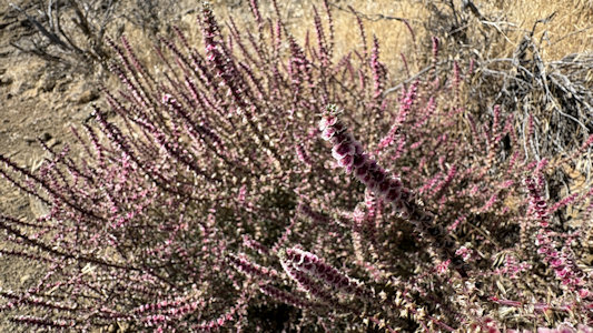
Some nice ...
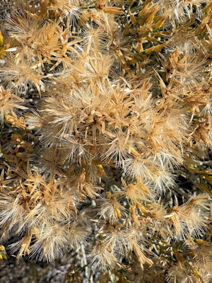
|
... plant details
|
Stopped on the way out ...
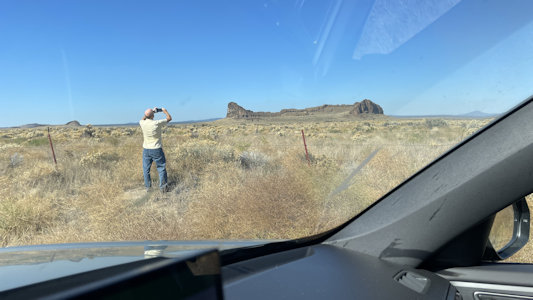
|
... for a distant photo
|
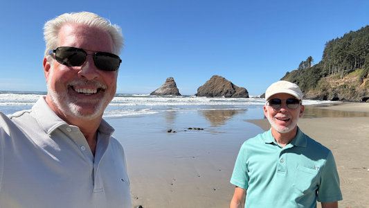
Haceta Head State Scenic Viewpoint
9/26/2025 Named for its crowning feature, this park also features an historic bed and breakfast, a sheltered beach that's easy
to access from the parking lot, and a challenging and scenic hike along a section of the Oregon Coast Trail. Perched atop 1,000-foot-high Heceta Head,
the lighthouse is one of the most photographed on the coast. The light atop the 56-foot tower was first illuminated in 1894. Its automated beacon,
seen 21 miles from land, is rated as the strongest light on the Oregon coast. We parked at the beach here, and although it offered some very nice views
of the ocean and rock structures, the lighthouse was obscured by trees – we got better views earlier from the Sea Lion Caves. Given our schedule, we
elected not to take the half mile hike up to the lighthouse. We also skipped a couple of other stops we had scoped out north on the highway; being more
like we have seen, or with fewer features of interest.
A panorama of the beautiful area ...
|
... and a little closer in
|
I set up for ...
|
... a detail shot of the rocks
|
Ken and me
|
Hat Rock State Park
5/27/2010 Lewis and Clark National Historic Trail
LaPine State Park
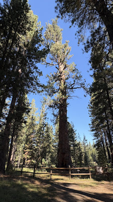
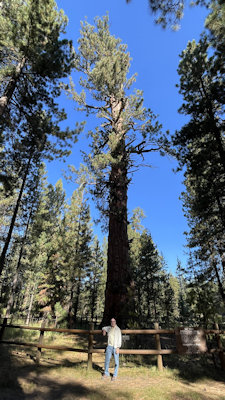
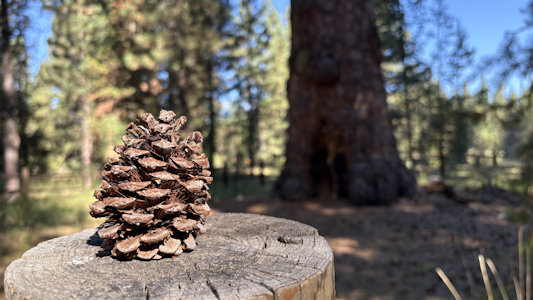
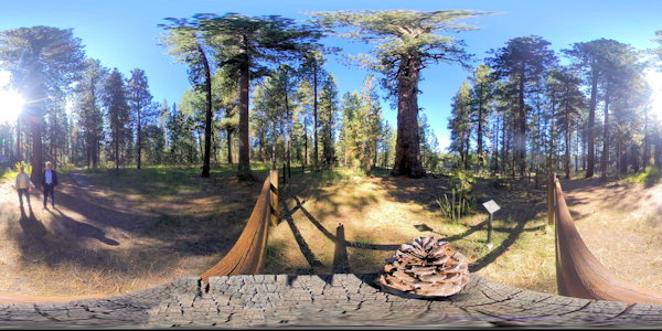
9/24/2025 Next stop, LaPine State Park. LaPine State Park resides in a forest of ponderosa pine along the Deschutes River. Within
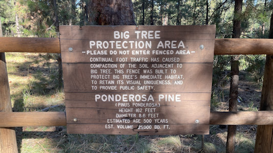
the park is a ponderosa pine nicknamed "Big Tree"; at nearly 162 feet tall and estimated to be almost 500 years old, it is believed to be the largest
ponderosa pine in the world. After a little ineptness on my part using the signage provided, and getting a view of the cool disc golf course among the
pines, we found the short and correct trail to the Heritage Tree, as noted also called succinctly enough, Big Tree. We enjoyed the quiet of the pine forest,
with so many of the trees towering over us.
The park sign ...
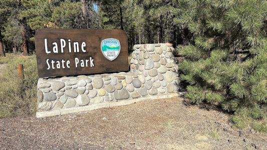
|
... and map
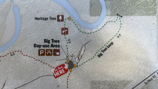
|
The "Big Tree" ...
|
... and me
|
Gotta protect the Big Tree
|
Something make a Little Tree
|
Ken sets up for ...
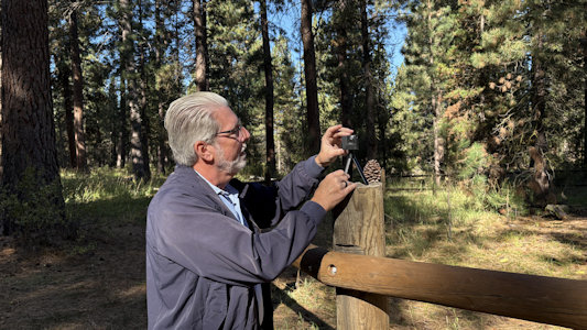
|
... a fun 360
|
Big Tree base ...
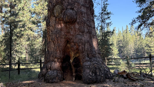
|
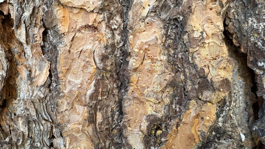
... and gnarly bark of a nearby friend
|
Seal Rock State Recreation Site
9/26/2025 Seal Rock features large offshore rock formations that provide habitat for seals, sea lions, sea birds and other marine
life. The beach includes interesting tidepools as well as excellent ocean views and a sandy beach. This offered more great views of the huge rock structures
along the coast, but the path down to the tide pools was closed for restoration. It looked like it would be a really tough climb back up, so maybe not
such a bad thing.
A look south - beautiful
|
Impressive monolith
|
A wide look north ...
|
... and a little closer
|
Catching some ...
|
... breaking waves
|
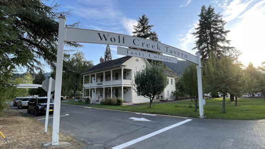
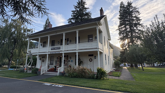
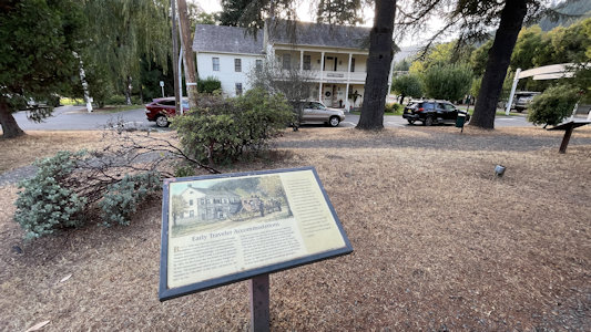
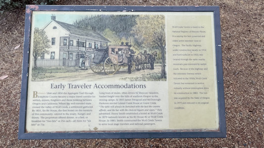
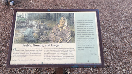
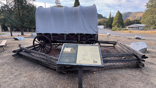
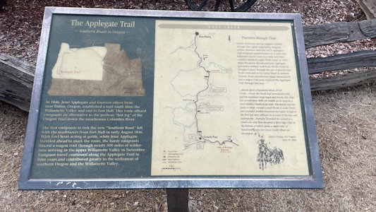
Wolf Creek Inn State Historic Site
9/25/2025 Imagine yourself as a traveler along a section of the Applegate Trail in the late 1800s.
You have just arrived by stagecoach to the Wolf Creek Inn, a welcome refuge from the perilous journey over mountains and across valleys. After paying 75
cents for a room, bath, and meals, you're ready to relax. You sit down to a hot meal and some easy conversation with the innkeepers or other guests.
Afterwards, the men sidle off to the tap room for some quaffs of beer while the ladies adjourn to the parlor. The conversation drifts from tales of
inspirational beauty to frightful experiences of the trail. There is also lots of interpretive signage here on the Applegate Trail/CA NHT.
Approaching ...
|
... Wolf Creek Inn
|
Near the Inn ...
|
... info about traveler ...
|
... including by stage

|
Info on travel travail
|
A wagon with ...
|
Applegate Trail info
|