Home
Travel
USFS
Oregon United States Forest Service
Columbia River Gorge National Scenic Area
9/20/2024 ... we got off the highway and started our trek in the Columbia River Gorge National Scenic Area (USFS). We first stopped at
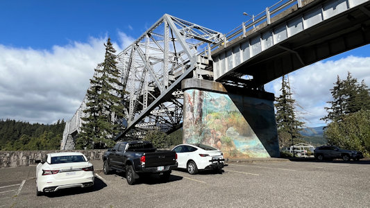
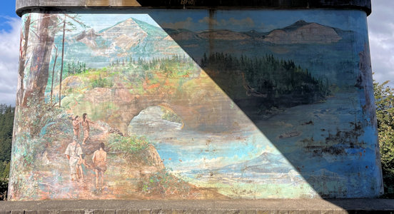
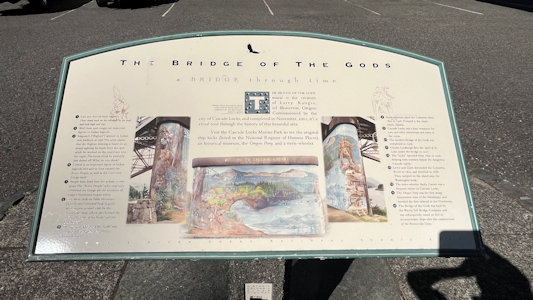
the base of the Bridge of the Gods in Cascade Locks for a mural on the south support pillar. “The creation of Larry Kangas, of Beaverton, Oregon, commissioned
by the city of Cascade Locks, and completed in November 2001, it’s a visual tour through the history of this beautiful area.” A sign here indicates that the
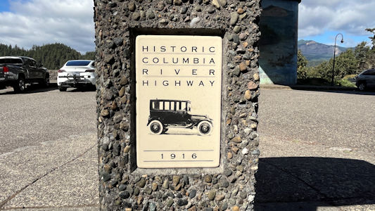
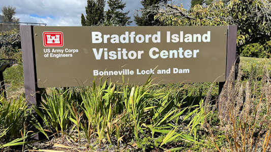
site is on the Historic Columbia River Highway, although not quite yet on the Scenic Byway/AAR. A little further along we drove onto Bradford Island for the
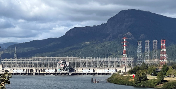
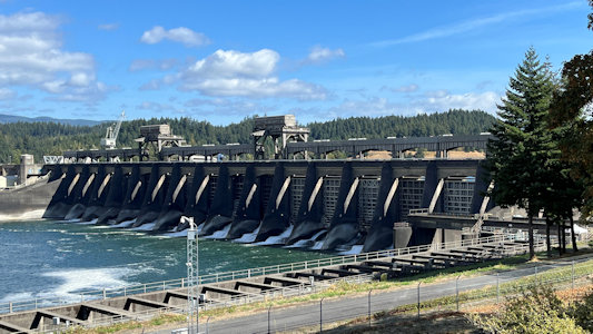
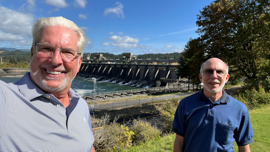
VC of the Bonneville Lock and Dam. This is part of the Bonneville Dam Historic District NHL, as well as on the Highway. The district includes the dam which
was the first major structure built with a "hydraulic drop" capable of developing more than 500,000 KW of electric power. We got some good views of the dam and
the power plant, then went into the VC where we got some more views from the top level, and then below the water level to view the fish running against the
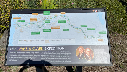
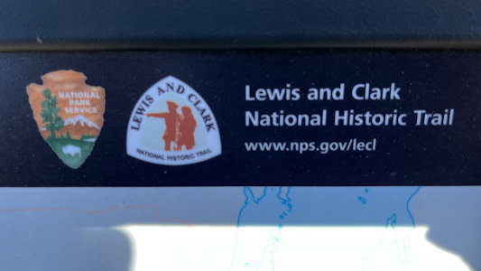
current along the fish ladder, allowing them to navigate around the dam. Also, the Lewis and Clark Expedition camped on Bradford Island on April 9, 1806, and
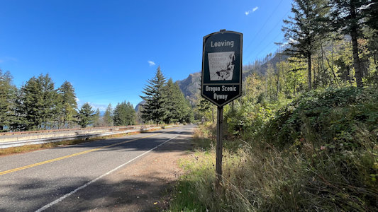
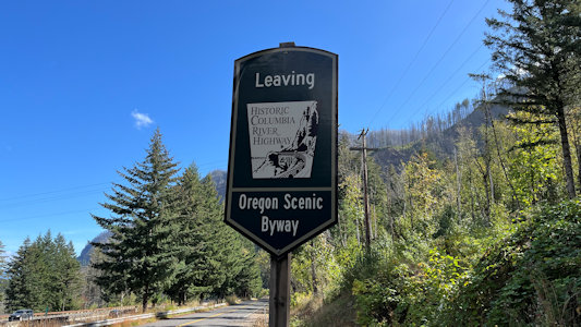
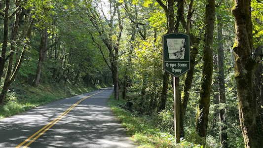
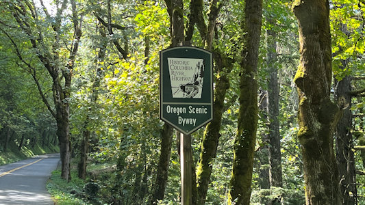
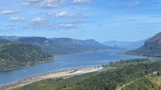
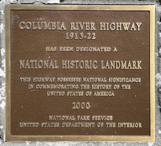
signage indicated it’s part of the L&C NHT. We continued west on the Interstate, then got off and navigated slightly east to the Historic Columbia River Highway
AAR NSB start/end point, then back west along the NSB. This is also the Columbia River Highway NHL. This 75-mile highway was built through the Columbia River
Gorge between 1913 and 1922 as the first planned scenic roadway in the U.S. Everything we see from here to the State Scenic Viewpoint are on the NSB and
in the Columbia River Gorge NSA. ...
Bridge of the Gods ...
|
... with a different kind of mural
|
Mural and area info
|
Yay - on the Highway
|
Bonneville Lock and Dam
|
Sign on the island
|
A surprise L&C site ...
|
... with the official emblem
|
A view of the dam ...
|
... and with Ken and me
|
The Byway sign at one end ...
|
... but we're going the other way
|
A view down the Byway ...
|
... and the sign
|
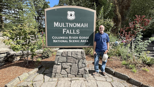
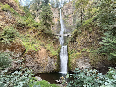
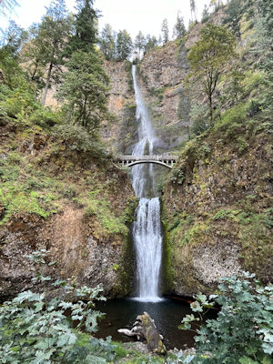
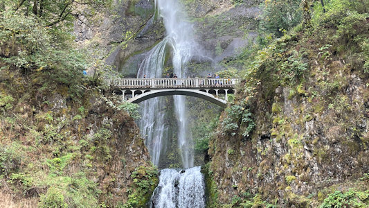
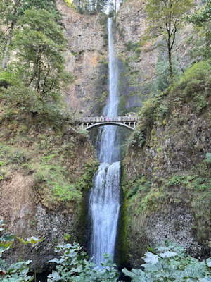
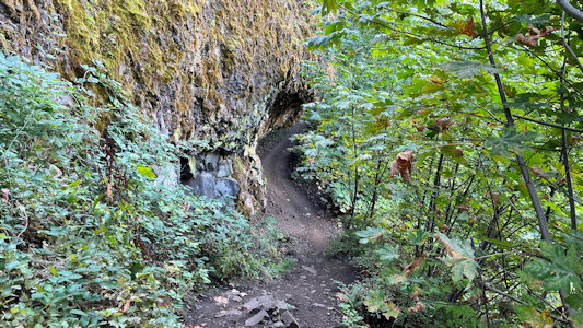
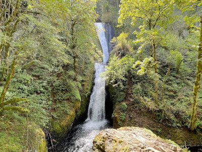
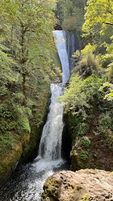
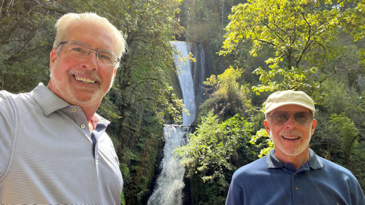
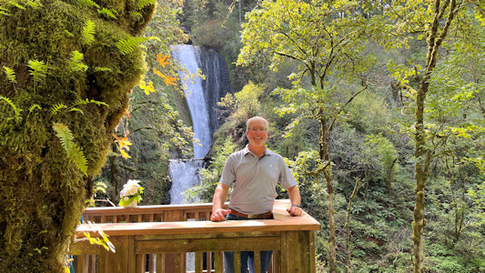
... The goal was to park at the Multnomah Falls area, but apparently that goal was shared by a gazillion of our fellow travelers. We were waved past the parking
area, it being full, and were told that we could park at the next falls down and walk back or try to get to the parking on the Interstate, a long drive.
After waiting to get cleared through a one-lane bridge, we found that at Waukesha Falls, that parking was full, with people in all sorts of non-standard
spots. We made one pass through, with no luck, then on the second pass Ken decided to try for a spot noted the first time, and maneuvered the car between
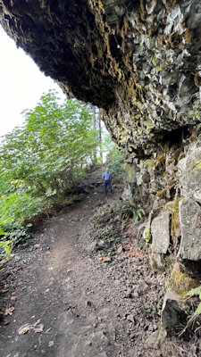
two trees. Jeez. There were nice picnic tables available, so we enjoyed our Subway before finally setting out for Multnomah. We took a narrow and rocky trail
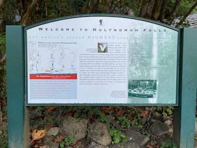
up the mountain from the road, and 0.4 miles later arrived at Multnomah. This site is also in the NPS Ice Age Floods National Geological Trail. The two-step
falls are really impressive, and while we could have taken a strenuous trail up to the bridge looking over them, we were already running a lot behind schedule,
so we decided to move on. ...
Me at the falls sign ...
|
... and lots of info
|
Beautiful views ...
|
... of the falls ...
|
... and the bridge
|
One more look
|
Fun trail to/from the car
|
Can you see Ken?
|
View of the river from the trail
|
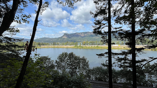
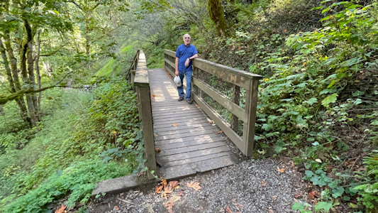
... Back along the trail, returning to the car, we drove east to Bridal Veil Falls, this also being part of the (Historic) Columbia River Highway NHL and NSB.
Plenty of easy parking here, and we took the steep switchback trail down to the base of the falls, these being the only falls below the road, between the
road and the Columbia. Very nice views of the smaller but closer falls, and back to the car. ...
One the way to ...
|
...Bridal Veil Falls
|
A pretty sight
|
Ken and me ...
|
... and just Ken
|
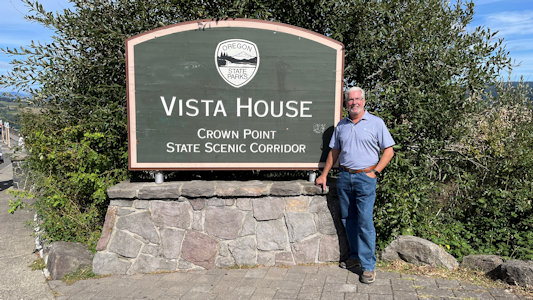
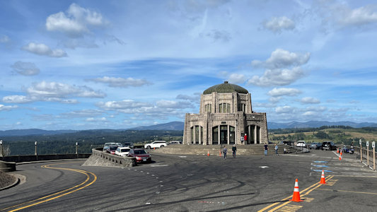
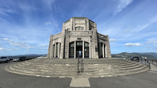
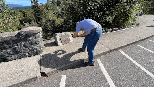
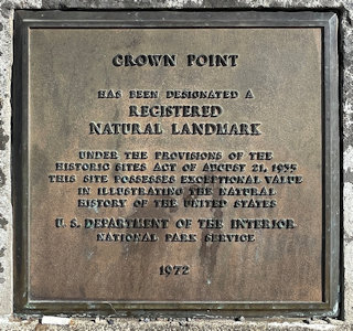
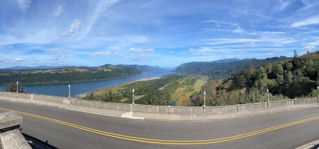
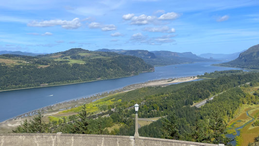
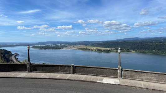
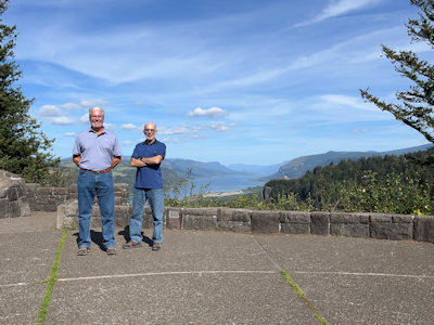
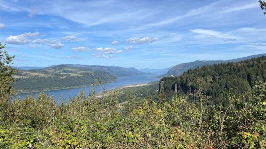
... More east on the NSB we stopped high over the river at Vista House in Crown Point State Scenic Corridor, an NNL and part of Ice Age Floods NGT. This is a
733 feet high basalt promontory on the Columbia River Gorge, the remains of a lava flow that filled the ancestral channel of the Columbia River. This spot
offers fantastic views of the Columbia in both directions, being able to see back east as far as the Bonneville Dam upstream. ...
Ken at the sign
|
Overlook area for Vista House ...
|
... and the building itself
|
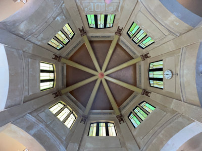
Up in the building dome
|
Ken photos ...
|
... the NNL plaque
|
A long look east ...
|
... and a little closer ...
|
... and closer on the river
|
Beautiful view west as well
|
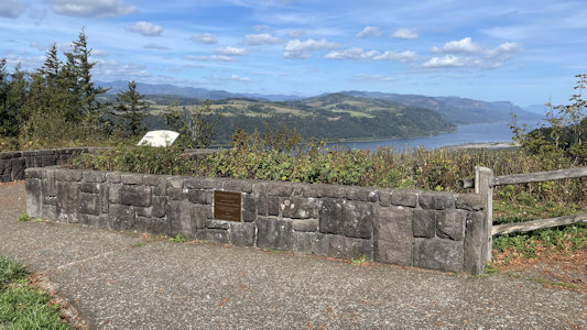
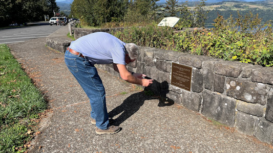
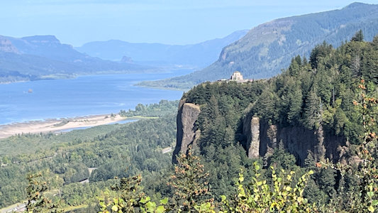
... A little more east we stopped at the Portland Women’s Forum State Scenic Viewpoint. One target here was the plaque for the Columbia River Highway NHL,
but as one might guess by the name we also got more great views of the river, here including the high bluff with Vista House.
The Viewpoint area
|
Ken photos ...
|
... the NHL plaque
|
Ken and me ..
|
... with a fantastic view
|
See Vista House?
|
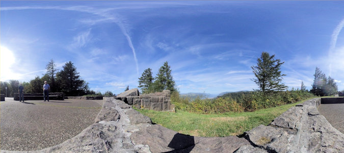
A 360 with us and the tiny view
|
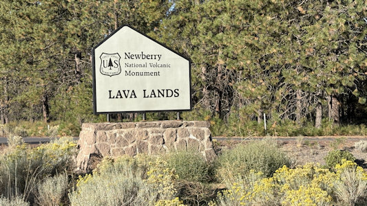
Newberry National Volcanic Monument
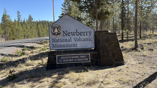
9/24/2025 Continuing south we stopped between towns at the VC for the USFS Newberry National Volcanic Monument. This monument
provides a unique opportunity to view the Lava Lands of central Oregon. Newberry National Volcanic National Monument includes 54,000+ acres of lakes,
lava flows, and spectacular geologic features in central Oregon. The highest point within the Monument is the summit Paulina Peak (7,985 ft.),
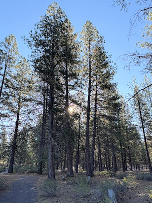
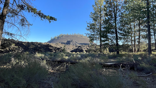
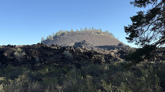
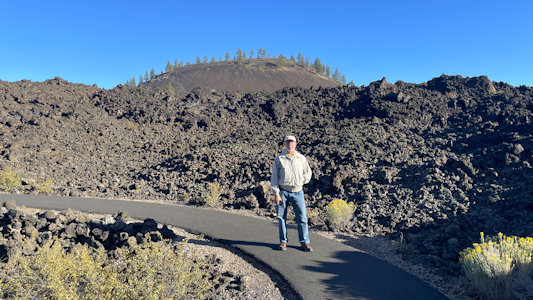
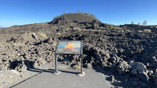
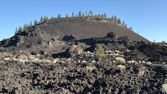
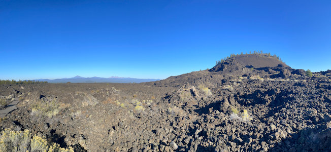
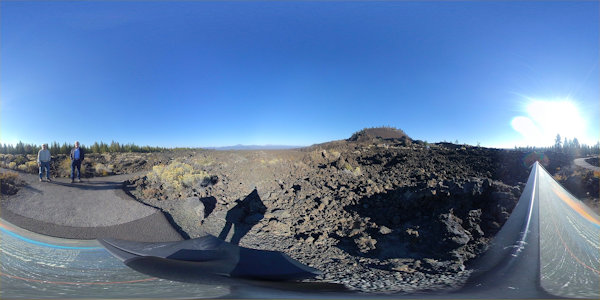
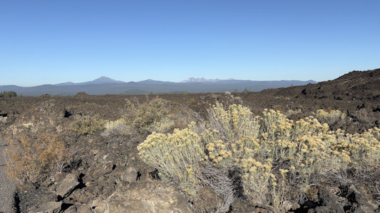
showcasing views of the Cascades, Newberry Caldera and across the High Desert. From here at Lava Butte, in season one can take a shuttle up the
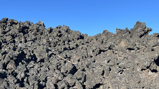
butte that loomed in front of us, but we took a trail (at first a very pleasant but wrong nature trail) up onto the lava field. This lava was scoria,
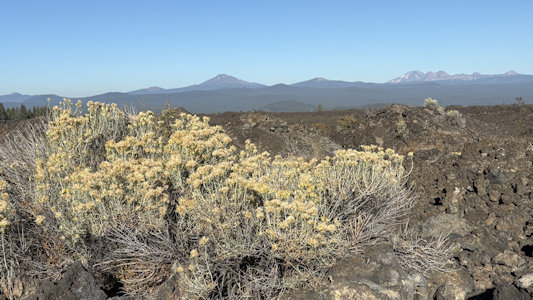
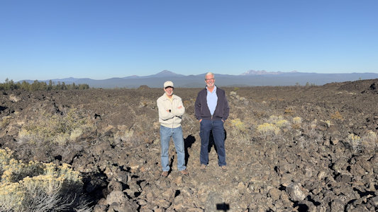
the kind that looked like pumice - full of tiny holes. We got fantastic views off to the Cascades, and the large butte right in front of us. We could
have spent more time here, but had a long day ahead. ...
The park sign
|
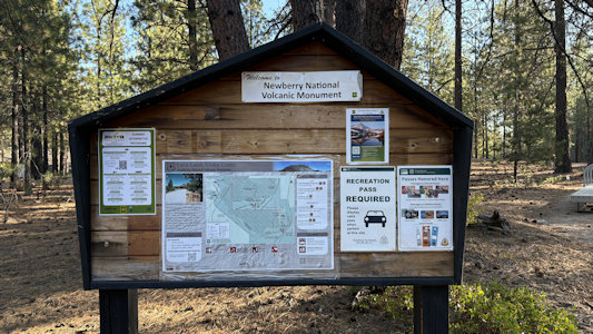
Interpretive signage ...
|
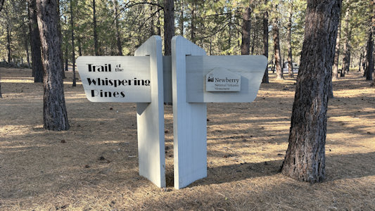
... and one for Whispering Pines trail
|
Are they whispering?
|
Our first views ...
|
... of the butte
|
Molten Land trail ...
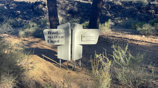
|
... with more info ...
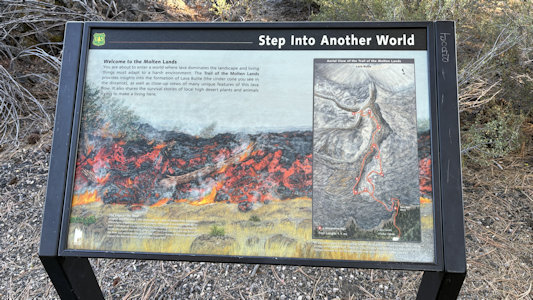
|
... and me on the trail
|
The butte ...
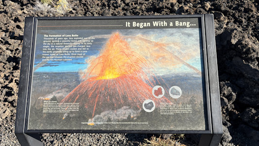
|
... and how it formed
|
The butte is surrounded ...

|
... by the lave flow
|
Yet another view
|
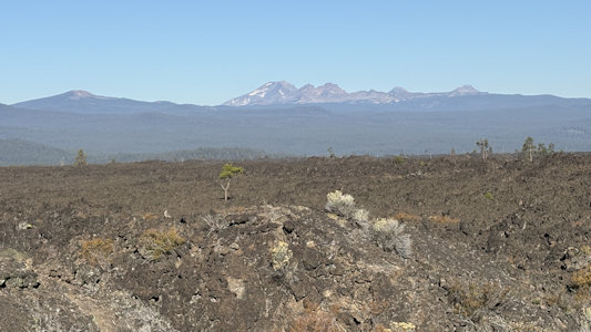
The butte and the view to ...
|
... the Cascades
|
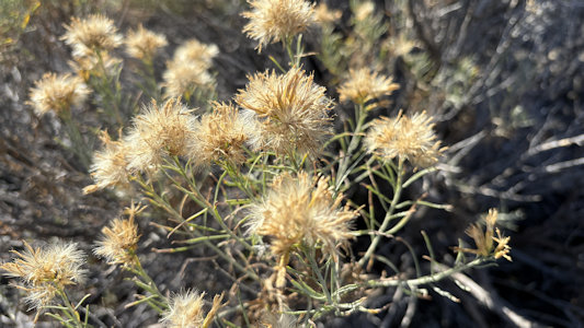
Nice closeup of the flora
|
A 360 with us
|
Me setting up for ...
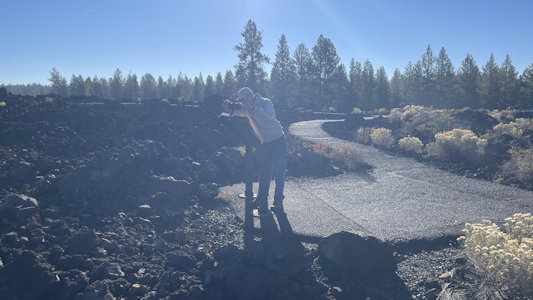
|
... a shot of us
|
Another view to the mountains ...
|
... with some snow cover
|
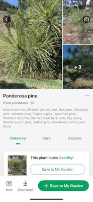
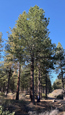
Ponderosa Pine as confirmed by ...
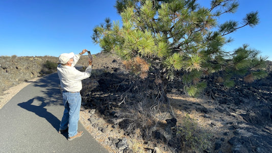
|
... a phone app
|
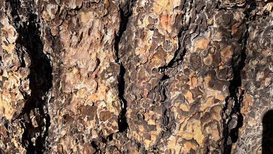
Cool bark
|
Ken is dwarfed by a pine
|
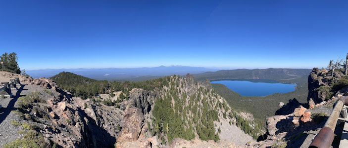
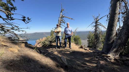
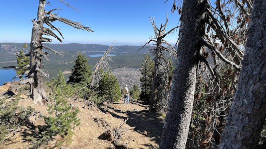
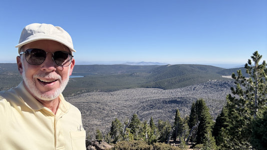
... More south brought us to the access road to the Newberry Volcano NNL. This large, active, shield-shaped stratovolcano,
named for geologist John Newberry, is located about 35 miles east of the major crest of the Cascade Range, within the Newberry National Volcanic
Monument. Our plans were to go to some falls, then a trail on a lava field, then to the peak of the volcano. I suggested we reverse it to put the
most important first, and we could judge what to eliminate if time dictated. The first part of the road was paved, but when we turned off for the
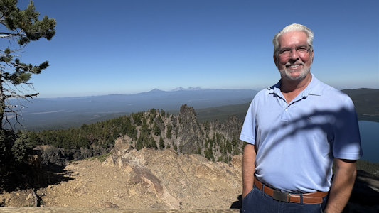
peak, it became gravel, with some extreme washboard seemingly around every tight bend on the switchbacks. We finally made it to the top, but Ken’s
vertigo had kicked in due to the sharp drop-offs, so he wasn’t a happy camper about that. That being said, the effort was worth it, because the
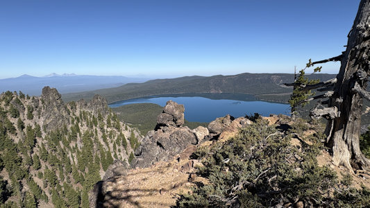
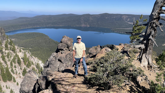
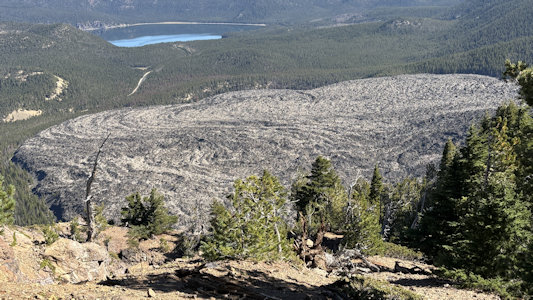
views from the top of Paulina Peak were fantastic. We could see many peaks of the Cascades, the nearby Paulina Lake and East Lake, and the whole
Big Obsidian lava flow shield. The volcano and its vicinity include many pyroclastic cones, lava flows and lava domes; Newberry has more than 400
vents, the most of any volcano in the contiguous U.S. We spent a lot of time taking a gazillion photos and enjoying the beautiful weather. Here
we decided that since a) time was tight and we burned a lot here already and b) we had already taken a walk on a lava fields, we would forego one
of the other planned stops for the walk on the lava shield. Heading down the mountain, with me giving Ken a break at the wheel for the precipitous
hairpins, we stopped at Paulina Falls, for a short walk and nice view of the falls at an overlook.
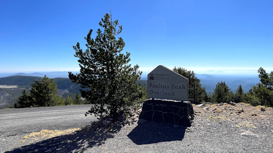
The sign for this section ...
|
... and on top of Paulina Peak
|
Wow - what a view ...
|
... with Ken enjoying it
|
The view with Paulina Lake ...
|
... and me
|
Both of us
|
Me checking out ...
|
Paulina and East Lakes near ...

|
Big Obsidian Flow
|
... the flow
|
The signage for ...
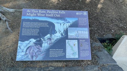
|
... Paulina Falls ...
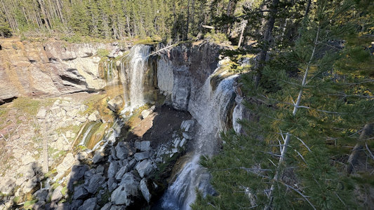
|
... and a closer look
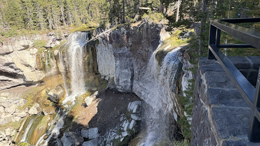
|
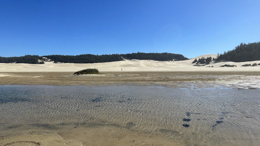
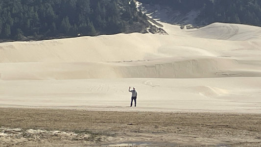
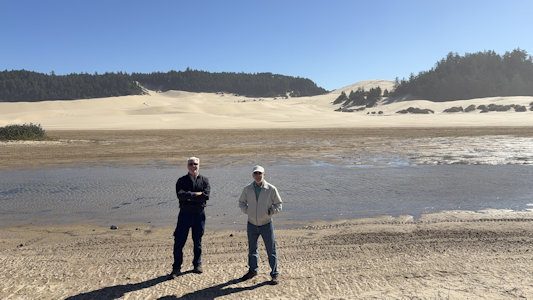
Oregon Dunes National Recreation Area
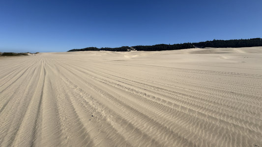
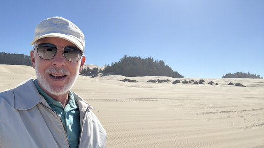
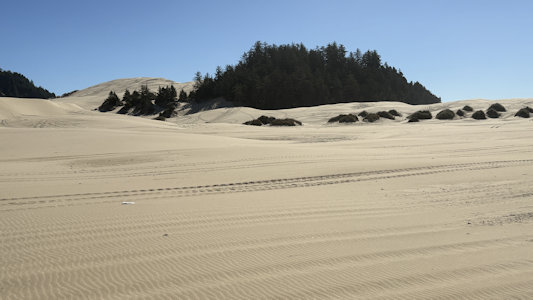
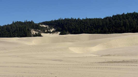
9/26/2025 Here we headed back south for the first of our coastal sights, the USFS Oregon Dunes National Recreation Area. Formed
by the ancient forces of wind, water and time, these dunes are like no others in North America, and extend for 40 miles along the Oregon coast between
Florence and Coos Bay. Wind sculpted dunes tower almost 500 feet above the ocean shore and blend with rivers, lakes and temperate rainforests to create
a remarkably diverse ecosystem. This long stretch of dunes runs a long way up the coast; we picked it up at a representative area that looked like it
had some nice viewing. We first parked at an area for the actual dunes, and saw a lot of people with trailers of OHVs, especially ATVs. Many people
were zipping up and down the dunes, looking like it was a lot of fun. Our VW SUV not being appropriate, we just walked out for our photos of the
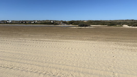
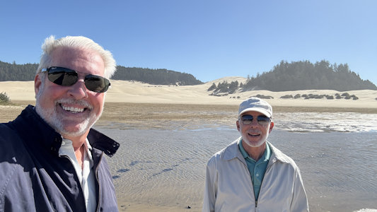
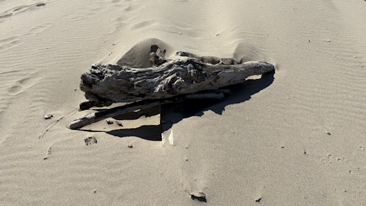
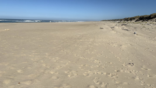
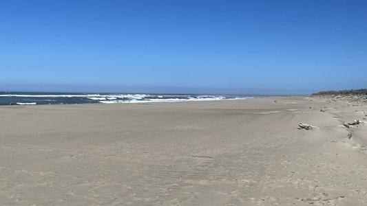
impressive dunes. Moving the car a little up the coast we parked and walked to the ocean beach side of the road. Although beautiful and serene, this
stretch of beach did not have some of the interesting features we’ll see later.
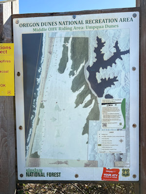
The park sign ...
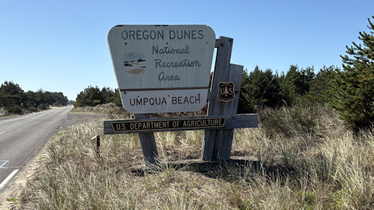
|
... and info
|
A panorama on the dunes side
|
A view across east ...
|
... and north
|
See me waving?
|
A little clearer now
|
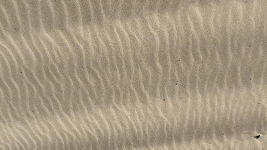
Little tiny micro dunes
|
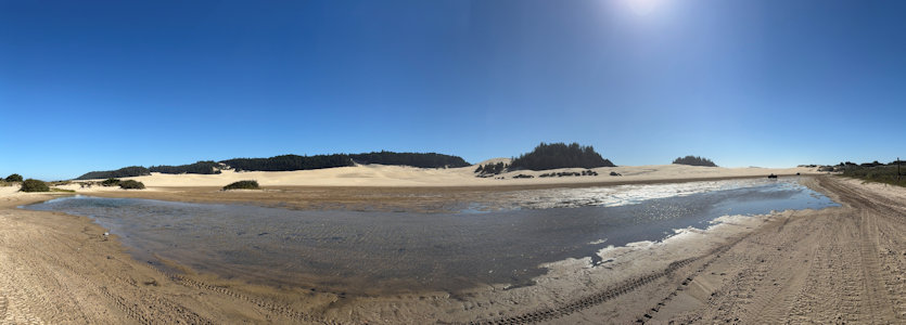
A panorama of the riding area ...
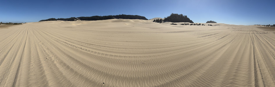
|
... and north
|
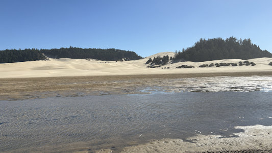
Looking back to Ken ...
|
... and me
|
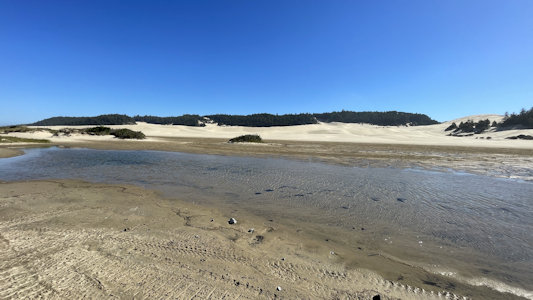
More riding dunes ...
|
... where I am
|
A regular selfie
|
Can you see the camera?
|
There it is, ready to take ...
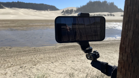
|
... a photo of us
|
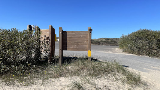
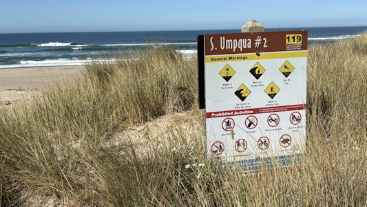
Some signage on the ocean side ...
|
... and a panorama
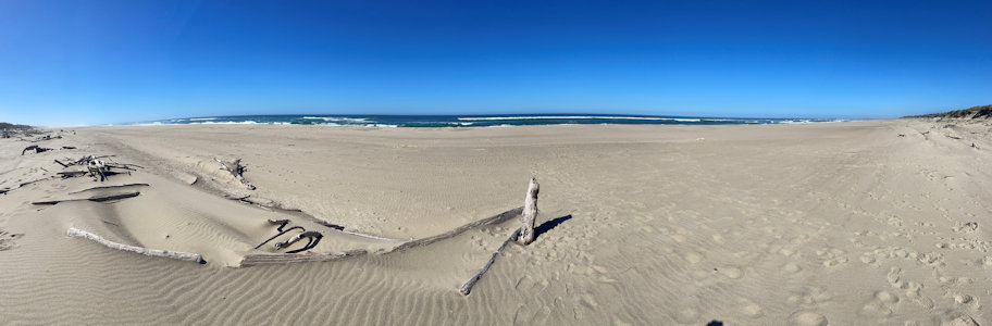
|
Looking south ...
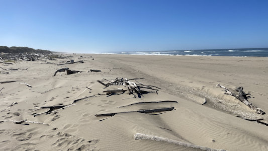
|
... with some driftwood ...
|
... and looking north
|
One more look
|
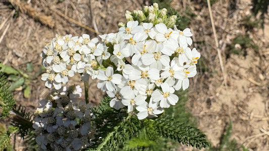
A pretty beach plant
|