|
|
|
|
|
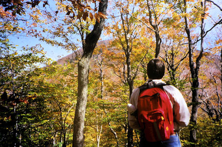
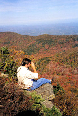
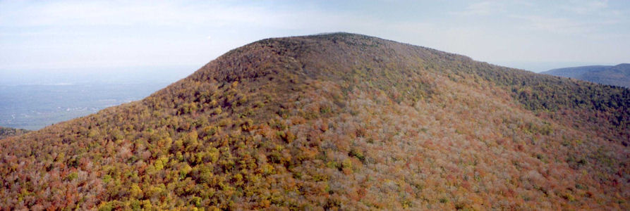
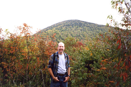
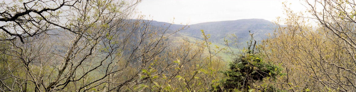
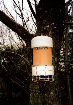
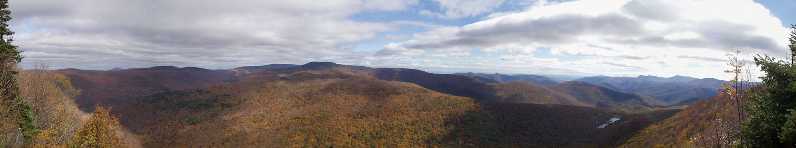
These are the 35 peaks in the Catskills that are above 3500 feet in height, listed in height order starting at the highest. Our goal is to climb them all (the ones with links are the ones we have). We may not make it, but we'll have fun trying! Most of the peaks have marked trails to the top, but a few do not, and bushwhacking is required. Most of these bushwhack peaks have a canister at the top, where you can sign in to prove you've made it.
|
1. Slide |
2. Hunter |
3. Black Dome |
4. Blackhead |
|
5. Thomas Cole |
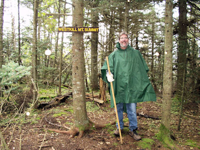
6. West Kill |
7. Graham |
8. Doubletop |
|
9. Cornell |
10. Table |
11. Peekamoose |
12. Plateau |
|
13. Sugarloaf |
14. Wittenberg |
15. Southwest Hunter |
16. Lone |
|
17. Panther |
18. Balsam Lake |
19. Big Indian |
20. Friday |
|
21. Rusk |
22. High Peak |
23. Twin |
24. Balsam Cap |
|
25. Fir |
26. North Dome |
27. Bearpen |
28. Balsam |
|
29. Eagle |
30. Indian Head |
31. Sherrill |
32. Vly |
|
33. Windham |
34. Halcott |
35. Rocky |
|
[5/26/98 Aborted attempt]
10/11/00 Wednesday
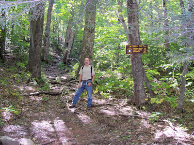
Bill arrived at Ken's house early; on the road by 6:30. Quick stop for deli breakfast, then headed upstate. Took a new way over the Whitestone and up the Hutch which worked out great. Stopped on 28 for deli lunch food, then headed down 47 to the trail parking area at Slide. Temperature a cool 49 deg., but otherwise a beautiful day - bright sun, leaves just a little past full color. A few people parked here already and getting on the trail. Changed into hiking boots, loaded up, and on the Phoenicia-East Branch trail at 10:50.
11:23 (delta 0.6, total 0.6 miles) Reached a water source (the pipe kind). Pretty stiff climbing, especially with the full packs.
11:27 (delta 0.1, total 0.7 miles) Intersection with the Wittenberg-Cornell-Slide trail, which we will take later. Time to look for a campsite further down the PE trail.
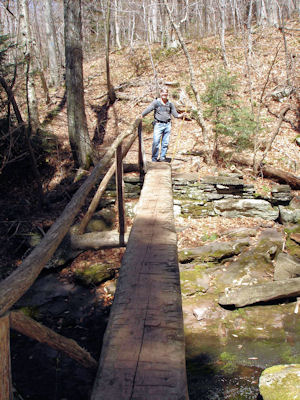
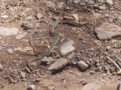
11:44 (delta 0.2, total 0.9 miles) Arrived at the spot where the trail crossed a stream which leads down to the West Branch of the Neversink. Found a great spot right near the stream, with flat, clear spots for the tents and some boulders for cooking on and building a fireplace. Had lunch sitting on a big rock by the stream, and did a little site prep for later. Back on the trail with the daypacks at 12:30. Went the little way back up the PE, then got on the WS that we passed before. The trail is fairly wide, climbing steadily with no big rock walls or anything really tough. On the way saw a little snake, gray striped about one foot long. At around 3700 feet altitude, saw patches of snow left over from the previous weeks bad weather.
1:57 (delta 1.55, total 2.45 miles) Intersection with the Curtis-Ormsbee trail, our way down later.
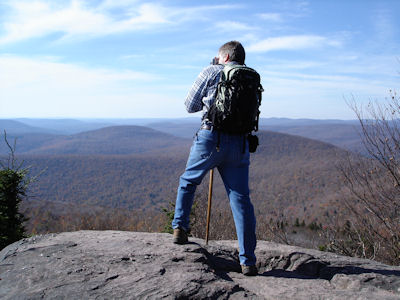
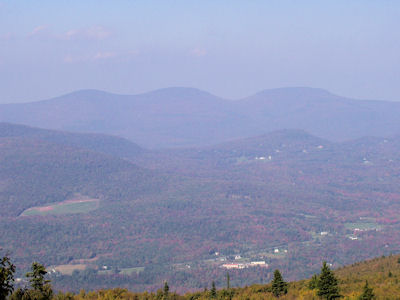
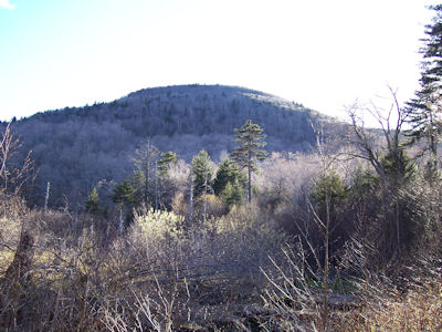
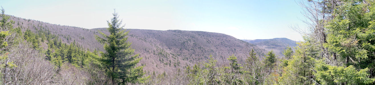
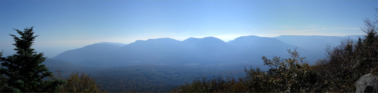
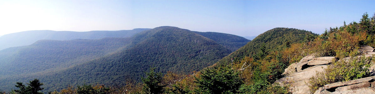
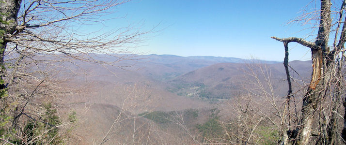
2:26 (delta 0.7, total 3.15 miles) Hit a great view north-east. To the north is Panther (tomorrow), and an excellent view of the Giant Ledge, especially with the southwest lighting putting the ledge in shadow. To the north are Cornell and Wittenberg. Enjoyed the view for a while, then continued to the summit.
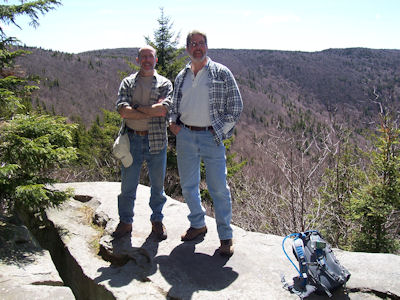
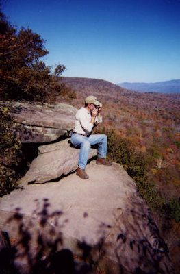
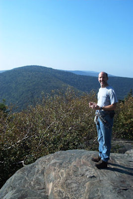
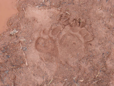
~ 2:40 (delta 0.1, total 3.25 miles) Reached the summit. According to the dots on the map, there should have been the Burroughs Plaque on the left, followed by a view on the right. At the summit, there was a small cement pad with some bolts showing. Down the trail a short way was a big rock ledge area, from which we had a great view east, with the town of Phoenicia with bridges over the Esopus visible. We searched for the plaque a little; Bill thought that it used to be on the cement pad, based on the map. Ken needed to see a plaque, so after he searched a bit more, he found it - on the face of the ledge we had been standing on! Mission accomplished, we could head back down. Retraced our steps down to the CO trail, and headed down that. The CO, and the part of the WS up Slide is on the Long Path. On the way down the CO, Ken spotted what he had read in a trail guide – bobcat poops on a rock, complete with long hairballs. Took a picture of this lucky find!
4:03 (delta 1.85, total 5.1 miles) Good view south, seeing Table and Lone.
4:18 (delta 0.2, total 5.3 miles) Another good view south.
4:36 (delta 0.35, total 5.65 miles) Intersection with the PE trail. Saw the monument we saw the last time we were here on a failed attempt on Slide (ran out of time and water) - made it this time!
5:00 (delta 0.6, total 6.25 miles) Back to camp.
|
|
|
|
|
|
|
|
|
|
10/1/99 Friday Ken arrived a few minutes after 7:00; quickly packed and on the road. Stopped to pick up Dunkin’ Donut breakfast. Ran into very heavy traffic on L.I. and the Bronx, but broke free in Westchester. Cruising along great until just before exit 19 on the Thruway, where we saw a sign saying something about route 23A past Palenville (where we wanted to be) was closed – exit at 19. Thinking we could wing it, we continued up to exit 20 and, sure enough, the road was closed after Palenville! The only alternative was a longish drive completely around the mountains in the Acra area (Acra Point, Burnt Knob, Windham). At one point we passed the nice restaurant with the great view that the whole family had eaten at on a Hunter trip. Cutting down through the center of the mountains, we finally came out in the town of Hunter, where we picked up the usual deli lunch. Continued only a couple miles down route 214 and, after circling once because we missed it, parked at the Becker Hollow trailhead. Finally hit the trail at 11:45 and registered. The first part of the trail was flat, through grassy glades and down what appeared to be an old road, and past an old foundation from something right on the river. Due to recent heavy rains and hurricane, all the streams and rivers were nice and full. Continued up stream a bit, then, at about 0.5 miles, found a great camp area. The tent area was down a slope, where it flattened out a bit in the “pine” trees, then down a very steep slop to the riverbed. The river was running nicely, with waterfalls making a great sound. To make it perfect, there was a huge, flat rock, waist high, just at the edge of the river. Having decided “this is the place”, around 12:15, we dropped the packs and had lunch. The new-and-improved day pack system required a little assembly. Bill had the GPD egg antenna mounted on a section of PVC pipe, running along the main pack. Strapped to the was the day pack, rolled up. Ken was carrying a flat piece of plywood, sized to fit the back of the daypack (and also set up to act as a table top that would sit on the camp chair – not used this trip because of the great kitchen rock!). The GPS pipe mounted to the plywood in the pack with screws and wingnuts, with the pipe running through a hole in the pack. In the pack went water, snacks and shirts. The weather was absolutely perfect – sunny, clear and cool, with the leaves in mid change. Back on the trail at 12:55.
2:25 [1.9 miles] Hit the intersection of the Becker Hollow and Hunter Mountain (spur) trails. The way up was not too bad, just climbed inexorably without much rest in flat areas. Lots of little streams crossing the trail. Two other hikers had suggested the best route to the top of Hunter was to continue up the BH trail and come back the HU trail, so we decided to do that. This hike we had a copy of the trail map with a lat/lon grid drawn on by Ken and covered with self-stick clear plastic. On the back is a table of key waypoints and lat/lons. Throughout the hike, correlation between the map/table and the GPS was very good, and it was quite handy for finding where we were between waypoints.
2:50 [2.05 miles] Intersection of the BH, main HU and Spruceton Valley (SP) trails near the top of Hunter in a nice flat area. Just a short distance down a spur was a spectacular view south from a rocky ledge. The wind was very strong (at least 25 mph), making it quite cool, but the view was unbeatable. Directly in front was tomorrow’s goal, Southwest Hunter, and off to the right was Spruceton Valley. Spent a few minutes taking panoramic photos and enjoying the sights. Continued on the SP trail past the summit of Hunter at 4040 feet.
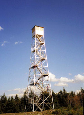
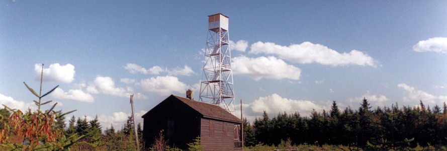
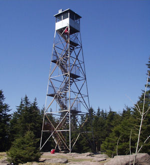
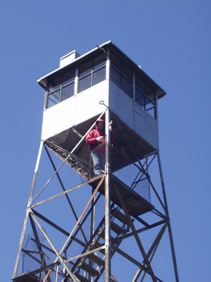
3:20 [2.3 miles] Reached the large clearing at the top of Hunter. Here there is a small cabin and an 8 story fire tower. We climbed the tower, and although the little cabin at the top was locked and boarded, the view from the top landing was great, especially to the northeast and southeast. Saw the Hunter ski area, 23A and the towns on it, and a great view of Black Dome and Blackhead. The wind was quite strong up there as well. Got back on the trail (the HU spur) at 3:50.
5:00 [4.0 miles] Back to campsite.
|
|
|
|
|
|
10/5/98 Monday Ken arrived a little after 6:30; picked up Dunkin Donuts breakfast and on the road at 7:00. Stopped at the rest area on the Thruway for creamers, and headed up north. Stopped in Tannersville to pick up sandwiches, hit the back roads, and parked at the end of Big Hollow Road east of Maplecrest. Changed shoes, and got on the Black Dome trail at 11:00. Weather is beautiful - clear skies, cool, leaves starting to change. Signed in the register and headed up the trail along the Batavia Kill.
11:28 (0.50 miles) Intersection of Black Dome and Batavia Kill trails. Continued for a short distance up the BD trail, and headed into the woods to look for a camp site. A stream (low on water, like all the streams) ran along the trail; found an ideal site on the other side of the stream in light woods near a glade of ferns.
11:40 Dropped the packs at the campsite. Had our sandwiches, and planned the tent/fire/cooking placement. Took the day pack off the main pack (GPS already attached), packed water and snacks.
12:25 Back on the BD trail, heading up the col between Black Dome and Blackhead mountains.
12:35 Crossed a stream; trail getting steeper and rockier. Can see the peak of Black Dome through the trees - it looks very high and steep!
12:56 (1.30 miles) Reached a spring - no water at all coming out of the pipe. From here on, can get some views back to last years hike area north around Burnt Knob.
1:32 (1.70 miles) Made it to the top of the col. The trail up was pretty tough - very steep in spots, lots of rocks. Continued along Black Dome trail up Black Dome, an even steeper ascent.
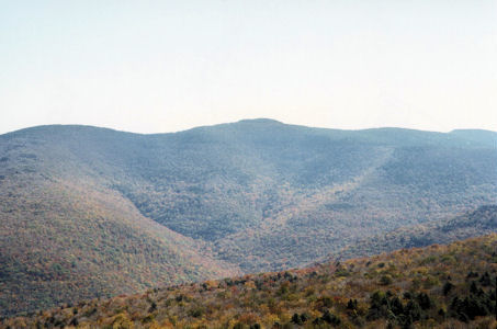
1:53 Nice view of Blackhead (looks very big, too!), and a little north.
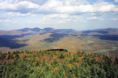
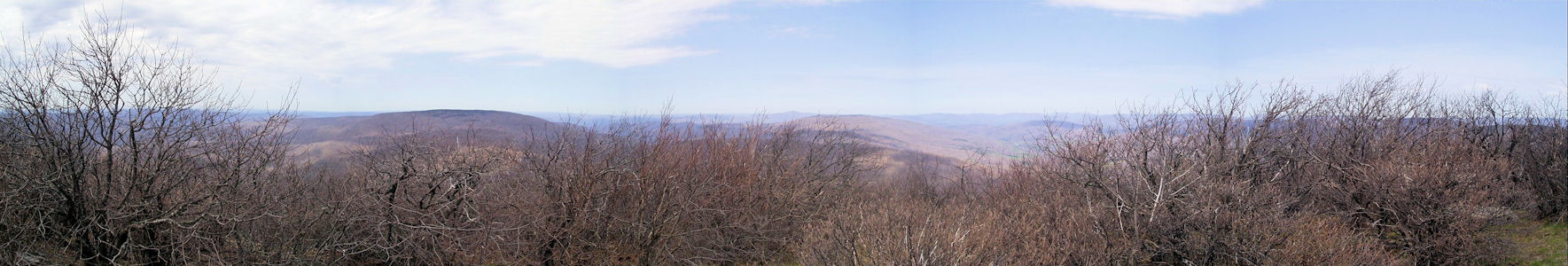
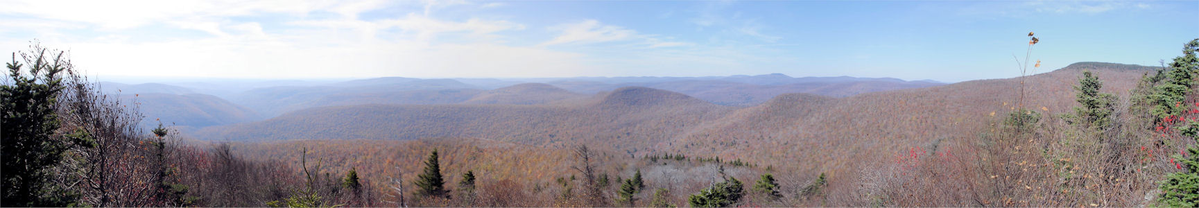
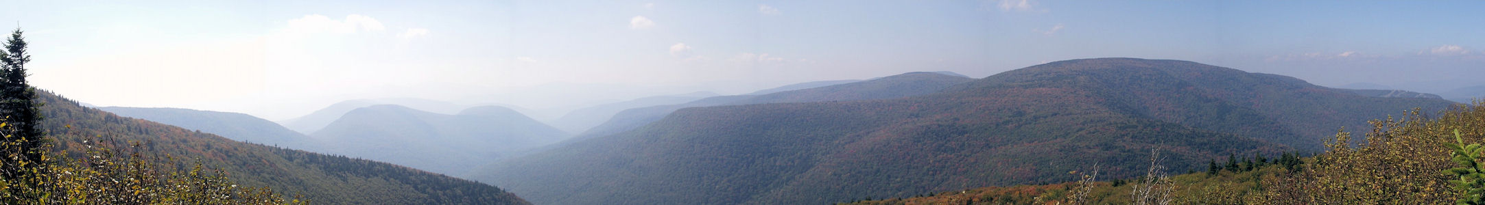
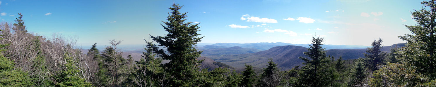
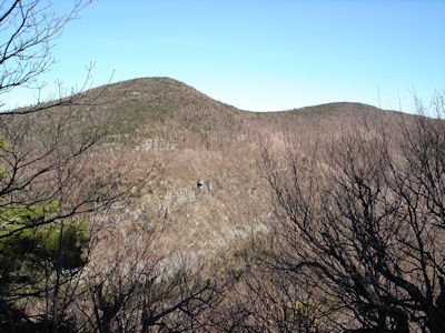
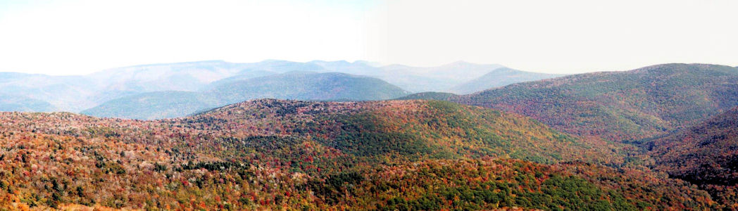
2:14 Climbed up and around a rock wall for one of the best views in the Catskills. Right in front (to the east) is Blackhead, with a bare rock area that we should get to tomorrow. To the north is Acra, Burnt Knob and Windham High Point. To the south, in the foreground, is Onteora and the East Jewett Range, Lake Capra and Colgate Lake; in the distance Hunter, Plateau, Sugarloaf, Twin and Indian Head mountains. Can see the ski slopes on Hunter and at Cortina valley. Hung out here a long time, enjoying the great view, weather, sounds, smells, etc. Continued up towards the summit.
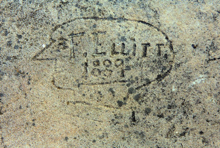
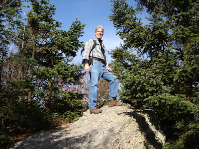
3:03 (2.30 miles) Reached a south-facing rock on the summit. Lots of people have carved or scratched their name on the rock, including some in the late 1800s. We added our initials and date by scratching with a stone - don’t think it will last long. Enjoyed this view for a while, then headed back down at 3:30.
4:30 (~4.10 miles) Back at camp.
|
|
|
|
|
10/6/98 Tuesday Woke up around 7:30 - night had gotten pretty cold, probably in the high 30’s or low 40’s. Out of the tents at 8:00. Had that first great cup of coffee, then the usual wolfed-down breakfast of eggs with bacos, followed by oatmeal and raisins. Ken did dishes while Bill packed the day pack with water and lunch, then broke camp and cleaned up. Left the packs at the site and hit the trail down the BD a short ways to the BK. Headed up the BK trail; Ken noted a nice little fern-filled glade to the side - turned out to be the back of our campsite - didn’t know we were so close!
10:52 (5.05 miles) Intersection of the BK and ES trails. Where last year we headed north towards Acra, this year we headed south towards the rather large-looking Blackhead. Having problems with the GPS getting a lock - seems like bad GDOP is hurting us. Oh well.
11:25 Nice view on the ES trail. Getting peeks of the Acra/Burnt Knob area, Blackhead, and the Hudson valley. Shortly after here the trail gets seriously steeper. With burning legs, hearts and lungs, the best way to proceed is to do short bursts with short rests in between. The distance traveled is not that far, but with the steep climb the vertical increase is noticeable.
12:23 (6.05 miles) Summit of Blackhead. Very nice up here with a lot of flat rocks in an open area surrounded by pines, but no views. Relaxed on a nice sitting rock, and had our usual cheese-carrots-chicken-fruit-pudding lunch. Chatted with a lone hiker for a while, then headed down the Blackhead Mountain (BM) trail towards the col between Blackhead and Black Dome.
1:31 Rocky outcropping on the side of Blackhead that we had seen and photographed from Black Dome yesterday. Wonderful views here, with Black Dome looming in front and the ranges north and south heading off to the west. Tried to reproduce a photo from the hiking guide here, with questionable success. Hit the trail for the stretch home.
1:59 (6.65 miles) Intersection of BM and BD in the col. Headed down the BD towards camp (third time on this section!).
2:30 (~7.85 miles) Back at camp. Reattached the day pack to the main pack, and headed out.
2:50 Intersection of BD/BK - last stretch.
3:09 (8.35 miles) Back at the car. Not dead tired - pretty good considering the climbing we did for the great sights. Changed shirts, socks and shoes and got on the road. Stopped at the rest area on the Thruway for McD’s dinner, and hit Levittown around 7:15. Another excellent adventure!
|
|
|
9/27/01 Thursday Bill up right before 7 (appetite returned with a vengeance!) and Ken shortly after; out of the tents by 7:30. The usual coffee, 4 eggs and oatmeal breakfast really hit the spot. Overcast skies, but still comfortable. Started cleanup around 8:45, once last cup of coffee, and packed up. Hit the trail at 9:45.
~10:00 (delta 0.2, total 0.2 miles) Back to car. Arranged the daypacks, headed off to the next trailhead by car. Parked at the end of Barnum road.
10:35 Hit the Black Dome Range trail. After skirting private land while climbing a rocky old road, signed in at the register.
~11:20 (delta 0.9, total 1.1 miles) Reached the first of two bumps on the way up, the first called Caudal. Nice views south, including Hunter with the tower visible. Note: hiking today is pretty tough - legs are really worn out from yesterday and tire quickly.
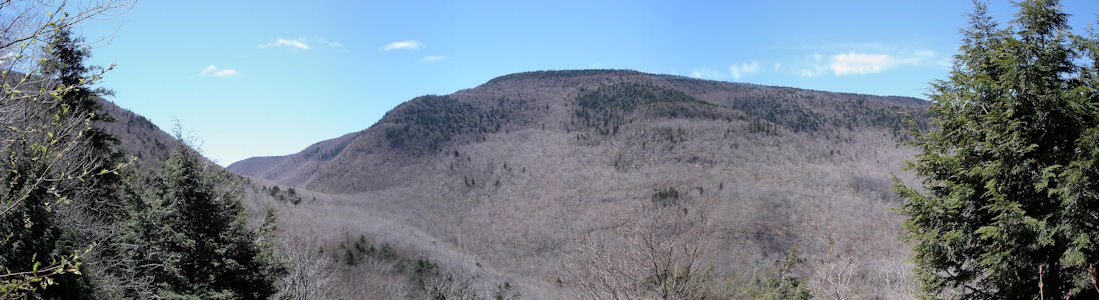
12:30 (delta 0.6, total 1.7 miles) Top of second bump, called Camel's Hump. Nice lunch on a rock here, and "enjoyed" the good view of Thomas Cole looming in front of us. Weather is threatening, with darker clouds forming, but ultimately no problem. Back on the trail at 1:00.
1:35 (delta 0.9, total 2.6 miles) Peak of Thomas Cole. Unfortunately, no view to be had up here, just the satisfaction of having conquered 3500 Club peak number 10. Back on the trail at 1:45, heading steadily back.
3:30 (delta 2.4, total 5.0 miles) Back to the parking area. Cleaned up, changed shoes, etc. and headed on out. Stopped near the Thruway for gas and snack, and again near Harriman for McDs dinner. Back to Ken's house before 8:00; dropped him off with all his gear, and Bill headed home, another great hiking adventure complete.
|
|
10/02/03 Thursday Bill left at 6:30; over to Ken’s house, on the road by 7, picked up Dunkin Donut breakfast and the usual rest stop donut. Into the Catskills, on 28 to 42, onto Spruceton Road to the trailhead parking. Explorer thermometer said 38° and some light rain was coming down – uh oh! Luckily the rain stopped, and we loaded up with full packs. Headed down the road, onto the Diamond Notch trail after signing in at a little after 11:00. Looked for campsites while walking along the Westkill, but “No Camping” signs were everywhere. Decided to go with Ken’s plan and continued to the bridge over the river. Continued down the river on the other side along the Devil’s Path trail.
12:00 (delta 0.8, total 0.8 miles) Left the trail where it turned up the mountain, went into the woods a little and down a little hill to near the river. Found a nice campsite (complete with circular stone fireplace), no “No Camping” signs, so loaded up the daypacks and covered the packs with a tarp. Back up to the trail around 12:30.
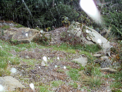
1:15 (delta 0.8, total 1.6 miles). After passing a spring, found a spot for lunch (the usual, with a change from Bel cheese to Gouda). Climb has been steady, but not unusual. Continued on the trail at 1:40, coming to a cave (a hollow under a rock overhang), with a used fire pit area. At one point, thought seeds or something were coming off the trees – realized it was snow! Very odd snow – looked like driveway salt.
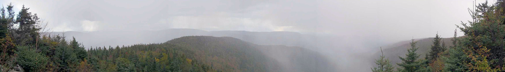
2:50 (delta 1.4, total 3.0 miles). Reached a great overlook (Buck Ridge Lookout). Fantastic views, almost 180°, SW to NE. Saw Hunter and tower, Blackhead range, Indian Head and other parts of Devil’s Path. Noticed some clouds stretching to the ground to the SW; in short time a snow squall had attacked us from behind and left us in a little snowstorm. Great views of the snow falling below us into the valley, but no views of mountains. The squall blew through, and the views reappeared. Headed off a short distance to another view to the north, also seeing the Blackhead range and the Spruceton Road in the valley. Continued a tenth of a mile up the trail to the true summit of the mountain, then headed back down the trail around 3:30.
5:05 (delta 2.4, total 5.4 miles). Back to camp.
|
|
|
|
|
|
04/29/04 Thursday Up at 7:00, out by 7:30, in a clear, not-too-cold morning. Did the usual coffee, eggs, drop the tents, oatmeal, but broke the pattern in electing not to have a second cup of coffee. Loaded the day packs with lunch and remaining water (day promises to be quite warm), loaded the main packs and left them at camp, hitting the trail at 9:50.
10:05 (delta 0.7, total 4.75 miles) First BL/DB.
10:35 (delta 0.95, total 5.7 miles) Second BL/DB. Continued a bit further down the DB.
10:40 (delta 0.2, total 5.9 miles) Intersection with unmarked trail towards Graham. The trail continues to be easy on the feet, with few rocks, but since it is unmarked and un-maintained has many annoying trees across it which must be pushed through or skirted. Headed downhill a bit, passed another unmarked trail/old road down the mountain and continued on towards the summit of Graham. Have shed all outer coats/shirts, the day warming up nicely and still clear skies with occasional cumulus. Pressed on to the summit, getting fooled many times by local peaks (“I think we’re there...”), only to find yet another peak behind it.
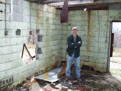
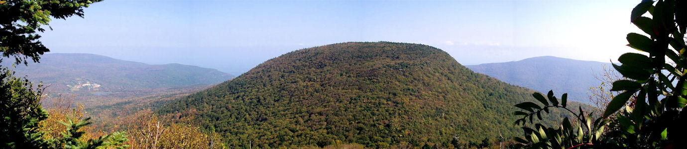
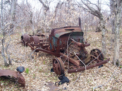
12:01 (delta 2.1, total 8.0 miles) Summit of Graham. Nice views back to Balsam Lake (can see the tower) and the Seager valley. Up here is an old abandoned TV relay station, with a block building and support towers. Sat in the roofless building (windy and chillier up here) among the pieces of tin roof and bits and pieces of electrical stuff and had lunch. Enjoyed the view a little more, and headed back down at 12:45.
1:58 (delta 2.1, total 10.1 miles) Back to DB trail. Very hot and tired by now!
2:01 (delta 0.2, total 10.3 miles) Second BL/DB.
2:24 (delta 0.95, total 11.25 miles) First BL/DB.
2:38 (delta 0.7, total 11.95 miles) Camp. Without pausing to think about the pain, put on the big packs and hand carried the day backs back on the trail.
2:50 (delta 0.2, total 12.15 miles) At the car. Cleaned up and got on the road. Car thermometer now reading 74°! Headed back to 17. Since it was reasonably early, and we were so close, decided to take a quick run over to Onteora. The camp matched the memories well, and looked in fine shape. Drove past the Admin and Health buildings, stopped at the lake, and continued to the PX. Back on the road to 17 and got gas a little south of Livingstone Manor. Usual McD’s dinner on the Thruway, and back to Kings Park in fairly light traffic by 7:45.
|
|
|
|
|
(no log)
(no log)
5/27/98 Wednesday Up at 7:00, beautiful day. Had the usual breakfast of coffee, Eggbeaters with Bacos, oatmeal with raisins. Great food again! Broke camp; Ken did KP (how appropriate) in our little stream up the road, while Bill attached the day pack to the main pack with GPS antenna still on it, for easier exchange later. Bugs are back. Back on the trail with full packs about 9:30.
9:57 Left the main packs in the woods just beyond the PT trail intersection (6.0 miles). Took lunch and 4 waters in the day pack. Headed down the PT trail.
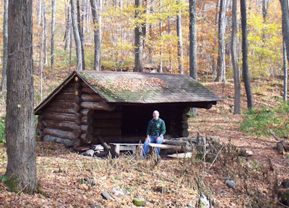
10:18 Reached the East Branch of the Neversink River, which we had driven along yesterday on the way in, after crossing the Deer Shanty Brook by walking on two large logs about a foot apart - wouldn’t be fun with the big packs. Saw the nice lean-to in this area (6.35 miles).
11:07 Hit a viewpoint; not the greatest due to obscuring foliage. Very tough trail - steady uphill hiking, with periodic rock walls to scramble up.
11:19 Another better view, though still obscured by foliage. Lots of steady, hard climbing. Finally passed the 3500 foot sign (that’s a large sign!), and shortly after hit the plateau at the top of the mountain (8.5 miles). Right around here the trail turned into a winding path in evergreen trees with a great smell.
12:28 Here the path started sloping off again (8.8 miles).We were trying to find a last good viewpoint shown on the map; Bill continued a ways down the other side but it was not to be found. On the way saw a 1.5 foot snake (olive/brown with yellow side stripes). Back down the nice path heading back.
12:36 Stopped for lunch of cheese, carrots, canned chicken, raisins and a leftover pudding.
1:18 Back to where the mountain sloped off again; Bill climbed a tree to try to get a better view. It helped a little, but still a lot of foliage. Took the long trail back down the mountain. A lot easier on the lungs and legs, tougher on the knees. Crossed the streams again, back to the trail intersection (11.6 miles). Reloaded the main packs, and hit the trail once more. Starting to get really tired, and the big packs don’t help. Luckily the trail here is pretty easy and downhill.
3:46 End of the trail (12.8 miles). Signed out, quite tired. Back on the road, through back roads to Liberty and home around 8:00. Another great hiking trip.
|
|
|
|
|
10/16/06 Monday Bill arrived at Ken’s house around 6:20 in the Explorer and got quickly on the road. Picked up Dunkin’ bagel breakfast and headed up to the Catskills in some traffic, stopping at the usual rest area. Navigation for this provided by Bill’s StreetPilot GPS “lady”; took us right to the parking area on Route 42 (although she disapproved of some of our route choices getting off Long Island). Packed up the day packs and hit the Peekamoose-Table (PT) trail at 10:35. Weather is perfect – cool high 40’s hitting near 60 under absolutely clear skies.
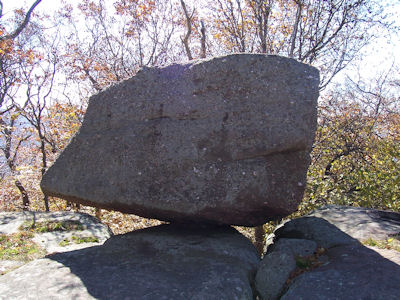
12:25 (delta 2.3, total 2.3 miles) Reconnoiter Rock, a car-sized boulder balanced on a flat rock ledge. Trail here has been pretty easy, including the gently-sloped, relatively rock-free old road near the beginning, but including a few short scramble sections. Saw two little snakes a little over a foot long and more than the usual number of chipmunks, it seemed. The warm sun and nice natural chairs made this spot perfect for lunch. Mostly usual fare (chicken/celery/jack cheese), with salted peanuts and a couple pickles added. Tasted excellent, although Bill had perhaps a bit too much too fast to be followed by hard hiking! Back on the trail at 1:15.
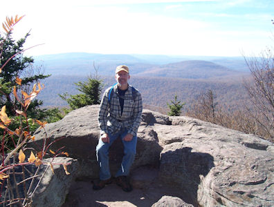
2:00 (delta 0.75, total 3.05 miles) Excellent 180° view south! Could see Table to the east, Doubletop, Balsam Lake and many other non-3500 peaks. Hung out here, taking photos, etc. Back on the trail at 2:15. Ascent to here and from here to the peak is some steep sections with scrambles alternating with some relatively flat areas. The climb is the largest total ascent we’ve had to do – around 2400 feet.
2:50 (delta 0.85, total 3.9) Peak of Peekamoose. Not a whole lot up here, just a small clearing with a big boulder off to the side. Ken climbed to boulder and could see a little bit, but was blocked by nearby trees for the most part. After a quick look around, on the trail down at 3:00.
3:55 (delta 1.6, total 5.5) Back to Reconnoiter Rock.
5:00 (delta 2.3, total 7.8) Back at the car. Cleaned up, and hit the road back home. Stopped at the usual gas station for gas and a snack, and the Ramapo rest stop for McD’s. Arrived at Ken’s house around 8:45, and Bill arrive home at 9:20. A nice hike in great weather, and another 3500 bagged.
|
|
|
|
|
|
|
10/01/02 Tuesday Bill awake at 6:00, out at 7:00; Ken out around 7:30. Decided to take advantage of the nice stream with big rocks and boulders near it, so carried breakfast supplies down and set up. Great cooking area with counter-high ledge on a big rock, little waterfalls a few feet away, beautiful views of the local sunrise. By a little after 8:00 had the first cup of coffee and delicious eggs (3 a piece) with bacon. Dropped the tents, and around 8:45 continued breakfast with 1 1/2 servings of oatmeal a piece with cinnamon, sugar and half-and-half, and a second cup of coffee. Cleaned up by 9:30, with Ken’s effort of cleaning dishes made easier by having the stream right there. Completed packing up, policed the site, and on the trail at 10:00.
10:15 (delta 0.3, total 6.1 miles) Back at the car. Bill put together the daypack, while Ken used the latest in camping gear, the laptop, to download yesterday’s pictures from the digital cameras. Hit the road towards the next hike, with the plan of checking out parking areas for other hikes up to the Devil’s Path. One didn’t pan out – no obvious way through private property to the trail. Found a second trailhead not apparently on the map, and then had to abort the effort due to a bridge under construction. Worked back around and down 214 to the parking area at Notch Lake in Stony Clove Notch. Hit the Devil’s Path trail, heading east this time, at 11:15. The first part of this trail is only a mile, but it climbs about 1700 feet, and is absolutely relentless, with virtually no flats. Very quickly got into a pick-a-spot, climb-up-to-it, rest-a-while, repeat mode. Tried something different that seemed to work well – started drinking small amounts of water, even before getting thirsty, every few rest stops. Ken carried 6 bottles of water, and in the unseasonably warm weather, it was needed, as a lot was getting sweated off!
1:15 (delta 1.0, total 7.1 miles) Reached Orchard Point, the west end summit of Plateau. The last 10 feet was straight up a rock ledge, to reach outstanding views. To the south, many mountains and ranges could be seen, back lit in the haze. To the west, Hunter loomed, with the ski slopes visible to the north. Hung out here a while, resting and enjoying lunch (same as yesterday, with carrots replacing celery and Ken having chicken as well).
Back on the trail at 1:50. Not far along, found a nice ledge with a big boulder and views to the north and east. After a photo op, continued down the trail along Plateau. From here, it’s a stroll, as the guidebooks say, through the woods with the smell of spruce.
2:45 (delta 2.0, total 9.1 miles) Declared ourselves at the peak of Plateau (3500 Club #12). The trail started sloping downhill, and the GPS said we were in the right area. No views here – we would have had to head downhill for that, and it was getting late. Headed back, making quick time. Stopped at the boulder overlook, realized that what we thought before might be the Blackhead range was actually High Peak/Roundtop, so Bill climbed the boulder to get photos of the Blackhead range. Continued back to Orchard Point, where we had pudding snack.
3:45 (delta 2.0, total 11.1 miles) Left Orchard Point for the final leg downhill. Down is easier than up, but not much, especially on tired knees.
4:40 (delta 1.0, total 12.1 miles) Back at the car. Took some photos around the lake, changed shirts/shoes, and hit the road home. Stopped on 28 before the Thruway for gas and snack, then at the Ramapo rest stop for McD’s. Reached Ken’s house at 8:45, and Bill headed home from there. An enjoyable and successful fall outing!
|
|
|
|
|
|
05/09/05 Monday Bill arrived at Ken’s house around 6:45 in Bill’s new Explorer (a.k.a. Terry’s previous one); headed out shortly after. Went to get Dunkin’ breakfast but it was gone (razed) – oh well, across the street for coffee and roll/muffin at a gas station. Headed upstate on a cool, gorgeous day. Traffic not too bad, off the Thruway in Saugerties and down Platte Clove Road and then back roads to the trailhead of the Roaring Kill (RK) trail. As we were pulling in a couple of ladies with strollers passed us, heading for the stream (Roaring Kill) just down the road. Bill checked out the stream area for camping and it looked promising, so Ken checked it out while Bill looked at a potential spot right up the trail from the register box. The stream looked like it would work, so put the packs on and headed there at 11:00.
11:05 (delta 0.1, total 0.1 miles) After passing the ladies/strollers, found a likely spot downstream on the opposite side. Beautiful area – lightly wooded, right next to a rocky/sandy area created by spring washout of the stream. Dropped the packs and set up the daypacks. Ken has a new one, which has a bladder in it to hold a bottle or two of water. A little tube passes over his shoulder and hooks into a little loop, ready for a quick sip anytime. With the daypacks loaded and GPS on, headed back to the car.
11:20 Trailhead (delta 0.1, total 0.2 miles) On the RK trail.
11:35 (delta 0.25, total 0.45 miles) Trail junction. Continued from here on the Mink Hollow (MK) trail. Hiking is pretty easy as these trails go, with good footing and not steep climbs. Passed an old quarry, with the trail appearing to have been cut through one of the tailings piles, creating a kind of wall.
12:55 (delta 2.0, total 2.45 miles) Reached a nice overlook on a boulder, looking at Plateau Mountain. Had lunch here, consisting of celery, cheese and salami. Very relaxing sitting in the sun, enjoying the view, but miles to go before we sleep! We noted that the trail had a tight switchback at the overlook; we came in on the lower trail, so headed out on the upper at 1:25. At some point we finally realized we blew it – we were heading back the way we just came! Oops – turned back, annoyed at ourselves. Luckily, the trail was still pretty easy here.
1:47 (delta 0.7, total 3.15 miles) Back at overlook. This time, took the lower trail. Headed down into the low area we had been looking into at lunch, and up into the col between Sugarloaf and Plateau.
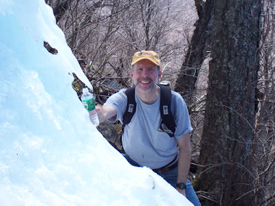
? (delta 0.55, total 3.7 miles) Junction with Devil’s Path (DP) trail. Lot’s of tough climbing getting to here, and more up to Sugarloaf – very steep, lots of rock walls. We passed through an arch in the rocks, and through the “Lemon Squeezer”, a narrow crack between two large rocks. The weather was quite warm (mid 70’s), we were getting very hot, and we realized that we didn’t bring enough water. This made the going very difficult, trying to conserve water for what we knew would be a very long afternoon. Just when we thought it would be really bad, what should appear on a steep rock face a little off the trail but a remaining ice patch from the winter! Bill found a little point of ice that was dripping steadily, and Ken found a fast running drip on the rock wall from the ice above to fill both us and the bottles. What a difference in mental attitude after that! Plenty of water, a good chunk of the climbing done – ready to conquer the mountain.
4:05 (delta .85, total 4.55 miles) Reached a boulder with a nice view back to Plateau. Continued on towards the summit of Sugarloaf. We were looking for a blazed trail to a viewpoint, and at one point we passed an unmarked side trail, but continued on. Soon, though, we felt we were at or past the peak. We went back, and sure enough the unmarked trail led to the viewpoint.
4:25 (delta 0.1, total 4.65 miles) Beautiful views looking south and east, including part of the Hudson valley, Ashokan reservoir, lakes, etc. Hung out here for a little, enjoying the rest and cool breezes, then back on the trail at 4:45, crossing the summit of Sugarloaf. Headed down on the long steep descent into Pecoy Notch. Glad we didn’t climb this way up! Really nice views of Twin all the way down.
? (delta 1.25, total 5.9 miles) Junction with Pecoy Notch (PN) trail. Much easier hiking from here out. Continued on the PN, reached and walked around a bog area; we heard frogs in this area from far away, but they got quiet when we got there.
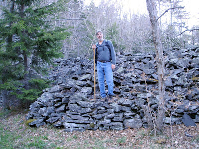
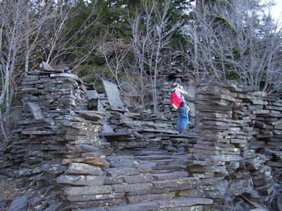
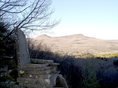
? (delta 0.95, total 6.85 miles) Reached Dibbles Quarry. This is a very interesting area with all kinds of structures made (informally) from tailings of the old quarry. This included a huge double throne platform (we sat in the thrones) with little towers, with great views across the valley to High Peak in the setting sun. The fact that the day was waning so fast was a little disturbing, but we knew we could set up camp in the dark even if it meant using the lantern. Continued on the PN and passed Mudd Quarry.
5:50 (delta 0.7, total 7.55 miles) Junction with RK trail again, having completed the loop up and around Sugarloaf.
7:02 (delta 0.25, total 7.8 miles) Back to the trailhead and the car. Left the day packs and unneeded stuff in car, and schlepped stuff to camp.
7:10 (delta 0.1, total 7.9 miles) At campsite.
|
|
|
|
|
|
|
|
|
|
(no log)
[10/2/99 Aborted attempt]
[11/15/99 Aborted attempt]
4/18/06 Tuesday Bill arrived at Ken’s house a little before 6:30 in his Explorer; picked up breakfast in the new Kings Park Dunkin’ Donuts and headed up to the Catskills with the usual rest stop. Ken bought some Gatorade in the gas station/store on 28 where we usually stop for gas on the way home, then continued to the parking area at the end of Spruceton Road. Boots on, GPS going and hit the trail at 10:25. Signed in at the register and spoke with a ranger who was checking the register book; he gave a few tips about spotting and using the herd path to get to Southwest Hunter. Headed up the Diamond Notch trail.
11:05 (delta 0.8, total 0.8 miles) Found our old campsite, as evidenced by the fireplace still there. This involved crossing the waterfall at the bridge and backtracking down the other side of the river. Ensured we had good spots for the tents and then loaded up the day packs. Bill had a new water bladder day pack (which he quickly learned to like a lot). Ken filled his with the Gatorade. Using the new thermometer-clock-compass-on-a-carabiner, determined the temperature to be a comfortable 66° under clear beautiful skies. Hit the trail at 11:30. Instead of retracing our steps up the wrong side of the West Kill, found a spot to ford it and got back on the DN trail, then onto the Devil’s Path up towards Hunter. Climbing not too bad as things go along here, although a steady ascent.
1:05 (delta 1.6, total 2.4 miles) After passing some nice white birch stands, hit a really nice view south and west from a big flat rock. Enjoyed our usual great lunch here (went back to chicken and replaced Gouda cheese with Monterey jack, which we both preferred). Also made use of Bill’s new microtripod-clamp thingie for the camera by strapping it to a tree – this came in handy a few times. Back on the trail at 1:45. Continued up the DP a bit more, then started looking for the famous herd path. The ranger had said they actually had to block the herd path a bit so folks wouldn’t accidentally take it rather than the DP, but we thought we were there using the GPS and map, so we headed off into the woods. We soon realized that we couldn’t be on any path, so we looked for it. Bill spotted an area that had potential (at least some sense of path in both directions), so we gave it a shot and it tuned out to be it. Once again (as in the first SW Hunter attempt) we launched off the trail too early, but luckily this time we recovered! This trail really hung in there for quite a while, without much altitude change, but then finally kinda pooped out in a clearing. From there we struck out where our sense of direction told us plus what was generally “up” looking for the true peak of SW Hunter (which is a bit flat at the top).
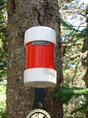
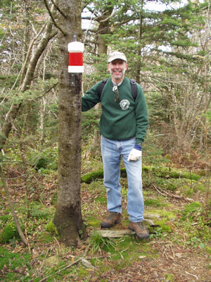
2:50 (delta 1.25, total 3.65 miles) Just as Bill said “I think I’ll look over left”, Ken did, and found the canister. Whoo-hoo – third time’s the charm! Did the requisite canister ceremony, but not much else to keep us up there as there were no views. The temperature had dropped to 55°, but still on a gorgeous day with only occasional strong breezes. There were still patches of snow and ice, however, in shadier areas. Decided to not backtrack but rather to bushwhack the way home as the total distance was much less. Headed down at 3:15. The plan was to follow the hump of SW Hunter over then down to the DN trail, but as we headed out, we kept dropping off the NE side of SW Hunter into the West Kill valley. This ultimately proved to be the most direct route, but some spots were tough, walking sideways along the mountain side or heading down steep slopes. This wasn’t to great on Ken’s toe, which had undergone surgery a month or so before, but there wasn’t much we could do. The compression bandage he put on it apparently helped some. Finally did hit the DN trail, but only a stones throw from the bridge! 59° here. Continued down the DP river trail.
5:15 (delta 1.5, total 5.15 miles) Back to camp.
|
|
|
(no log)
10/12/00 Thursday Woke up around 7, started getting dressed and packing around 7:30, out of tents by 8. By 8:45 had our first cup of coffee and first breakfast course of 4(!) eggs each, excellent as ever. Feeling a little exposed knowing where the trail was, decided to drop the tents, then around 9:30 have the second course of 1-1/2 servings of oatmeal with a box of raisins each, followed by the last cup of coffee. A healthy breakfast! Finished cleaning up the site, and got on the trail at 10:30.
11:05 (delta 0.9, total 7.15 miles) Back at the car, feeling very lucky we chose yesterday for the hike. On the way down we passed a lot of people, including a group of 14 from IBM. Headed up the road (along the PE trail) a short ways and parked. Loaded up the daypacks with water, lunch, etc., and hit the PE trail at 11:35.
12:11 (delta 0.65, total 0.65 miles) After a steady climb, the last part over a big rock garden, hit the intersection with the Giant Ledge-Panther-Fox Hollow trail, which we took.
12:47 (delta 0.75, total 1.4 miles) Down a little side trail, found a fantastic view east on the ledge. A big flat open rock, with a sheer 200 foot drop down overlooking the valley. To the north is Panther and to the south Slide, with Cornell and Wittenberg to the south-east. Took pictures, and enjoyed the view, and the day, which is perfectly clear, sunny and warm. After some other folks showed up, got back on the trail.
1:06 (delta 0.3, total 1.7 miles) Found another ledge to have lunch. Had the usual - canned chicken, carrots and little cheeses. Enjoyed this view a little, and hit the long trail up Panther. At the edge of the Giant Ledge, saw the daunting view of Panther looming high up in front of us, and the drop down into the valley, meaning we a) had to make up the difference we were dropping down before climbing Panther and b) had to climb back up on the return. Nevertheless, a slow and steady climb brought us to the top part of Panther, for a so-so view, with a bit more to go to the summit.
3:01 (delta 1.5, total 3.2 miles) The summit of Panther. An open rock face gave a view to the east, but not nearly as good as the Giant Ledge. Oh well, the point was to make the next in the 3500 club, and we made it. Didn't spend much time, but headed back. Downhill sections were tough on the knees, and the uphill area back up Giant Ledge we could have done without, but made excellent time back, even beating Ken's "management challenge" of the Giant Ledge view to trail intersection (0.6 miles) in less than 15 minutes.
4:53 (delta 3.2, total 6.4 miles) Back at the car, tired but satisfied.
Changed, cleaned up a little, and on the road home. Stopped on 28 for gas and snacks, and again on the Thruway for McD dinner. Arrived back at Ken's house a little after 9, and Bill home around 9:30. A great hike!
|
|
|
|
|
04/28/04 Wednesday Bill headed to Ken’s house at 6:15; packed up and on the road with Dunkin Donuts breakfast in hand at 7:00. Usual donut stop on the Thruway, then off on 17 up to Livingstone Manor. Saw the little caboose/info center reminding us of Boy Scout camp days. Took back roads along the Beaverkill (narrowing to one lane at times) to the trailhead parking near Balsam Lake. Temperature according to the car thermometer 32° with flakes of snow occasionally and very overcast skies. Hit the Dry Brook Ridge (DB) trail at 11:10. Note: Dry Brook comes from “Drei Brücke” meaning “three bridges”.
11:15 (delta 0.2, total 0.2 miles) Hit a big open field, and spotted a likely camp area near the far tree line. Scoped it out, and decided to stay. Packed up the day packs and back on the trail at 11:48.
12:08 (delta 0.7, total 0.9 miles) First junction with the Balsam Lake Mountain (BL) trail. The DB has been a very easy, open, many times grassy trail; the BL heads steeply up Balsam Lake Mountain – our destination. Weather is clearing rapidly to blue skies, but still cold and windy.
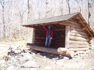
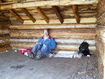
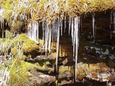
12:45 (delta 0.5, total 1.4 miles) Hit the lean-to after a short trip down a side trail. Sat in the back of the shelter out of the wind and enjoyed the usual great lunch. Headed back to the main trail and photo’ed some pretty icicles hanging off a rock ledge near a little stream. Continued up the mountain at 1:15.
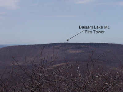
2:03 (delta 0.25, total 1.65 miles) Summit of Balsam Lake Mountain. There is an open clearing with a new fire tower here. Climbed the tower, braving very cold, very windy conditions, for a magnificent 360° view. Could see tomorrow’s destination Graham with Doubletop next to it and Slide visible between them. Also could see the towers on top of Graham, to be visited tomorrow. Virtually cloudless skies by now made for great views. Hung out and chatted with another hiker for a while (who said it was 45° according to his thermometer). Since the hike up was easy and the day was early, decided to take the longer route back down and finish off the BL trail. Back on the trail at 2:45.
3:09 (delta 0.75, total 2.4 miles) Second intersection of BL and DB, completing the half loop. Headed back down on the DB, seeing what we would encounter tomorrow on the way up. Nice trail – gentle slopes, easy on the feet (not too many rocky sections), and a beautiful section along the edge of a deep notch, looking sharply down at a stream and across to other mountains.
3:27 (delta 0.95, total 3.35 miles) First BL/DB intersection. Continued towards camp, filling 2 water bottles from a stream crossing the trail right before camp.
3:46 (delta 0.7, total 4.05 miles) Back at camp.
|
|
|
|
|
|
|
10/24/08 Friday Bill arrived at Ken’s house at 6:15 in Bill’s Explorer; got right on the road with quick Dunkin stop. Since Bill forgot the GPS beanbag base, we have a jury rigged setup with the EZ-Pass suction cup holder on the windshield securing the GPS to the dash. Took the usual route up the Thruway and 28, heading south by Belleayre. After a little backtracking on Dry Brook Road (a confusing road with forks), found the trailhead parking area, arriving at 10:05. Set up the day packs and hit the Seager (SE) trail at 10:20 on a beautiful if chilly day (initial temps at freezing or a little above, probably rising to 50 or so). Signed in the register and proceeded down a wide trail (old road) covered with leaves, paralleling the very pretty Dry Brook.
10:55 Falls (delta 0.9, total 0.9 miles) Really pretty spot on the brook with some falls and, just beyond, a bridge over some cascades and chutes. Hung out here for a while taking photos, then pushed on. The yellow-blazed trail really could use a few more blazes, as there are wide areas and forks, making it hard to be certain we’re on the trail. Crossed over the brook, using Ken’s pole for balance while stepping on stones and continued down an old road. Crossed back over the brook.
11:?? (delta 0.5, total 1.4 miles) Realized that leader Bill must have missed the trail at the first brook crossing, based on the GPS. Headed back down the road and over the brook, adding another few tenths of a mile to an already long hike.
11:?? (delta 0.2, total 1.6 miles) Back where we originally crossed the brook, and up into the woods on the trail. More climbing here than the really flattish early part.
12:00 Lean-to (delta 0.9, total 2.5 miles) Checked out the nice lean-to and fireplace, then kept going. At this point we hit the worst part of the hike, with the classic relentless climb, causing the classic hike-rest-hike-rest pattern that we love so well. Luckily the footing was easier than many other hikes, with fewer rocks and no rock walls or the like.
12:50 SE/PW (delta 0.9, total 3.4 miles) Reached the Seager/Pine Hill-West Branch (a.k.a. pitching wedge) intersection sign, our lunch goal. Although we were quite beat, to the point where Bill didn’t feel a whole lot like lunch for a while (yikes!), we did have the usual lunch, with slight change of Ken having a roll instead of meat. Rested a little, but having done the math and realizing that we would have to be careful about darkness (clouds rolling in somewhat too), we hit the trail. The next section had a steady climb, but not nearly what the last stretch did, albeit with tougher footing. A fresh snowfall (no doubt the night before) made this section very pretty but required more careful walking. We were looking for a relatively ill-defined spot on the trail where we would make a straight bushwhack to the peak. Ken thought there should be a cairn to help out, but we never did spot it.
2:?? Bushwhack (delta 1.3, total 4.7 miles) Since the trail was clearly heading downward, and our destination was pretty plain to our left, we set out on the bushwhack. As these go, this one was fairly easy, with not too many trees and branches to divert us. We took aim at a large tree at what appeared to be near the peak, and were able to head pretty much straight there. This area looked somewhat peak-ish, but Bill thought an area a bit further off to one side looked good too. Bushwhack-leader Bill headed purposefully that way, while wing man Ken took a more careful look around to avoid missing the canister if it was where we were.
2:45 Peak (delta 0.3, total 5.0 miles) Bill spotted a sign on a tree where he was headed; it wasn’t until he got there that he saw the gray canister on the other side of the tree – lucky for the sign! Did the usual ceremonial duties, and ever mindful of the time, headed back. No real views anywhere on this hike, just the mountainous horizon peaking through the pretty much bare trees. Ken had spotted what was supposed to be a herd path near the end of the bushwhack up, so we decided to take that back down. It paid off for a while, then kind of pooped out, so we bushwhacked the remaining bit back to the trail, ending up just beyond where the trail headed downhill and where we bailed on the way up.
4:40 SE/PW (delta 1.6, total 6.6 miles) Back to the trail intersection, with knees starting to hurt, and us feeling like we should have made better time even though we took almost no breaks. Brief rest, and down the steeper section of the trail. Passed the lean-to, and paused for just a bit more near the falls area for some low-light photos. Hit the last section of near flats, still enjoying the walk-in-the-woods feel of this part even though we were pretty tired and leg-sore. Not feeling nearly as bad as at the end of other hikes, though (still complaining about Sherrill!), so that’s a good thing.
5:45 Parking (delta 3.0, total 9.6 miles) Back at the car. Took the last photo, cleaned up and hit the road. Usual gas and snack stop at Mobil (Bill needing sustenance, not having a lot of lunch and having a while to go before dinner), and on the Thruway. McDs dinner at Ramapo a little before 8:00, to Ken’s house in light traffic before 10:00 and Bill finally home a little after 10:00. One more 3500, one more bushwhack (but they’re really getting tougher...)
|
|
|
|
(no log)
5/12/00 Friday Ken arrived a little before 7 (with the Explorer for the first time). Loaded up quickly and headed out. Stopped for the usual Dunkin Donuts breakfast and hit the road. Weather was overcast with on and off rain. Hit lots of traffic on the Grand Central and especially after the Whitestone on the Cross Bronx. Cleared up once on the Bronx River. At Kingston headed up 28, stopping to buy sandwich lunch for the trail. Also stopped for another tarp – great idea, as it turned out! We had a two day trail pair picked out, but due to the weather (threat of more rain, not great visibility), decided to go for the bushwhack attempt on Rusk. Continued up and around into the Spruceton Valley. Parked at the trailhead, got boots on, fired up the GPS, etc.
11:45 Took pictures at the trailhead, then realized – wrong trailhead! Oops. GPS off, packs back in the car, headed down the road another 3 miles.
12:00 At the correct trailhead (blue-blazed Spruceton). More pictures here, then on the trail. The whole part we were on was a wide jeep trail – easy hiking. Signed in at the register on the way in.
12:20 ~0.5 miles. Near where the trail hairpinned sharply right and uphill, away from the stream we were following, decided to find a campsite. Very quickly found a nice spot, with reasonably level ground, right on the stream, with trees for the tarp.
12:30 Set up tarp between three trees and a log in a lean-to fashion, just high enough in the front to stand. Put the packs underneath just in case the rain started again. Had our sandwich lunch, and set up the day pack with GPS and water.
1:23 Set out on the bushwhack attempt on Rusk. Started out along the stream, then near a rock wall that looked like the park border. The direction (uphill) was pretty clear, confirmed by GPS waypoints. Note: this is the first use of the GPS after the Selective Availability was turned off, making it a few times more accurate. The path was much easier to hike than Southwest Hunter, with much fewer high-density tree areas. Not nearly as many diversions and slow going. Near the summit, there were some rock walls to skirt and/or scramble up. Also near the summit was a great view south and west of Hunter (with the tower visible) and our old nemesis Southwest Hunter.
~3:15, ~1.35 miles. At the summit of Rusk. Walked in a little, and could see the definite downslope off to the sides, so continued inward a bit, looking for the 3500 Club canister. Bill thought the ground was still rising a little to the left, Ken thought to the right, so splitting up was the way to go. Bill wrapped around left for just a short ways, looked right towards the center of the area we were circling, and there was the canister! Yahoo! Ken actually was very near it – had he looked left at one point instead of continuing straight, he would have seen it. The canister was a length of tube, white and red, with end caps and strapped to the tree. Bill opened it and took out the professional record book – a little notebook in a zip-lock. Filled out our names and recorded the conditions, and took lots of photos.
3:36 Time to head down. Not as obvious as it appears. The direction up is easy – there is only one up, but there are lots of choices for down. After obviously veering off course a little, used the GPS and the known views from the summit to get back on course. While the way up was slow with many rests, the way down was virtually non-stop.
4:43, ~2.2 miles. Back at camp just as the rains started.
|
|
|
|
10/3/05 Monday Bill arrived at Ken’s house around 6:40 in a rented Crown Victoria; picked up Dunkin’ Donuts and on the road a little after 7:00. Headed up to the Catskills with the usual rest stop and got to the Long Path trailhead west of West Saugerties. Loaded the day packs, got the GPS going (this time pre-loaded with waypoints) and hit the trail at 10:36.
11:02 (delta 0.95, total 0.95 miles) Huckleberry Point intersection; continued along the Long Path, or so we thought. We should have believed the huge “Trail” arrow sign but instead we headed into private property for a short distance. Retraced our steps and continued along the right trail.
11:15 (delta 0.3, total 1.25 miles) Huckleberry Point intersection for real. Continued on the Long Path.
12:10 (delta ~1.5, total 2.75 miles) Lunch spot in the Pine Plains, sitting on a log with the usual faire. Trail to here has been pretty easy, with gentle climbs and some flat spots. This will be the same for the remainder of the Pine Plains. Back on the trail at 12:42. Took a brief break at 1:05 for Ken to do some “bear activity”.
1:18 (delta 0.95, total 3.7 miles) Intersection with a snowmobile trail. Headed steeply up the mountain from here.
1:27 (delta 0.2, total 3.9 miles) Intersection with the snowmobile loop around the shoulder of High Peak. Went a very short distance on this, then headed up on an unmaintained but blazed (sometimes not all that great) trail up to the peak. On the way met two hikers. The woman in the group had apparently climbed all Catskills 35 in every month of the year. Sigh – guess our 20 so far pales a bit in comparison.
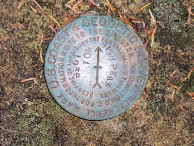
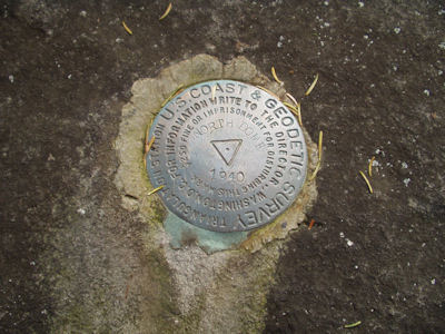
2:25 (delta 0.7, total 4.6 miles) Peak of High Peak. Found the USGS marker. Ken went off looking for a view to the east; didn’t find that but we did find a bit of airfoil and the crankshaft from a plane crash. According to a web site, “It occurred on June 13th, 1967. This Piper PA-23 (aircraft registration # N5604Y) was flown using VFR into adverse weather conditions attempting to clear the summit without success, resulting in 2 fatalities.” Back on the trail at 2:37, looking for the viewpoint but making some false starts due to poorly marked trail.
2:54 (delta 0.3, total 4.9 miles) Great view south on some open rocks. In front of us was the whole Devil’s Path, and we could take pride in having climbed every one from Indian Head right in front to Hunter (tower visible) off to the west. The view was a little hazy, especially with the placement of the sun and some smoggy stuff over the Hudson Valley. Nevertheless, a great spot. Relaxed here with some flan dessert (slightly shaken up). After some searching around and more false starts, found our way back on the trail, hitting another even more open ledge (probably the one intended) and then very steeply down the side of the mountain, with lots of scrambling. Glad we didn’t come up this way.
3:48 (delta 0.4, total 5.3 miles) Intersection with the snowmobile loop trail again. Continued around east on this.
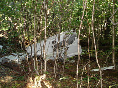
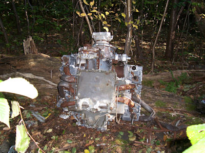
4:12 (delta 0.7, total 6.0 miles) Came across the wreckage (quite substantial) of a small plane. Lots of large pieces, including chunks with the landing gear sticking out, as well as the engine. Kind of eerie seeing this sitting strewn around the trees. Again, according to a web site “This Piper PA-32 (aircraft registration number N7146C) was an air taxi cargo flight which actually crashed on June 25th, 1987 with 2 fatalities. Probable cause of the crash was determined to be clouds, darkness and pilot flying VFR into high terrain”. Broke off the snowmobile trail here and bushwhacked ESE to pick up the Long Path. Did reasonably well; had to go down into and back out of a deep ditch near the end that perhaps could have been avoided.
4:36 (delta 0.3, total 6.3 miles) Reached the Long Path, and headed back down the way we came up earlier.
5:07 (delta 0.95, total 7.25 miles) Intersection with the Huckleberry point trail.
5:30 (delta 1.05, total 8.3 miles) Back at the car, another 3500 under our belts. Cleaned up and got on the road, heading out to the Thruway and north. Stopped at a rest stop before Albany for Roy Rogers dinner, then continued up to Syracuse. Checked in the Hilton Garden Inn a little after 9:00.
|
|
|
|
|
|
9/30/02 Monday Bill arrived at Ken's house early; on the road in Ken’s new Explorer by 7:00. Stopped for the usual deli breakfast, then headed for the Catskills, also with the required donut stop on the Thruway. Drove to the trailhead at Prediger Road and got ready for the trail. Weather really great – clear blue skies, comfortably warm. A change to the navigation hardware – now have the Etrex on a short pole and platform just sticking out of the day pack – no huge egg antenna. Headed out on the Devil’s Path trail a little after 11:00
11:15 (delta 0.3, total 0.3 miles) Reached a nice stream, and headed off trail to find a campsite. Went beyond the “No Camping” signs enough to feel comfortable, and found a nice place with soft ground, with the stream down a short slope. Made sure all the campsite requirements were met, loaded up the day pack, and headed back out a little after 12:00.
(delta 0.15, total 0.45 miles) Hit the intersection with the Jimmy Dolan trail and took it up into the notch.
12:52 Lunch off the side of the trail, consisting of the usual canned chicken/tuna, cheese and celery.
2:00 (delta 1.6, total 2.05 miles) Intersection of the Jimmy Dolan and Devil’s Path trails. This is the second time up the JD trail for us – last time was in the cold wind and rain, with full packs. A lot more pleasant this time! Headed off the trail a short ways to a nice view off the notch to the south. Back on the DP up Twin. Hit a nice overlook back across the Notch with great views east, with Indian Head directly in the foreground, Overlook to the right and Plattekill Clove to the left with the Hutterian Brethren and the Preserve. Continued up the trail, which climbed steeply at times, with a few scrambles.
2:45 (delta 0.4, total 2.45 miles) Overlook from the false summit of Twin. Beautiful sweeping views from nearly east to west across the south. Some haze to the south, especially into the sun, but great nonetheless. The true summit of Twin is visible off to the west, our destination.
3:20 (delta 0.6, total 3.05 miles) Summit of Twin. More great views. Sugarloaf off to the west, blocking Plateau, but views of the top of Hunter and its fire tower. Spent some time here enjoying the sights, then headed back.
4:30 (delta 1.0, total 4.05 miles) Back to JD trail intersection.
5:30 (delta 1.75, total 5.8 miles) Back to the campsite.
|
|
|
|
(no log)
(no log)
10/11/04 Monday Bill arrived at Ken’s house a little before 6:45 in a rental picked up the night before; picked up Dunkin’ breakfast and on the road right after 7:00. Breezed up to the Catskills in very light Columbus Day traffic. Turned off route 28 right before route 42 (the Spruceton Valley road) and went a short ways to the security gate for the Timber Lake summer camp. Ken had arranged for parking permission here via fax to the folks that run the camp. Tried to buzz in at the security building, but no response, so parked at the adjacent little lot (we weren’t sure of the procedure, but that was probably it). Donned the day packs and walked into the camp at 10:22. Timber Lake is a very nice, high-end-looking summer camp with a beautiful location and great looking sports facilities. We walked as far north as possible on the camp roads, then headed up the mountain bushwhacking. The plan was to immediately find the unmaintained trail up the side of North Dome, but this proved elusive for a while. After some false starts (paths that looked like the right trail), finally found the real trail, with a lot of help from the GPS. The trail has some blazes in faded yellow and/or red paint, and is not obvious in many places (overgrown). We had hoped to make great time on this part, but it was hard climbing, we lost the trail occasionally, and overall it was quite slow.
12:29 (delta 1.98, total 1.98 miles) Found what we thought was the first of two viewpoints, and sat on a rock with an okay view (some trees in the way) for lunch. A new item on the menu this time – salami instead of canned chicken. It really hit the spot for hungry hikers. Back on the trail at 12:54. Almost immediately hit the real viewpoint – a precipitous rock ledge with a spectacular view east. We could see many of the peaks on the Devil’s Path, including Hunter with the fire tower peeking over West Kill. Also could see a great view of the camp below. Trees had very good color, although probably not quite peak yet. After enjoying the sights for a bit, back on the trail toward the second view.
1:35 (delta 0.35, total 2.33 miles) A new event for hiking/camping - we don’t know what a bear does in the woods, but we know what Ken does. After a brief interlude, continued on the trail and hit the second viewpoint. Also a high rock ledge, and if anything even better than the first. From this vantage Hunter was completely visible. Really enjoyed just hanging here. Even though the day was cool (50’s) and breezy, we were warm from hiking and there was plenty of sun. The views were fantastic, but it was time to get going. From this point we left the trail (as it was) and headed straight up North Dome. Again, the GPS was indispensable in keeping us on track to the peak.
2:23 (delta 0.52, total 2.85 miles) At the peak of North Dome. Ken looked at the GPS and said “we should be right there”; unfortunately he was standing next to a tree blocking his view to the canister about 30 feet away, so Bill caught it first. Did the usual ceremony with the canister log, and took a picture of the survey plate. At this point we had hoped to continue down the back side of North Dome and bushwhack up Sherrill, only about 1.5 miles away, but regrettably the trip up North Dome took way longer than expected, so we had to bail on that idea. Headed down North Dome looking to intersect the trail around the first viewpoint. The slope of the mountain, however, kept pushing us parallel to the track rather than intersecting.
3:01 (delta 0.46 miles, total 3.31 miles) At this point we were right on top of the trail near the lunch stop but couldn’t manage to see the blazes. Continued down, drifting away from the trail according to the GPS, but then finally caught up with it. Stayed on it to the point where we entered it in the morning, but decided that there was a better route home by continuing to follow the trail.
4:01 (delta 0.97, total 4.28 miles) Rejoined our path from the morning just above the camp. From here we found our way into the camp from behind some buildings in a messier area (maintenance and worker dwellings, with lots of stuff in the back), down a steep embankment. Got back on the camp road and headed back to the gate. On the way, wandered around, looking at the camp and getting a good view back on North Dome where we had been.
4:31 (delta 0.74, total 5.02 miles) Back at the car. Changed out of our boots, cleaned up, and got on the road.
|
|
|
|
5/9/03 Friday Breakfast at the hotel. Packed the car and headed out at 7:45. Thruway east, 10/23 south to Prattsville again, the same backroads but stopped earlier on Ski Run Road. Daypacks on, hit the trail at 10:35 in nicer weather and lots of bugs! Headed up the old ski road, climbing steadily but not as steep as Vly.
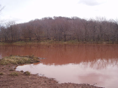
11:50 (delta ~1.7, total 1.7 miles) Hit the Benjamin Dover Hunting Club at the top of the ridge to Bearpen. Headed up another old road along the ridge. Not much climbing here, just lots of puddles. Near the peak, came upon a little pond (muddy red water) and little lizards. Climbed up a rock wall for a nice view back along the ridge, then a little bit further.
12:50 (delta ~1.6, total 3.3 miles) At an open flat area at the peak. Excellent 180° view north. Not too many mountains we know out here, but could see Hunter slopes to the east. Up here are some old frames/engines/transmissions of trucks used as ski lift pullers long ago. Sat on a nice rock, enjoying the views and lunch. Back on the trail at 1:35.
2:15 (delta ~1.6, total 4.9 miles) Hit a good pace down to the cabin and continued down. Spotted a snake on the trail (about a foot, green with some other colors) with a lump that looked like lunch. It was enjoying its nice sunning until Bill poked at it and it rolled up in a squirmy ball and kind of rolled away into the leaves.
3:15 (delta ~1.7, total 6.6 miles) At the car. Took some photos of the great views back at Vly and Bearpen. On the road, hitting the usual gas/drink stop and McD’s dinner, Ken’s house around 7:45, to Bill’s house to empty the car, dropped the rental at the airport, finally back home by 9:00.
|
|
|
|
|
05/03/07 Thursday Bill arrived at Ken’s house at 6:15 in the Explorer; picked up Dunkin’ bagel breakfast and headed up to the Catskills. Traveled far up 28 and then south and east to the Rider Hollow parking area, arriving at 10:10. Hit the trail around 10:25, planning on hitting Balsam today and Eagle tomorrow. Signed in at the register which was right at the parking area, and headed down a broad trail paralleling a beautiful stream with plenty of little cascades and white water. Not trying to be heroes, we started looking for camping area right away, and about 0.2 miles in spotted a potential area to the side of the trail opposite the stream. The area wasn’t perfect, with lots of surface rocks and not many really level spots. We decided to leave the main packs there, betting that even if we found some place better, it wouldn’t be far away. Continued down the trail with the day packs.
11:00 (delta 0.15, total 0.35 miles) Intersection of the MN and OM trails. Here we headed to the right across the stream on a steel channel bridge, then a beam and plank bridge. Between where we left the packs and here we spotted a number of good camping spots, along with “No Camping” signs, but here, up a little slope, was a nice area intended for camping (“Camp Here” sign), with pre-made fireplace and better spots for the tents. Decided that this was the likely camp spot, and continued on.
(delta 0.15, total 0.5 miles) Reached a lean-to with a huge fireplace and some small- and medium-sized firewood, to be used later. Kept going from here, still following the stream. This stream and others we crossed or paralleled on the way up and on the loop back provided really nice scenery and sound. Stopped around noon for a carrot break, in an attempt to avoid a big sits-in-your-stomach lunch for Bill.
12:35 (delta 1.25, total 1.75 miles) Reached the intersection of the OM and PW trails. Eagle is up the trail south from here, and Balsam north. Met a guy who had done Balsam, was heading up Eagle and then bushwhacking down – a better man than us! We had our usual lunch, this time with no meat for Bill but more veggies (some saved for later). Back on the trail at 12:55.
1:50 (delta 0.75, total 2.5 miles) Reached the peak of Balsam, as determined both by GPS and the fact that nowhere else seemed higher. Nothing to see here – keep it moving ... .
2:05 (delta 0.2, total 2.7 miles) A nice viewpoint to the east. Although not spectacular compared to some we’ve seen, this one offered great views of many of the mountains we’ve climbed, and the fantastic weather (reached mid 60’s under deep blue skies) helped. We looked down on the town of Big Indian, and taking note of an intersection in the road with distinctive buildings, we decided to stop on the way home to look back on our viewpoint if we could. Panther loomed to the right, with Slide off further south. Much of the Devil’s Path was to the left, including Hunter on which we thought we could see the tower. Peeking over the top was some of the Blackhead range. Hung out here enjoying the sun, breeze, soaring birds, etc., then reluctantly moved on around 2:20. Much of the trail at the top of the mountain was littered with downed trees from the recent severe storms. Occasionally we had to skirt around one across the trail.
(delta 1.05 total 3.75 miles) PW-MN intersection. Uneventful hiking before and after this, with some steep sections, a grove of very tall straight trees, and nice streams again at the end.
3:50 (delta 1.05 total 4.8 miles) Back at the MN-OM intersection, and decided to use the campsite here. Dropped the daypacks and headed towards the parking area to pick up the main packs (0.15 miles). On the way back, realized that Bill’s pack (mostly bedroll) was just a tiny bit wider than the width of the steel bridge, making crossing fun.
(delta 0.2 total 5.15 miles) Back at the campsite.
|
|
|
10/02/07 Tuesday Bill arrived with the Explorer at Ken’s house at 6:15; picked up the usual Dunkin’ bagel breakfast and on the road up to the Catskills. Same route as in the spring up to the Rider Hollow parking area, arriving at 10:15. Loaded up and hit the trail at 10:30, after signing in at the register. We knew right where we were headed this time, electing to camp at the same location as for the Balsam hike.
10:45 (delta 0.35, total 0.35 miles) Intersection of the MN and OM trails. Went across the stream on the bridge, and right up to the campsite. Other than some foil and rocks in the fireplace, everything was the same, so we dropped the main packs and loaded up the daypacks. We noted that there was not much wood at all around, so as we hit the trail we decided to be on the lookout for good wood along the way. Not too far past the lean-to we did see some long fallen branches about 3” thick at the base, so we dragged them out to the trail for later pickup.
12:20 (delta 1.4, total 1.75 miles) Intersection of the OM and PW trails. The climb to this point was really tiring, but although we didn’t know it, it was the worst part of the total hike. The weather was comfortable, with highs around 70, some sun and light breezes. We had our usual lunch, with Bill substituting a fresh roll for the chicken. Back on the trail at 1:00. We climbed Haynes, which wasn’t bad at all, then hit a long stretch of gentle ups and downs, followed by another moderate ascent on Eagle. We knew there were no views on this hike, so our only destination was the true peak, which was on an unmarked side trail.
2:30 (delta 2.1, total 3.85 miles) Reached a cairn on the trail conveniently marking the side trail to the peak. After a brief stretch down this trail, found another cairn marking the peak of Eagle. Had our lunch dessert of pudding here, and, that being the extent of the excitement for this hike, got back on the trail at 2:50.
4:05 (delta 2.1, total 5.95 miles) Back at the intersection of OM and PW. Headed down the steep part of the trail, and after we reached the stream near the lean-to, picked up the branches we left. Dragging these back was fun, scoring lines in the trail and scraping leaves and dirt along.
5:00 (delta 1.05, total 7.0 miles) Reached camp.
|
|
5/17/97 Saturday Ken arrived a little after 7:30. Weighed the packs with the scale Ken brought: Ken start pack weight 45 pounds, Bill 42 pounds. In the Olds about 8:00 and, after a Dunkin Donut stop, on the road up the Thruway to Saugherties exit in good time. Went into Saugherties and bought sandwich lunch, then followed the increasingly detailed maps obtained from computer CD to the parking area off Prediger Road west of the Thruway. Decided that we weren’t that hungry, so put the sandwiches in the pack. Bill called in to Maur on the cellphone (not a great signal), then we started on the trail.
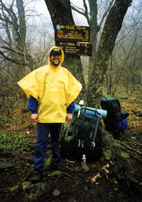
12:05 p.m. Shortly after the start of the trail, registered at a sign-in box. At this point we optimistically (naively?) were planning to hike the Devils Path (DP) trail out to Pecoy Notch, about 6 miles, so this was the destination we entered on the register. Weather cool, windy with on-and-off rain. Bill hiking with the somewhat nerdy-looking large GPS antenna mounted on a stick and strapped to the pack frame, with a cable running down to the receiver on his belt.
12:20 p.m. First intersection with Jimmy Dolan (JD) trail (0.45 miles). Decided that, with the bad weather (better forecast for tomorrow) and surprisingly rough trail, we would take the JD trail, which would intersect the DP trail again and cut off 2.6 miles - we could take the longer DP route tomorrow.
1:00 p.m. Stop for lunch mid JD trail. At this point we realized that this was a far tougher hike than anticipated. One has to watch every foot plant because of rocks, branches, etc., and some parts are quite steep, requiring large upward steps. Sandwich lunch with Power Bar (a.k.a. Plumber’s Helper) and water hit the spot.
1:25 p.m. Back on the trail. The next hour and a half were probably the worst of the trip. Rain came down somewhat heavy at times, and the ponchos were not quite big enough to cover the pack, so they blew around our heads. Trail was constantly climbing without a break, at times very steep requiring hand holds to pull up. The hike became a series of short drives (scrambles) up, with a short break in between.
2:45 p.m. Junction with DP (2.05 miles). At this point we realized how unrealistic our goals were. A women hiking down Indian Head said that the way she came was a bit tougher than what we had just done, but our intended route was much tougher! Decided to change direction and go up Indian Head Mountain on the DP trail, actually in the opposite direction we had intended to come through. This would allow us a short jaunt down the Overlook (OL) trail tomorrow if we wanted (eternally optimistic!).
3:05 p.m. Head out on DP. This climb up Indian Head actually didn’t seem as bad as the JD trail, partly because the rain let up, and partly because there were some flatter areas that ran though Red Spruce stands - actually quite nice if you ignored the pain! We crossed the 3500 foot mark of the mountain, so were committed to crossing the peak and heading back down (no camping allowed above 3500, but we really hadn’t seen anything suitable anyway above or below). Crossed the peak at 3573 feet, for a total climb of 1573 feet in about 2.5 miles. Somewhere around here the GPS batteries died (used the wrong kind, and the big antenna seems to take additional power); luckily spares were available for tomorrow. Soon after hitting the 3500 foot mark on the way down, we came to a huge rock wall that required hanging on root handholds and feeling for a foot plant - not at all what we expected. Also, there were significant areas of icy snow left.
4:40 p.m. (about 3.05 miles) Realizing it was getting late, and the rain was holding off, we went off-trail (bushwacked) to look for a campsite. After a short meander through the woods, we spotted what might make an OK campsite well down the mountainside. Ken took his pack off and went down, and confirmed that it was adequate if not great. Bill came down and agreed, especially since it was getting late.
5/18/97 Sunday 6:15 a.m. Awoke to icy ground but clear skies and nice sun. Dressed, with only cold feet a problem. Made a delicious (and quickly eaten) breakfast of scrambled eggbeaters with Bacos, oatmeal with raisins, and hot coffee.
8:00 a.m. Done with breakfast, started cleanup of camp, took down tents, had another quick cup of coffee, and packed.
10:00 a.m. Finished cleanup, headed back to trail up the steep slope.
10:15 a.m. On DP trail. Although the trail was still very steep at times (this time going down, which often felt more dangerous), the hike was much more enjoyable in the warm sun, with great views of the valley occasionally. With the sun came some annoying little bugs.
10:35 a.m. (about 3.55 miles). Broke out on a rock ledge about 10 foot square, with a magnificent view of the other mountains, the Hudson River, Echo Lake, etc. This is what all the work was for! Spent some time here taking pictures and enjoying.
10:45 a.m. Back on the trail. Ken suggested Bill go down the trail, which would place him below the rock ledge, making a good picture. This was by far the trickiest and most dangerous part, requiring a careful climb down the steep rock, using handholds and small ledges for footing. Continued down the mountain, now getting tired and sore. We have met a few groups of people over the two days, going in both directions. Here we passed a few groups of day hikers, most of whom we didn’t think would want to go up the steep rock wall we came down.
12:45 p.m. Lunch of canned chicken, carrot sticks and Baby Bel cheese, with Ken enjoying his last beer.
1:35 p.m. Intersection with OL trail (4.8 miles). Really looking forward to getting back, although the trail is in a really nice area, with streams, some spring flowers, etc. Too bad most of the views are straight down, watching where to plant ones feet.
2:25 p.m. Intersection with JD trail (6.25 miles). The home stretch.
2:45 p.m. End of the trail (6.7 miles). Signed out (and changed our destination, just to make us feel better). Pooped out, but very satisfied in a successful and hard-fought trip.
3:00 p.m. On the road home, in one shot (by Ken again) without stopping, due to an error in judging where we could get Dunkin Donuts coffee at a rest area.
6:30 p.m. Home, tired but happy. 300 miles drive. Ken pack weight 38 pounds (down 7), Bill 34 pounds (down 8).
|
|
|
|
|
[4/19/06 Aborted attempt]
5/5/08 Monday Bill arrived at Ken’s house at 5:55 in a rented Explorer. Did the usual Dunkin Donuts stop (with an added News 12 interview for Ken on a story about illegal activities at the DD), then headed up to the Catskills. Arrived at the DEC parking area on Route 42 around 9:20 and loaded up the day packs. Having failed to make Sherrill on the last attempt by following the river gorge up, we decided to make this attempt up the main shoulder of the mountain. We immediately noted that our friends the bugs were out in force; these proved to be one of the day’s many real annoyances (both of us having forgotten our bug nets and repellent). Ultimately the path up the mountain was pretty straightforward, always with a pretty clear direction of up. The footing wasn’t bad, and there were few if any tight stands of trees to block us, but there were plenty of thorny bushes. Between the branches, bushes and bugs, by days end we had myriad bloody marks on our arms. Despite the relatively straightforward trail, both of us were really beat by the time we started cresting the mountain, the very warm day not helping. Guess we’re just getting old. We reached a false peak area, and after looking for the canister here, realized we had to continue further to the true peak. We wandered round there for a bit; Ken decided to take a short rest and had no sooner sat down then Bill spotted the canister.
12:55 (delta 2.2, total 2.2 miles) Ken took the record book down but since it was late we decided to have lunch before filling it out. We elected to drape our flannel shirts over our heads while eating to keep the bugs away a little – very attractive. We had just started the usual meal (neither of us actually that hungry) when a party of about 8 other hikers showed up. They did their log bit, so Ken did ours when he could. Not wanting to be hanging with this group down the mountain, we finished up lunch and got on the trail at about 1:30. Our plan was to angle over from the true peak to the trail we followed up, but as we kind of predicted we fell off the side of the mountain towards the river. We finally just ended up at the riverbed, and took to struggling along there. At this point we were really not interested in hiking anymore but had a mile and a half to go. We had to bounce back and forth across the river (which was flowing pretty nicely in spots) finding areas we could walk, skirting downed trees and large rocks, etc., which didn’t make for a lot of forward progress. Finally we saw that the ridge above us offered what looked like a reasonable path, and pretty much anything was better than walking in the riverbed. We dragged ourselves up there, and things were much improved. We immediately recognized this area as where we had bailed on the last attempt, so we had hopes that the old road which constituted the beginning of the trail was not far ahead. Sure enough, we reached that and finally arrived back at the parking area.
16:10 (delta 2.2, total 4.4 miles) At the car, tired, hot, scratched and bug-bitten – yay, so much fun! Changed shirts and cleaned up a little, then hit the road north and west over back roads (through very pretty countryside) ending up on the Thruway. Hit the first rest area for BK dinner, then continued to the Doubletree in Syracuse, arriving around 7:30. Checked in and called it a day.
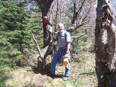
|
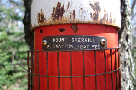
|
5/5/03 Monday Bill left at 6:30 in rental car picked up yesterday. Over to Ken’s house, picked up Dunkin Donut breakfast on the road. Into the Catskills, on 28 to 42 to 23, then on backroads to the end of the road between Vly and Bearpen. Put on daypacks and on the trail at 11:15. Lots of annoying bugs out! Hiked up an old road (now hardscrabble) to the col between the mountains.
12:15 (delta 1.3, total 1.3 miles) At the col. Up here is a big black shack – maybe a winter snowmobile cabin? Headed up Vly; a bushwhack trail but has paint blazes, so very easy. Hit the top and found the canister around 1:15 (about 2.3 miles total). Signed the log, and had a great lunch (usual stuff). A few photos of the view north, then headed back down (2:15).
3:30 (delta 2.3, total 4.6 miles). At the car . We had thought of doing Bearpen too, but it was voted too much! Weather is overcast, with cold breezes, but at least the wind keeps the many annoying bugs away! On the road north on 23 and 10 to the Thruway. Dinner at a rest stop McD’s, and into Syracuse at 7. Checked in the Hilton.
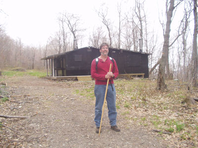
|
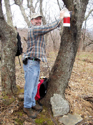
|
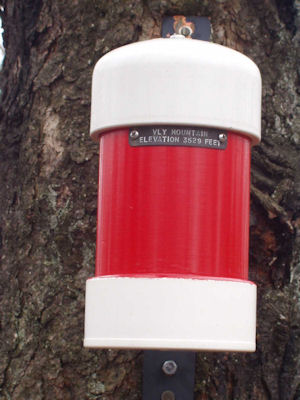
|
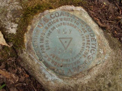
|
9/26/01 Wednesday Bill arrived at Ken's house, on the road in the somewhat-crowded Grand Am (Explorer in the shop) by 6:30. Picked up breakfast, over the Whitestone and up the Hutch, with requisite donut stop near Harriman. Up into the Catskills, onto back roads near Hunter and parked at the trailhead on Peck Road near Maplecrest. Weather cool, partly cloudy, many leaves turning already. At the trail, what looked like a bad thing - a crowd of 14 backpackers! Oh well. Let them move out (slowly), and we got on the Elm Ridge trail at 10:50.
11:15 (delta 0.2, total 0.2 miles) After signing the register and proceeding up a gentle slope for a bit, saw the big group hanging out on the trail. Decided it was a good time to find a campsite. Bushwacked west some (probably our furthest off the trail) and, after passing a nice grassy glade (complete with a little wood pile, rock ring fireplace and little teepee firewood arrangement!) found a 90 degree intersection in a stone wall with the corner missing which would serve nicely as fireplace and kitchen. Readied the daypacks, this time with lunch brought from home rather than bought at deli, and headed back out at 11:45.
~12:05 (delta 0.9, total 1.1 miles) Intersection with the Escarpment trail, which we followed east. Caught up with the big group here, along with another group at the nearby lean-to, but never saw them again.
12:30 After passing a cool area where the spruce roots were exposed at the surface, creating an eerie sight in the dark, dense woods, and passing a little set of footbridges (not needed - no surface water), stopped for lunch sitting on a broken-down rock wall. Had a lunch like our usual second day - chicken/tuna, celery, cheese, etc. - found it much more satisfying than sandwiches, and easier to hike after eating. Back on the trail by 1:00.
~2:00 (delta 2.2, total 3.3 miles) Peak of Windham. Ken found the survey marker attached to a rock near the trail. Had set the new GPS barometer altitude at the parking area - reading at the peak corresponded very closely with the actual altitude (within about 30 feet). Continued a bit further for some excellent views north despite the clouds, including Albany off in the distance. Decided at this point to try to continue on to the viewpoint on Burnt Knob that we had reached on an earlier hike.
~3:00 (delta 1.3, total 4.6 miles) After descending a good chunk of Windham, came on a nice view southwest. Could see back into the Batavia valley, including Ken's "Batavia Lake", and the two humps on the way up Thomas Cole to be attacked tomorrow. Continued down towards Burnt Knob.
3:30 (delta 0.4, total 5.0 miles) Back at the view! Realized that the distance to the destination viewpoint was further than expected, giving up altitude all the way, so bailed on the idea. Time to head to camp.
4:15 (delta 1.3, total 6.3 miles) Windham peak again - nothing like climbing a tough mountain twice!
5:50 (delta 3.1, total 9.4 miles!) Whew - back to camp after a long, tough hike. Set
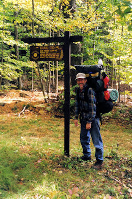
|
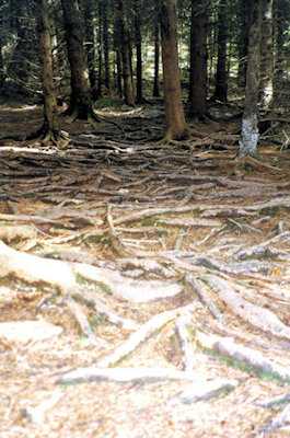
|
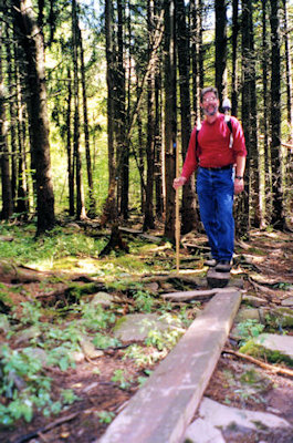
|
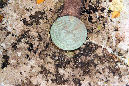
|
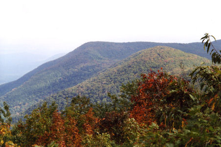
|
10/03/03 Friday Up at 7:00, out of the tents by 7:30 in the cold crisp morning air on what will be a gorgeous day. Did the usual morning ritual – coffee, eggs (~ 8:15), dropped the tents, oatmeal and a second coffee. Food never fails to taste super. All cooking water came from the river. Tried some new eggbeaters – southwestern style. Package says 7 servings; not sure if it’s a believable number, but they all got eaten! Very tasty, with a bit of a kick. Easy cooking cleanup in the river. Have to remember to use a little less oatmeal and water – lots of food and it fills the cook pot to the brim. Last check, got back on the trail at 10:25. Took a few photos at the bridge. As we headed down the river, realized there was a clear sight to the campsite – could easily make out fireplace! Oops – wonder if anyone passed by?
10:55 (delta 0.8, total 6.2 miles). Back at the car. Packed up the daypacks for the next hike. Headed back down the road, taking a few photos along the way.
A short distance back down 42, pulled in the Halcott parking lot. Headed a short distance to a very nice waterfall, and climbed the slope alongside. The climb up Halcott is a bushwhack. Passed through various terrains and tree types – more open conifers, tighter deciduous. Followed the sound of the rivers as a guide, along with GPS checks against the map and trying to sight the peak. Lots of downed trees made some meandering necessary.
1:10 (delta ~0.7, total 6.9 miles) About halfway up the mountain, stopped for the usual lunch sitting on a big log. Head back on the trail at 1:35. About ¾ of the way up, hit a very steep section which made for tough climbing. In some areas, very slippery leaves and moss on dirt – no rocks for purchase. Right near the top, saw what appeared to be a rather well-defined summit area, so had some hope for finding the canister quickly. Sure enough, Ken, leading the bushwhack, spotted it soon after cresting at about 3:30. Whoo-hoo! Signed in the logbook, although got the bushwhack count off by one – Bill didn’t think Bearpen was one. Nothing to see up here, so headed back down.
4:15 (delta ~2.1, total 9.0 miles) Back at the bottom. Took a few photos at the waterfall, then back to the car to clean up. On the road, stopping at the usual gas/convenience at about 5:15, and down the Thruway to dinner at McD’s. Continued to Ken’s house a little before 9:00, and Bill headed home. Another fun and successful hike/camp trip.
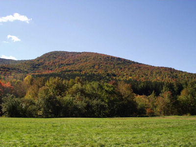
|
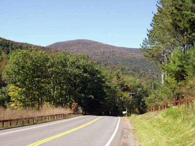
|
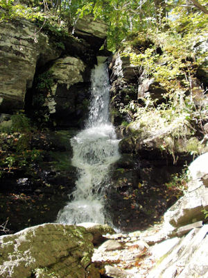
|
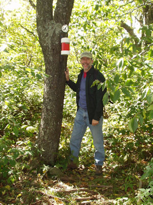
|
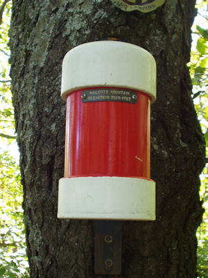
|
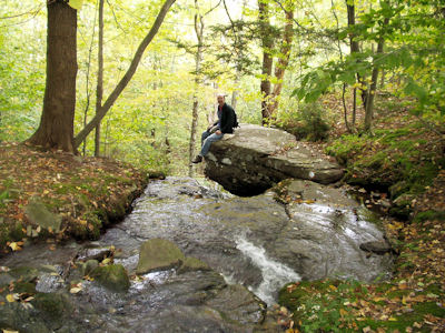
|
(no log)