Home
Travel
NPS States
NPS Types
National Monuments - Arizona
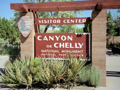
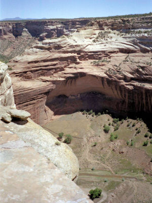
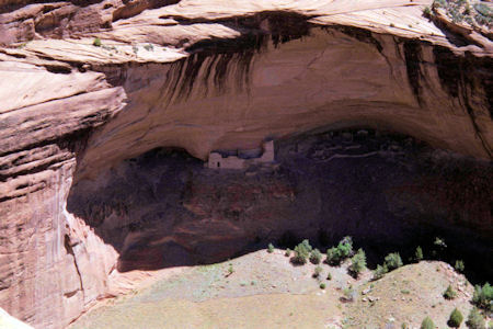
Canyon de Chelly National Monument
5/23/2001 ... then up to Canyon De Chelly NM in Arizona. Drove the North Rim, walking the trails to viewpoints into the canyon,
seeing the cliff dwellings.
The park sign
|
The canyon ...
|
... and a close-up of the dwellings
|
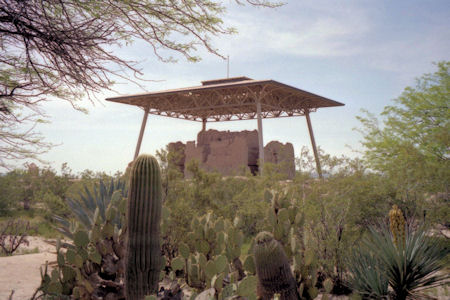
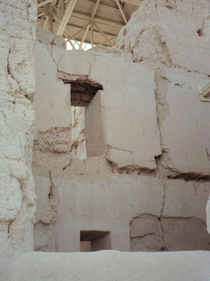
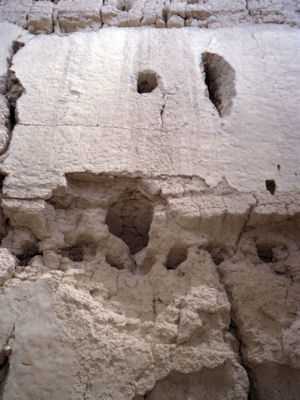
Casa Grande Ruins National Monument
4/12/1992 ... then south of Phoenix to Casa Grande Ruins NM.
The ruins under protection
|
Some details of the construction
|
Obvious deterioration
|
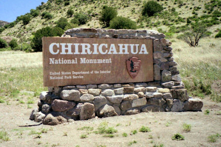
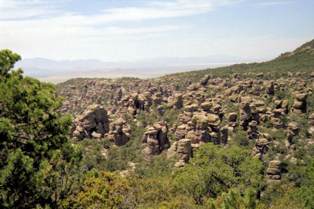
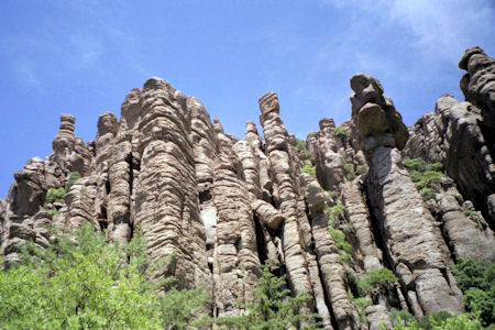
Chiricahua National Monument
5/16/1998 Drove to Chiricahua NM. ... Drove through the park, seeing beautiful pinnacles, spires, balancing rocks, etc.
caused by erosion. Took a shorter hike at the end of the road with great views.
The park sign
|
A view of the area
|
Some of the cool formations
|
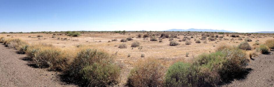
Hohokam Pima National Monument
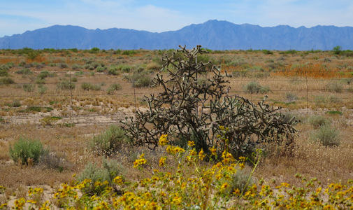
4/30/2014 On the road south, where I pulled onto the shoulder of I10 for photos of Hohokam Pima NM (also Snaketown NHL).
Snaketown is an site archaeological that was inhabited by the Hohokam people between 300 BCE and 1200 CE. According to the NPS website,
“There are no roads, signs, buildings, exhibits at this site”, “There are no written materials distributed about the park. No park brochure
or guide has been developed” and “Archeology studies were done and the site re-covered with soil. There are no ruins, pits, or other features
to see. Any artifacts are protected by law”, so photos from the road is the best I can get!
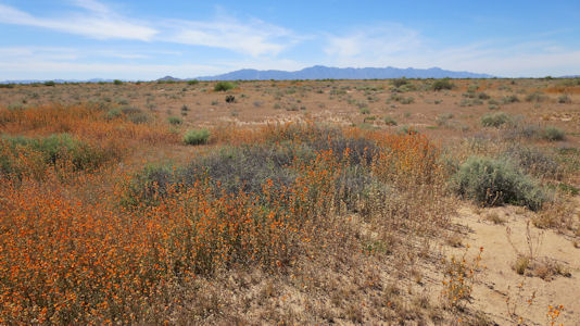
A panorama of the Reservation and the National
Monument
|
Another view
|
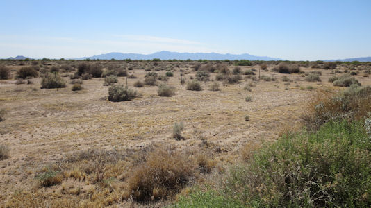
4/7/2019 We ... went south to a stop on the side of the highway for the Snaketown NHL/Hohokam Pima National
Monument. Snaketown is an archaeological site that was inhabited by the Hohokam people between 300 BCE and 1200 CE, but the site
is owned by the Gila River Indian Community, which has decided not to open the area to the public. Being on the busy highway, we
quickly did our photos and moved on.
Some pretty views ...
|
... of the site
|
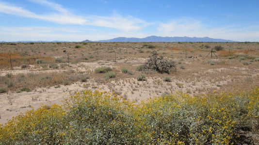
Ken taking photos ...
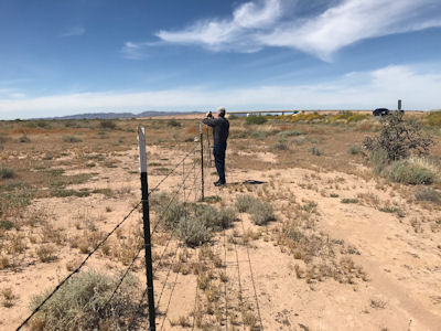
|
... of yet another view
|
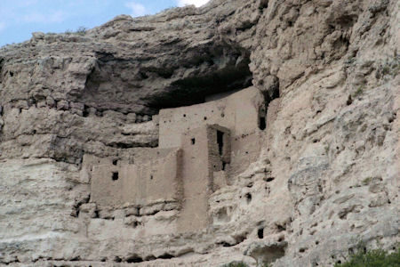
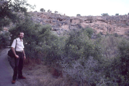
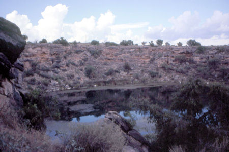
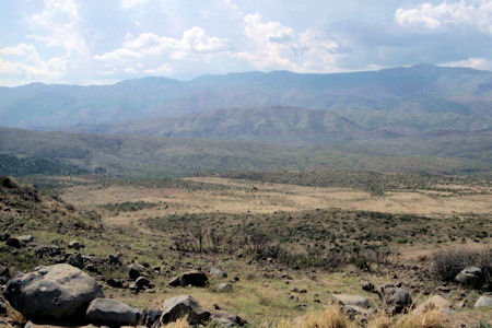
Montezuma Castle National Monument
9/17/1983 Drove to Montezuma Castle, south of Flagstaff. ... Very interesting cliff dwellings. Drove to Montezuma
Well
- big hole in ground. Very out of breath after climbing not too tremendous flight of stairs - due to high altitude (about 1 mile high).
The cliff dwellings
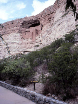
|
Amazing construction right in the cliff
|
Me on the trail
|
Montezuma Well
|
A view of the surrounding area
|
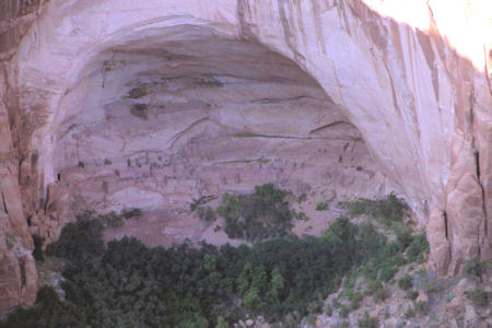
Navajo National Monument
9/20/1983 Drove through Painted Desert up to Betatakin Ruins in Navajo National Monument ...
Betatakin Ruins
|
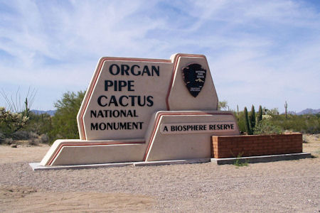
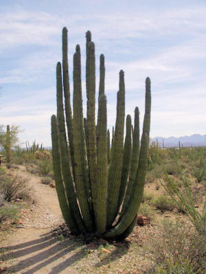
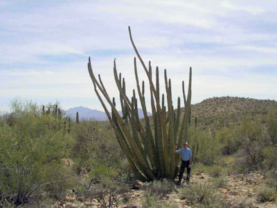
Organ Pipe Cactus National Monument
3/18/2004 ... continued to Organ Pipe Cactus NM. Had lunch at the visitor’s center, then walked a 1.2 mile
trail through different cactus, including lots of Organ Pipe and Saguaro. Drove a 20 mile loop into the mountains ...
The park sign
|
The park area with ...
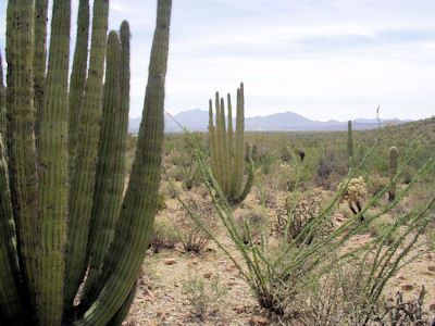
|
... the eponymous cactus
|
Pretty and prickly!
|
Me in front of an ocotillo
|
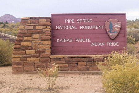
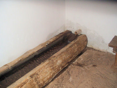
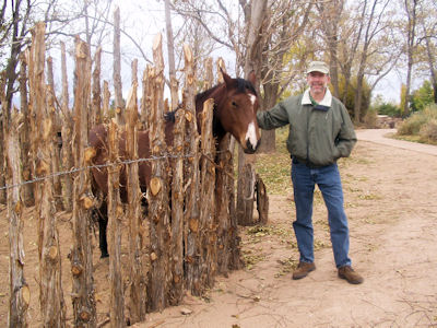
Pipe Spring National Monument
11/7/02 Headed east to the Pipe Spring National Monument. Walked the grounds, pet a nice horse, then took the tour of the ranch house
built over the spring in the 1800s.
The park sign
|
The ranch house ...
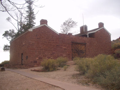
|
... and the spring outlet inside
|
Me and a new buddy
|
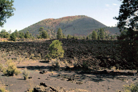
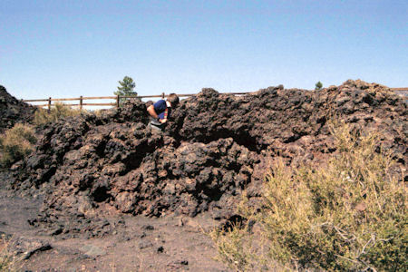
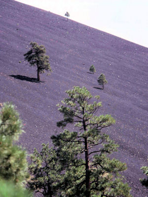
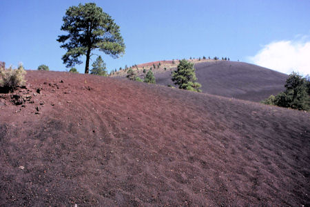
Sunset Crater Volcano National Monument
9/20/1983 Drove to Sunset Crater National Monument. Walked around "Lava Trail" at base of crater, into little cave.
A long view of the volcano
|
Ken checking out a cave
|
Hardy little trees!
|
A rugged looking area
|
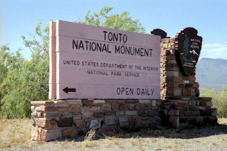
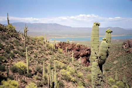
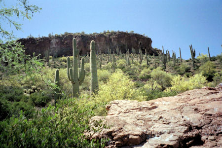
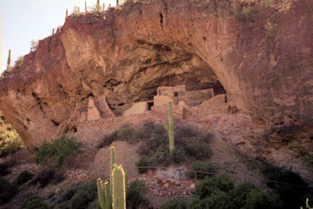
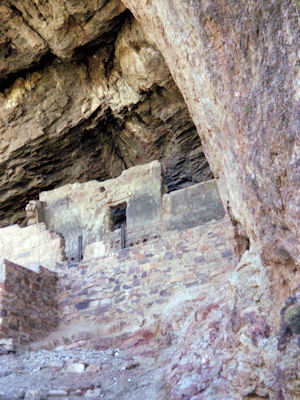
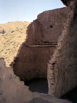
Tonto National Monument
5/24/2001 ... then on to Tonto NM. Temperature - 95°. Saw a film at the visitor center, then Dad hung out,
bought books, etc. while Mom and I climbed up the hill in the hot sun to see the Salida people dwelling ruins in the cliff face.
Stood and rested in the shade of a Saguaro and enjoyed the spectacular views of Lake Roosevelt and the mountains. Walked around
the ruins, then back down.
The park sign
|
A view of the surrounding area
|
Our destination up there
|
Getting close to the cave dwellings
|
Almost there
|
A look at the remaining ruins
|
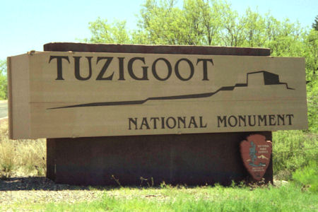
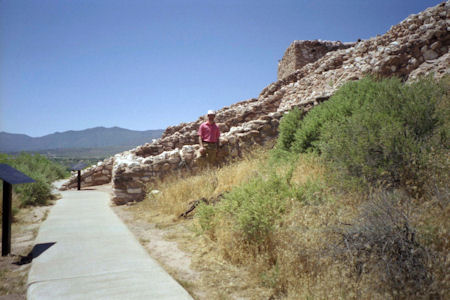
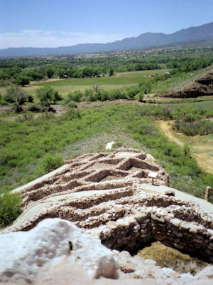
Tuzigoot National Monument
5/17/1998 From there down to Tuzigoot NM, for a walk around the hilltop ruins of a Sinagua settlement.
The park sign
|
Me on the path to the ruins
|
A look across the remaining walls
|
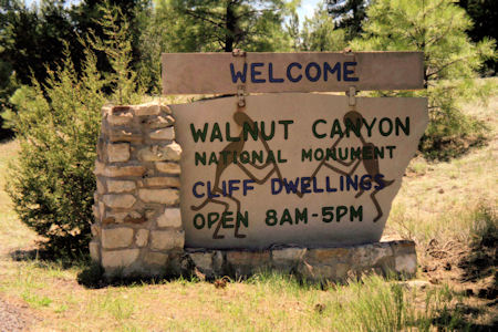
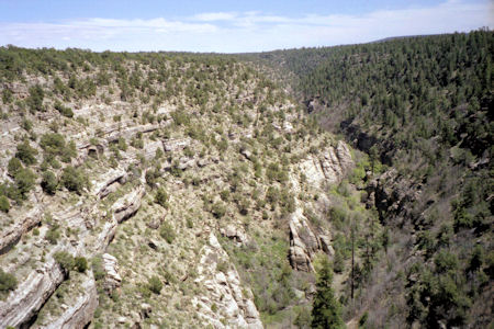
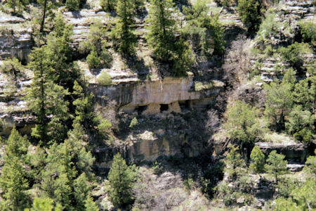
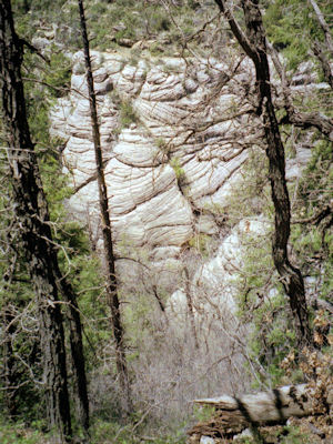
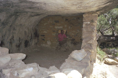
Walnut Canyon National Monument
5/17/1998 Went to Walnut Canyon NM. The canyon has walled settlements built on the cliff under the overhangs.
Took a walk down into the canyon to view some, then back up 240 steps in thin air - a little puffing! Beautiful scenery here.
The park sign
|
A wide view of the canyon
|
A look at one of the settlements
|
Cool flowing rock formation
|
Me in one of the dwellings
|
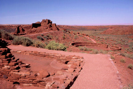
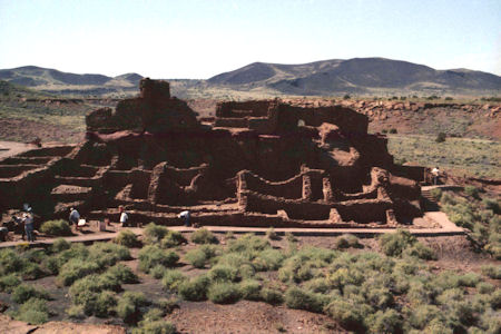
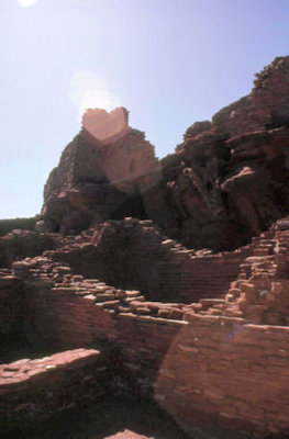
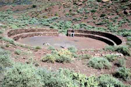
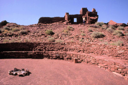
Wupatki National Monument
9/20/1983 Drove to and visited Wupatki National Monument.
A wide look at the area
|
The remains of a Sinagua pueblo dwelling
|
A close-up of the construction
|
Ken in the kiva-like structure
|
The pueblo from the kiva
|