Home
Travel
State Parks
Minnesota State Parks
Cascade River State Park
6/21/2009 North Country National Scenic Trail
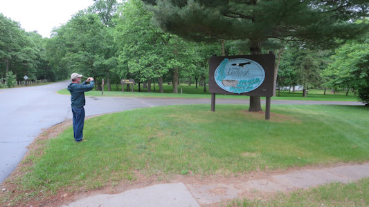
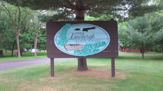
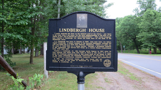
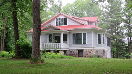
Charles A. Lindberg State Park
6/2/18 First stop was back over the river a little to Charles A. Lindbergh House and Park NHL in Charles A. Lindbergh State Park. This 1½ -story farmhouse is the only known extant residence associated with both Congressman Charles August Lindbergh, Sr. and his aviator son, Jr. We were here before hours so all we could do was photo the home from the fence line.
My getting my photo of ...
|
... the park sign
|
Interpretive signage
|
The Lindbergh residence
|
Fort Snelling State Park
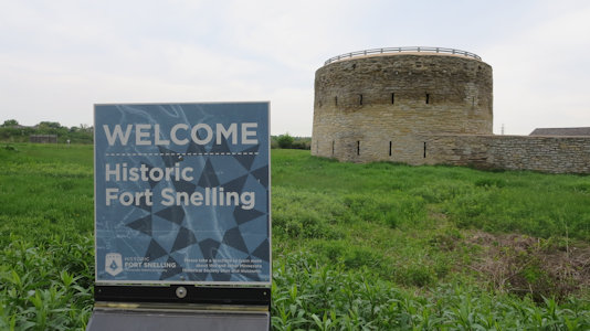
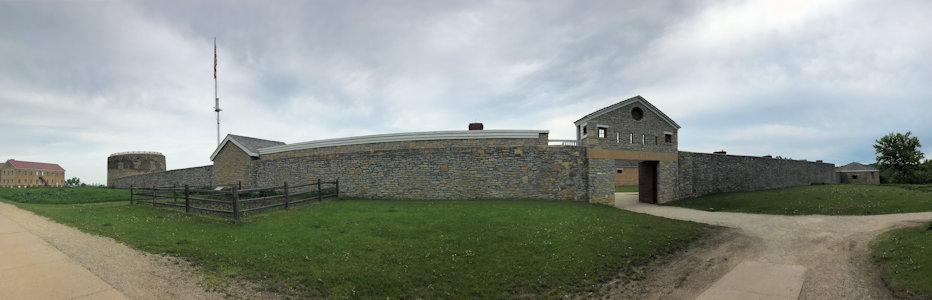
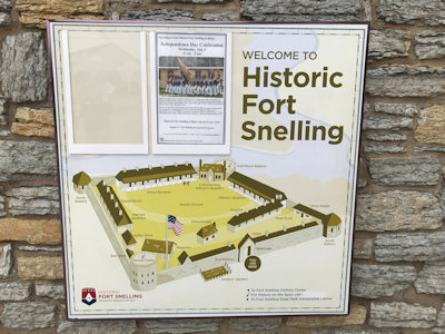
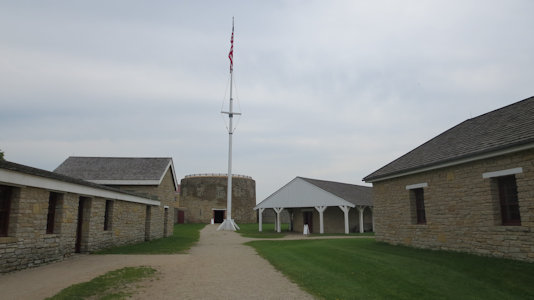
5/29/2019 Our first stop was right at the airport in Minneapolis - Fort Snelling NHL (located in Fort Snelling
State Park and part of the Mississippi National River and Recreation Area), a military fortification located at the confluence of the
Minnesota and Mississippi rivers built in 1825 to protect the northwestern territories. After outdoor photos, we noted people up on the
main tower, which we thought was supposed to be closed. We asked at the gate and it was school groups, and the gate people were nice
enough to let us grab a few photos inside.
Sign and tower
|
A good panorama
|
Some interpretive signage ...
|
... and a quick look inside
|
Gooseberry Falls State Park
6/21/2009 North Country National Scenic Trail
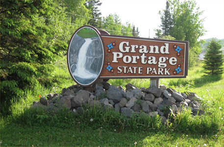
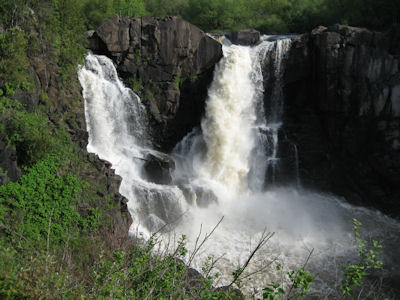
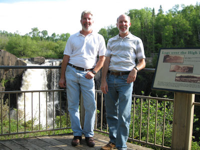
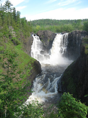
Grand Portage State Park
6/21/2009 Headed north to Grand Portage SP right at the border. Walked about 1/2 mile to High Falls on the
Pigeon River (also the border). Beautiful views of very impressive falls and gorge (the reason for the Grand Portage).
The park sign
|
Wow!
|
Ken and me by the falls
|
A view from downstream
|
Itasca State Park
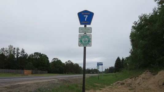
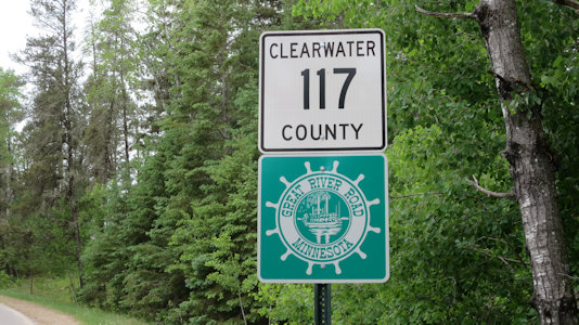
6/1/2018 Heading out of town we got on a stretch of the Great River Road NSB [MN], which in this area
pretty much just was a country road. We angled over to Itasca State Park, as the day improved significantly, eventually
becoming nicely sunny and pleasant. Heading into the park we crossed the Mississippi as a large stream/small river, and
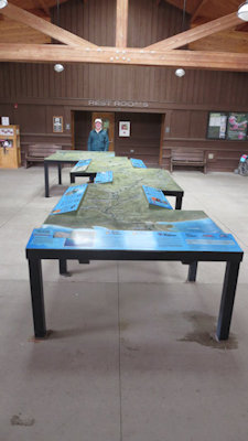
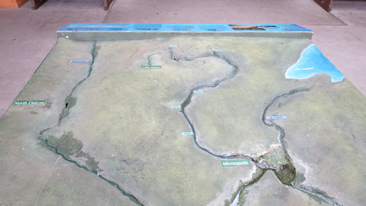
noted more stretches of the NSB. After viewing a long, well-done maybe 20 foot 3D model of the Mississippi River valley
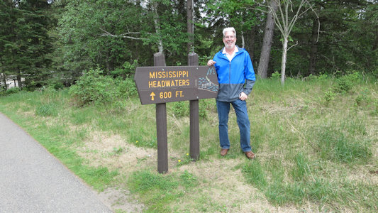
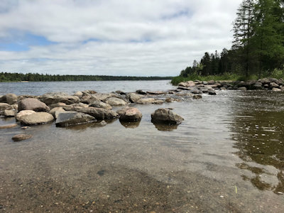
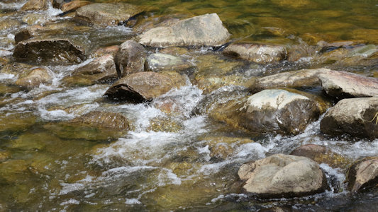
with feeding rivers at the VC, we walked down to the Headwaters of the Mississippi. Here, pretty Lake Itasca tumbles
over a line of rocks and small boulders to start the great river’s run to the Gulf. We watched some kids wade and walk
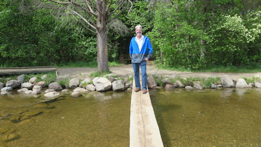
across the rocks and we crossed the stream on a half-log bridge. After picking up some great maple walnut fudge at the
gift shop for a snack, we hit the road again ...
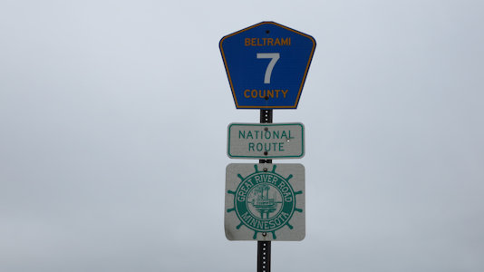
The byway near Bemidji ...
|
... and closeup of the sign
|
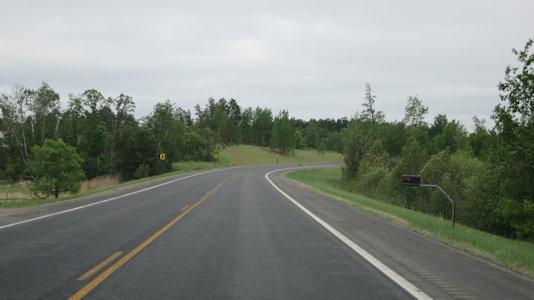
Not all that scenic
|
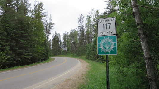
Closer to Itasca ...
|
... and another sign
|
The river model
|
Itasca to MSP
|
Ken on the headwaters path
|
Me and headwaters marker
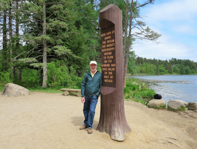
|
Ken and me at ...

|
Mississippi Headwaters
|
The Mississippi starting small
|
Ken on a footbridge
|
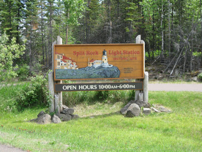
Split Rock Lighthouse State Park
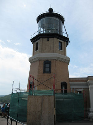
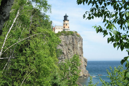
6/21/09 ... then south again to Split Rock Lighthouse SP [Split Rock Light Station NHL]. Paid admission here,
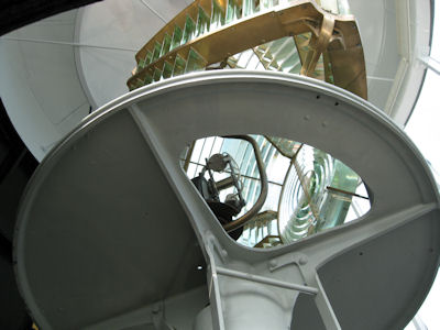
and walked a short way to this short-ish lighthouse on a tall, steep cliff. After checking out an exhibit area, we walked to the top
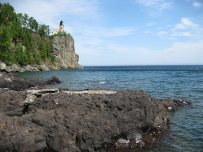
of the lighthouse for a look at the lens and some good views. Unfortunately, the view from the ground of the lighthouse wasn’t great
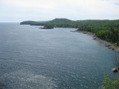
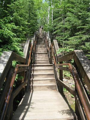
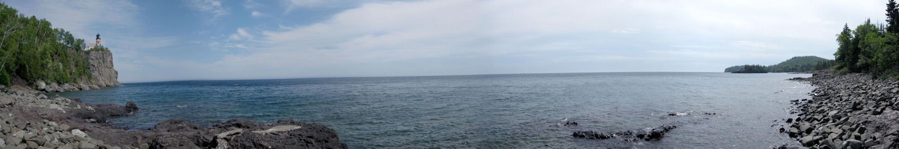
due to reconstruction equipment. To get good views from further away we walked down 171 steps on a boardwalk/stairs to the beach, where
it was definitely a good view up the cliffs. Weather is starting to turn a little overcast and breezy, but nice to walk around in.
The park sign
|
The light
|
Great view
|
The fresnel lens
|
The long climb down
|
Beautiful panorama from the lakeshore
|
Another view from the shore
|
A little closer
|