Home
Travel
NPS States
NPS Types
National Historical Parks - Multi-State
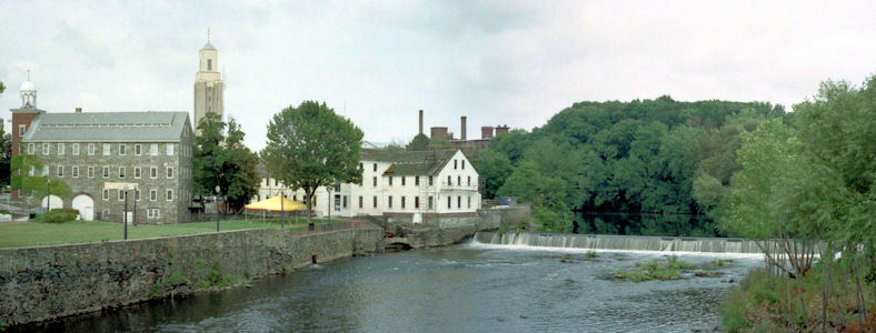
Blackstone River Valley National Historical Park (Massachusetts, Rhode Island)
8/24/1996 Continued up to Pawtucket and the [Old] Slater Mill [NHL]. This is denoted as the birthplace of the
Industrial Revolution, where Slater and two others started a cotton mill (part of Blackstone River National Heritage Corridor)[now Historical Park][RI].
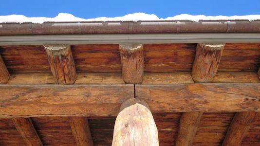
Took a tour here, starting with a house (1700s) moved to the site. Saw a demonstration of making linen thread by hand from flax.
Next to a waterwheel-powered machine shop, then the mill. Saw good demonstrations of the processes from cotton carding all the
way through spinning, weaving and braiding (with some dangerous looking machines!)
A nice panorama of the mill and river
|
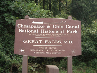
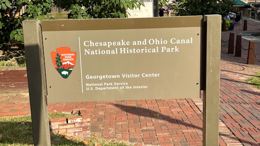
Chesapeake and Ohio Canal National Historical Park (District of Columbia, Maryland, West Virginia)
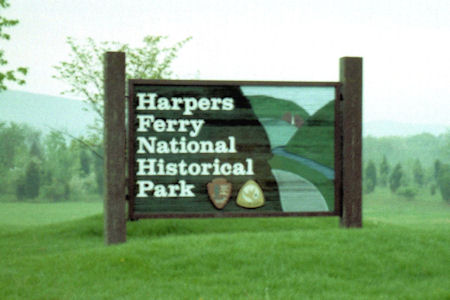
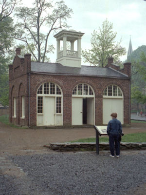
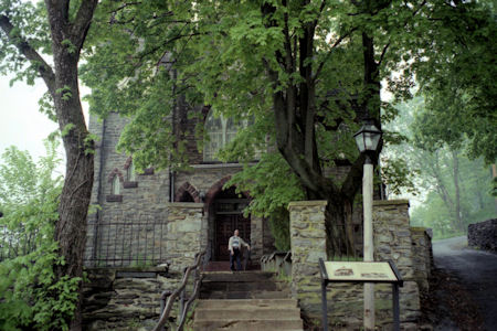
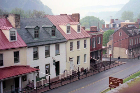
5/4/1996 Harpers Ferry National Historic Park
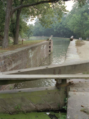
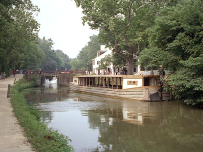
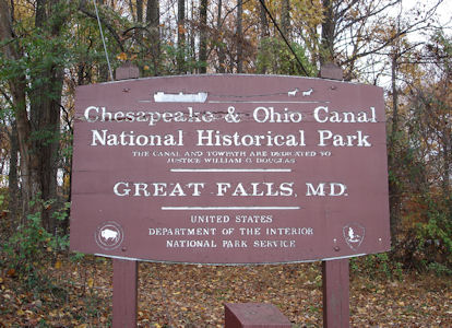
7/26/1997 Drove along the Potomac to the Great Falls Tavern on the C&O Canal (NPS)[MD].
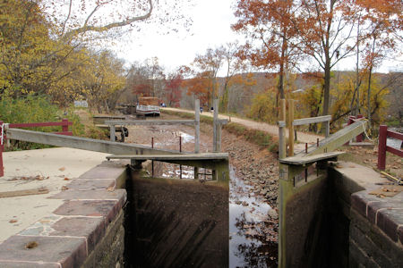
Walked along the towpath (a barge and mules were still here) seeing six locks, then through the woods on a
boardwalk to a very impressive view of the Great Falls of the Potomac.
The park sign
|
A lock along the towpath
|
A canal barge
|
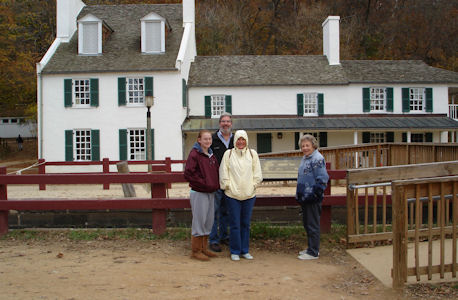
11/9/2008 ... we used both GPS and mapping to meander to the Chesapeake & Ohio Canal NHP [MD],
right on the Potomac [in Potomac, and on the Potomac River Water Trail NRT]. Checked out some of the canal exhibits and the canal locks itself (unfortunately without
water), then took paths, bridges and boardwalk over Olmsted Island to the Great Falls. Although the skies clouded
over a bit, we enjoyed nice views of the falls (which Ken and I saw from the VA side a few years ago) including a
kayaker running the rapids.
The park sign
|
A lock on the rather dry canal
|
The family by the VC
|
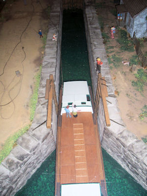
A model in the VC
|
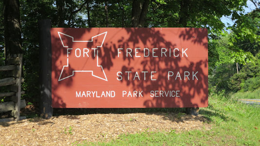
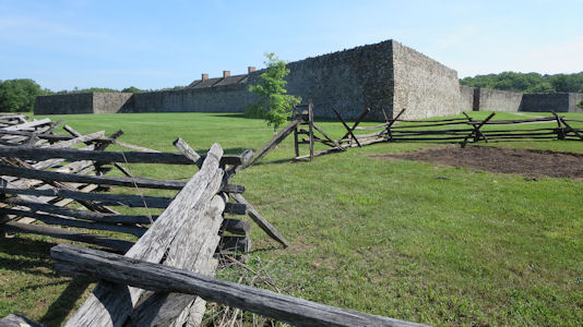
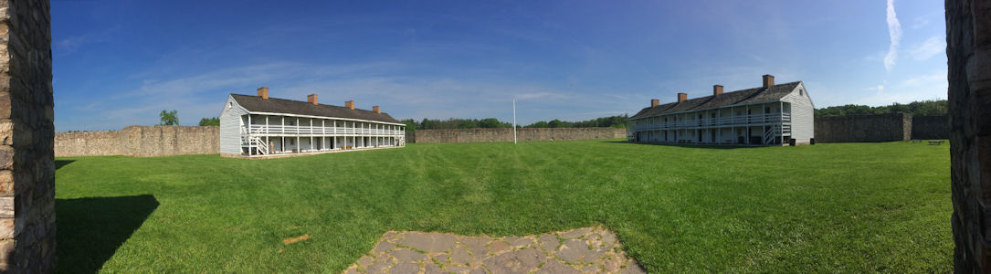
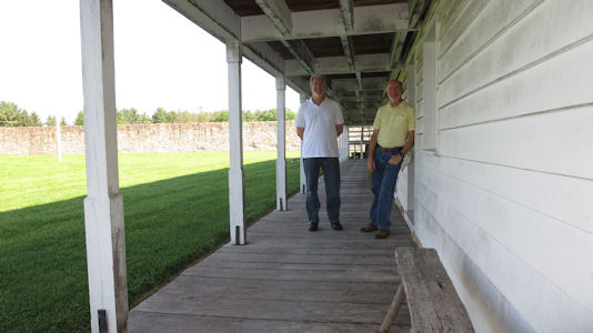
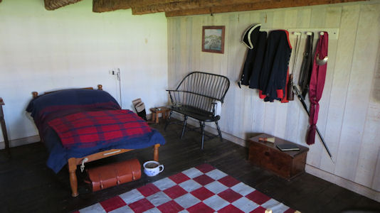
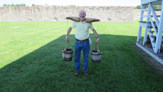
5/27/2016 Fort Frederick (also State Park and in the Chesapeake & Ohio Canal NHP [MD]). This is a star fort active in the
French and Indian War and the Revolutionary War. Here we took a few minutes walk on a warm but pleasant morning to the fort and went within
the walls. We looked through the typical reconstructions of the barracks buildings and tried our hands at using a water bucket carrier.
The park sign
|
A view from outside ...
|
... and from the gate
|
Ken and me by the barracks
|
A look inside
|
This is heavy!
|
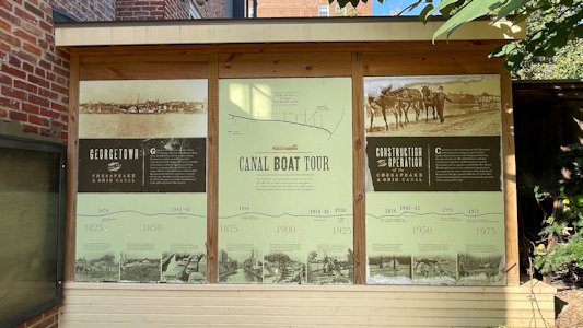
10/13/20247 Walking down to the canal for a photo of the Historic District plaque, we also saw some signage and an old barge
in the canal for the Chesapeake and Ohio Canal NHP. The area was very nice; despite the canal being either totally dry with weeds, or a little water
here and there, the canal paths on each side had nice seating areas.
The park sign ...
|
... and info
|
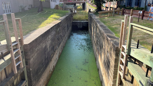
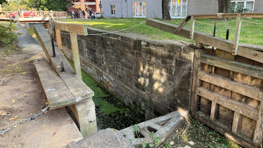
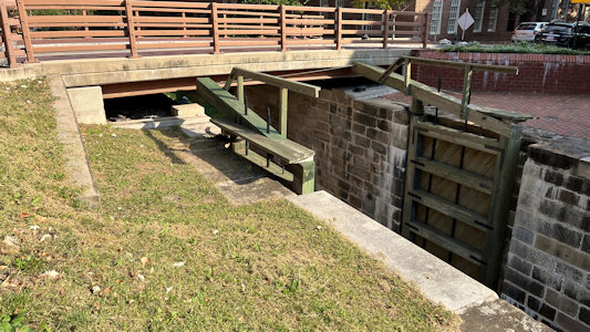
The locks and canal
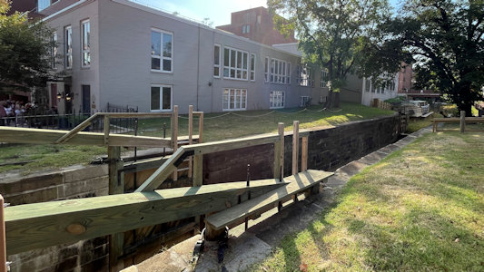
|
Cool locks ...
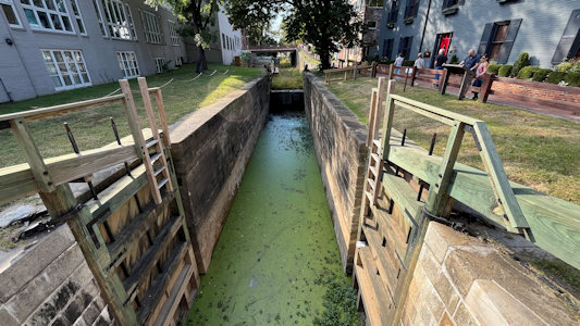
|
... but pretty murky canal
|
The canal with barge ...
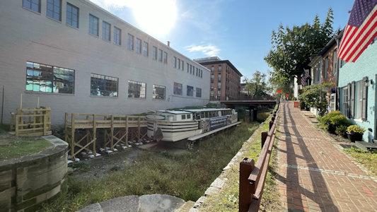
|
... and a little closer
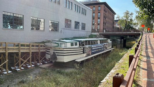
|
Looking in the other direction
|
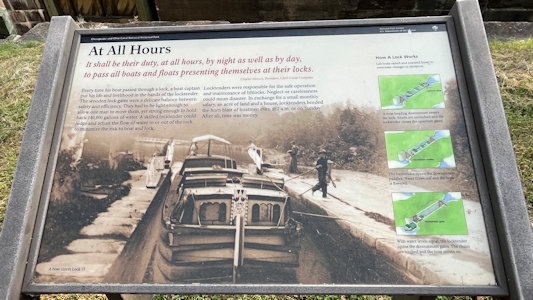
More info with nice photo
|
More lock detail
|
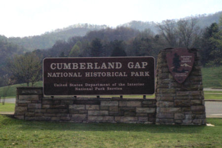
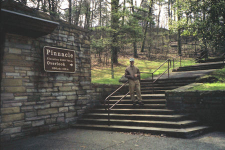
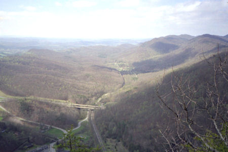
Cumberland Gap National Historical Park (Kentucky, Tennessee, Virginia)
4/5/1998 Stopped at visitor center in Cumberland Gap NHP [KY, VA], then drove up very steep switchback
road to Pinnacle Overlook. A gorgeous day, so had great views of TN, KY and VA, and the mountain gap. Took an
enjoyable hike along the TN/VA border ridge.
The park sign
|
Me on the trail
|
What a view!
|
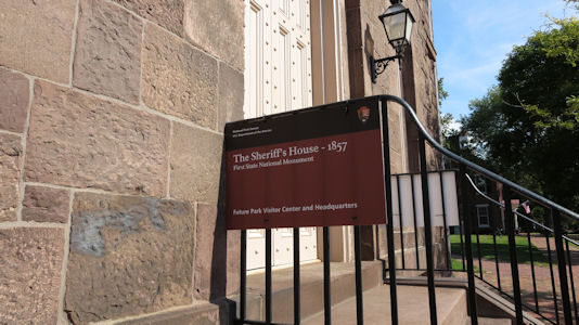
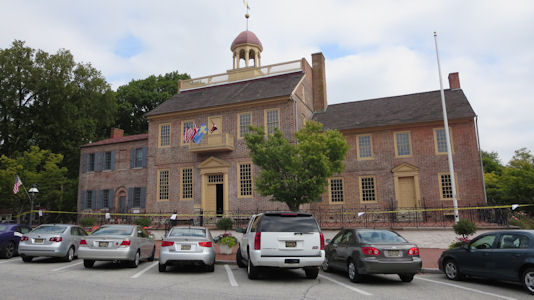
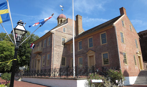
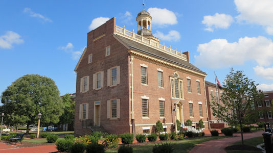
First State National Monument (Delaware, Pennsylvania)
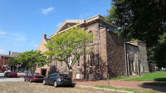
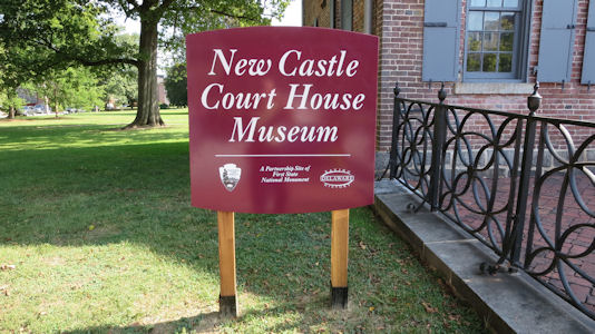
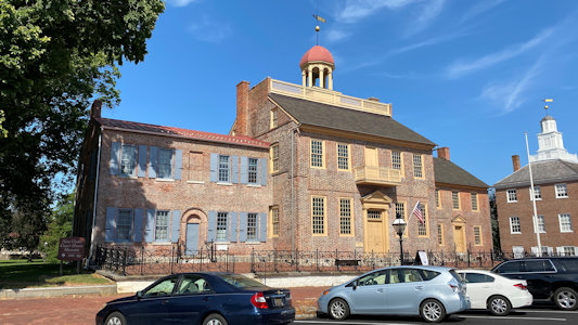
9/19/2014 First stop, New Castle and the NC County Court House (NHL). One of the oldest courthouses in the US,
it is the center of a circle with a 12-mile radius that defines most of the border between the states of DE and PA and a small part
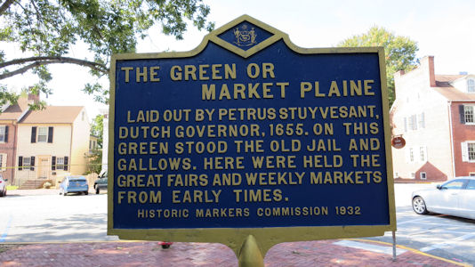
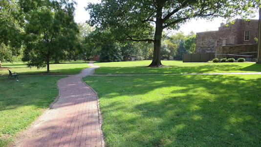
of the border between DE and MD. The whole old part of town was very quaint and we walked around Court House and Green, checking out
buildings. These included the Dutch House, one of many sites in the New Castle NHLD. Originally settled by the Dutch West India Company
in 1651, under the leadership of Peter Stuyvesant, the District is a site significant for its architecture from the 17th, 18th, and
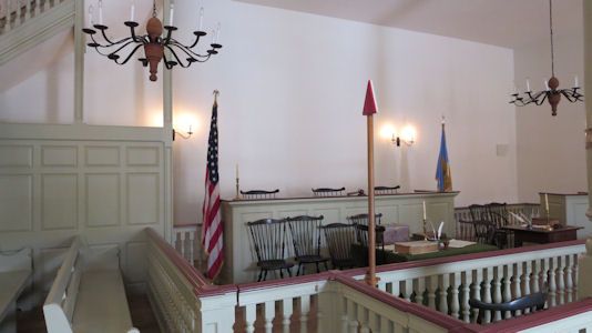
19th centuries. We also saw the Sheriffs House, soon to be the VC for the First State NM [DE]. We went into the Court House, an NHL and in
the NM, and got a nice tour and talk about the court house and its proceedings as well as the Underground Railroad. ... Into Dover,
we parked at the First State Heritage Center for quick look around the exhibits, also mostly on the Underground Railroad. We walked
across the street for photos of the capitol building (Legislative Hall) and went inside to check out the chambers. We walked a couple
blocks to the Old State House which sits on the Dover Green, part of the First State NM.
An NPS sign for the ...
|
... soon-to-be VC
|
Signage for the Green ...
|
... and the Green
|
Sign for the Court House
|
A view of the Court House ...
|
... and another
|
Nicely reconstructed interior
|
Dover Old State House
|
One side of the Dover Green ...
|
... and the other
|
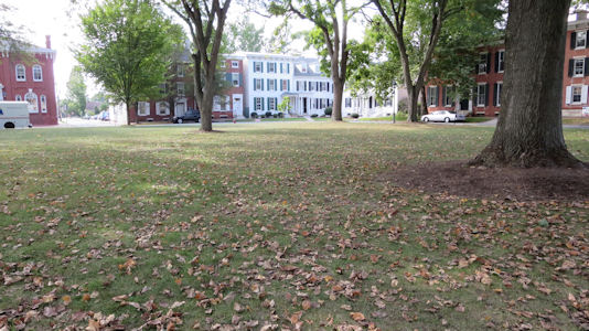
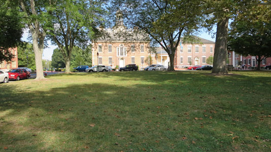
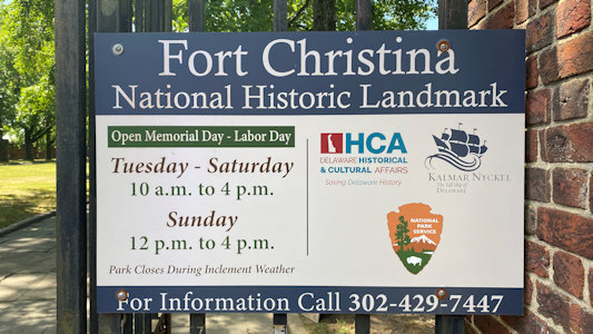
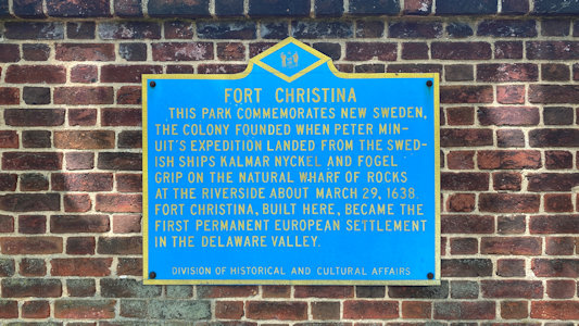
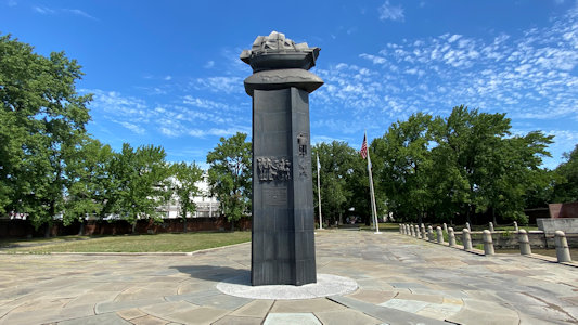
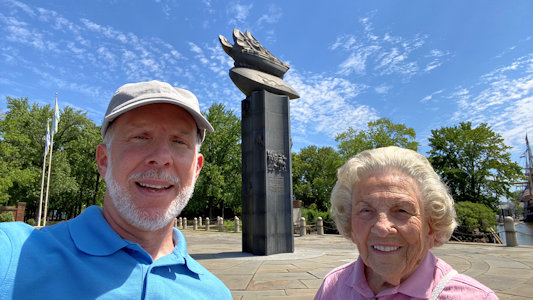
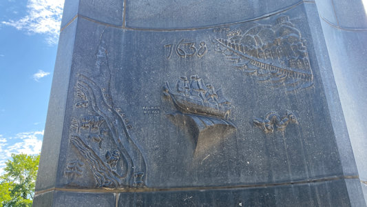
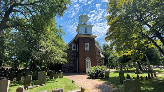
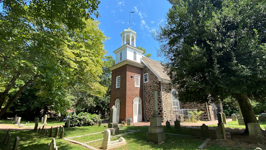
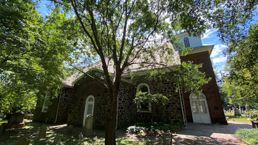
7/31/2021 our first stop in Wilmington - Fort Christina NHL (also in the First State NHP [DE]). This was the location on the
Christina River of the first Swedish settlement in North America and the principal settlement of the New Sweden colony. We walked through the
park and checked out the stone monument near the river. ... we drove another very short way to Holy Trinity (Old Swedes) Church. Consecrated on
Trinity Sunday, 1699, by a congregation formerly of the New Sweden colony, it is among the few surviving buildings that reflect the Swedish
colonial effort. This and the Fort are both second attempts, being closed the last time I tried. At the church a young woman let us in, and
we could walk around the grounds and take our photos - second time’s the charm for these. The site is also in the First State NHP. ... Back
on the road in more traffic up to New Castle and parked right out front of the Court House where we had been years ago for the First State NHP.
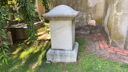
We enjoyed a stroll around the historic area, in the NHP, for a few sights I had missed, not doing Signer yet. In the Immanuel Episcopal
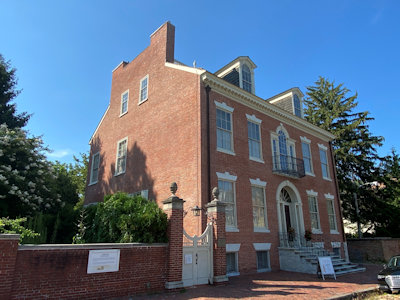
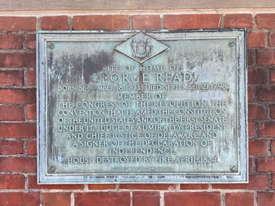
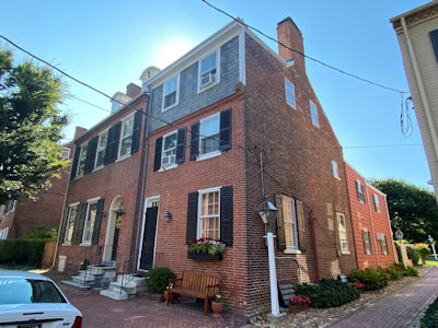
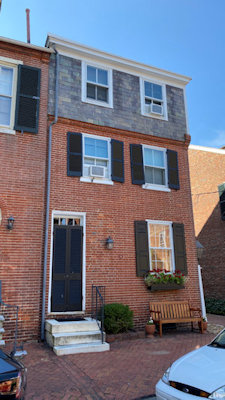
Church graveyard, we found the smallish monument for Signer George Read. Around the corner we stopped at the George Read II House NHL. Built
in 1793 for George Read, Jr., was the largest and most sophisticated residence in the state at the time and is a significant early example of
high-style Federal period architecture. In the garden area adjacent was the home of father and Signer George Read, the structure long gone.
The Read home has a great view looking out at the Delaware, for whatever reason there being no buildings across the street, although there
are plenty on both sides. We continued a very short way on the Strand to the home of Signer Thomas McKean after he was married in 1763.
The Landmark sign ...
|
... and interpretive info
|
The monument view to the river ...

|
... and from
|
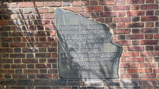
An original fort stone
|
Me and Mom
|
Some monument detail
|
Holy Trinity from one angle ...
|
... and another ...
|
... and another
|
New Castle Court House
|
Caesar Rodney grave area ...
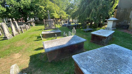
|
... and close-up
|
George Read II House
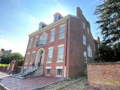
|
Another view
|
George Read house marker ...
|
... and site
|
Thomas McKean Home view
|
... and a front view
|
Harpers Ferry National Historical Park (Maryland, Virginia, West Virginia)
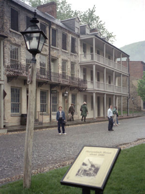
5/4/1996 ... then drove to Harpers Ferry NHS [MD, WV] (a little rainy, then just cloudy). At the visitor center,
took a bus into the town. Real nice - old stone buildings with stone or metal roofs, steep stone walkways and stairs. The
town has been flooded many times (as late as this Jan.), being at the confluence of the Potomac and Shenandoah rivers.
Saw a building in the middle of archeological investigation - many layers of progress, alleys once now covered in the middle
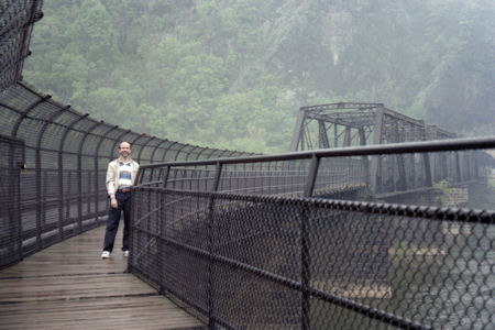
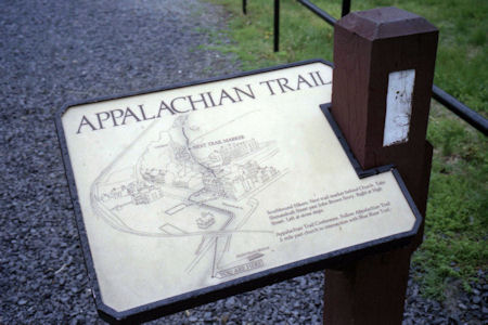
of a building. Walked to the railroad bridge and across the Potomac on a foot bridge. This is the path of the Appalachian Trail [MD. WV],
which continues down the Potomac in one direction and through Harpers Ferry in the other [and is also on the Potomac Heritage NST and in the C&O Canal NHP for MD and WV].
Saw the C&O Canal (not in great shape, due to flood). Back into town, saw original Harper house, church, shops on High Street ...
The park sign
|
Maureen on Shenandoah Street
|
Me over the Potomac on the AT
|
An AT blaze and signage
|
The Arsenal
|
St. Peter's Church
|
High Street
|
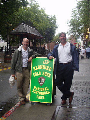
Klondike Gold Rush National Historical Park (Alaska,
Washington)
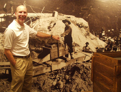
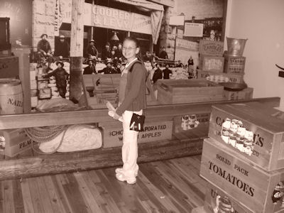
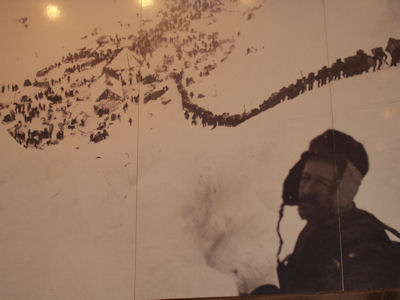
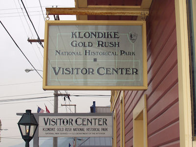
8/22/2004 ... dropped off right in front of the Klondike Gold Rush NHS [WA] ... Saw an excellent, if a bit old, film on the 1897 gold rush, and
looked around some of the museum exhibits.
A park sign on the street ...
|
... and in the window
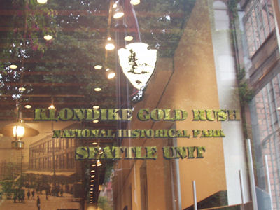
|
Me being silly
|
Kim looking old-timey
|
The expression says it all
|
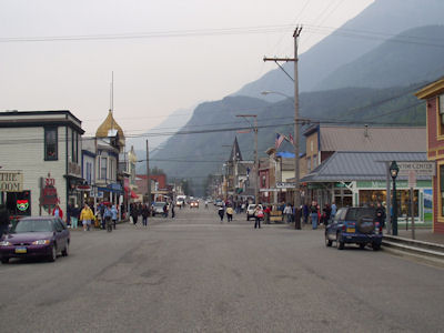
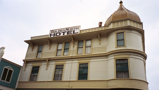
8/25/2004 ... saw the Skagway unit of the Klondike Gold Rush NHP [AK] and a few historic buildings.
The park sign
|
The historic street then ...
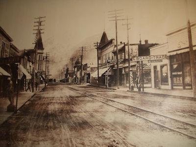
|
... and now
|
A cool dome on an old hotel
|
Lewis and Clark National Historical Park (Oregon, Washington)
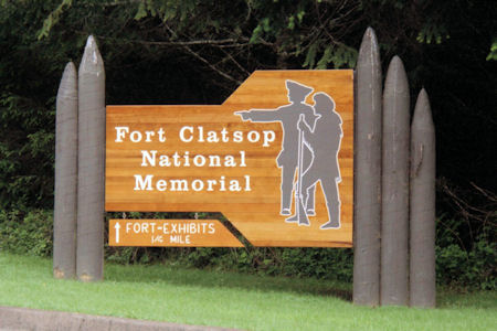
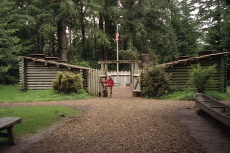
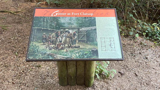
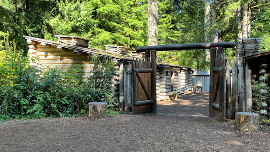
5/22/1998 Drove to Fort Clatsop National Memorial [Lewis and Clark NHP, on the L&C NHT in OR], the winter (1805-6)
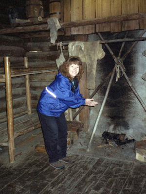
settlement of the Lewis and Clark expedition. Nice museum and slide show about the area. Walked down to the reconstructed
log fort and saw the rough conditions they passed a very wet winter in. Walked a bit more to the canoe landing area.
The park sign
|
Me in front of the fort ...
|
... and Maureen inside
|
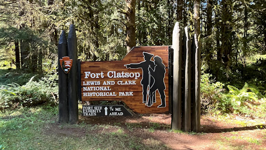
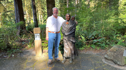
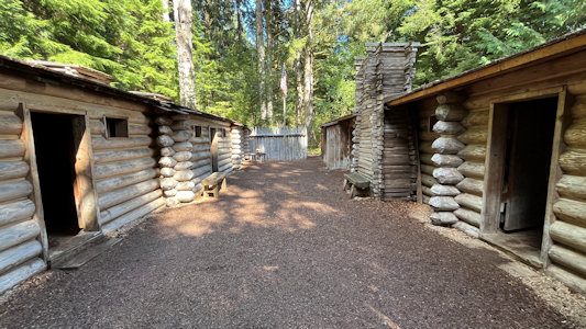
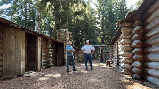
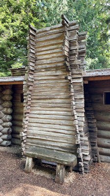
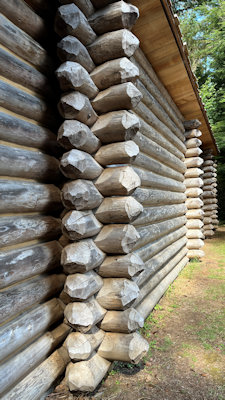
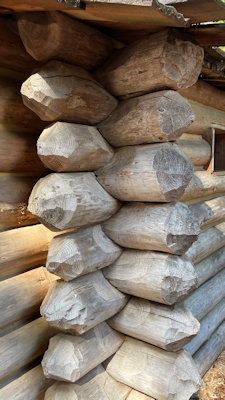
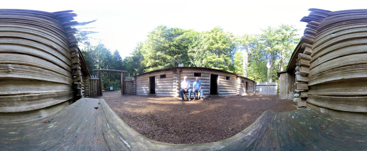
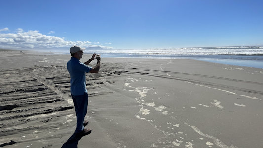
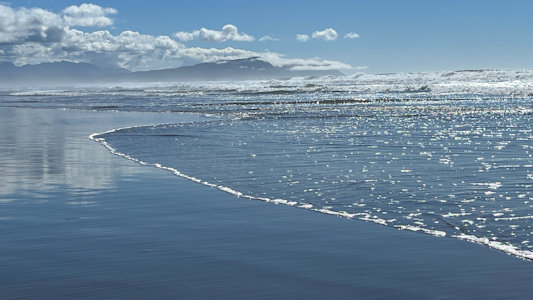
9/18/2024 Starting to wind our way around the curve south towards the coast we stopped at Fort Clatsup, part of the Lewis
and Clark NHP and on the L&C NHT. Fort Clatsop was the winter encampment for the Corps of Discovery from December 1805 to March 1806; the fort
was completed by January 1st and housed 32 men, one woman, a baby, and a dog. This was quite enjoyable, first taking a nice walk on the trail
through huge trees (and with a beautiful and lifelike bronze statue of Sacajawea and child) and ending up at the replica fort. We were lucky to
have the very well-done structure to ourselves for photos. I had been here around 26 years ago, but the replica I saw had burned in 2005, giving
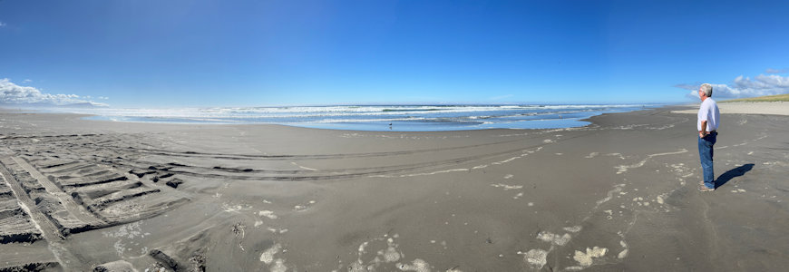
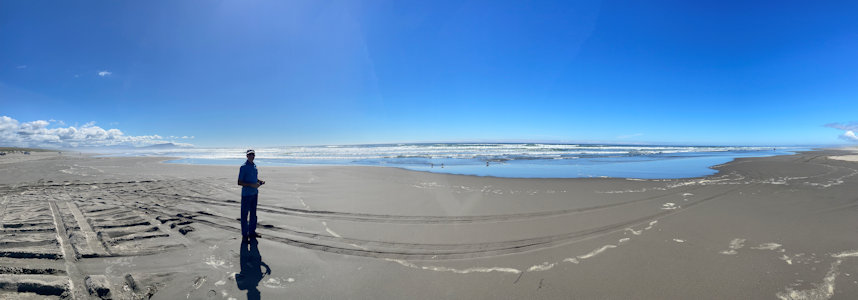
me a view of this nice newer one. Although we had considered only one stop for the L&C NHP/NHT, we decided to do both and continued to Sunset
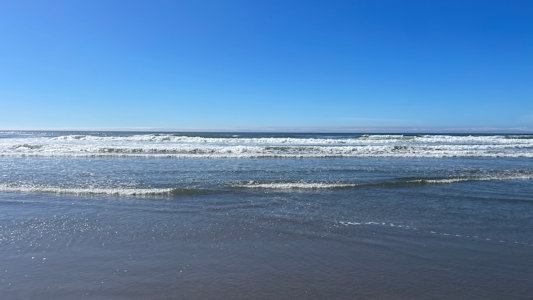
Beach, and were very glad we did. We parked in a sand lot and walked to the beach over some rutted sand where other people continued to drive
on the beach - we for sure could have with likely no problem in our Durango, but elected not to. Standing at the water’s edge was really satisfying,
hearing the crashing waves, with the ocean shining in the sun and raising a salt mist off in the distance against the land. Ken did his requisite
hand-in-the-water ceremony while dodging some overachiever waves.
The park sign
|
Ken and Sacajawea
|
Some info
|
Outside views ...
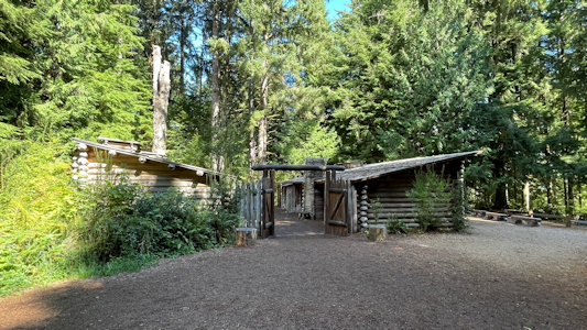
|
... of the nicely reconstructed ...
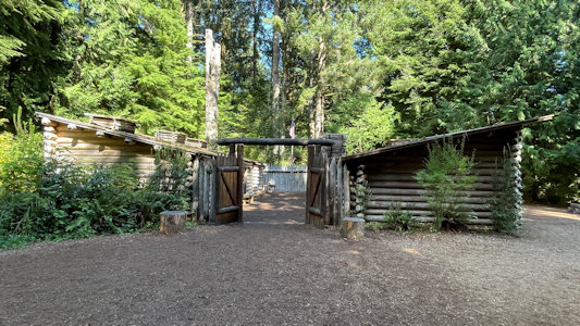
|
... winter encampment
|
A look inside ...
|
... with us
|
Nice details ...
|
... of log ...
|
... construction
|
Cool 360 inside
|
Ken surveys Sunset Beach ...
|
... while I photo ...
|
... the waves coming ashore
|
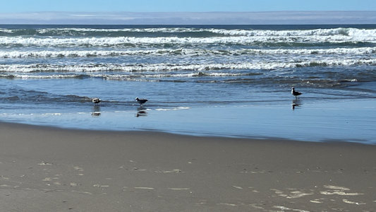
Birds at water's edge
|
The shore and ...
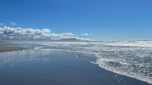
|
... distant outcroppings
|
A panorama with me
|
Manhattan Project National Historical Park (New Mexico, Tennessee, Washington)
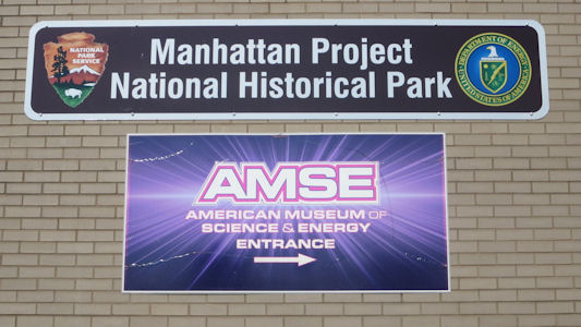
9/16/2016 ... then went to the nearby American Museum of Science and Energy, now also the VC for the Manhattan Project NHP [TN].
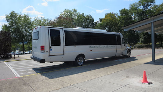
Checked in for my tour then checked out the museum. Pretty good displays, with some feeling a little stale. At 11:30 got on a bus with 33 others
for a very good tour of the Oak Ridge area. The guide was excellent, with 54 years in the nuclear industry at Oak Ridge. The best part of the tour
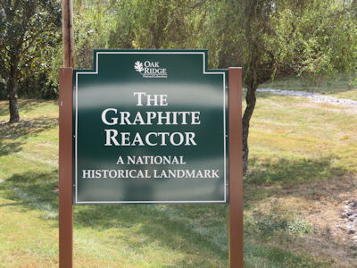
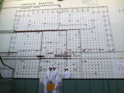
was the X-10 Graphite Reactor, itself an NHL. Built during World War II as part of the Manhattan Project it was the world's second artificial
nuclear reactor and was the first reactor designed and built for continuous operation. We could view the broad face of the front of the reactor
where the uranium fuel was fed into the large array of files in the heavily shielded wall. The whole tour took 3 hours, returning around 2:30.
The park sign
|
Our tour bus
|
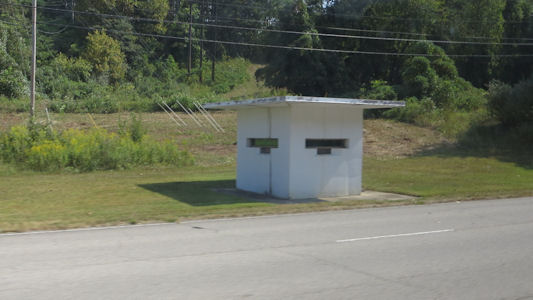
An original guard shack
|
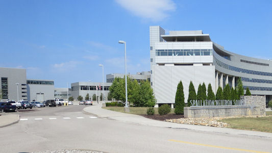
Spallation Neutron Source Facility
|
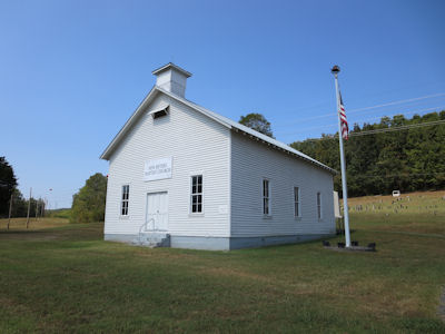
Bethel Church
|
The reactor sign
|
The X-10 Reactor ...
|
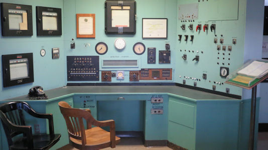
... and control room
|
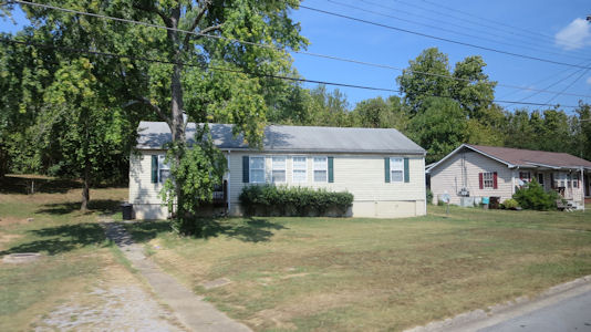
Original Oak Ridge housing
|
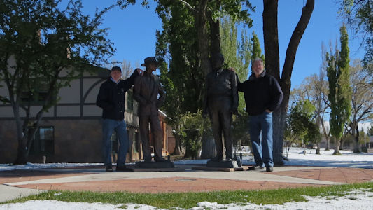
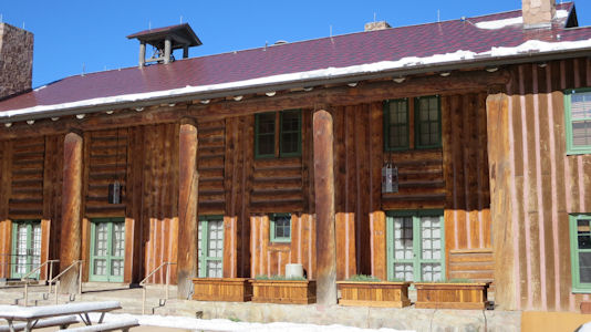
4/30/2017 We drove to the central part of town for a combined stop - the Los Alamos Scientific
Laboratory NHL District and a unit of the Manhattan Project NHP [NM]. The laboratory was founded during World War II as a
secret, centralized facility to coordinate the scientific research of the Manhattan Project, the Allied project to
develop the first nuclear weapons. We parked at the Fuller Lodge and walked around admiring the rustic structure
from the days during the war. Fuller Lodge was one of the main structures of the Los Alamos Boys Ranch School,
serving as its headquarters in its later years; it was converted into a mess hall and guest quarters during the
Manhattan Project. We moved over to where the NHL plaque was, and decided to make quick stop in the NPS VC for a
unigrid. Unfortunately we had to extricate ourselves from a little old guy Ranger who was intent on telling us
everything there was to know about the days of the Manhattan Project.
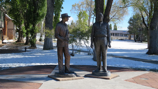
Dr. Oppenheimer and General Groves
|
Two more statues
|
Fuller Lodge from afar ...
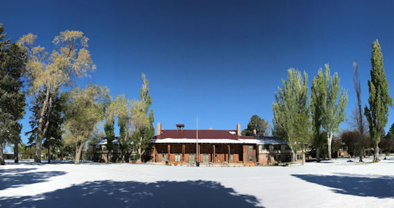
|
... and close up
|
Lamp detail ...
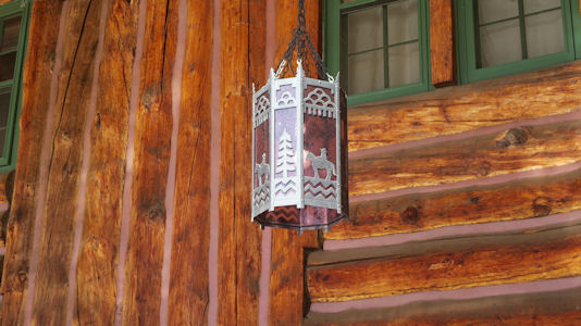
|
... and lodge construction
|
Nez Perce National Historical Park (Idaho, Montana, Oregon, Washington)
5/30/1997 Big Hole National Battlefield
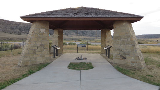
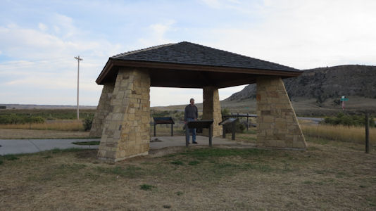
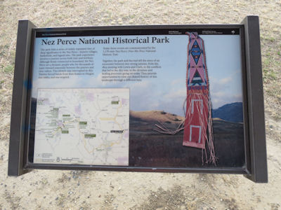
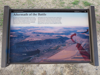
9/22/2018 We continued up towards Billings and stopped in Laurel for a small site in the Nez Perce NHP [MT]
and on the NHT. We have a habit of saving uninspiring little sites for the last of our trip visits and this was certainly one.
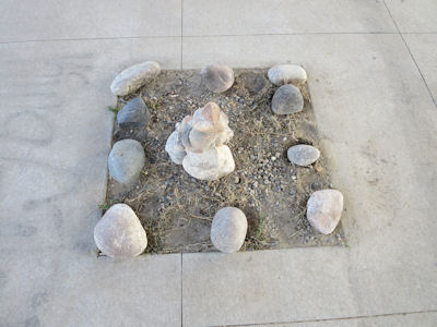
There was a stone canopy kiosk with a little rock cairn in the center and three interpretive panels. They describe the September
13, 1877 Battle of Canyon Creek, a military engagement between the Nez Perce Indians and the 7th Cavalry.
The site kiosk
|
Ken reading ...
|
... info about the site ...
|
... and battle
|
Rock cairn
|