Home
Travel
NPS States
NPS Types
National Heritage Areas (Non-Units) - Pennsylvania
Delaware & Lehigh Navigation Canal National Heritage Area
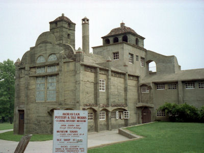
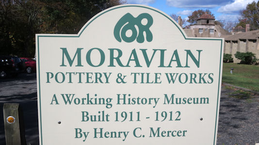
7/3/1994 Drove down to Doylestown to visit Moravian Tile Works and Pottery Factory (in Delaware
and Lehigh Navigation Canal National Heritage Corridor)[and Fonthill, Mercer Museum and Moravian Pottery and
Tile Works NHL]. Interesting 1911 concrete building. Saw slide show and took tour which included people making tiles.
The Tile Works
|
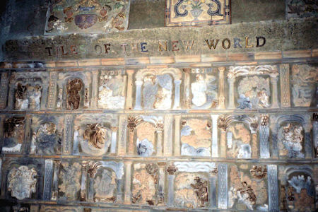
Some unique tiles
|
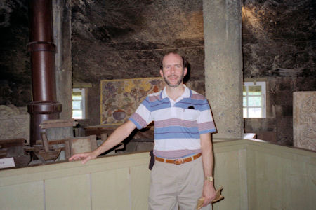
Me in the factory
|
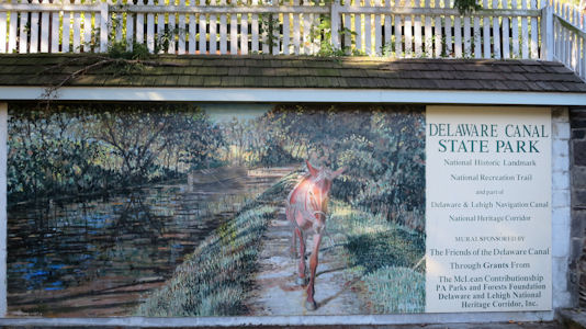
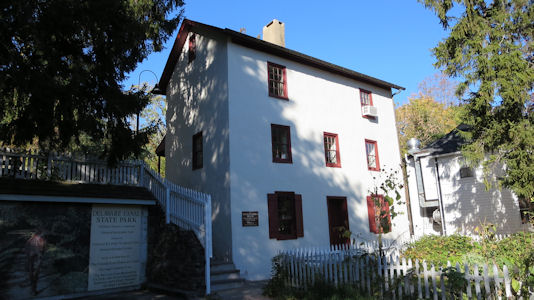
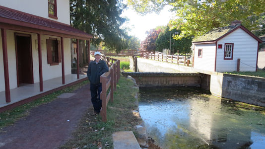
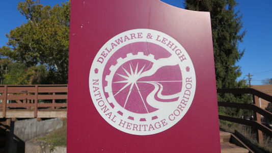
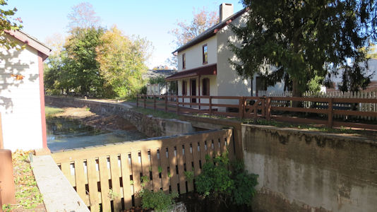
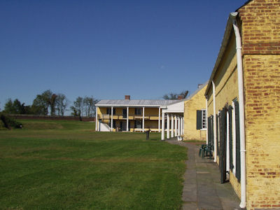
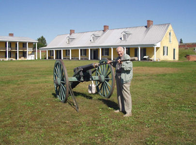
10/18/2015 Delaware Canal (State Park) - At 60 miles, running parallel to the Delaware River, it is the only canal
that remains fully intact from the towpath canal-building days of the 19th century. Also part of the Delaware and Lehigh Navigation Canal
NHC [and on the Delaware Canal Heritage Trail NRT]. We were at the south end of the NHL/Park, in New Hope, and enjoyed walking along the
towpath in the brisk weather.
The park sign
|
The Locktender's House ...
|
... and me around back
|
The NHC sign
|
A look up the canal ...
|
... and the lock
|
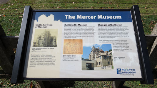
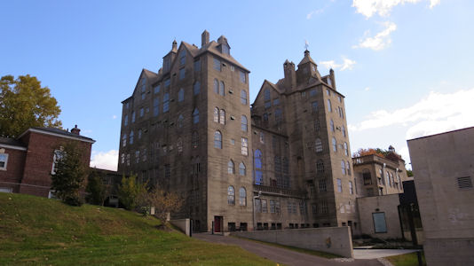
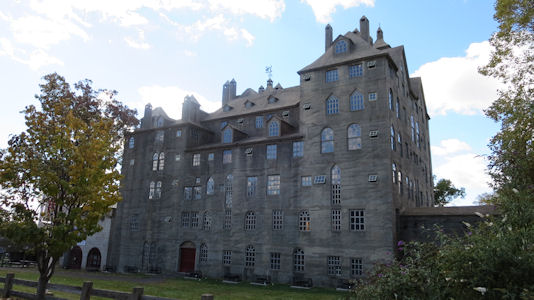
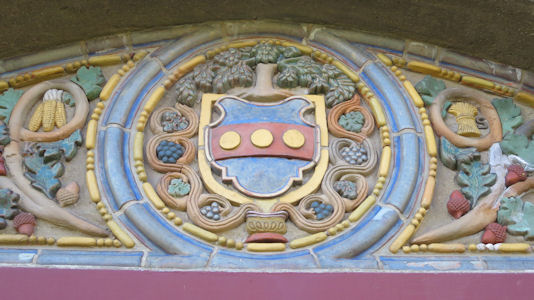
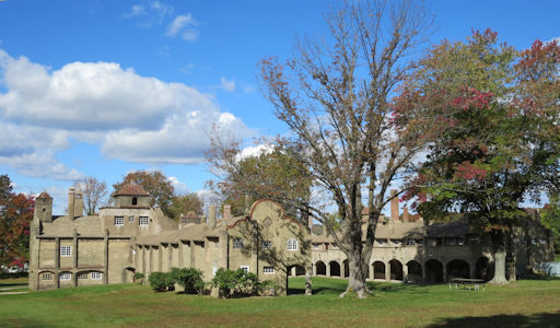
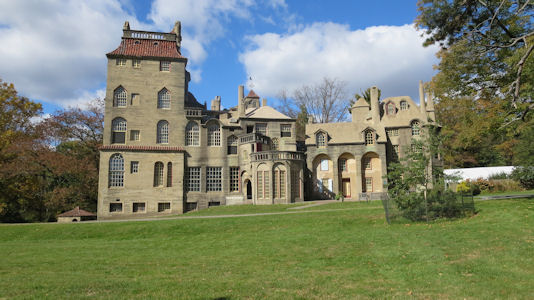
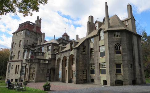
10/18/2015 Fonthill/Mercer Museum/Moravian Pottery and Tile Works (Doylestown) - Three previously individual
sites associated with archeologist and tile maker Henry Chapman Mercer. We stopped at the museum, then went the short way to the
factory and the Fonthill mansion. These sites are also in the Delaware and Lehigh Navigation Canal NHC..
The museum sign
|
The museum in back ...
|
... and front
|
The front door ...
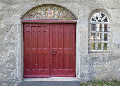
|
... with decorative tiles
|
The sign for the tile works
|
The Pottery and Tile Works
|
A couple of views ...
|
... of Fonthill
|
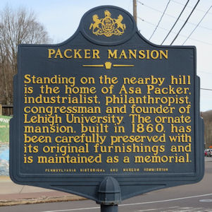
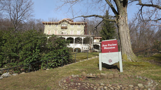
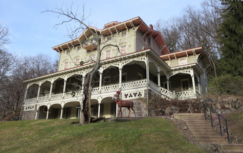
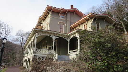
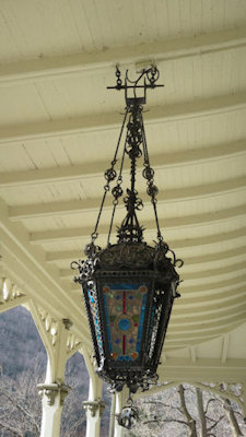
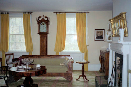
12/28/2015 Walking back through town, we went up another hill to see the Asa Packer Mansion NHL.
This Italianate Villa-style house was the 1861 home of the coal and railroad magnate and founder of Lehigh University.
The mansion is also in the Delaware and Lehigh NHC.
Historical info
|
The house and sign
|
The house from below ...
|
... and the side
|
Details on the porch
|
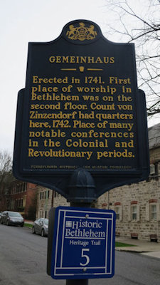
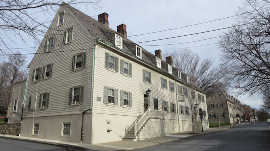
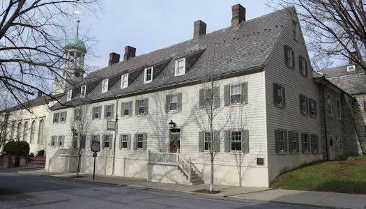
12/28/2015 We checked out some of the really attractive buildings, including the Church,
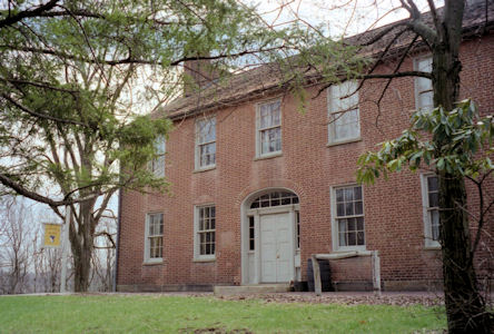
Brethren’s House and Old Chapel, then walked to the Gemeinhaus - Lewis David De Schweinitz Residence NHL (in the
Delaware and Lehigh NHC). Built to house the married couples of the Moravian community as well as the community's
place of worship, it is the oldest surviving building in Bethlehem, and is significant for its association with
the botanist and mycologist Lewis David de Schweinitz.
Historical info
|
The house from one end ...
|
... and the other
|
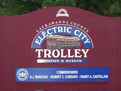
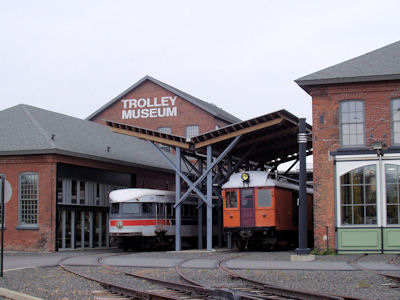
Lackawanna Valley National Heritage Area
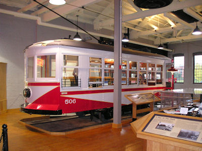
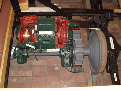
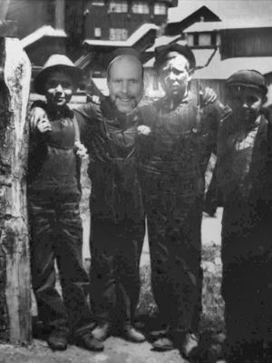
10/2/2004 First stop the Lackawanna Electric City Trolley Museum (part of Lackawanna Valley National Heritage Area).
Some interesting stuff here on the history of trolley service (and saw a working trolley heading off on an excursion).
Steamtown National Historic Site
The park sign
|
The Trolley Museum
|
Nice trolley on display
|
Good detailed exhibits too
|
Me and the boys
|
Oil Region National Heritage Area
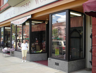
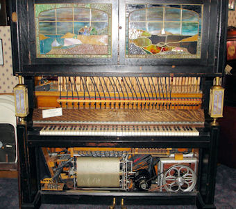
7/1/2007 In Franklin … went to the DeBence Antique Music World. Took a guided tour of dozens of instruments
(all playing live) including metal disk music boxes, Victrolas, tube radio, player pianos, calliope, orchestrons, etc. All sounded
fantastic! This place happened to be listed as part of the Oil Region NHA, but for real oil stuff we continued past Oil Creek
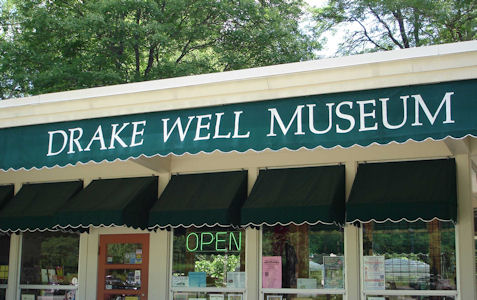
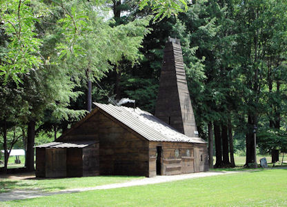
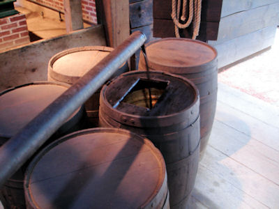
(where the Indians collected surface oil) to Titusville and the Drake Well Museum [Drake Oil Well NHL]. Visited the inside museum
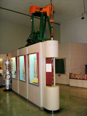
which had exhibits and films on oil in general and on Edwin Drake who struck oil here in 1859. Outside went into a reconstruction
of the original well building with a working steam engine actually pumping oil out of the Drake well (and back in for recycling).
Strolled around the outdoor exhibits and an antique car show which happened to be going on.
Mom in front of Music World
|
One of the many working instruments
|
The museum sign
|
Learning how a well works
|
Nice diorama
|
The orginal Drake well
|
The live pumping oil
|
The Drake home
|
Path of Progress National Heritage Tour Route National Heritage Area
4/11/1997 Fort Necessity National Battlefield
Also walked to Mt. Washington Tavern on Route 40, which was the first National Road. Nicely reconstructed interior of upscale
tavern for coaches. Friendship Hill National Historic Site [All of this
in the Path of Progress National Heritage Tour Route].
Mount Washington Tavern outside ...
|
... and inside
|
4/12/1997 Johnstown Flood National Memorial
Allegheny Portage Railroad National Historic Site [Johnstown Flood
and Allegheny Portage Railroad are both in the Path of Progress National Heritage Tour Route].
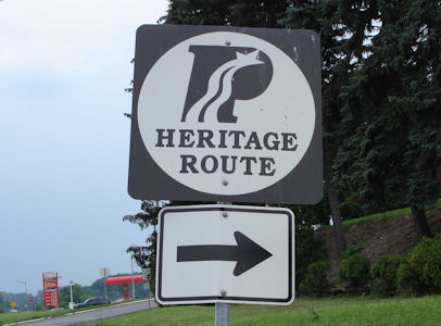
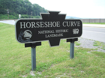
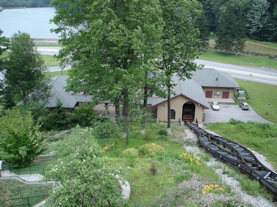
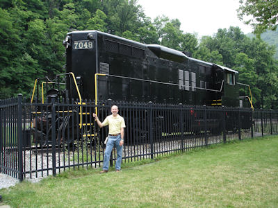
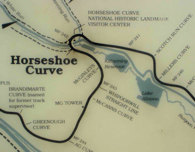
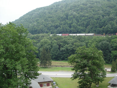
7/2/2006 Headed east to near Altoona to Horseshoe Curve [NHL] (in the Path of Progress National Heritage
Tour Route). This is a huge horseshoe-shaped bend in the mountains, avoiding a difficult bridge across the valley. Since the
funicular only ran each half hour, walked slowly up (hot and sticky) to the top for nice views and a look at a locomotive and
signs. No trains, so walked back down and checked out the little museum. Got some ice cream and were ready to head out when
they announced a train. I ran up, getting rubbery-legged at the top, but managed to get great views of a freight train filling
the whole curve. Pretty cool! Back down, cooled down and hit the road.
A Heritage Route sign
|
The Horseshoe Curve sign
|
The view from the curve
|
Me in front of a big loco
|
A map of the curve
|
A train from one side ...
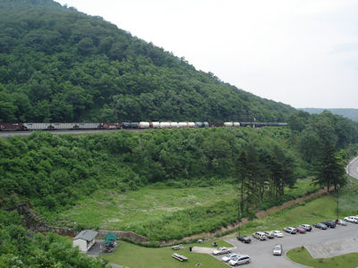
|
... to the other
|
8/24/2009 [Note: the US30 part of the LH, roughly from McConnellsburg to Jennerstown and Ligonier to
Latrobe is on the Path of Progress National Heritage Tour Route].
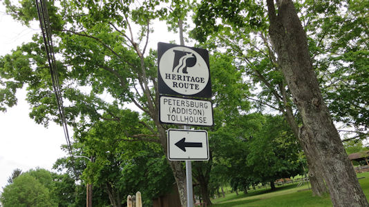
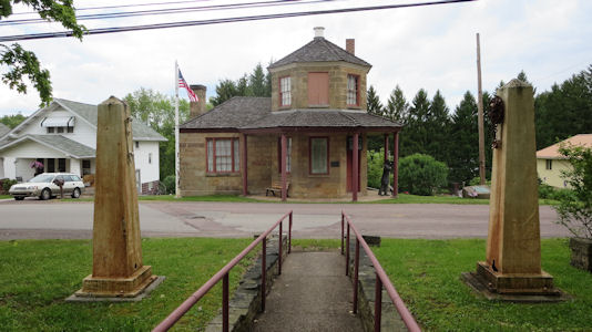
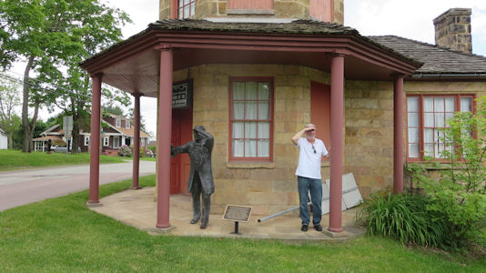
5/27/2016 Petersburg Toll House & NR Sculpture – “The Toll Keeper” (in the Path of
Progress NHA). This was the first of four life-sized bronze sculptures we would visit, all of which just begged for a silly ‘part of the tableau’ photo.
Fort Necessity National Battlefield
The PoP sign
|
The tollhouse and pike mounts
|
Ken being silly
|
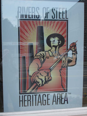
Rivers of Steel National Heritage Area
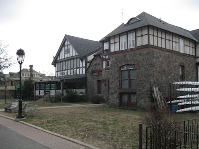
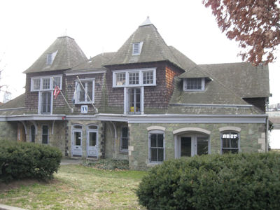
7/1/2006 Parked at the Bost Building [NHL], center for the Rivers of Steel NHA but it was closed so only
looked at window exhibits and took photos.
A Heritage Area sign
|
The Bost Building
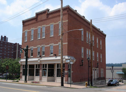
|
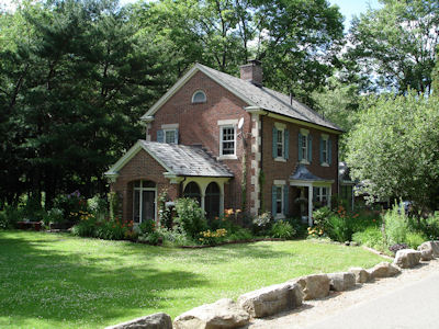
7/2/2006 On the road back towards Pittsburgh to the Frick Art and Historical Center. Arrived at 9:58,
got on the 10:00 tour of Clayton, the home of the coke tycoon Frick (this is in the Rivers of Steel NHA). Beautiful Victorian home,
with excellent docent. Lots of beautiful woodwork and original furnishings. Had excellent, if pricey, lunch at the café, then a
quick look in the carriage museum with both carriages and cars.
The Center sign
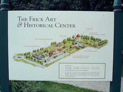
|
Clayton
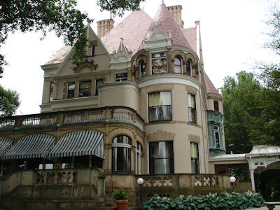
|
The greenhouse
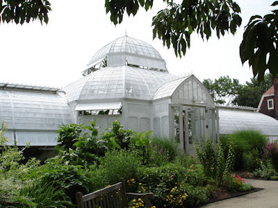
|
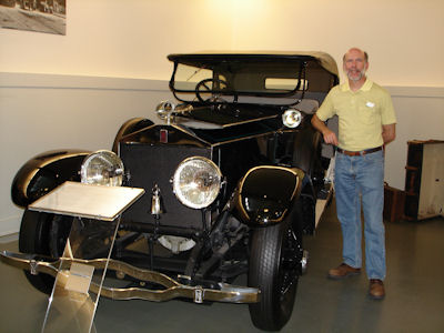
Me in the carriage museum
|
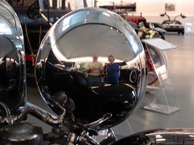
Mom and me in a big headlight
|
Schuylkill River Valley National Heritage Area
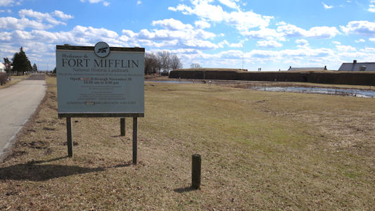
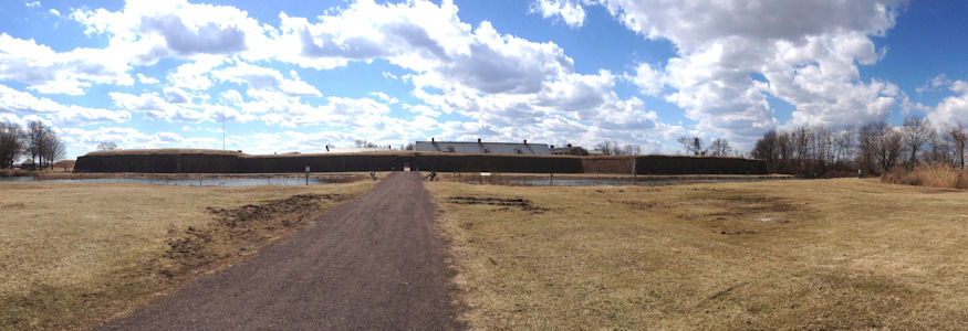
10/3/2004 On the road down to Phili; went past the airport to Fort Mifflin [NHL], in the Schuylkill River Valley
National Heritage Corridor. This fort was primarily a line of defense of the Delaware in the Revolution although eventually lost to the
British. It also was used well into the 19th century. Walked around in gorgeous weather, looking at the fort and river. From there across
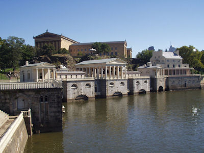
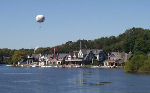
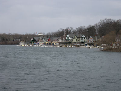
Phili to near our next destination looking for lunch in a bit of a rough area’ finally found a KFC. Went to the park on the Schuykill
intending to go to the Water Works also in the NHA but it was closed due to a recent flood. Still interesting architecture set on a
man-made waterfall in the river, with a view of old boathouses [Boathouse Row NHL]. Also saw the Phili Museum of Art on the hill above
the river. Walked around down to the boathouses with ice cream snack, watching roller skaters, etc.
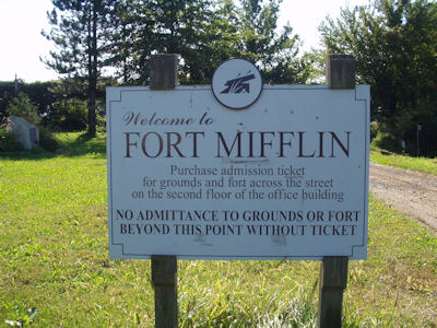
The fort sign
|
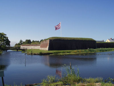
A wide view of the fort
|
Barracks on the inside
|
Dad loading a cannon
|
The Water Works
|
Boathouse Row
|
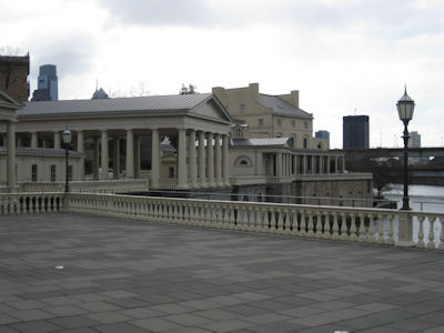
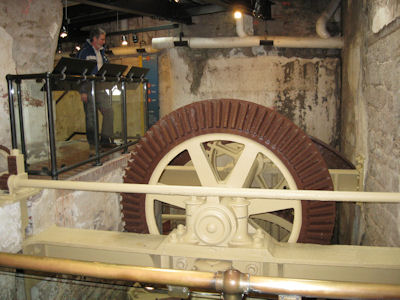
2/21/2013 Fairmount Water Works NHL – Philadelphia's second municipal waterworks, designed in 1812 by Frederick
Graff, built between 1812 and 1872, and operating until 1909. This is a cool architectural attraction as well as an interpretive center
for the old waterworks. I had been here also, but it had been closed due to flooding. We checked out the views along the river, then
went in and saw the very nice technical exhibits. Some of it was kid-oriented, but we learned a lot about the old waterworks, which
originally pumped water up to the heights where the art museum is now, creating a reservoir for serving Philadelphia with fresh water.
Both the boathouses and the water works are in the Schuylkill River NHA [and on the Schuylkill River Water Trail NRT].
Boathouse Row
|
One boathouse ...
|
... and another
|
The Water Works
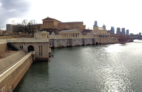
|
Nice classical architecture
|
Me by some of the machinery ...
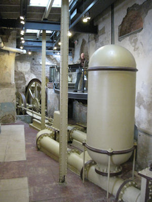
|
... and Ken by some more
|
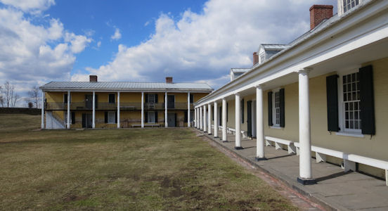
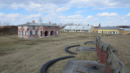
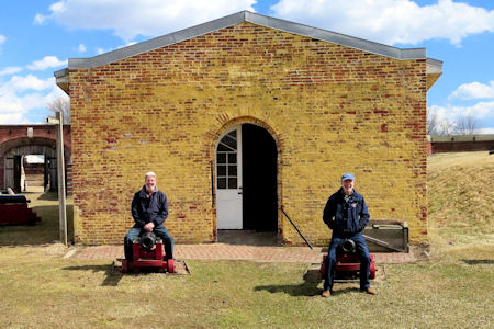
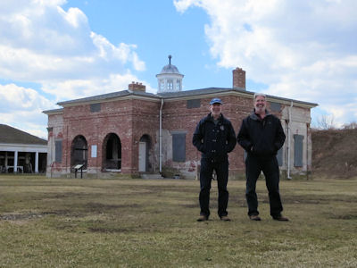
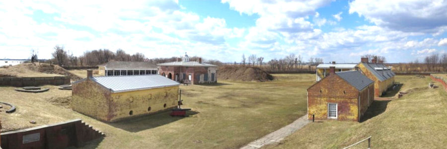
3/15/2014 ... then continued east to near the Phili Airport and arrived at Fort Mifflin, an NHL and in the
Schuylkill River Valley National Heritage Corridor. The fort sits on Mud Island on the Delaware River, and during the Revolutionary
War, the British Army bombarded and captured the fort as part of their conquest of Philadelphia in autumn 1777. It was very pleasant
walking around the fort, although some areas were a little squishy and muddy. There are some inside static displays here and the
usual things like quarters, ammunition magazine and rampart walls to walk on.
The fort sign
|
A panorama of the outside
|
Classic view of the quarters
|
From the rampart and gun emplacements
|
ken and me riding the cannons ...
|
And by the central building
|
A panorama from the rampart
|
Susquehanna National Heritage Area
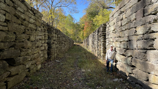
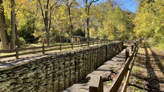
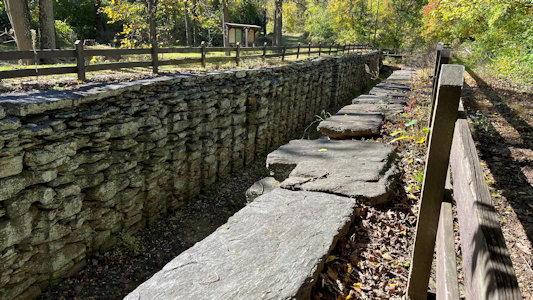
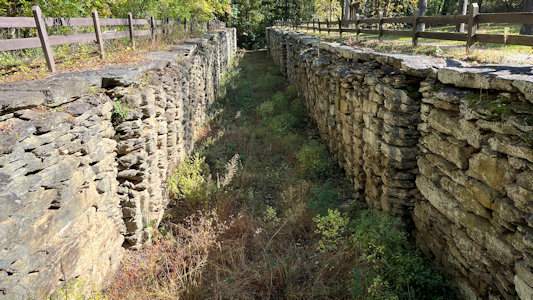
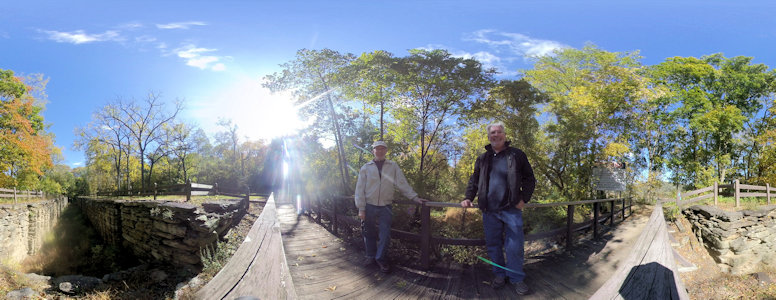
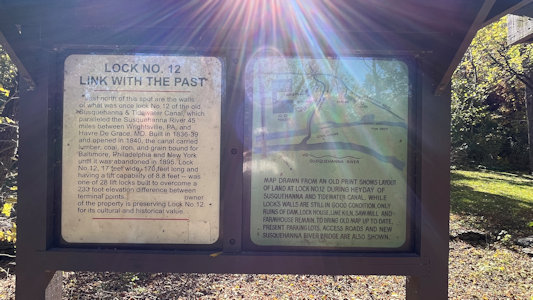
10/22/2023 Onwards to the parking area for the Lock 12 Recreation Area, a representative site for the Susquehanna NHA. This site is also on some trails:
Mason-Dixon Trail NRT (at the southern end). A 30 mile-long hiking path, following the western slopes of the Susquehanna River between Wrightsville and Norman Wood Bridge,
with rock formations, stream crossings and scenic overlooks.
Susquehanna River Water Trail - Lower Section NRT. Running from Harrisburg to the Mason-Dixon Line, the Lower Section passes through a tremendous diversity of natural and
built environments, from industrial yards to bird habitat.
Captain John Smith Chesapeake NHT. This trail that stretches over 3,000 miles and traverses most of the Chesapeake’s great rivers commemorates Captain Smith’s exploration
of the Bay in 1607 through 1609.
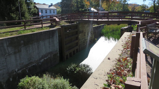
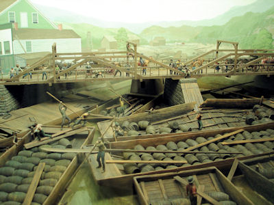
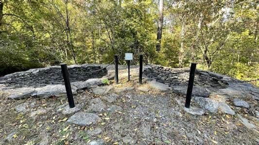
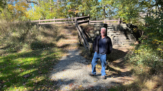
The site proved to be a little disappointing in the dearth of real interpretive signage, especially about the NHA or any of the related trails. Still, we walked down to the
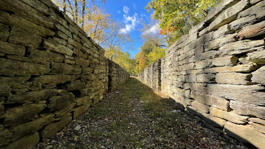
remains of an old lime kiln, then to the lock area where we could get to both the bottom and top of the deep stone walls skillfully constructed to create the lock area for
the Susquehanna and Tidewater Canal. There was not really much obvious defining the rest of the old canal around, and the views of the Susquehanna were pretty poor due
to the trees, so we moved on.
Area info
|
This area has ...
|
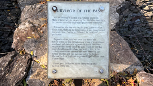
... lime kiln remains ...
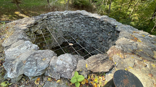
|
... with info on them
|
Ken on the way to the locks/canal
|
The lock area from the bottom ...
|
... with me
|
A look from above ...
|
... showing impressive construction
|
One more from the crossover
|
A 360 of us by the lock
|
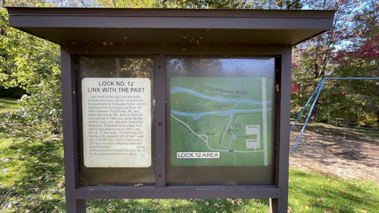
Info about Lock No. 12
|