Home
Travel
Byways
Oregon Scenic Byways
Historic Columbia River Highway
Total Segments Traveled
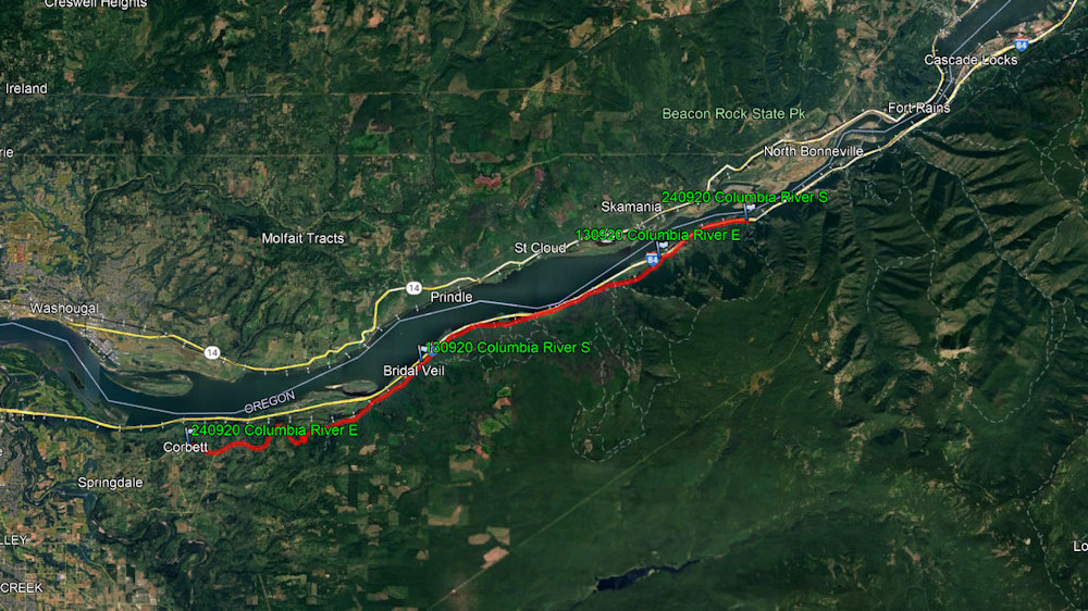
9/20/2013 For a while I got on Historic Columbia River Highway Scenic Byway, passing the spots
I saw years ago like Multnomah Falls (very crowded). This is also in the Historic Columbia River Highway NHL. This
75-mile highway was built through the Columbia River Gorge between 1913 and 1922 as the first planned scenic roadway in the US.
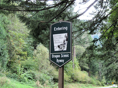
The Byway sign
|
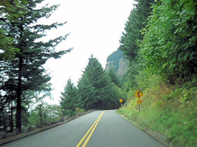
A view down the Byway
|
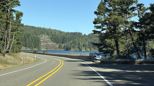
9/20/2024 Columbia River Gorge National Scenic Area
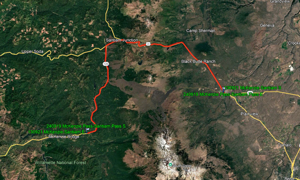
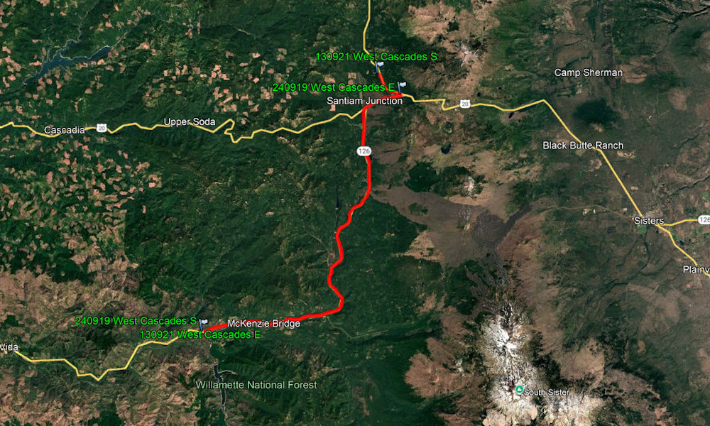
McKenzie Pass-Santiam Pass Scenic Byway
Total Segments Traveled
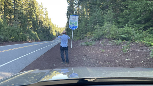
9/21/2013 Started to head to Salem via the
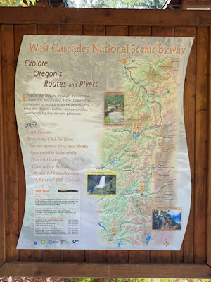
West Cascades Scenic Byway, then turned around and
took that Byway towards Eugene. Most of that section was also part of the McKenzie Pass-Santiam Pass Scenic Byway.
This whole drive was really beautiful.
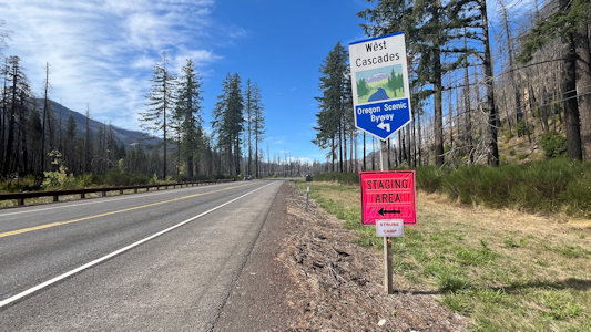
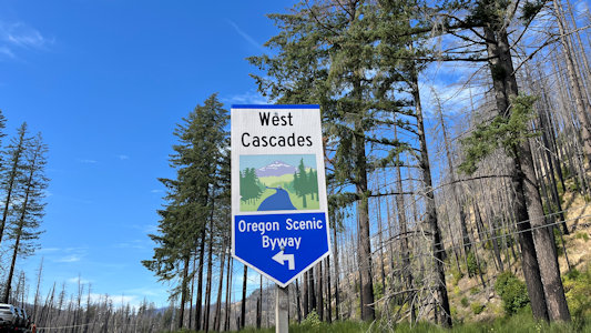
9/19/2024 West Cascades Scenic Byway ...
Pacific Crest NST
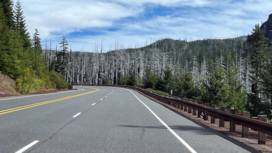
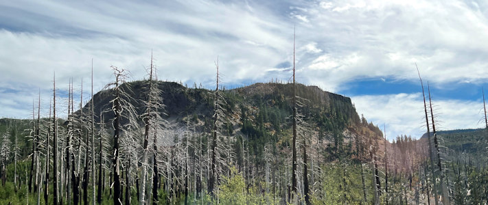
Sad views ...
|
... of burnt trees
|
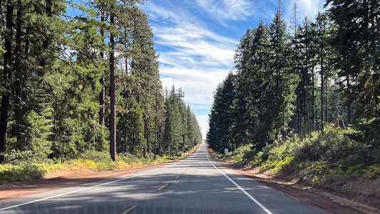
A much better view of the Byway
|
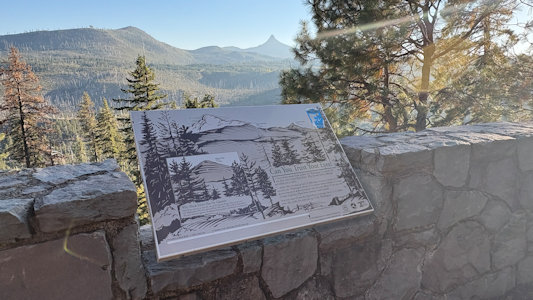
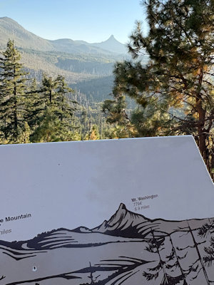
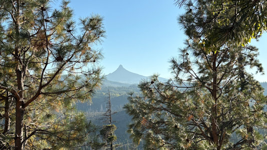
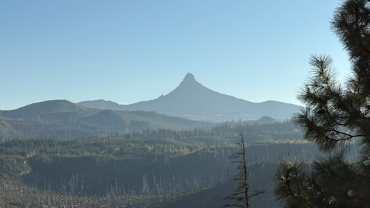
9/23/2025 We took the NSB from the intersection with the West Cascades all the way to Sisters. On the way we stopped at
a wayside for some nice views of Mt. Washington and interpretive signage. We noted that these were the same NSBs we took last year, in fact even
passing the same Pacific Crest National Scenic Trail trailhead we stopped at then!
Nice wayside ...
|
... where we could see ...
|
... Mt. Washington ...
|
... in the distance
|
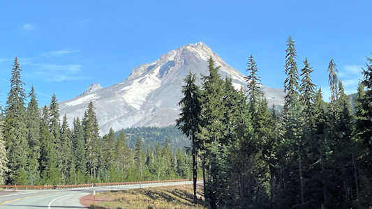
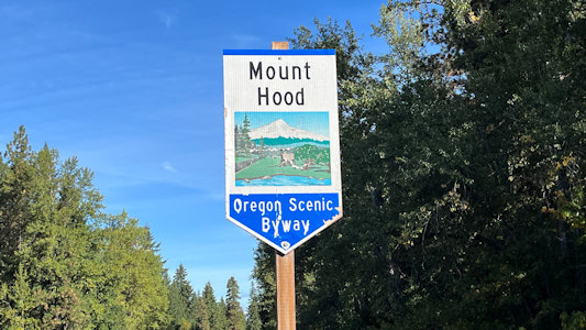
Mt. Hood Scenic Byway
Total Segments Traveled
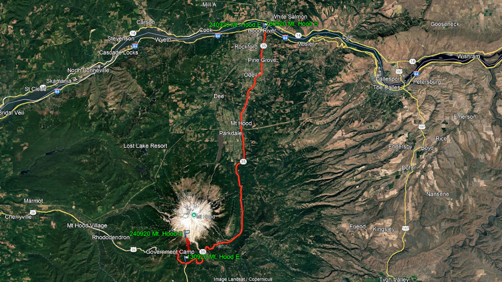
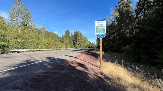
9/20/2013 Headed south for a long ride through beautiful scenery including very impressive
Mount Hood on the Mt. Hood Scenic Byway.
Mt. Hood from the Byway
|
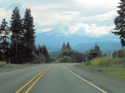
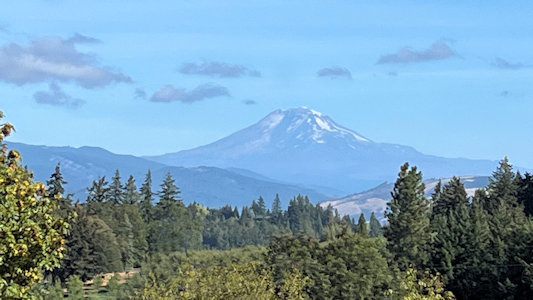
9/20/2024 Checking out, we said goodbye to
Timberline Lodge and headed down the mountain, on one end of the Mt.
Hood NSB. ... Continuing north on the NSB, we arrived in Hood River ...
What a great view of Mt. Hood!
|
I photo ...
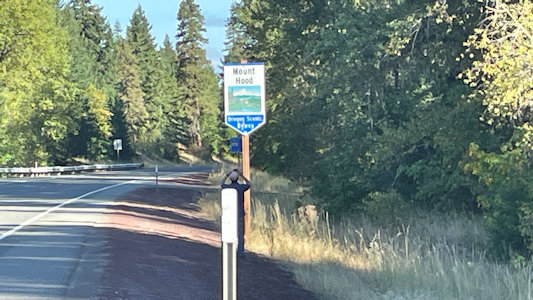
|
... the Byway ...
|
... and the sign
|
Another beautiful mountain view
|
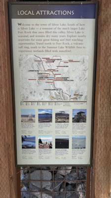
Outback Scenic Byway
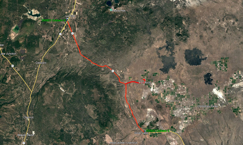
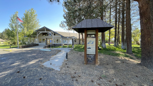
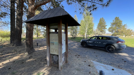
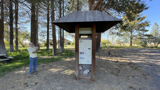
9/24/2025 Leaving the main highway, we angled off southeast, with lunch in the car. We hit a sign for the Outback NSB, along with a
couple of tactical little kiosks about the NSB, which we will follow all the way to Silver Lake later.
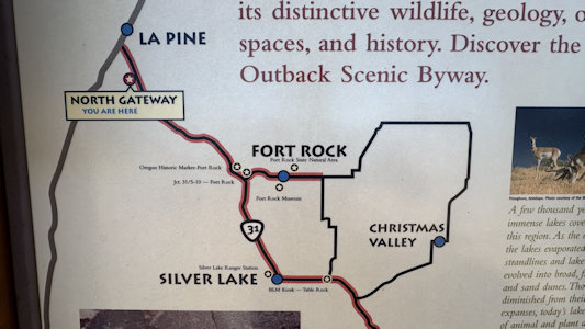
Fort Rock State State Natural Area Leaving here, we
juked east off of our route for a mile to hit Silver Lake, where we hit a planned NSB kiosk at the end of our excursion on the Outback NSB.
Outback Byway ...
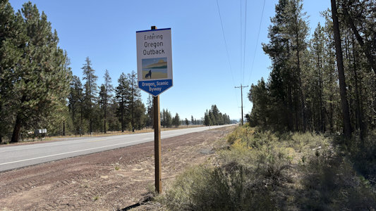
|
... and sign
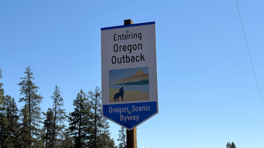
|
First Byway kiosk ...
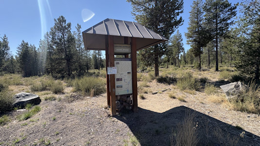
|
... at the northwest end
|
Second kiosk ...
|
... with our ride ...
|
... and me photoing info
|
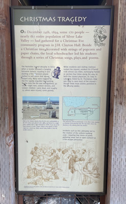
Silver Lake fire tragedy ...
|
... and local attractions
|
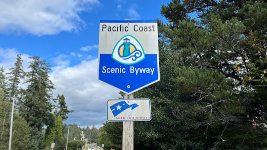
Pacific Coast Scenic Byway
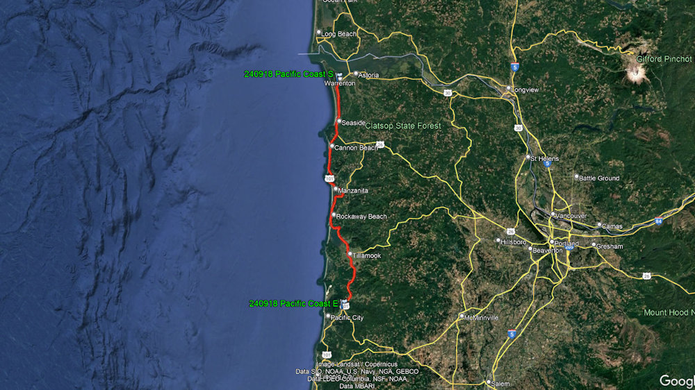
Total Segments Traveled
9/17/2024
Lewis and Clark National Historical Park ...
We now started a coastal trek along US101, following the Pacific Coast Highway NSB AAR that we had picked up as we turned south after Fort Clatsop.
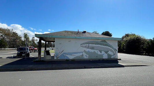
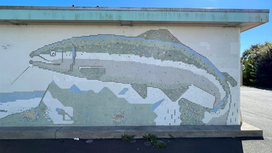
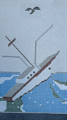
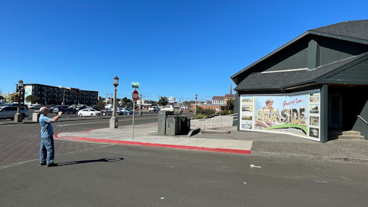
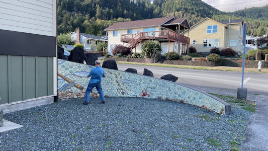
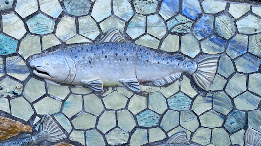
In Seaside we stopped for two murals. The first was actually a mosaic of salmon on the back of a public
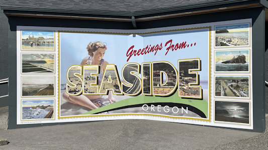
rest room. The second was a typical Greetings mural, with postcards of local sights, including our next stop. ...
Lewis and Clark National Historic Trail ...
At this point, being a little behind schedule, we elected to bypass a detour to an NRT, and ...
Oregon Islands National Wildlife Refuge ...
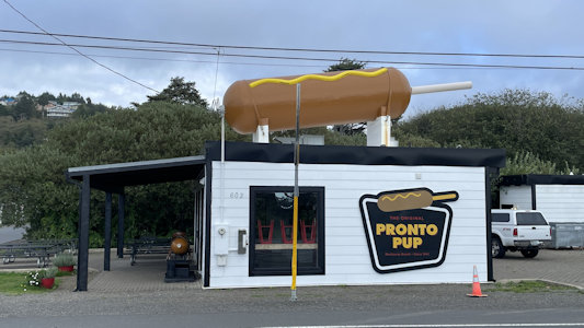
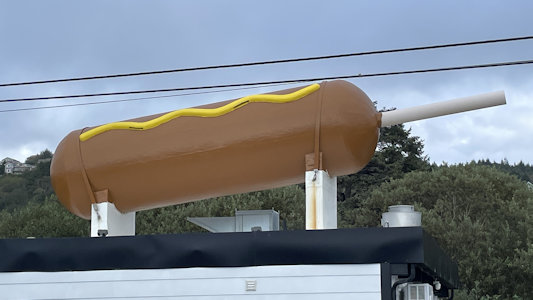
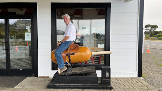
Sadly, we left this great spot, climbed our way back up the car, and continued south. In Rockaway Beach we made a quick stop for a Giant Pronto Pup
RA.
“Pronto Pup claims to be where the corn dog was invented, and to have the world's largest corn dog. Also look for the World's First Riding Mechanical
Corndog, a reworked child's horsey supermarket ride” This was a big corndog on top of the store; whelming but what we do. In Garibaldi we checked out
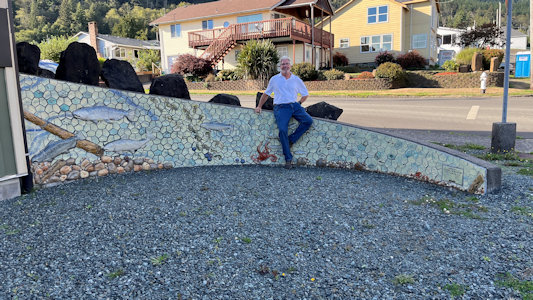
a “Life Cycle of Salmon” mosaic mural on a low wall with raised sea life elements including salmon.
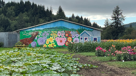
Finally, a little more south we stopped at a flower business in Tillamook for a nice mural
of flowers including Dahlias, behind a large field of flowers that kind of ran into the mural. Further south, we left US101 and the NSB ...
.
A rest room mural ...
|
... with salmon ...
|
... and boat
|
I photo ...
|
... the Seaside postcard mural
|
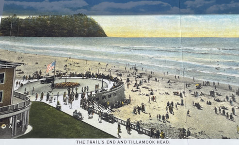
Postcard details ...
|
... of sights ...
|
... in Seaside
|
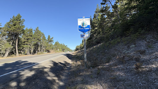
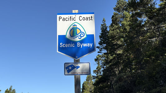
Pulled over to photo ...
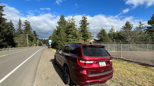
|
... the NSB ...
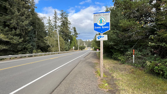
|
... and sign
|
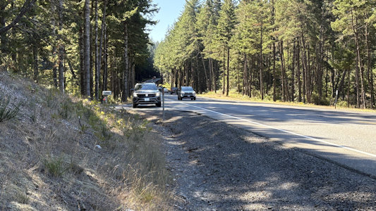
A view down the NSB ...
|
... and along the way
|
Giant Pronto Pup on the building ...
|
... and up close
|
Ken on a corndog
|
More nice views ...
|
... along the NSB
|
I photo a mural detail ...
|
... of a salmon
|
Ken hangs by the mural
|
More views ...
|
... and Ken with our ride
|
Tillamook flower business ...
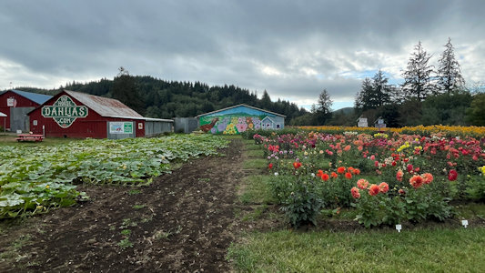
|
... with a nice mural
|
A pretty closeup ...
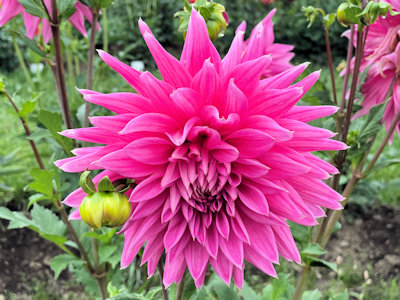
|
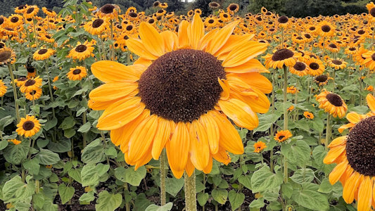
... and lots of sunflowers
|
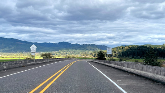
9/26/2025 At the point where we hit US101, we joined the Pacific Coast NSB, which we followed for the remainder of our trek north along the coast. ...
Coos Bay Mural ...
North Bend Books By The Bay Mural ...
USFS Oregon Dunes National Recreation Area ...
Exploding Whale Memorial Park Roadside Attraction ...
Sea Lion Caves Roadside Attraction ...
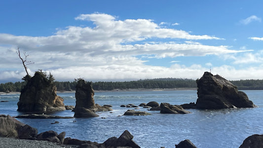
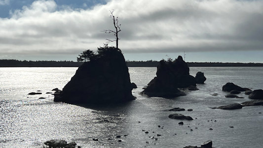
Haceta Head State Scenic Viewpoint ...
Yachats Oregon is Magic Mural ...
Seal Rock State Recreation Site ...
BLM Yaquina Head Outstanding Natural Area ...
Devil’s Punchbowl State Natural Area ...
Joe the Sea Lion Roadside Attraction ...
World’s Shortest River Roadside Attraction ...
Lincoln Reads On A Horse Roadside Attraction
A look down the byway ...
|
... with the sign ...
|
... and Ken waiting for me
|
Pretty views on the byway
|
West Cascades Scenic Byway
Total Segments Traveled
9/21/2013 Started to head to Salem via the West Cascades Scenic Byway, then turned around and
took that Byway towards Eugene. Most of that section was also part of the McKenzie Pass-Santiam Pass Scenic Byway.
This whole drive was really beautiful.
The Byway sign and road
|
Looking down the road
|
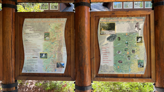
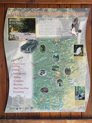
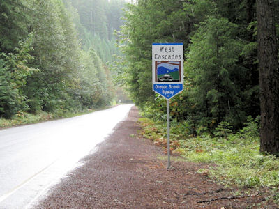
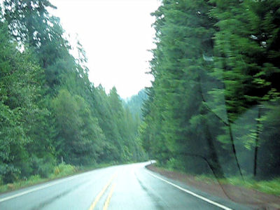
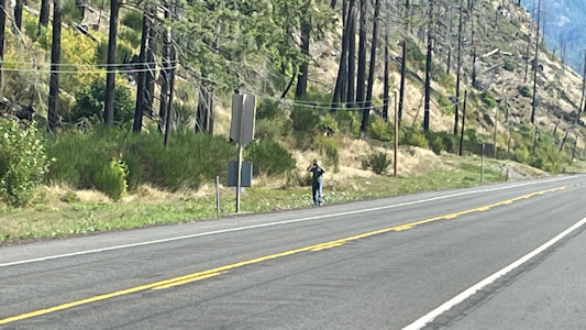
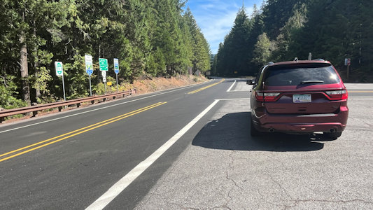
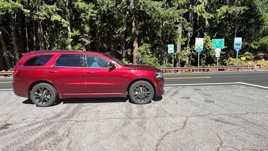
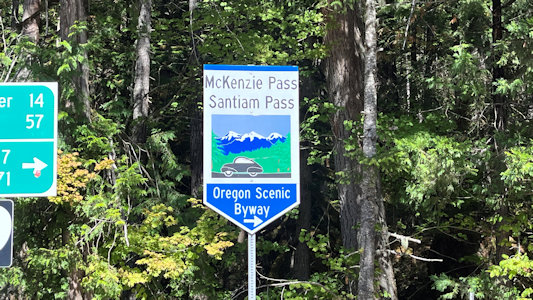
9/19/2024 The next stop was for a sign for the West Cascades NSB. We followed this for a while, noting signs about wildfires
impacting travel. Along our travels most of the way east we saw many signs of the fires, including burnt trees right near the highway. ... At the
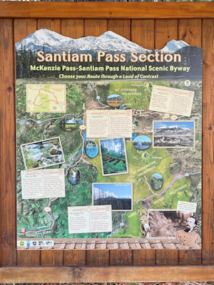
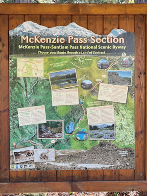
very nice McKenzie Ranger Station (one of the few noted “sights” on the NSB) we saw interpretive signs about the NSBs we were/would be on, then from
a ranger-like person found out that we needed to change our plans. We had wanted to take a due east squiggly road route that had a Pacific Crest NST
access point, an NRT and a roadside lava exhibit, but that road was closed. We were forced to take the more circuitous but actually faster route up
northeast then down southeast. Oh well. At the intersection of what we wanted to do and had to do, we photoed signs for the West Cascades and
McKenzie Pass - Santiam Pass NSBs. The West Cascades continued northeast, and the McKenzie/Santiam Pass formed the loop of what we would have taken
and actually did take. Along our route there were a number of one-lane sections with crews clearing trees and brush, and on one section there was
a follow-me car leading past one of the active fire areas. There were plenty of fire crew vehicles and a fire camp, and in one spot some obvious
smoke and a strong smell in the air. We left the West Cascades NSB at the northernmost part of our half loop.
I photo ...
|
... the West Cascades route ...
|
... and sign
|
Ranger Station signs ...
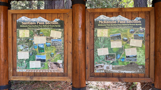
|
... and a 3D map
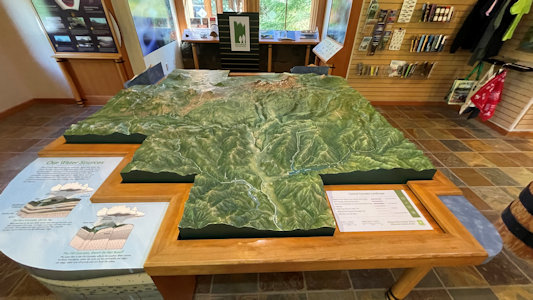
|
Parked at ...
|
... the intersection
|
... to photo signs ...
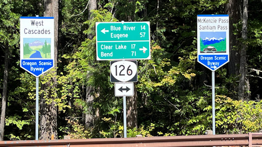
|
... for West Cascades ...
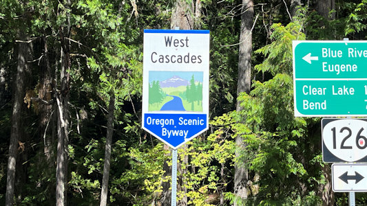
|
... and McKenzie/Santiam Pass
|
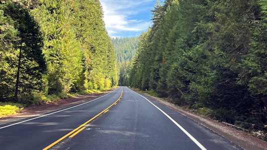
A view along the pretty byway
|
9/23/2025 West Cascades NSB. This spot at Hoover Falls was good for a photo-op of the falls/cascades on the North Santiam River,
representative of the NSB, which we will follow until we pick up the McKenzie Pass-Santiam Pass NSB. The stop was also to take credit
for a “pin town” of Idanha – a new feature for trip planning is to actually look for something to do in every town/location on our
National Geographic pin maps marked with a dot and label! Ken elected to video while I (using work gloves from my collection of emergency
stuff in my pack) scrambled down a slippery slope of crushed stone and brush to the river edge for photos.
I photo ...
|
... the byway ...
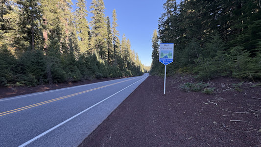
|
... and sign
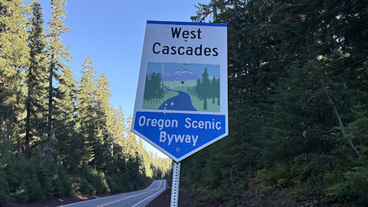
|
A panorama of Hoover Falls area ...
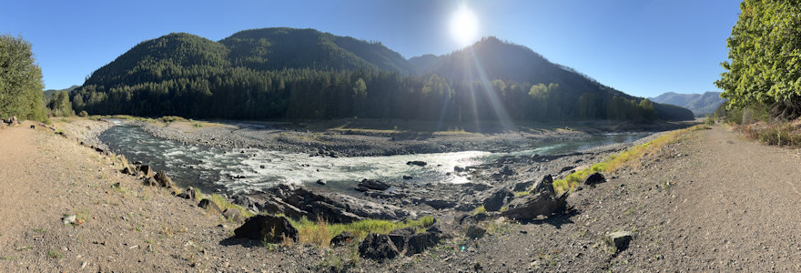
|
... and a closeup
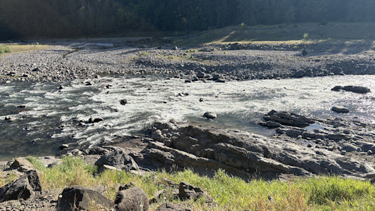
|