Home
Travel
Route 66
Route 66 - Small Segments
Here are my log entries for the small, typically incidental,
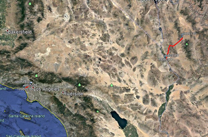
segments that I traveled, and below are maps of those segments. The map waypoints are labeled by date and 'S'tart or 'E'nd.
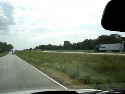
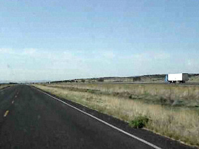
5/17/98 Stopped in Kingman for Denny’s dinner. Got on historic Route 66
here, and drove about 50 miles through wonderful mountain areas, and through the
little town of Oatman with mules wandering around. Joined up with the interstate
at the Colorado River, into California and all the way to Barstow.
5/18/98 [from St. John’s Episcopal and St. Vincent’s churches in Los Angeles] Drove up to Sunset Boulevard which
at that point was part of Route 66. Followed it to Santa Monica and took that all the way down to the ocean - the end of 66.
5/21/00 On the way, near Joplin at Galena, got on old Route 66 for a while. [to Riverton]
5/22/00 Went into Carthage for a drive around the old section to look at Victorian homes, and went along Route 66 for a little.
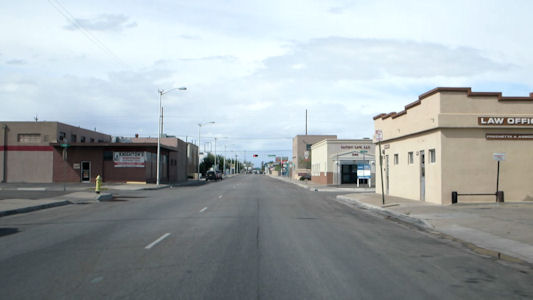
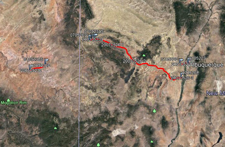
5/22/01 Another quick stop at K-Mart [in Albuquerque], then drove Route 66 through the historic area to near
Old Town and the Museum of Natural History and Science. Walked the Trip Through Time museum exhibit, saw excellent large screen
movie "Lost Worlds", and then equally good planetarium show about the universe. Got back on 66, good lunch at Mac's then
continued on 66 to I40 and the Acoma Sky City. ... Back on the road to near Gallup and checked in the Best Western Red Rock on 66.
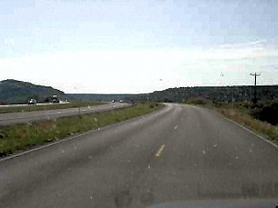
5/23/01 Down 66 through Gallup, then up to Canyon De Chelly NM in Arizona. ... Left the [Petrified Forest National]
park as it closed, and headed into Holbrook on I40, the westbound Route 66. Had dinner at Denny’s on Route 66, then checked in a Best
Western Adobe, also on 66.
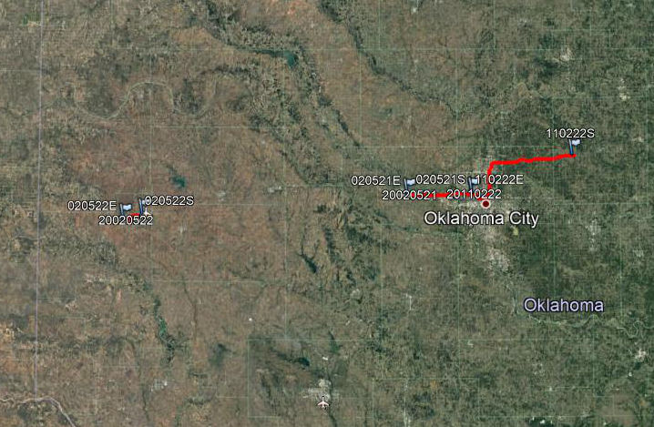
5/21/02 Headed west [from Oklahoma City] on Route 66 to El Reno, stopping for ice cream on the way.
5/22/02 Drove into town [Elk City], with a detour to see a bit more of R66. Saw the National Route 66 Museum
(not as good as the OK), as well as a little recreated town and a good farm implement museum. A little shopping at Walmart, then
headed out on R66 to the interstate.
5/23/02 ... then to the Cadillac Ranch to see the 10 Cadillacs buried in a field (scratched our names on one).
From there on R66 into an older area [of Amarillo] for a little more souvenir shopping.
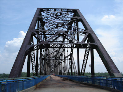
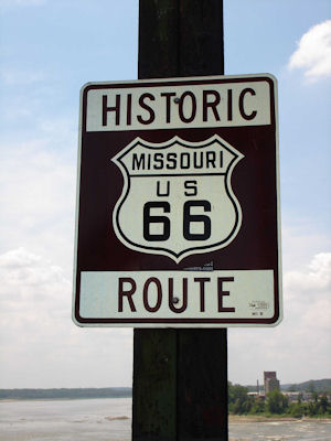
7/28/2006 On the road south, ... before crossing the Mississippi on I270, starting my Route 66 trek [IL, MO].
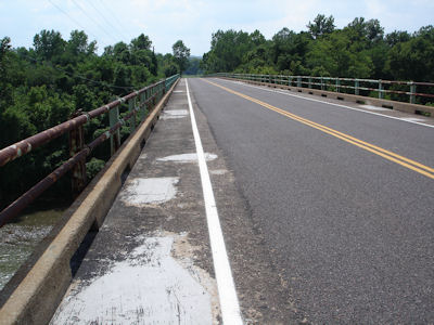
Immediately off, parking just a bit downstream at the Chain of Rocks bridge, the original R66 crossing (now closed).
Walked about 2/3 of the mile to the Illinois side, looking up river to the nearby I270 bridge and down to St. Louis.
Couldn’t take the heat, so in the car for the long drive on R66 (programmed into the GPS). Only a short stretch interstate
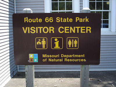
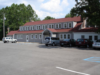
west of St. Louis, getting off briefly for a look at Route 66 State Park (near Eureka) and an old building on R66, now a
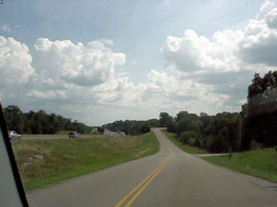
visitor center and museum. The rest of the way was on frontage roads, meandering north and south of the interstate through
little towns, past now dead gas stations and motels – very cool! Wound up in Rolla (after 125 miles on R66) and checked
in the Hampton (on Route 66!).
The Chain of Rocks sign ...
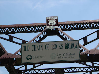
|
... and Bridge
|
66 signage
|
Perfect name!
|
66-era building
|
Looking along the original Route 66 bridge
|
Route 66 along the north of the Interstate ...
|
... and the south
|
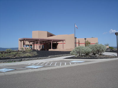
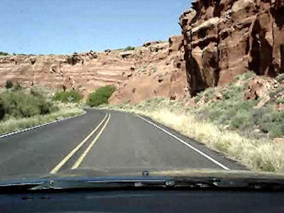
5/26/2007 Followed Route 66 [NM] out of town all the way to Grants. Most of the way on frontage roads,
at times on tight, curvy roads around rocks. In Grants, got coffee (on Route 66), then went to the NW New Mexico Visitor
Center (part of NPS/BLM/FS). Got good info for where I was headed, then back on R66 and a short stretch of interstate.
Headed SE on Route 6, part of the older stretch of R66.
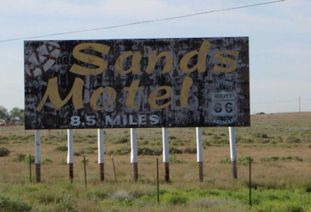
An old-timey motel sign
|
The sign for the ...
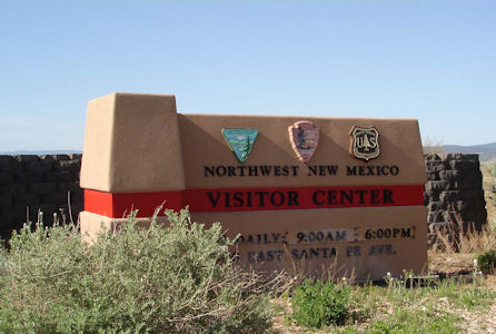
|
... NW New Mexico VC
|
Route 66 along the north of the Interstate ..
|
... and the south
|
On a winding rougher stretch
|
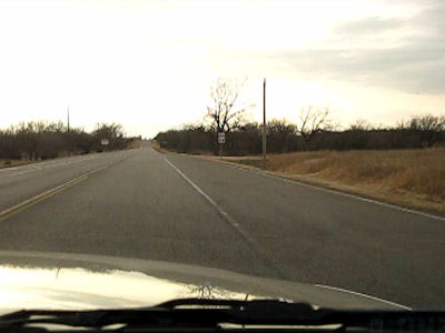
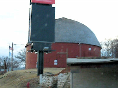
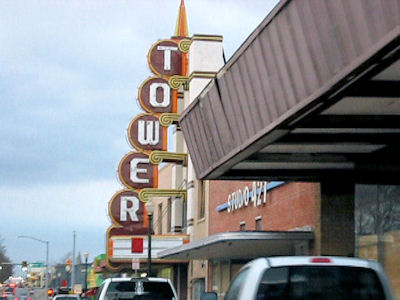
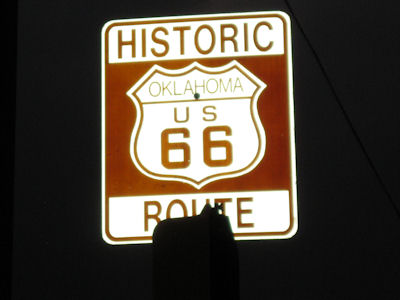
2/22/11 Headed back south and east on Interstates then off onto Route 66 [OK]. We followed this west-ish,
winding through country roads, 6-lane commercial areas and back roads, all staying on Historic Route 66. We did see some
old-timey buildings and such, as we zigged and zagged around northwest OK City. We hit the spot where I had previously
started heading west, but continued a little further in search of a sign in the rapidly-growing dark. I finally spotted one
in the median of a divided road above a traffic light, so Ken pulled in and I walked back for a photo.
Route 66 secondary roads ...
|
... and back roads
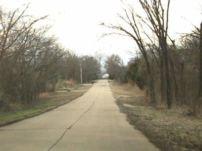
|
The Round Barn
|
An old movie theater
|
Route 66 signage in the dark
|
4/28/2017 El Camino Real de Tierra Adentro National Historic Trail
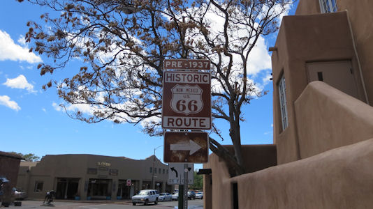
4/29/2017 ... then continued north and jumped on a stretch of Historic Route 66 NSB [NM].
Uninspiring view on 66
|
4/30/2017 Historic Route 66 [NM]. We passed a road sign while walking, and later we’ll follow it as the NSB
out of town. Santa Fe Trail Byway
Byway sign
|
5/26/21 Note: from here in Carthage, through a little bit of Kansas and on to Vinita, OK tomorrow we will be on and off of Route 66.
Being from about the same era, many of the sights are of equal interest to we JH travelers or R66 travelers.
Jefferson Highway - Missouri
5/27/21 Heading into Kansas, our designation in Galena was a ghost sign, which was very nice, but it was on a building with some R66 interest
and across the street from another. We could see that we would pretty much have to ignore all the real and artificial R66 sights, or we’d never
get anywhere. ... Old Riverton Store (Riverton). “It has been in continuous operation for 94 years and is part of the living history of Route
66. ... Today, the shop has changed little from its original 1925 construction. … The Old Riverton Store predates the designation of Route 66
by eighteen months.” (routemagazine.us) Marsh Rainbow Arch Bridge. The bridge is a single-span concrete Marsh arch bridge and is the sole
surviving bridge of this type on the entire length of the former Route 66. This bridge, unlike what we’ll see later, is nicely preserved and
painted, on a small original alignment side road off the modern road. There were many R66 medallions painted right on the asphalt approaching
and leaving it. ... Hole in the Wall Conoco. From travelok.com “Allen's Conoco Fillin' Station in Commerce was built in 1929 or 1930 by F.D.
Mitchell as a place for travelers to stop along the newly paved Route 66. While it served Conoco fuel gas for the first few years it was open,
it became a Phillips 66 Gas Station in 1938. It is rumored that Bonnie & Clyde may have stopped for gas here”. The tiny station was built out
from the exterior wall of the final building on main street. While photoing this, a guy came out of a very cute R66-era Dairy King and told
Ken that the gas station was all a fake, which annoyed him as his little place was a true feature on the highway (he had been there 40 years
himself). Our research found no support for this, however. ... Waylan’s Hamburgers. From travelok.com “Located right on Route 66, Waylan's
Ku-Ku Burger is an original fast food drive-in chain from the 1960s. The only location still standing, Waylan's Ku-Ku Burger is an authentic
Route 66 hot spot ...” ... In Vinita we checked out Clanton’s Cafe. From their web page, “It is the oldest continually owned family restaurant
on Route 66 in the state of Oklahoma”. It was a little early for lunch, having done a bit better against plan than expected, but it was a good
opportunity, so we picked up McDs burgers and ate them in the car (still no inside dining) parked facing a huge and very detailed mural
about the town.
Jefferson Highway - Kansas
My traveled segments on Google Earth:
Full Map -
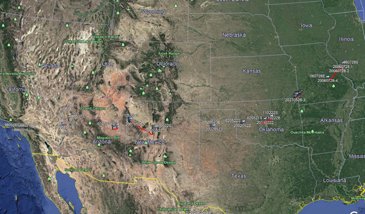
Section 1 -
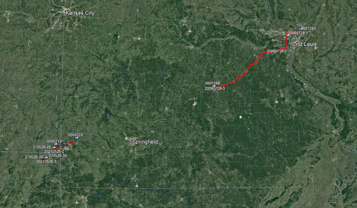
Section 2 -
Section 3 -
Section 4 -