Home
Travel
Byways
Multi-State Scenic Byways
Beartooth Highway (Montana, Wyoming)
Total Segments Traveled
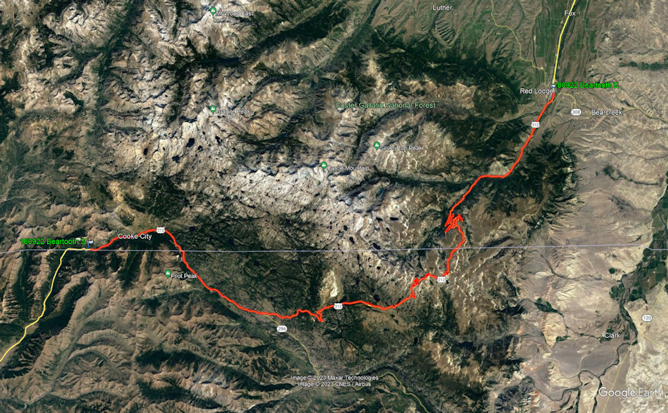
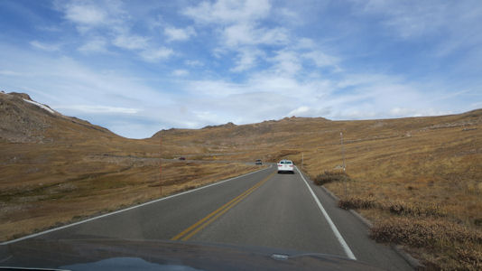
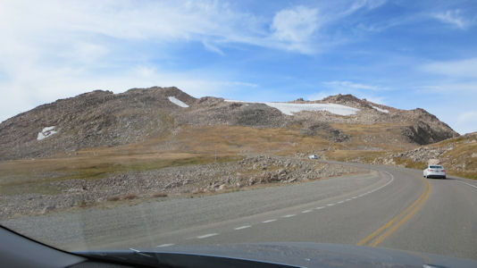
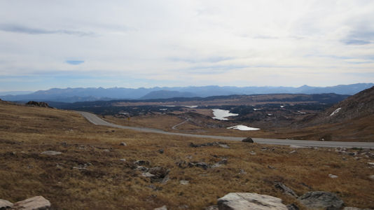
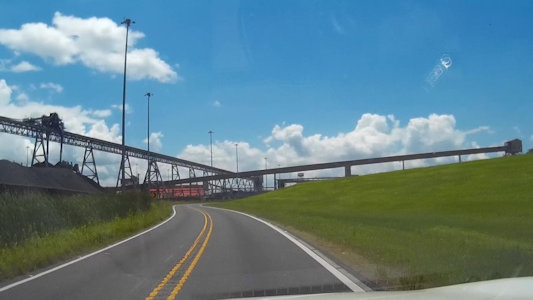
9/22/2018 ... we immediately got on the Beartooth Highway NSB All-American Road [MT, WY]. The first main chunk of the
68 miles was quite beautiful, but the third quarter was spectacular. We climbed over 4,000 feet to about 10,900 feet on tight
switchbacks with great views in all directions. At times we could see our upcoming road in multiple switchbacks far below. The
last stretch was reasonably straight and level, bringing us out in Red Lodge, having traversed the whole length of the NSB.
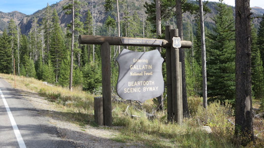
National Forest and Byway sign
|
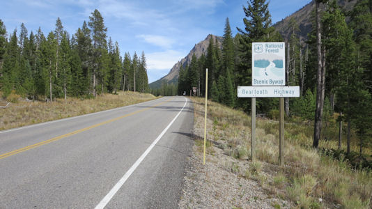
Another sign and the highway
|
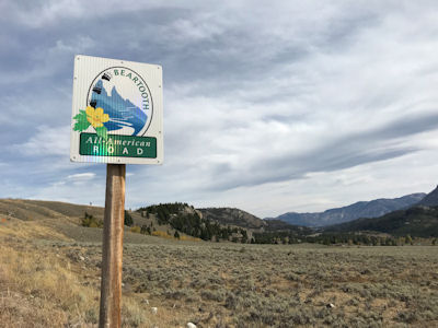
All-American Road sign
|
Another view ...
|
... with some remaining snow
|
Switchbacks in the distance
|
Nice view of the mountains
|
Blue Ridge Parkway (North Carolina, Virginia)
Total Segments Traveled
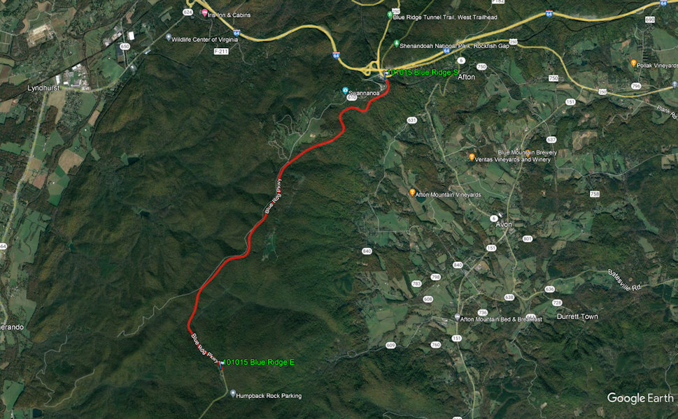
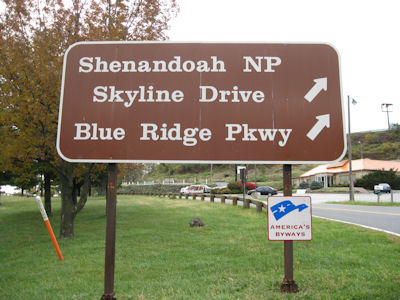
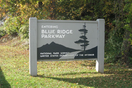
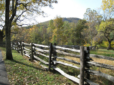
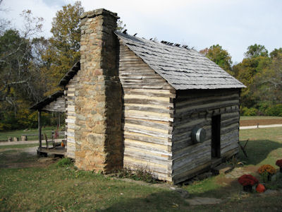
10/15/2010 Back south on the Skyline to where it became the Blue Ridge Parkway (Byway)[VA] and took that
south a few miles to the Humpback Rocks VC. Here we walked to a farm area, noting the Rocks on the way. The farm consisted
of real 1800s buildings relocated here in the 1950s and was very nice.
A general sign for the Park and Byways ...
|
... and for the Blue Ridge
|
A pretty view down the road
|
Humpback Rocks in the distance
|
The cabin at the farm
|
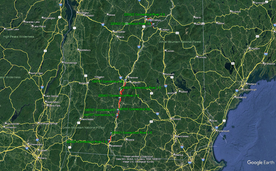
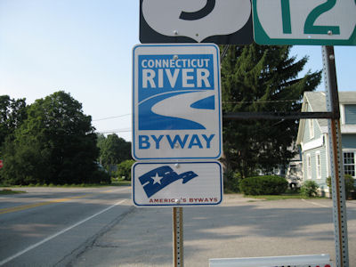
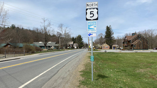
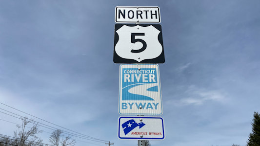
Connecticut River Byway (Massachusetts, New Hampshire, Vermont)
Total Segments Traveled
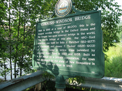
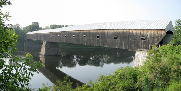
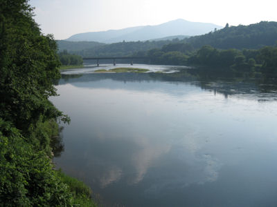
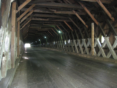
7/7/2010 On the road west to the Connecticut River into VT, then north on the
Connecticut River Byway [VT]. In Windsor, crossed into NH on the longest covered wooden bridge in the U.S.,
and parked for some photos. Continued north in NH on the same scenic byway [NH] into Lebanon ...
The Byway sign
|
A sign for ...
|
... a really long covered bridge!
|
Looking down the river
|
The tunnel view back to VT
|
4/21/2022 Onwards, hitting a little stretch of the Connecticut River NSB (which we will hit in both VT and NH), to Rockingham, VT
and the Rockingham Meeting House NHL ... Hitting the CT River NSB for a bit more, and into Cornish, NH, we reached the Salmon P. Chase Birthplace
NHL ... A bit further, and again a little along the NSB still in Cornish, we reached Augustus Saint-Gaudens Memorial NHL/Saint-Gaudens NHP.
A look down the byway ...
|
... and a sign
|
Some views ...
|
... of the mountains ...
|
... and the byway itself
|
Crowley's Ridge Parkway (Arkansas, Missouri)
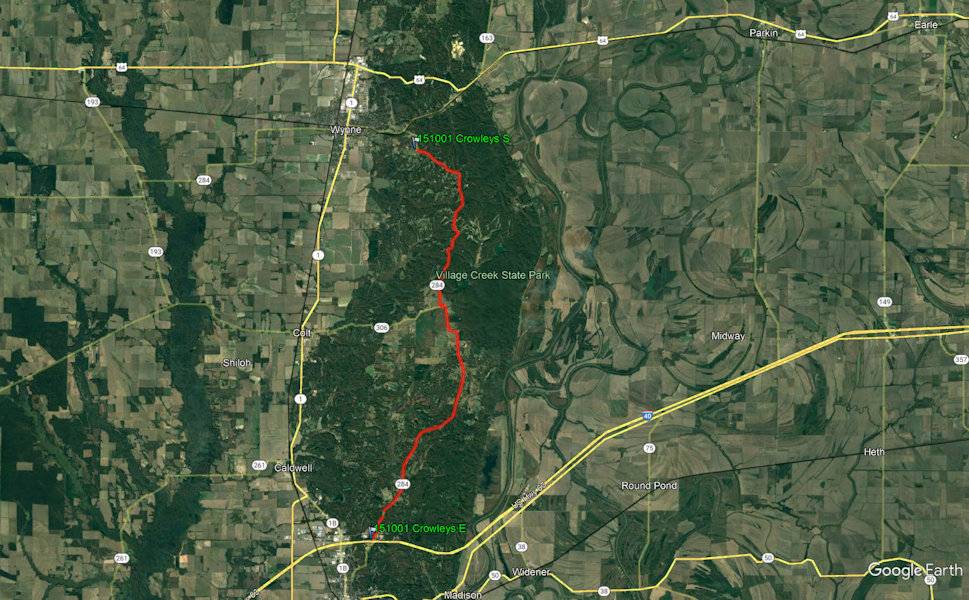
Total Segments Traveled
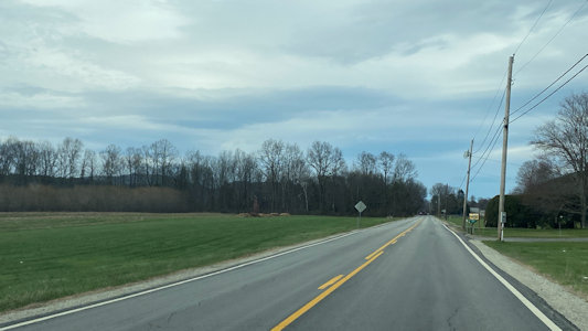
10/1/2015 We continued west, then south on a pleasant but not unique stretch of the Crowley's Ridge Parkway Scenic Byway [AR].
A view along the Byway
|
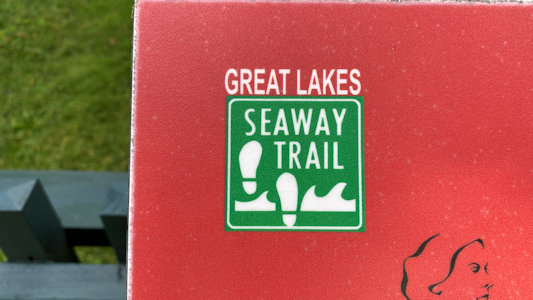
Great Lakes Seaway Trail (New York, Pennsylvania)
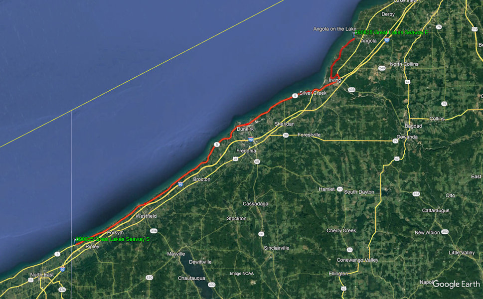
Total Segments Traveled
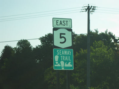
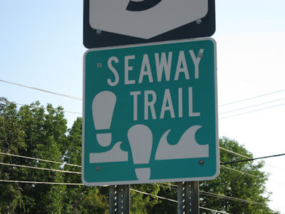
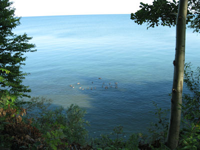
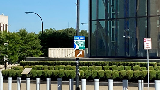
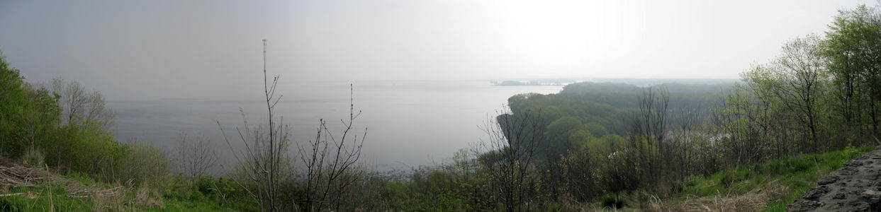
8/25/2009 Soon after getting on I90, we bailed off to the road running along Lake Erie. This
is the Great Lakes Seaway Trail Byway [in NY, also the Great Lakes Seaway Trail NRT], and it really is scenic. We passed through many pretty vineyards with views
out on the lake. We stopped at a little park for a potty break, and a Tim Horton for coffee. After a while the route
was less scenic, so we jumped back on the Thruway and continued to Buffalo.
One Byway sign ...
|
... and another
|
A nice panorama out on the lake ...
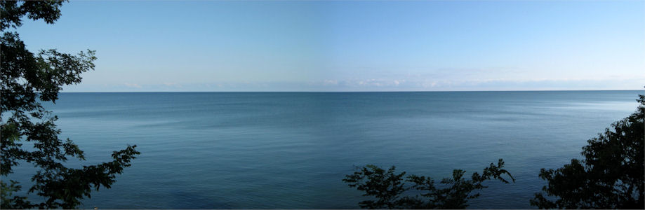
|
... and some local detail
|
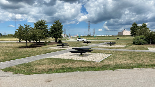
7/20/2020 [Buffalo] ... then (for a short time on the Great Lakes Seaway Trail NSB) continued to ...
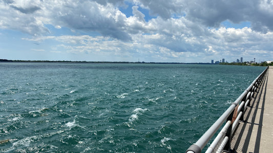
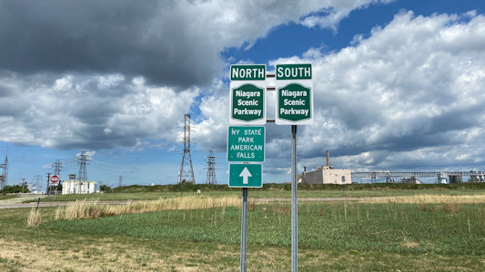
At this point we were very hungry, having completed one more site before Ken’s planned lunch break, so we navigated to near the Niagara River,
and also on the Great Lakes Seaway Trail NSB [and NRT], for an eat-in McDs lunch. We followed the NSB up to the Niagara Falls area, and would hit the
NSB here and there while in the area. ...
Tuscarora Heroes Monument ...
A Byway sign on the way ...
|
... and another
|
Ken in a park by the river
|
A panorama of the river
|
Looking back to the car
|
A long view of Niagara Falls
|
Also on the Niagara Scenic Parkway
|
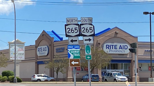
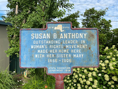
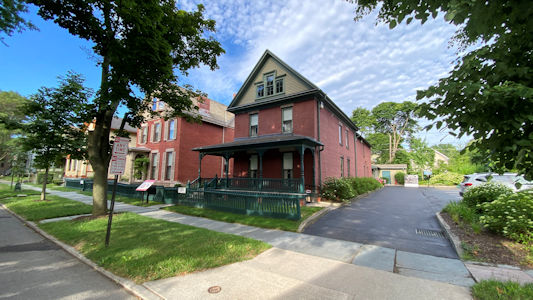
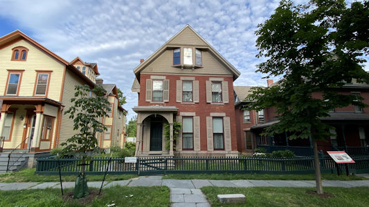
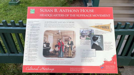
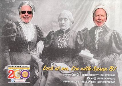
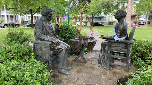
7/21/2020 Susan B. Anthony House NHL. The home of the suffragette for forty years, while she was a national figure in the women's
rights movement. Photo-op here, including a bronze statue vignette nearby. We also noted that, according to the signage, this location is on the Great
Lakes Seaway Trail NSB[/NRT], which takes a dip from the shore down into Rochester.
The NYS sign
|
A view of the house from the side ...
|
... and front
|
Interpretive signage ...
|
... showing the NSB
|
Silliness with Ken and me
|
Nice bronze vignette
|
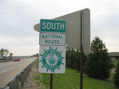
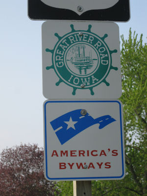
Great River Road (Arkansas, Illinois, Iowa, Kentucky, Louisiana, Minnesota, Mississippi, Missouri, Tennessee, Wisconsin)
Total Segments Traveled
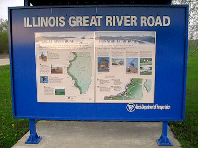
5/9/2011 In Fulton we headed north on the Great River Road Scenic Byway on the Illinois side. Since we didn’t want to
spend the time to go to the park we originally planned, we decided to just wing it and turn around when we had had enough. Conveniently after
not too many miles we found a road where we could get close to the river, near a downstream lock and dam. Back along the SB to the LH in Fulton.
The Byway sign
|
Some interpretive signage
|
A look down the Mississippi
|
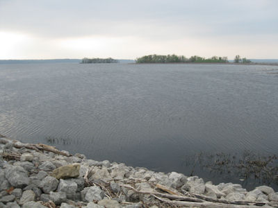
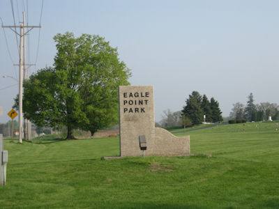
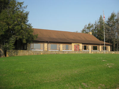
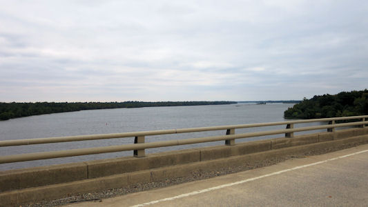
5/10/2011 We first headed north on the Great River Road Scenic Byway in IA to Eagle Point Park. We checked out the
Frank Lloyd Wright Prairie-style-inspired Lodge overlooking the Mississippi at its widest point (in fact, the haze obscured seeing the
other side. Headed back south into Clinton (noting that for a while on the LH we would also hit the GRR SB).
The Byway sign ...
|
... and sign for the Park
|
An interesting structure
|
Prairie-style lodge
|
Hazy view across and down the Mississippi
|
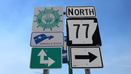
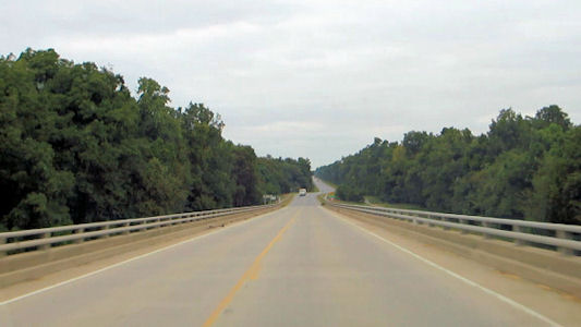
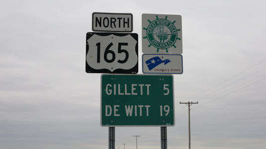
10/1/2015 As we crossed the Mississippi into AR we got on a stretch of the Great River Road Scenic Byway,
although it was pretty much local streets in West Memphis.
Crossing the Great River
|
A Byway sign
|
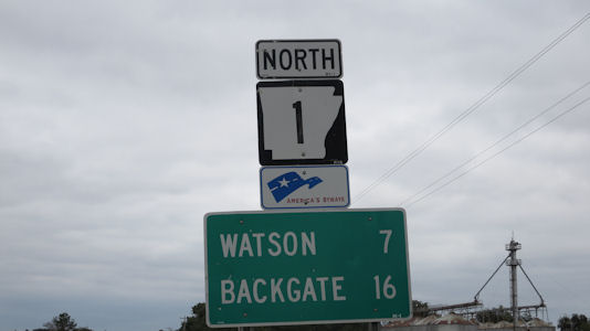
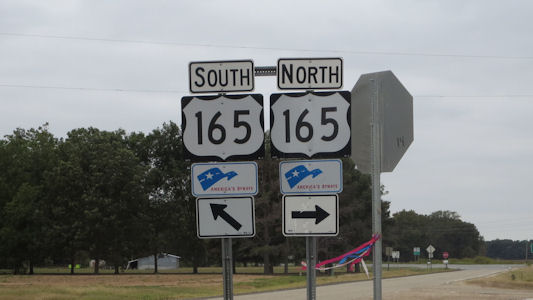
10/3/2015 ... having gotten back on the Great River Road Byway [AR] ...
A Byway sign
|
A representative cotton field ...
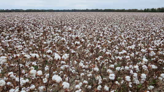
|
... and close-up

|
Another sign
|
A view down the Byway ...
|
... and the Arkansas river
|
Yet another sign
|
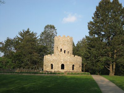
6/1/2018 Itasca State Park
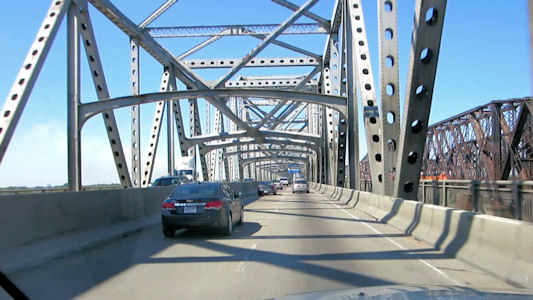
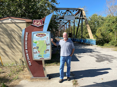
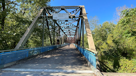
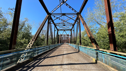
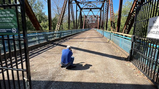
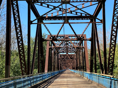
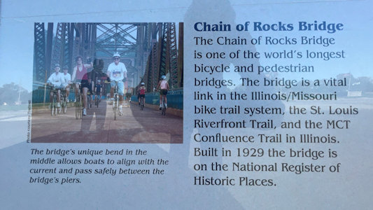
10/17/2021 Old Chain of Rocks Bridge. The bridge spans the Mississippi River on the north edge of St. Louis. The eastern end of the
bridge is on Chouteau Island (Madison, Illinois), while the western end is on the Missouri shoreline. Its most notable feature is a 22-degree bend occurring
at the middle of the crossing. Originally a motor route, the bridge was for a time the route used by U.S. Route 66 (US 66) to cross over the Mississippi,
but the bridge now carries only walking and biking trails over the river; the New Chain of Rocks Bridge carries vehicular traffic to the north. The bridge
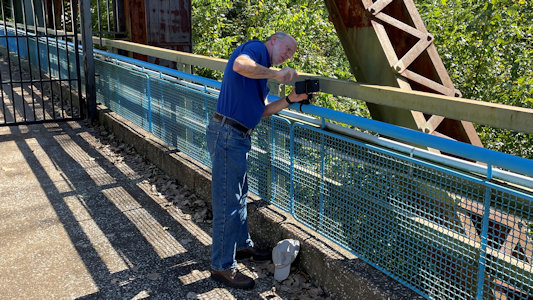
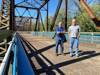
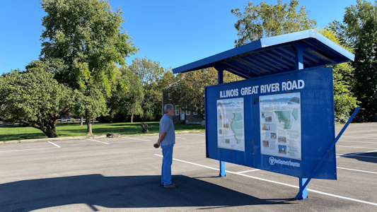
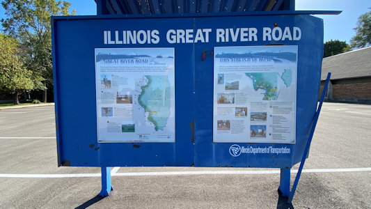
is on the Great River Road NSB [IL, and on the Mississippi River Water Trail NRT]. Leaving Chain of Rocks, we headed on a detour to the north, on the Great River Road NSB.
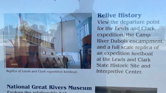
Lewis and Clark State Historic Site.
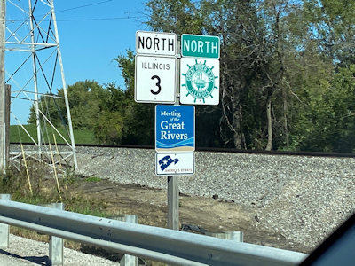
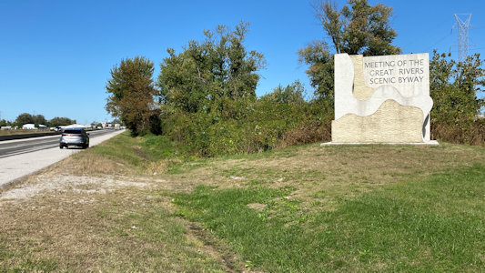
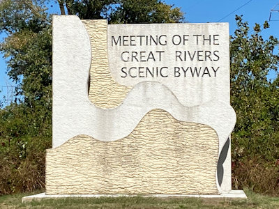
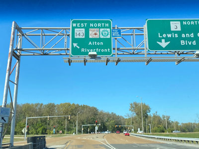
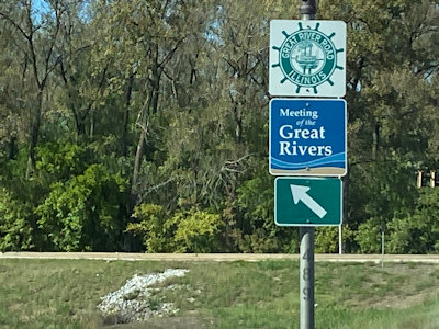
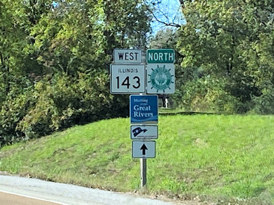
As we continued north, we were on the Meeting of the Great Rivers NSB (where the Missouri, Mississippi and Illinois Rivers meet to form a 35,000-acre floodplain)
and, as noted, also the Great River Road NSB. From [the Missouri side of the Chain of Rocks Bridge] we navigated back over the river into Illinois, following
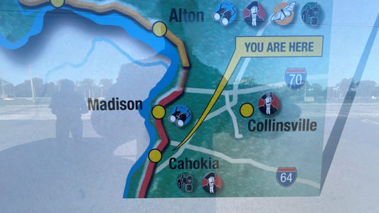
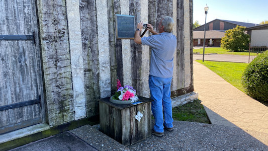
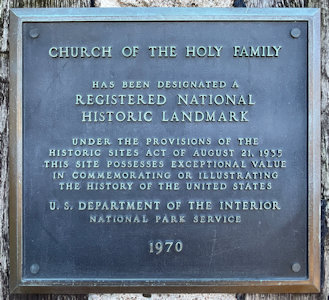
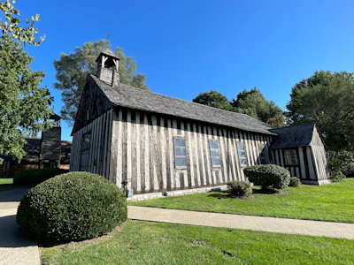
the Great River Road NSB, to a very convenient triple hit in Cahokia with one parking. First there was signage about the NSB. ... On the other side of the NSB
sign (and on the NSB) is the unusual Church of the Holy Family NHL. Built beginning in 1786, it is a remarkably unaltered example of the French colonial
construction style known as "poteaux-sur-solle" (post-on-sill). The large vertical timber with aggregate fill construction is very rough but quite interesting.
Ken at the bridge
|
One look to Missouri ...
|
... and another
|
How low can you go ...
|
... for a photo
|
Setting up for ...
|
... our photo
|
Road signs for the byways
|
Pulled over for ...
|
... a great sign
|
Overheads for the byways
|
And yet ...
|
... more signs
|
Ken reading ...
|
... the byway signage
|
We were here!
|
And here!
|
We are here
|
Front view of Church

|
Ken photoing ...
|
... the NHL sign
|
A nice side view ...
|
... and detail
|
6/6/2022 As we hit the Mississippi and turned east we picked up the Great River Road NSB. We would follow this pretty much
all the way down to New Orleans on the east/north side, sometimes having to head north a short stretch to get on the southbound road over a large
bridge, and reverse the process to pick up the GRR NSB on the other side of the river. We realized that while driving along the Mississippi sounds
nice, there is actually a levee running the entire length, so one never sees the river unless taking a bridge over. We did note a large amount of
heavy industry along the way, with what looked like coal processing and refineries. Doing our sights along the river …
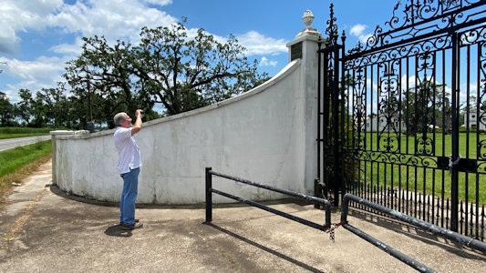
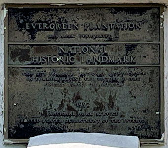
Wallace - Evergreen Plantation NHL. Composed of 37 buildings, including a main house and 22 extant slave cabins, this is an intact example of major
plantation complexes found during the antebellum era. Just photos through a gate here.
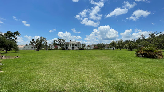
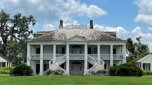
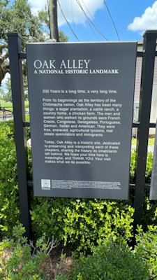
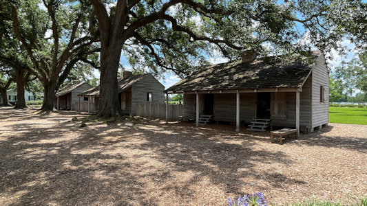
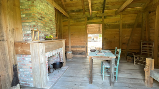
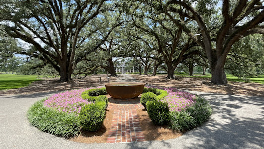
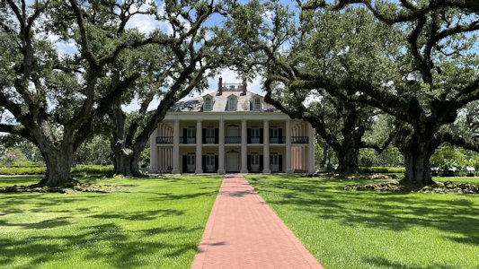
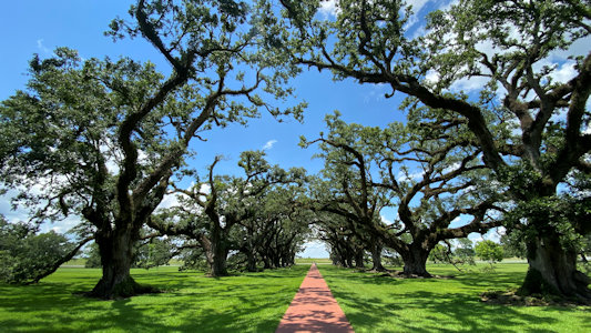
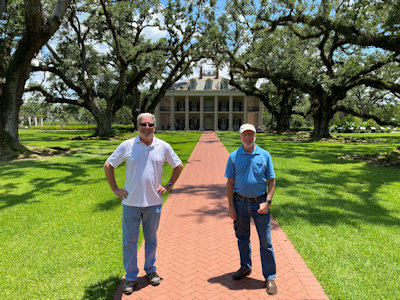
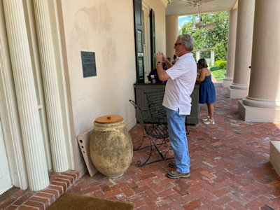
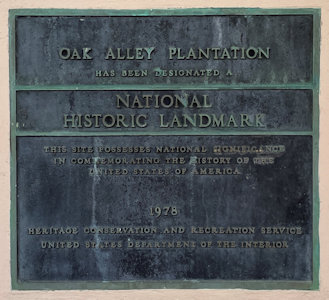
Vacherie - Oak Alley Plantation NHL. It is named for an alley (French allée) or canopied path of southern live oak trees about 800 feet long, planted
in the early 18th century. Here we needed to spend some time, with admission tickets required. We checked out some of the outbuildings including
slave quarters, then headed for the Big House main building. Although it was really hot by now, we enjoyed walking along the long allee of huge,
beautiful live oaks stretching out from the mansion. We could have spent a lot more time here, including a tour of the mansion, but we were on
Ken-and-Bill-trek time, so off we went.
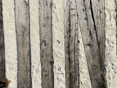
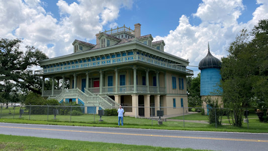
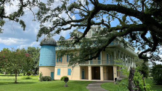
Garyville - San Francisco Plantation House NHL. Finished in 1853, this is a galleried house of the Creole open suite style and one of the finest
plantation houses in North America. I had been here years ago, but at this point the place is closed up and has an uncertain future, and all we
could do was take some photos through the chain link fence.
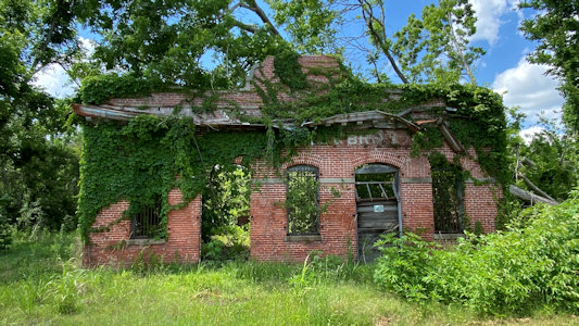
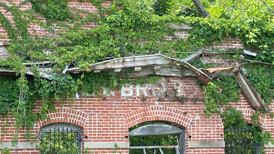
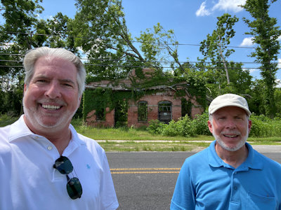
LaPlace - C. Alexandre & Bro, one of the area’s leading merchants after its doors opened in 1928. This place is really in bad shape, with pretty
much just the brick walls remaining, and large trees growing out of the insides. …
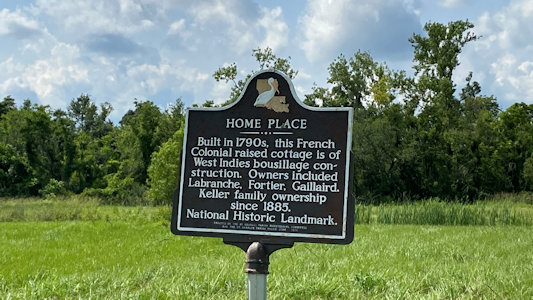
Hahnville - Homeplace Plantation House NHL. Built sometime between 1787 and 1791, it is one of the nation's finest examples of a French colonial
raised cottage. This house is sadly deteriorating, with the roof in really bad shape; just photos before moving on.
Evergreen Plantation at a distance ...
|
... and closer up
|
Ken photoing ...
|
... the NHL plaque
|
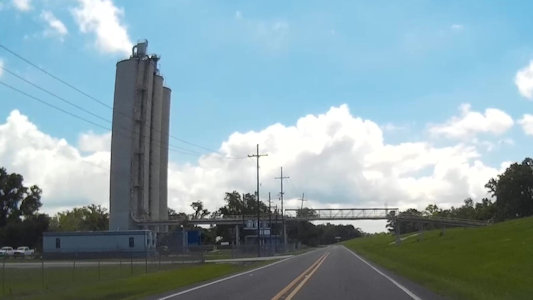
Industry along the NSB
|
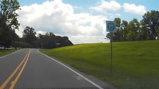
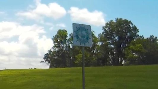
Passing the only ...
|
... NSB sign we saw
|
Another cool industrial complex
|
Oak Alley sign
|
Slave quarters outside ...
|
... and in
|
Heading to the mansion on one side ...
|
... and the other
|
The beautifual allee
|
Ken and me in the allee
|
Ken photoing ...
|
... the NHL plaque
|
San Francisco Plantation
|
Another view
|
1928 C. Alexandre & Bro
|
Some of the remaining sign
|
Ken and me out front
|
Homeplace Plantation sign
|
A distant view ...
|
... and closer in
|
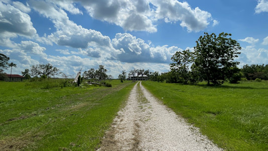
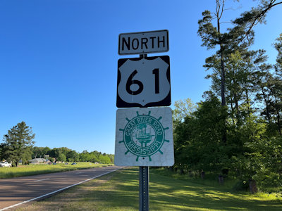
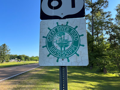
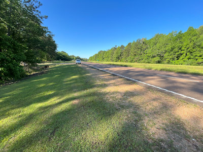
4/29/2023 Down the road - a crazy straight highway through dead flat landscape – we noted signs that we were on the Great River Road AAR
(which we knew) and entering the Mississippi Delta NHA (which we didn’t). ...
Winterville State Park
4/30/2023
Vicksburg National Military Park ... Continuing south we entered Port Gibson on the GRR. ...
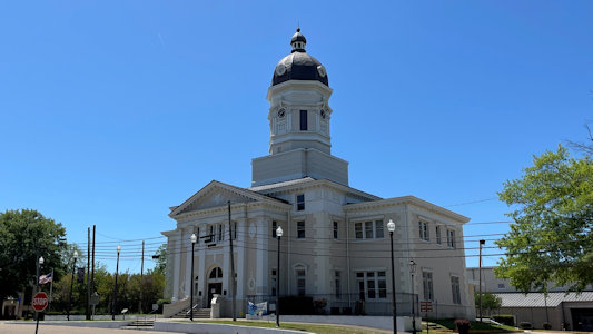
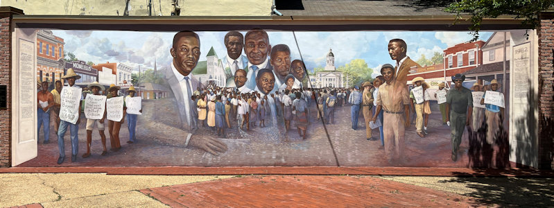
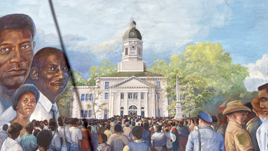
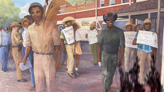
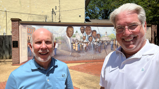
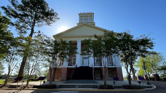
Nearby at the Claiborne County Courthouse we stopped at a very detailed mural (with interpretive info) about the 1966 Port Gibson Boycott, led by the local chapter
of the NAACP, of majority white businesses in Port Gibson and Claiborne County.
Claiborne County Courthouse
|
Port Gibson Boycott Mural
|
Detail of the Courthouse ...
|
... and leaders
|
Me and Ken
|
5/1/2023 Heading back NE (on the Great River Road all the way back to Port Gibson), we got on the side loop road at the south, where we had
failed yesterday at the north end for Port Gibson. We entered Alcorn State University in Lorman, where at the gate we were allowed in but (we think) asked to stay
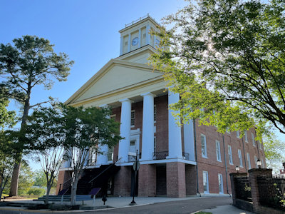
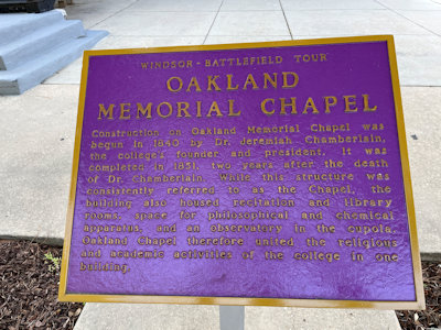
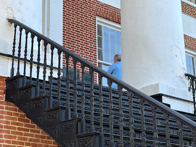
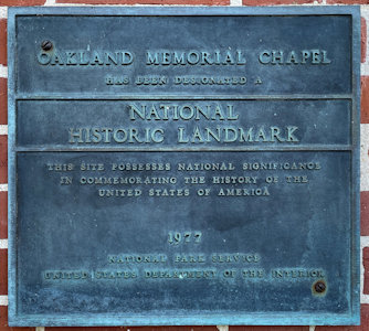
in the car, and when Ken mentioned the destination Chapel, heard something about “stairs”. We checked out the Oakland Memorial Chapel NHL, ignoring the stay in
the car part since it seemed pretty silly with nobody around. The chapel is an historic church and academic building on the campus of Alcorn University, the
first land grant university for Black Americans. We did note an interesting set of iron stairs leading up the front that Ken climbed to photo the NHL plaque.
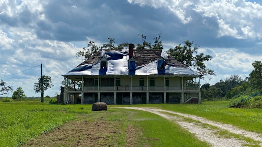
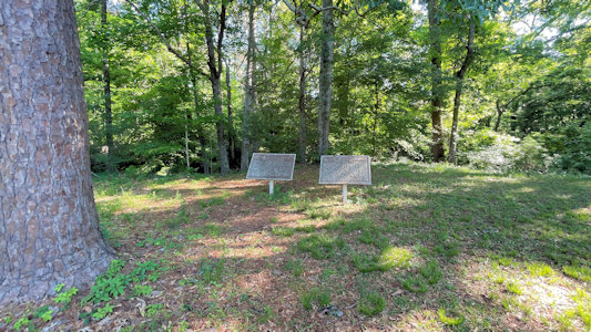
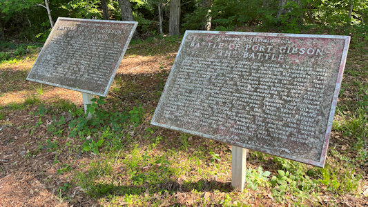
Leaving the University, a short distance away we found signage for the Port Gibson Battle Site NHL, in lieu of the house that we couldn’t get to. The spread out
site is where the 1863 battle was fought, when Union Army forces were establishing a beachhead after crossing the Mississippi River in a bid to take the Confederate
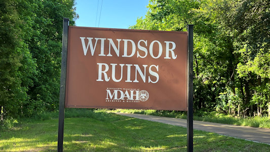
fortress of Vicksburg. From there, Google decided to send us up the loop road rather than back the way we came; this was a bonus since we could hit a roadside
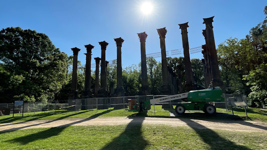
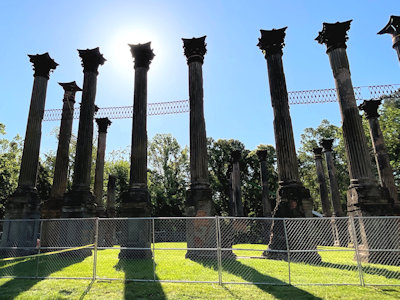
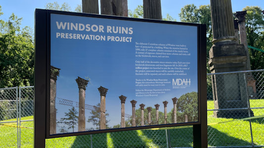
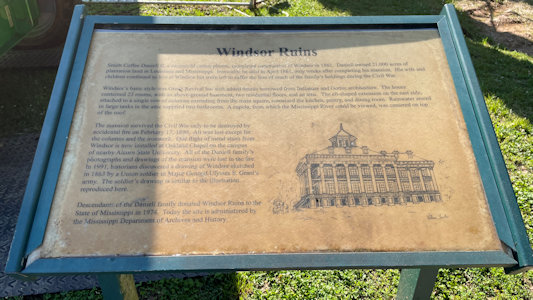
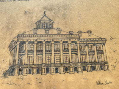
attraction of Windsor Ruins near Port Gibson. The ruins consist of 23 standing Corinthian columns of the largest antebellum Greek Revival mansion ever built
in the state, standing from 1861 to 1890, when it was destroyed by fire. Although there was a lot of preservation construction going on, with huge manlifts,
the site was pretty cool. We even learned that the iron stairs that survived the fire were moved to Oakland Chapel - the ones we noted! Finishing the loop
road (GRR), we photoed the Port Gibson house road we failed on yesterday, just to remember why.
A look down the GRR ...
|
... with sign ...
|
... and detail
|
Looking back the other way
|
On Alcorn University ...
|
Oakland Memorial Chapel ...
|
... and interpretive signage
|
The stairs, with Ken ...
|
... photoing the NHL plaque
|
Port Gibson Battle Site NHL ...
|
... with interpretive signage
|
Sign for ...
|
... Windsor Ruins (and construction)
|
Nice view of the columns
|
Sign about the preservtion ...
|
... and historical details
|
A detail of the mansion ...
|
... and the stairs
|
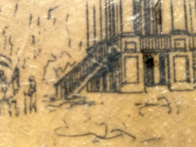
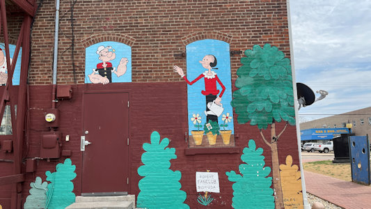
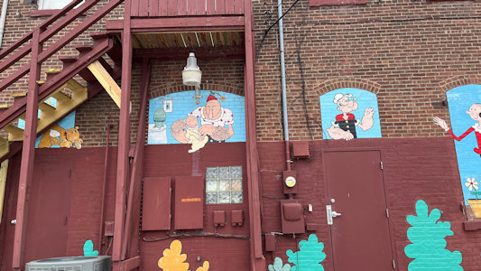
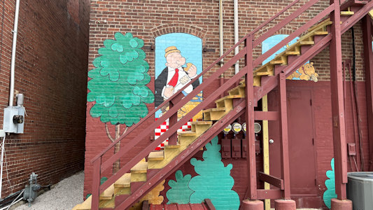
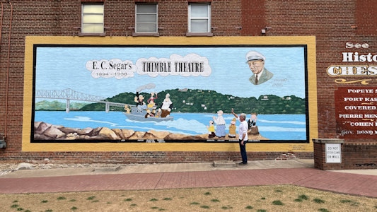
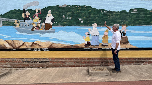
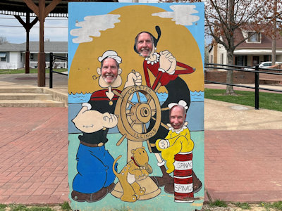
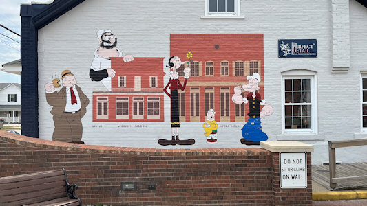
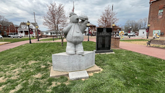
3/27/2025 In town we parked at Gazebo Park for a little more fun. There were a number of murals of the various Popeye characters, along with some
stick-your-head-in-the-hole photo cutouts for photo ops and an RA statue of Wimpie. “A granite statue of pudgy, hamburger-loving J. Wellington Wimpy, from the Popeye comic
strip, was erected in Chester in 2006. It was the first of the town's ambitious, decades-long project to honor hometown hero Elzie Crisler Segar, Popeye's creator, with
statues of his Sunday Funnies family scattered along a ‘character trail’ in town. Wimpy was based on a Chester resident and former boss of Segar, William ‘Windy Bill’
Schuchert. The statue's location is significant, as it stands in small park that used to be the tavern where Bill would go to get his frequent hamburgers.”
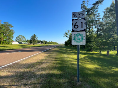
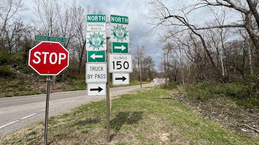
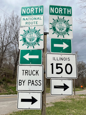
Here we also picked up the Great River Road NSB. We’ll stay on it until before Valmeyer later on; sights we and/or the Federal Highway Administration consider on the NSB are noted with a “GRR”.
Heading out of town ... we continued to Ellis Grove and the
Pierre Menard House NHL and SHS (GRR). ...
A short distance away we stopped in
Fort Kaskaskia SHS (GRR). by the DAR. ...
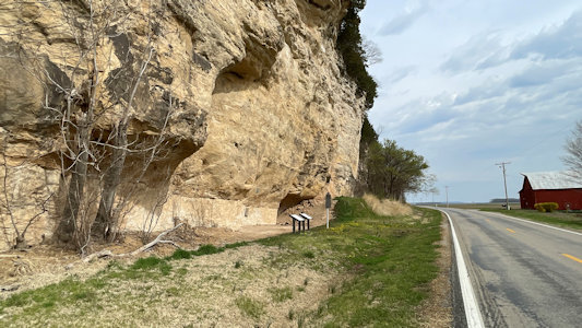
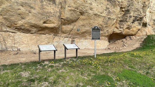
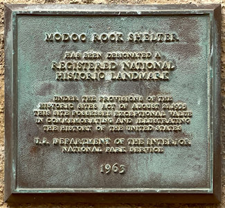
A bit more northwest brought us to Modoc, and outside of town we stopped along the long line of towering cliffs to check out
Modoc Rock Shelter NHL (GRR). The site is
located beneath the sandstone bluffs that form the eastern border of the Mississippi River floodplain at which Native American peoples lived for thousands of years
starting at least 9000 years ago. This is a pretty cool area, with the extremely high cliffs abruptly transitioning to the flat Mississippi valley (American Bottom).
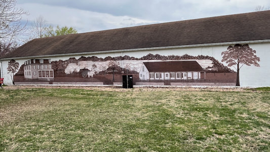
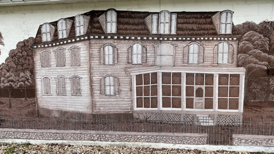
While driving to our next destination we spotted a tactical mural in Prairie du Rocher – a monotone view of a couple of old buildings presumably in town (GRR). ...
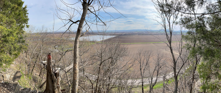
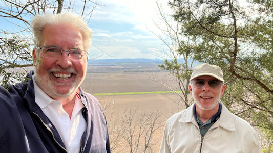
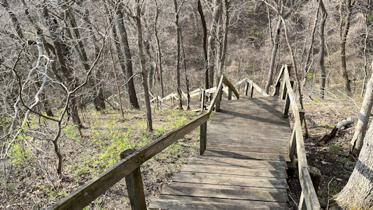
Further upriver brought us again to the base of the bluffs where we parked for
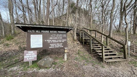
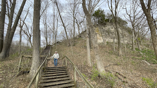
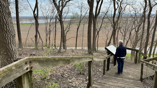
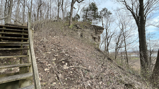
Fults Hill Prairie Preserve NNL (GRR). The site contains high-quality examples of loess
hill prairie and limestone glade which were once more extensive in this region. Although we could have taken a 1.4 mile loop up and around the bluffs, we elected to
just take the first leg, which was a 211-step strenuous climb up some sometimes rickety stairs to a nice view of the plains.
A look down the byway ...
|
... with signage
|
Some Popeye characters ...
|
... on a building ...
|
... in Gazebo Park, Chester
|
A mural with Ken ...
|
... waving to a bunch
|
Cute little group
|
Yet another Popeye mural
|
A Blimpie Roadside Attraction
|
Info about ...
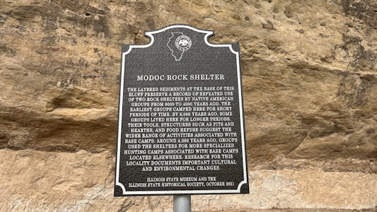
|
... Modoc Rock Shelter
|
Lots of signage
|
Ken photos ...
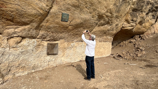
|
... the NHL plaque
|
In Prairie du Rocher ...
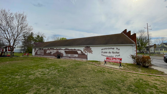
|
... a more monochromatic mural
|
Some nice details ...
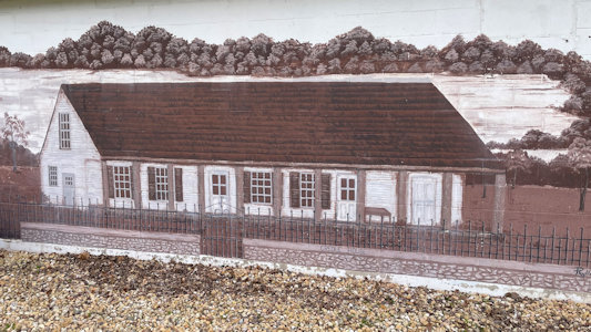
|
... of local buildings
|
At Fults Hill Prairie Preserve NNL ...
|
... there's a hill to climb
|
Ken reading signage part way up
|
Almost there
|
A good view of the American Bottom
|
Ken and me
|
Okay, time to head down ...
|
3/28/2025 Meeting of the Great Rivers
Historic National Road (Illinois, Indiana, Maryland, Ohio, Pennsylvania, West Virginia)
(Go here for the full drive of the Historic National Road)
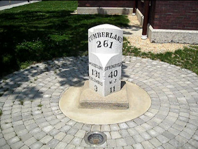
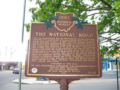
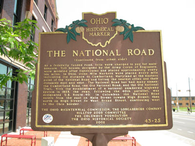
5/29/2011 We headed out of town west on the National Road (OH 40, running on the 40th parallel) ...
Looking back east
|
A mile marker
|
A sign with lots ...
|
... of information!
|
Historic Route 66 (Arizona, California, Illinois, Missouri, New Mexico, Oklahoma)
Starting in 2021, see Route 66 pages.
5/26/2007
R66 Segments
2/22/2011
R66 Segments
4/28-30/2017
R66 Segments
5/26-27/2021
R66 Segments
10/15-17/2021
R66 Illinois
Journey Through Hallowed Ground Byway (Maryland, Pennsylvania, Virginia)
Total Segments Traveled
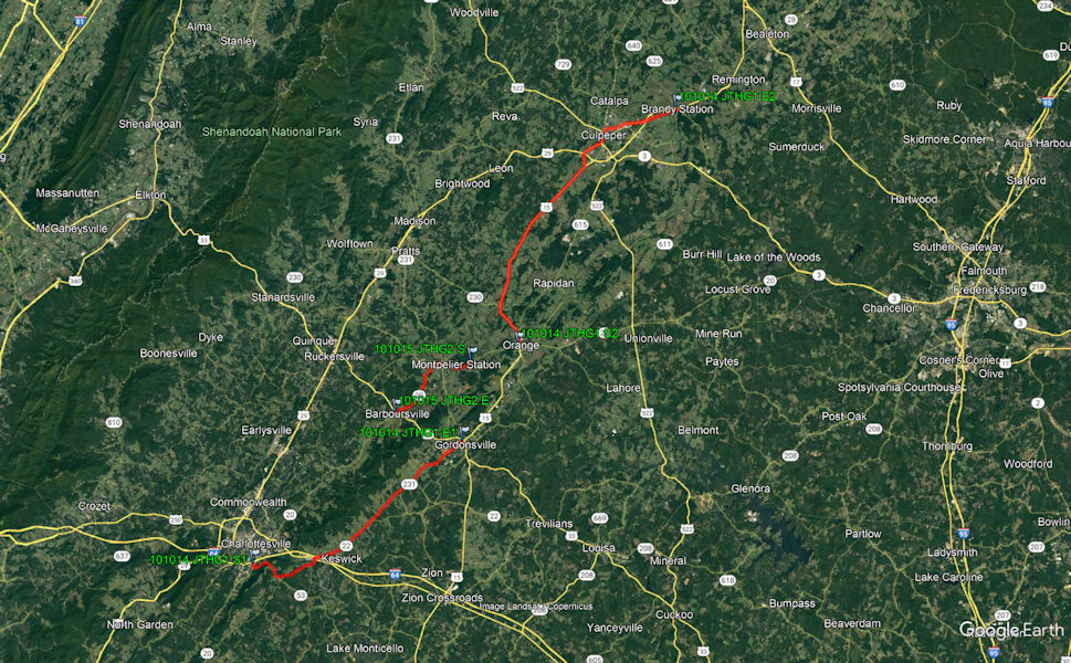
10/14/2010 Journey Through Hallowed Ground National Heritage Area
Natchez Trace Parkway (Alabama, Mississippi, Tennessee)
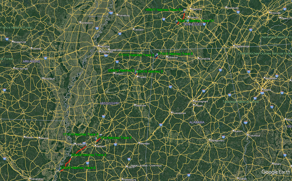
Total Segments Traveled
9/17/2016 Natchez Trace Parkway
10/14/2017 Natchez Trace Parkway
4/30/2023 Natchez Trace Parkway
5/1/2023 Natchez Trace Parkway
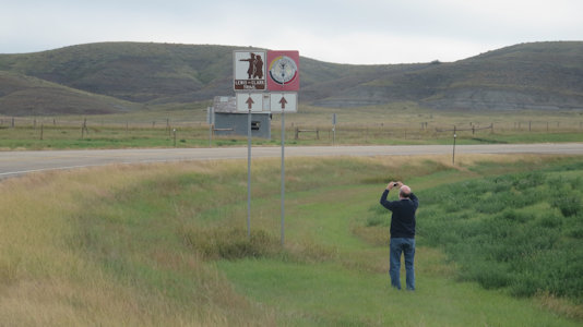
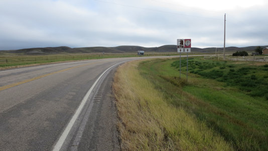
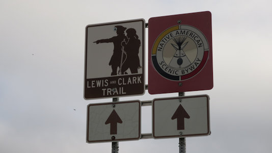
Native American Scenic Byway (North Dakota, South Dakota)
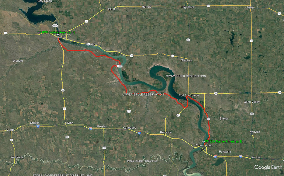
Total Segments Traveled
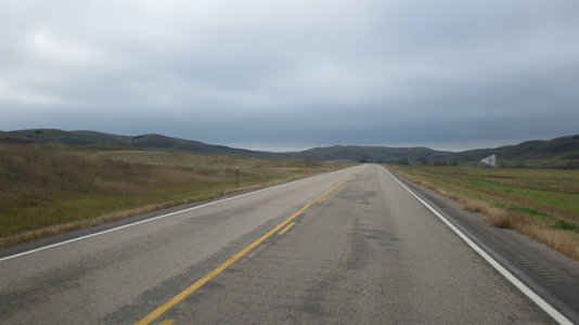
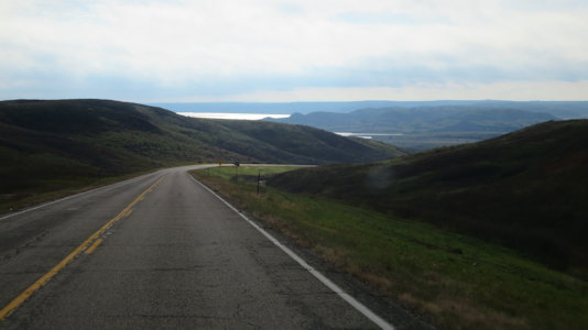
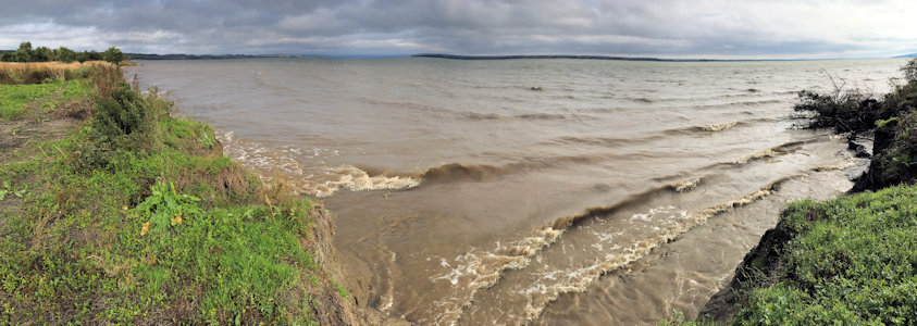
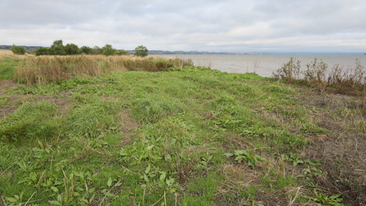
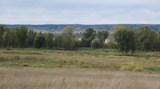
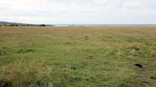
10/4/19 Back on the road we returned through Fort Pierre and headed south and east on the Native American NSB [SD], which we followed
for quite a while along the Missouri River through the lands of the four tribes of Lakota Sioux: Crow Creek, Lower Brule, Cheyenne River, and Standing Rock.
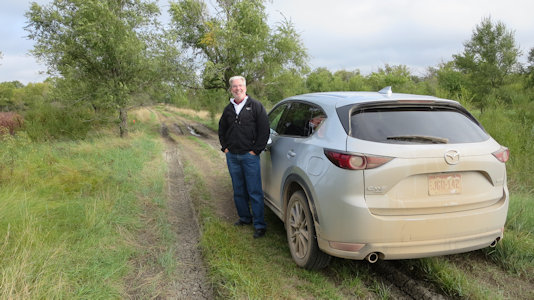
In Lower Brule on the eponymous reservation we stopped for another site NHL. We went down a narrow dirt road with grass down the middle, finally deciding to
park where the ruts got deep and muddy. We then walked down to the Missouri for representative views of the Langdeau Site NHL. The site consists of fifteen
depressions consistent with traditional earthlodge construction from between 1100 and 1300 CE, with no evidence that the village was fortified. Back on the
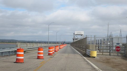
highway (and the NSB) we crossed the river over the Big Bend Dam which creates a very wide part of the river, or lake. We continued on the north/east side
of the river to the Fort Thompson Mounds NHL in Fort Thompson. This is a complex of archaeological sites extending about 6 miles along the Missouri River,
one of the largest known complexes of burial mounds in the Plains region north of Kansas. Not much to do here but declare “we are here”, take our photos and
move on to the Crow Creek Site NHL. This is the site of an overwhelming attack and massacre occurring around the mid-1300s CE between Native American groups
along the Missouri River. We had planned to park on the road and hike down closer to the river, but there was a barbed wire fence that prevented that, so we
just took the representative photos from the road. These site NHLs don’t offer much but at least they are generally quick to accomplish! Finally leaving the NSB
at its end in Chamberlain, ...
Me photoing ...
|
... the Byway ...
|
... and sign
|
A view down the Byway ...
|
... and another
|
Ken where we walk to ...
|
... a panorama of ...
|
... Langdeau Site NHL
|
Big Bend Dam
|
Fort Thompson Mounds NHL
|
A closer look at the Missouri River
|
Crow Creek Site NHL
|
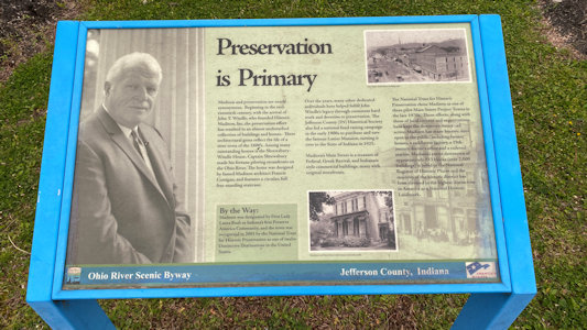
Ohio River Scenic Byway (Illinois, Indiana, Ohio)
Total Segments Traveled
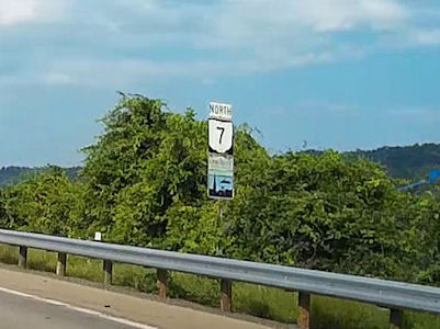
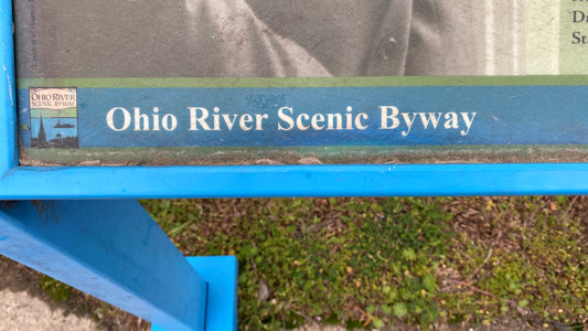
9/10/2016 Crossing the Ohio River, we took the eponymous NSB [OH] north to Mount Pleasant.
Byway signage
|
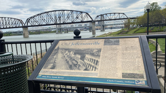
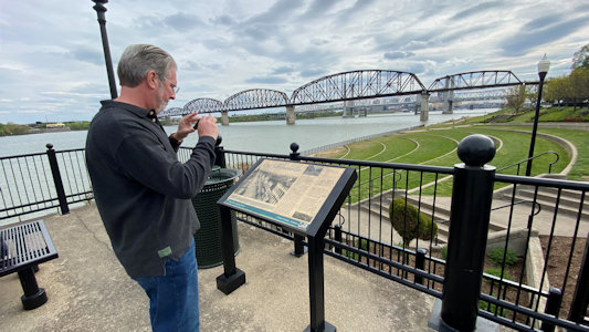
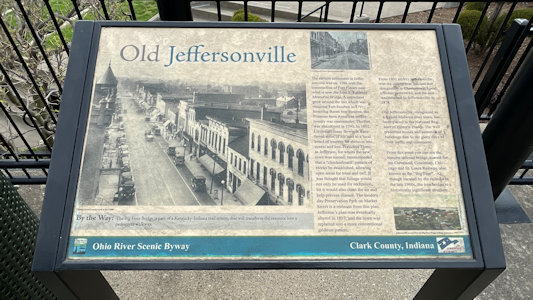
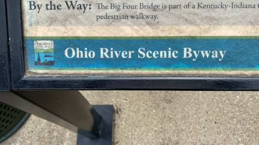
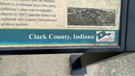
4/23/2021 From there we drove into Jeffersonville, IN and parked at the river to see Ohio River NSB. The stop was at a
historical panel about Jeffersonville, along the NSB.
Right by the river ...
|
... Ken photoing ...
|
... the NSB sign
|
It's official ...
|
... even with logo
|
4/24/2021
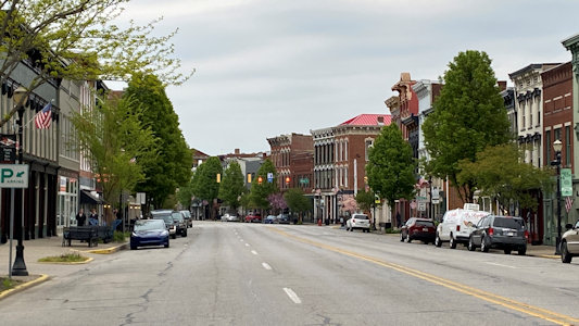
Falls of the Ohio State Park. From here we followed the river for a while
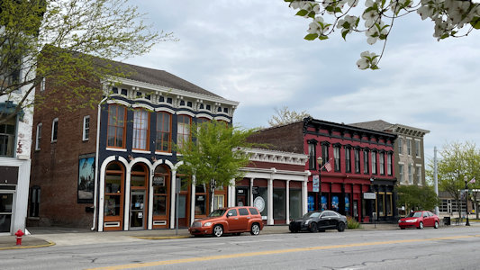
on the Ohio River NSB [IN], then continued northeast, still along the NSB, up to Madison. We started out parked downtown in the large, and very quaint, Madison
National Historic District NHL. Recognized for its unique Midwestern beauty and architecture scheme, many of the prominent buildings were built by
Madison-native-architect Francis Costigan, who favored the Greek Revival style. We enjoyed checking out the many historic buildings, all the while
looking for a plaque, which we did not find. We did find signage in town for the NSB, and one along the river about the Historic District. ...
Last we went to Lanier Mansion NHL and SHS. Completed and occupied
in 1844, it was the home one of Madison's pioneers, a lawyer and banker, becoming the president of the Madison Branch of the State Bank of Indiana and a major
investor in Indiana's first railroad. The striking mansion is on a large property with gardens and open field behind it. We spent some time with photos,
including a new walking 360° video.
Madison Historic District
|
Some of the many historic buildings
|
Interpretive signage ...
|
... on the NSB
|
Santa Fe Trail (Colorado, New Mexico)
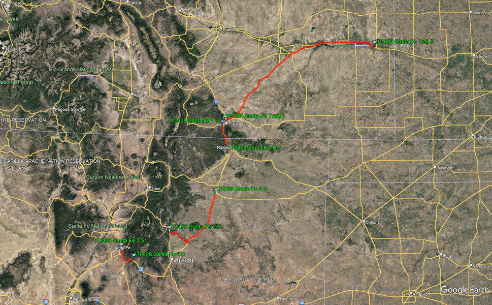
Total Segments Traveled
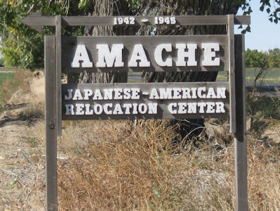
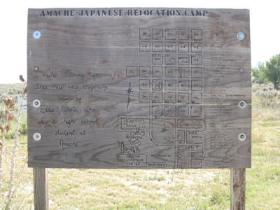
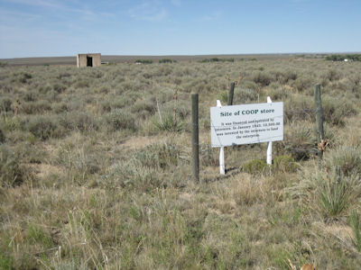
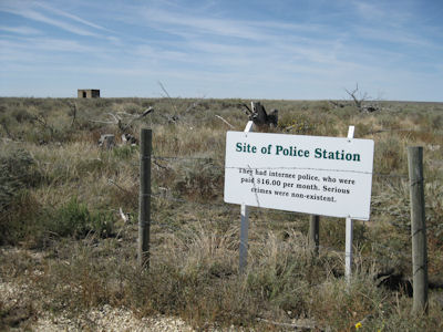
10/4/2012 ... back down and on the road east and south to Granada and the Granada Relocation Center NHL.
Also known as Camp Amache, this was one of ten Japanese relocation centers created after Pearl Harbor. Not much here but a grid
of roads around brush and grass, and some signs indicating where various buildings were. Headed east, stopping for gas and a
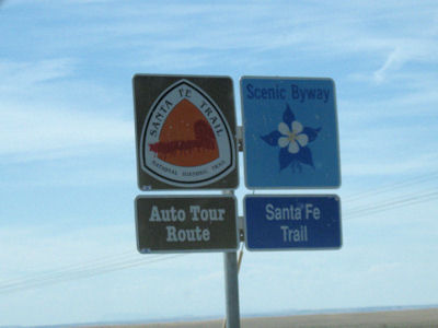
sandwich and apple slices lunch (in the car). The whole stretch was along the Santa Fe Trail Scenic Byway [CO]. I stopped at two
Santa Fe NHT sites. First was Sierra Vista, with nice views across the plains to the Rockies (considered a milestone along the
route). The other was at Iron Spring which was an important water stop. I noted that, as we saw in Nebraska, the railroad
followed along the same route.
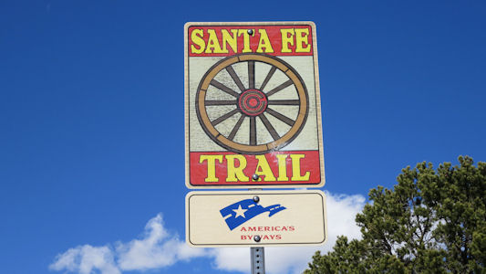
Byway signage
|
Sign for Camp Amache
|
The layout of the camp
|
One building location sign ...
|
... and another
|
4/28/2017 Santa Fe National Historic Trail
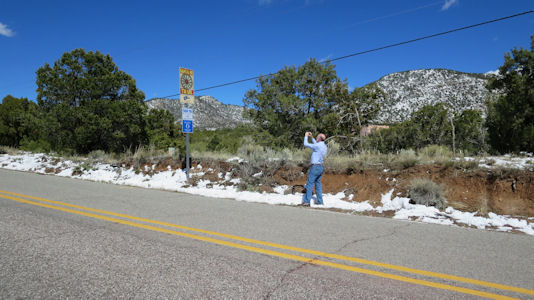
4/30/2017 Back in the car we almost immediately got on Historic Route 66 NSB and the
Santa Fe Trail NSB [NM], both of which we will stay on almost to our last stop. We drove a very short way to the
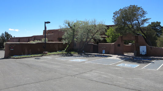
NPS Region III HQ NHL. The office, a masterpiece of Spanish Pueblo Revival architecture, provides support
for Park Service properties throughout the intermountain region of the American Southwest. Here there was
a gate across the driveway and “no trespassing” signs with warnings of video surveillance, but we ignored
all that and walked to the buildings for quick photos. ...
Pecos National Historical Park
The park sign
|
The Region III HQ
|
Me photoing ...
|
... the NSB ...
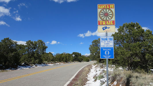
|
... and the sign
|
Trail of the Ancients (Colorado, Utah)
Total Segments Traveled
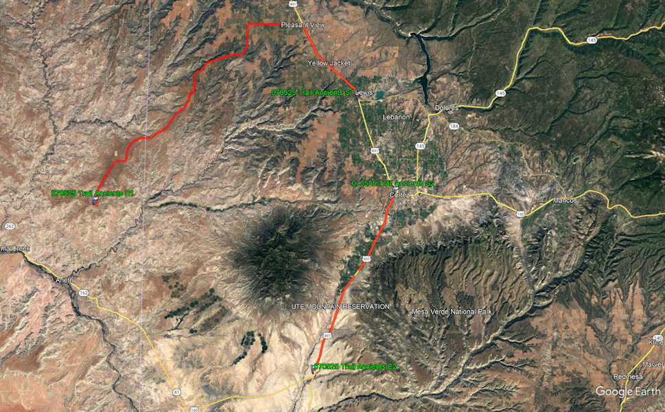
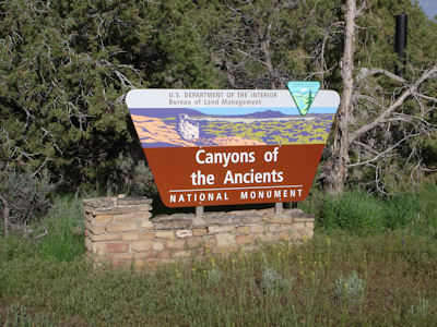
5/25/2007 Headed off into the Canyons of the Ancients NM (BLM) via back farm roads and
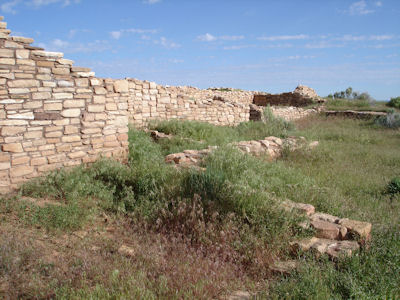
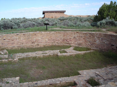
dirt roads [on the Trail of the Ancients Byway in CO]. ... I arrived at Lowry Pueblo [Ruin NHL] (no one else there,
weather gorgeous). Took a nice walk around the nicely excavated and preserved pueblo and kiva. Continued on
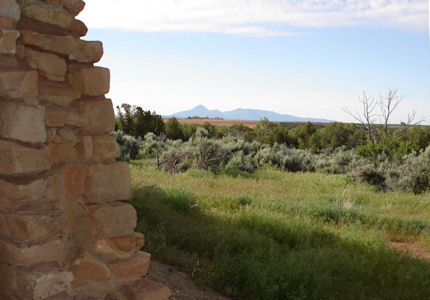
the back roads to Hovenweep NM.
A quick look in the visitor center, then took the 1 ½ mile hike around the canyon
containing many towers and other buildings perched right on the canyon ledge. Needed plenty of water in the
warm, dry air. Back on the road completing the loop back to Cortez [including the Byway in UT] ...
BLM sign
|
Cool stone construction
|
A view of the mountains
|
A big kiva
|
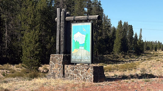
Volcanic Legacy Scenic Byway (California, Oregon)
Total Segments Traveled
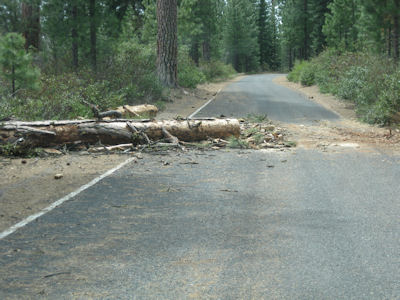
5/13/2009 Headed north on I5, east on 89, then north on back roads (small) to get to
Lava Beds NM. On the way had pretzels and trail mix for lunch. The road I was on (this and others on the Volcanic
Legacy Scenic Byway [CA]) was a logging road and was pretty rough with large potholes with paint warning outlines.
One was covered by three A-frame wood barriers, one that said “Road Closed – Unsafe for Travel”. I, of course,
ignored it. Mile after mile I passed downed trees, but each one was cut so that one vehicle could pass, so I
pressed on. Just as a I started to see some signs of lava – snow! It covered the road and was clearly impassable
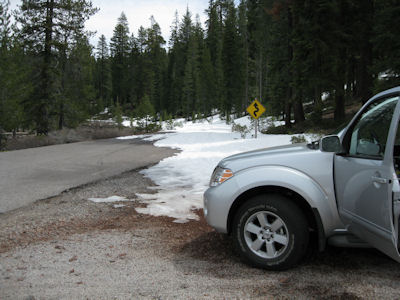
for me. Crap! All the long way back to I5 (96 miles RT detour) and attacked the monument from the north.
The Byway sign
|
Road is still passable
|
Oh well - not anymore
|
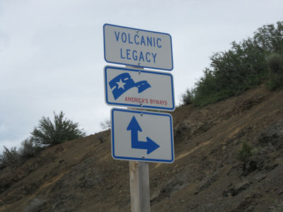
9/24/2025 Heading north, as we then juked west, I videoed a sign for the Volcanic Legacy NSB (OR), which we took
for a way west then south into Crater Lake and continuing to Fort Klamath (we will also hit sections tomorrow). ...
Crater Lake National Park
On-the-fly sign photo
|
A couple of looks ...
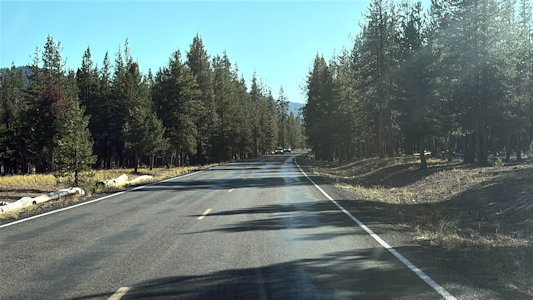
|
... along the byway
|
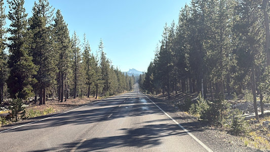
9/25/2025 Heading south into CA, we started the day with another of my last contiguous U.S. NPS units. On the way we
noted signs for the Volcanic Legacy NSB (CA), and will in fact see them regularly over our morning travels. ...
Lava Beds National Monument ...
Tule Lake National Wildlife Refuge ...
Lower Klamath National Wildlife Refuge