Home
Travel
NPS States
NPS Types
National Historic Trails (Non-Units) - Multi-State[L-N]
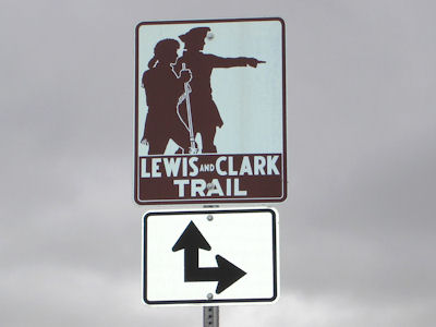
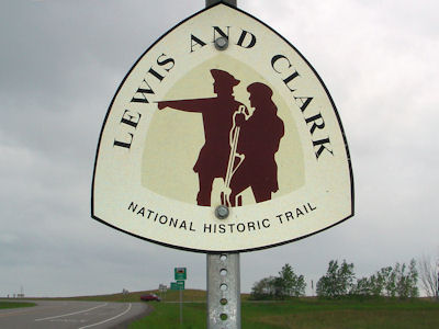
Lewis and Clark National Historic Trail (Idaho, Illinois, Indiana, Iowa, Kansas, Kentucky, Missouri, Montana, Nebraska,
North Dakota, Ohio, Oregon, Pennsylvania, South Dakota, Washington, West Virginia)
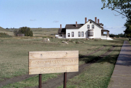
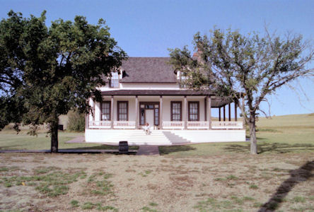
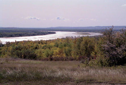
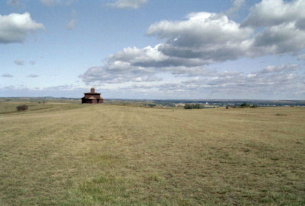
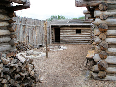
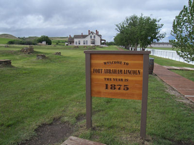
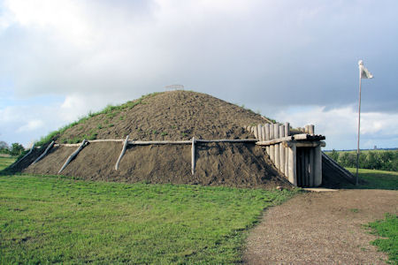
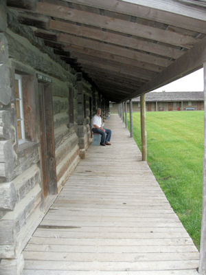
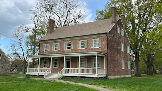
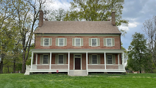
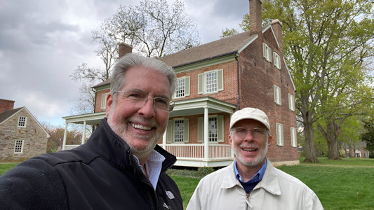
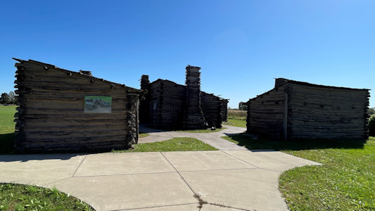
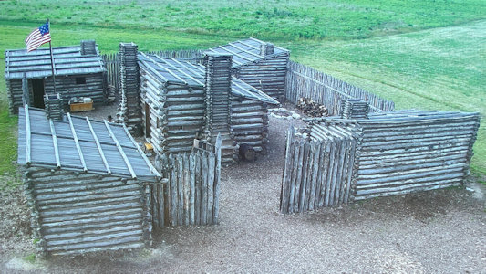
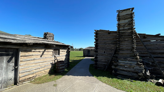
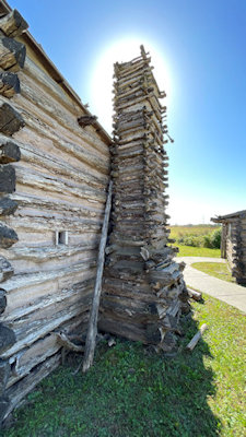
9/9/1992 Back short distance to Mandan and Fort Abraham Lincoln State Park. Very pretty park on
Missouri River with visitor center and museum, reconstructed village of Mandan Indians [on the Lewis and Clark NHT in ND],
ruins of original fort and reconstruction of Gen. Custer's house, and fort towers from fort - fun and interesting
but winds up to 30 mph made walking around tough.
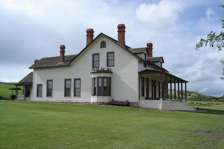
The Custer house ...
|
... with Maureen out front
|
A view of the Missouri
|
A blockhouse
|
5/30/1997 Big Hole National Battlefield
5/22/1998 Lewis and Clark National Historical Park
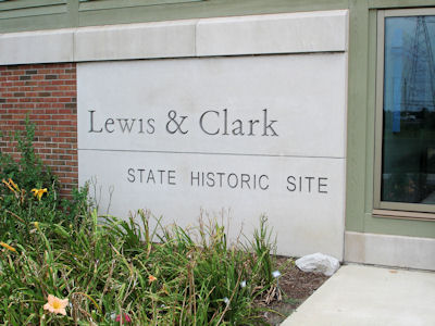
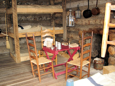
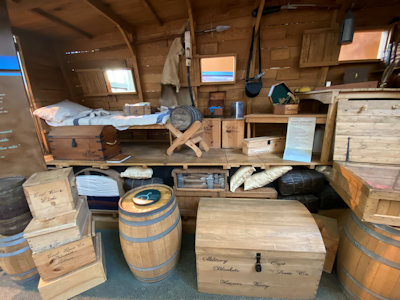
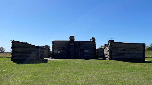
7/27/2006 Continued south a few miles [along the Meeting of the Great Rivers Scenic Route] to Hartford and the
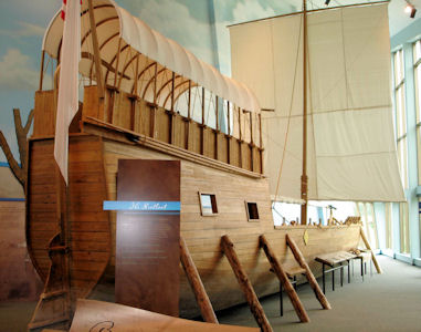
Lewis & Clark State Historic Site [L&C NHT in IL]. Saw an excellent museum about the site where L&C wintered before setting out up the Missouri. Nice
film, good exhibits and a really cool full size keel boat cut in half lengthwise, showing the stores and other stuff. On the grounds
is a replica of the encampment with log cabins in a little fort, fully outfitted.
The museum sign
|
Cool keel boat
|
L&C memorial
|
Camp Dubois outside ...
|
... inside the fort ...
|
... and inside a building
|
7/29/2006 Back east towards St. Louis (interstates this time!) and up to St. Charles and the Lewis & Clark Boat
House and Nature Center. Saw the working models of the boats used by L&C and a great museum on nature of the area and the L&C expedition,
particularly their stay here before pushing up the Missouri. Both here and Camp Dubois are on the L&C NHT [MO].
The Boat House
|
Nice displays overlooking the river
|
Excellent dioramas
|
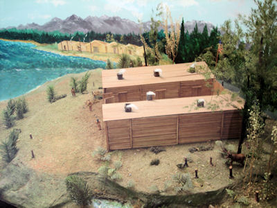
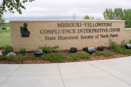
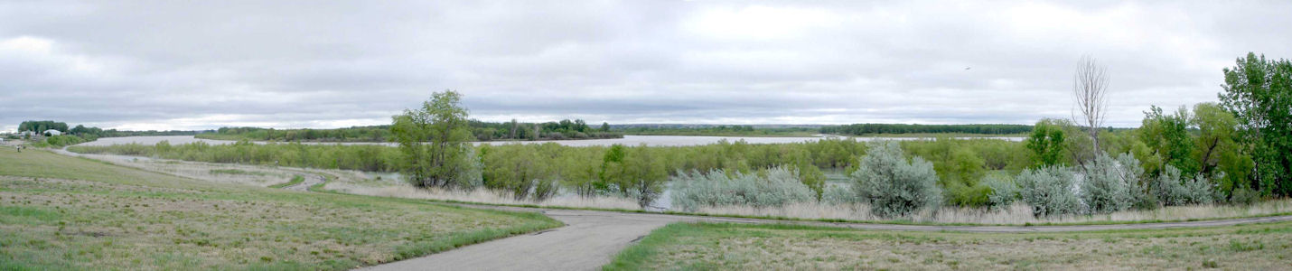
6/12/2008 Fort Union Trading Post National Historic Site Continued a short ways to the Confluence
of the Missouri and Yellowstone Interpretive Center where we saw the said confluence (explored by L&C) and escaped the clutches of an
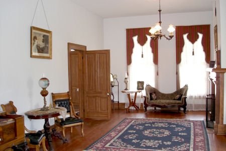
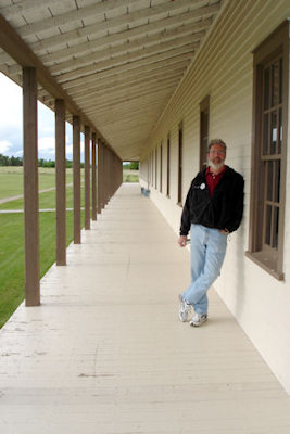
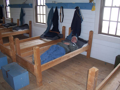
overly-helpful guide lady [and also on the NHT in ND]. … Continued to Fort Abraham Lincoln SHS in Mandan. After some confusion on how the tours
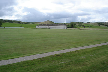
worked, got a guided tour of General and Mrs. G. A. Custer’s house at the fort, and checked out the barracks. This is the fort from which
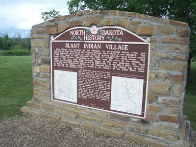
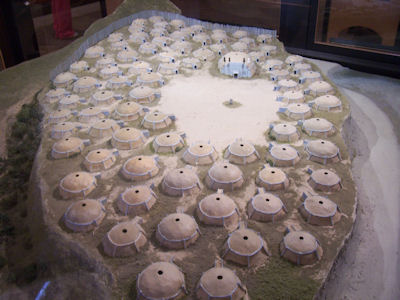
Custer lead the troops to the famous battle at the Little Bighorn. Next went to the visitor center to check out the museum and pick up the
tour (just the two of us) of the On-A-Slant Village (Mandan) given by a young woman who looked Native American (but we neglected to ask).
This once large village of earthen-covered domed lodges lasted from the mid-1500s to mid 1700s (smallpox doing them in). L&C noted the
ruins of the village in their logs [and the site is on the NHT].
Sign for the NHT
|
The sign for the Confluence Center
|
Nice panorama of the river
|
The state park sign
|
Custer's house outside ...
|
... and inside
|
The barracks
|
Ken keeps guard ...
|
... while I rest
|
Sign for the Mandan Village
|
A nice model of the village
|
A cool reconstruction outside ...
|
... and inside
|
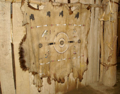
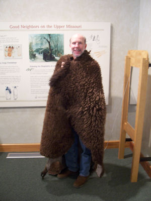
6/13/2008 Knife River Indian Villages National Historic Site ... then got back on the road
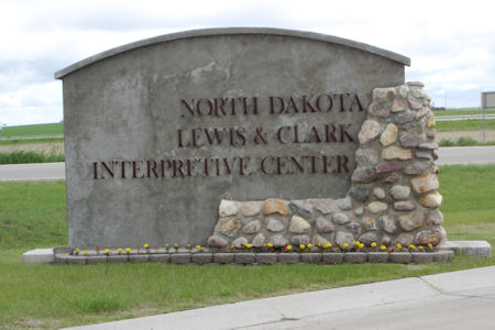
north. ... Continued over Garrison Dam, then south down to the L&C Interpretive Center (across the road from our first Cenex dinner
stop) [and on the NHT]. This place had very good exhibits on L&C and Sakakawea, including art, history displays, a dugout canoe, etc.
L&C did spend one quarter of their trip in ND, but enough of them for one vacation!
The NHT blaze
|
The Interpretive Center sign
|
Me as a mini-explorer
|
Ken by a canoe ...
|
... and me in a bear robe
|
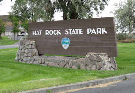
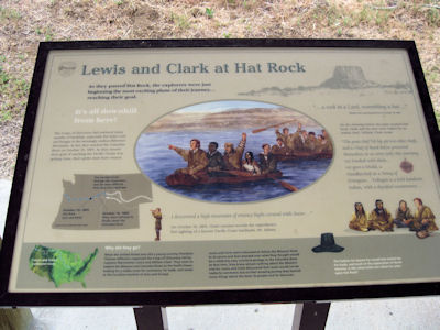
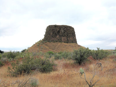
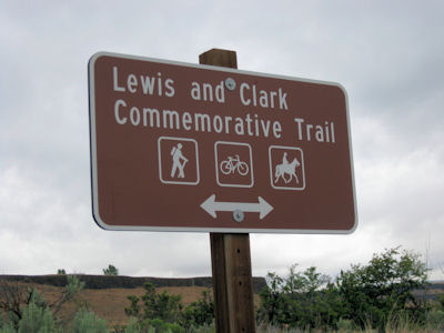
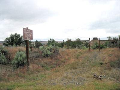
5/27/2010 Stopped at Hat Rock SP along the Lewis and Clark Trail [OR] [and on the NPS Ice Age Floods National Geographic Trail (NGT)].
Parked right near the eponymous rock
structure and hiked up to it. L&C passed through here, noting the feature that can be seen from quite a way despite it not
being that big. The rock is made of vertical columns, like many others in this region.
Horsethief Lake/Columbia Hills State Park.
The park sign
|
Some L&C signage
|
Hat Rock
|
The L&C trail sign ...
|
... and the view to Hat Rock
|
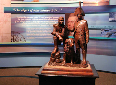
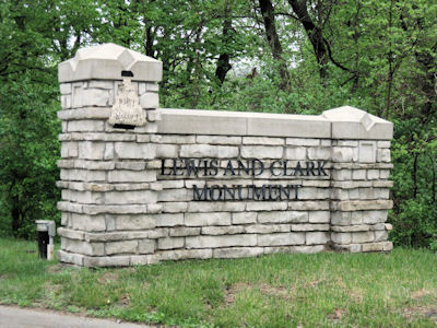
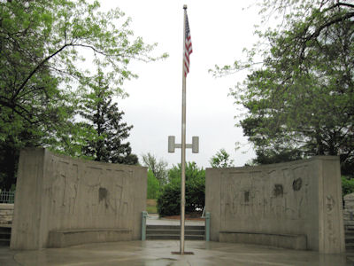
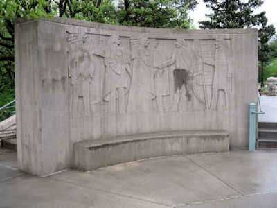
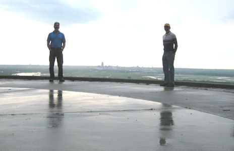
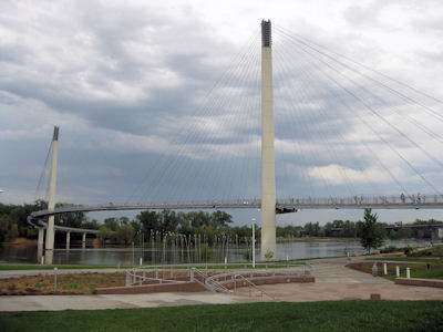
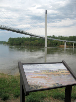
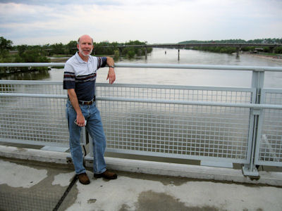
5/11/2011 First was Lewis and Clark Monument Park on the Lewis and Clark NHT [NE]. This site, high along the “bluffs”
overlooking the Missouri, was used for a “council” with the natives by L&C. The rain was pretty much stopped, and we enjoyed a great
view of the river, Omaha and the airport under a reddish sky. ... crossed the river into Omaha and went north along the river ... Back
a little south and we found the NPS HQ for the Lewis and Clark NHT [IA]. There was interpretive signage about L&C and nature. We walked on a
very cool curving bridge over the water for some nice views of the very rapidly moving water and the area. The whole riverfront is
revitalized as a dining and entertainment complex, right where L&C landed in 1804 after crossing the river from the bluffs area.
The park sign
|
The council memorial
|
Details of the memorial
|
Ken and me overlooking Omaha
|
The bridge at the NHT HQ
|
Interpretive signage
|
Me on the bridge
|
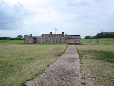
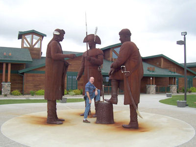
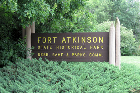
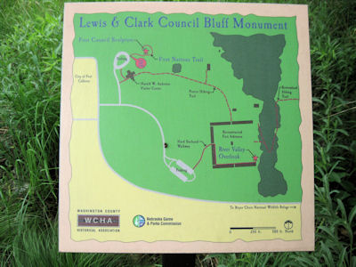
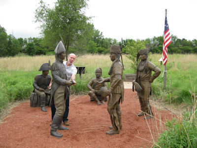
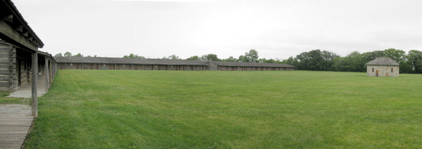
5/24/2012 ... then to Fort Atkinson NHL (Fort Atkinson State Historic Park) in Fort Calhoun. This is the
first US Army post to be established west of the Missouri River in the unorganized region of the Louisiana Purchase, erected
in 1819 and is credited as the first town in Nebraska. The site is along the Lewis and Clark NHT [NE], and we saw a nice sculpture
tableau of the Lewis and Clark Council Bluff [sic] meeting, walked around the reconstructed fort and saw another sculpture
marking the actual meeting place.
The park sign
|
A map of the area
|
Me joining the council
|
The fort from the outside ...
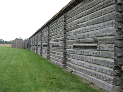
|
... and inside
|
Ken in front of the barracks
|
6/4/2017 Santa Fe National Historic Trail
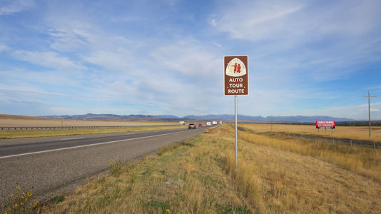
9/21/2018 We headed east into the plains, then spent the day going roughly south skirting and into the mountains,
much of it on the Lewis & Clark Auto Tour Route, hitting NHLs and L&C [MT] sites:
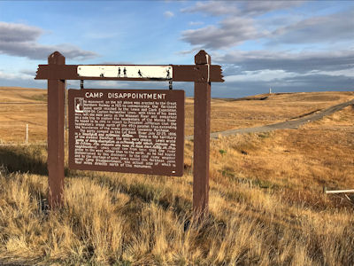
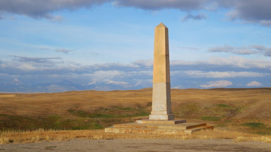
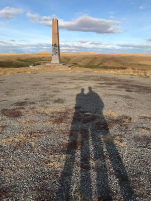
Camp Disappointment NHL/L&C NHT, the northernmost campsite of the Lewis and Clark expedition, on its return trip from the Pacific Northwest.
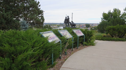
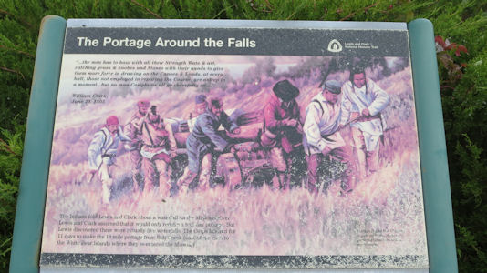
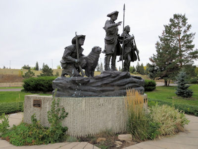
Just a sign and a somewhat defaced obelisk here, out on the windy plains ... Great Falls Portage NHL/L&C NHT. This is the route taken by the
Lewis and Clark Expedition in 1805 to portage around the Great Falls of the Missouri River during the outbound portion of the expedition.
Three stops for this. First we hit a memorial site with a bronze statue depicting Lewis’s part of the split team. Then heading up the
Missouri we found a spot with some signage (unfortunately behind a fence) and another where we could stand right on the river where the
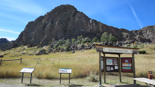
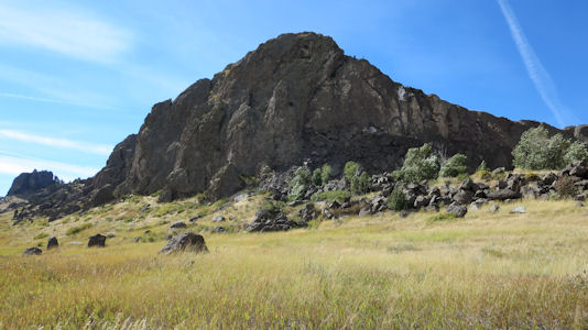
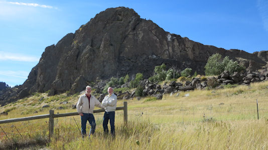
party ended the arduous portage around the falls. ... Tower Rock State Park/L&C NHT. We stopped in a little interpretive area at the base
of a large rock formation noted by L&C. We didn’t think it was really unique from the surrounding formations, but enjoyed it nevertheless,
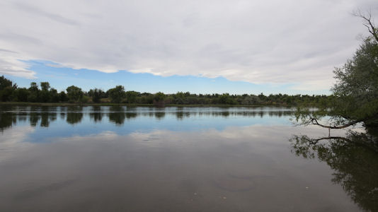
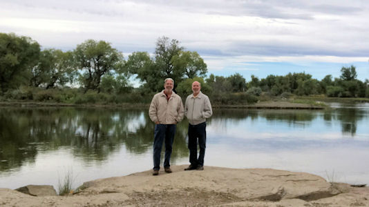
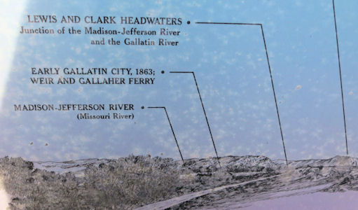
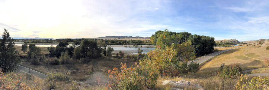
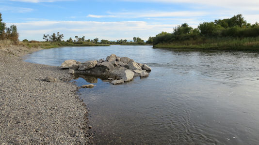
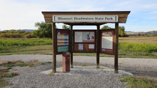
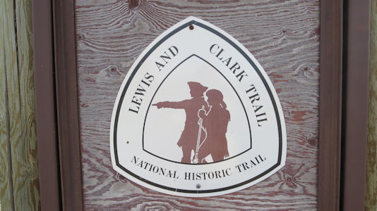
and continued on into Helena. ... Three Forks of the Missouri NHL, in Missouri Headwaters State Park (and on the L&C NHT), which marks the
official start of the Missouri River at the confluence of the Gallatin, Madison and Jefferson Rivers. We climbed a trail to a nice viewpoint
of the true confluence of the three rivers off in the distance, then went to an area where we could go to the edge of the Madison River
right before it joined the other two to form the Missouri.
Camp Disappointment Sign
|
The obelisk monument
|
Ken and me in the early sun
|
Great Falls monument area
|
Interpretive signage ...
|
... and NHT detail
|
Monument close-up
|
Great Falls Portage area ...
|
... with Ken and me
|
Tower Rock park area ...
|
... and a closer look
|
Interpretive signage ...
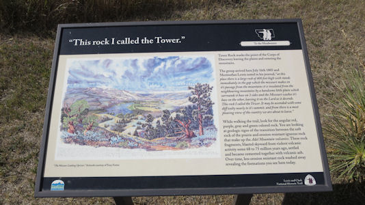
|
... with NHT emblem
|
Me and Ken
|
Me taking photo of ...
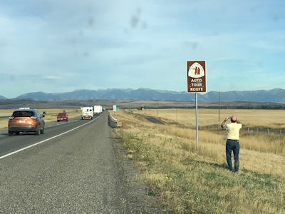
|
... the L&C Trail auto tour sign
|
Three Forks signage ...
|
... and our panorama
|
A look upstream
|
Interpretive kiosk ...
|
... and one more emblem
|
5/31/2019 Pony Express National Historic Trail
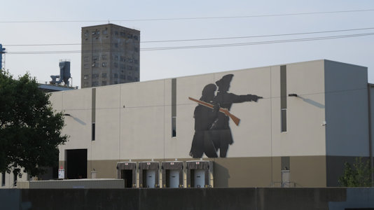
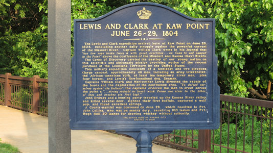
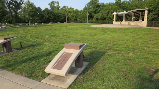
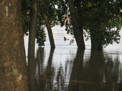
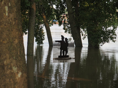
... Kaw Point (Kansas City). This is a Lewis & Clark NHT area [KS]. We found a lot of signage
about L&C, along with other memorials to Indian nations, etc. The nearby factory had a huge L&C mural on the side.
We were looking for a large L&C sculpture at the side of the river, but disappointingly yet amusingly, the river
was so high that all we could see was Clark’s hat at the top of the sculpture looking like a shark fin.
Factory mural
|
KS interpretive sign
|
A lot of info in this area
|
One of the panels ...
|
... with NHT info
|
What we saw and ...
|
... what we should have seen
|
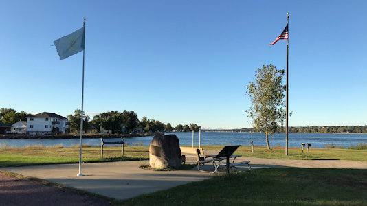
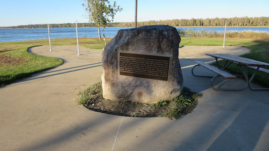
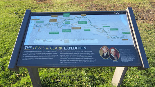
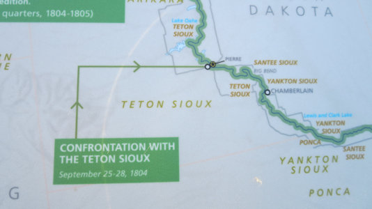
10/3/2019 Arriving in Fort Pierre we did the last sights of the day. First, an exhibit in Fischers Lilly Park for the Bad River
Encounter Site on the Lewis & Clark NHT [SD]. Here L&C had a little problem negotiating safe passage up the Missouri due some language issues with the natives,
but eventually got it worked out.
Bad River Encounter Site ...
|
... with plaque ...
|
... and signage
|
Our place on the Trail
|
NPS stuff
|
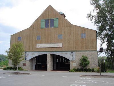
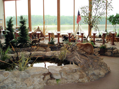
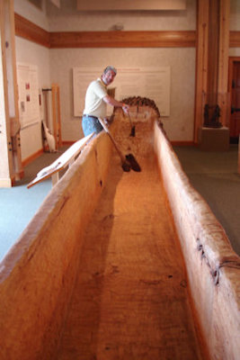
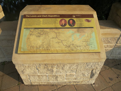
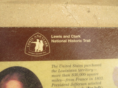
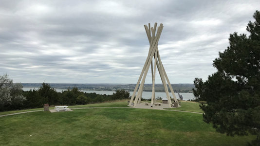
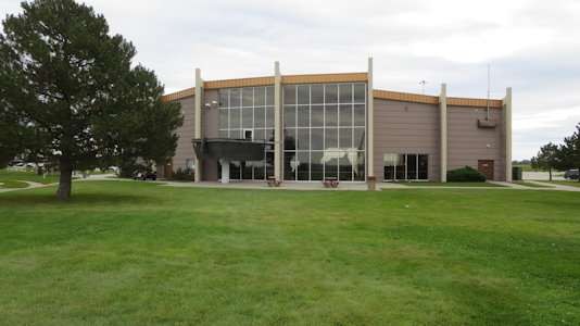
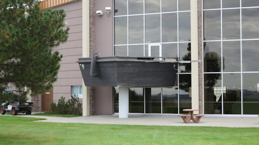
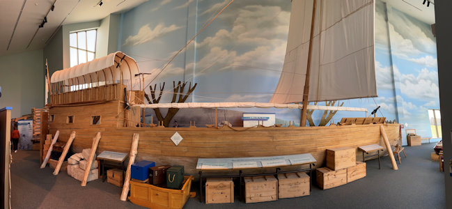
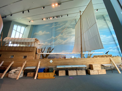
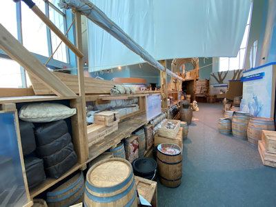
10/4/2019 ... then went a short way to the Interstate and stopped at the Lewis and Clark Interpretive Center for
information on the NHT [SD]. Although on the short list for things to bypass if time was tight, this turned out to be very interesting.
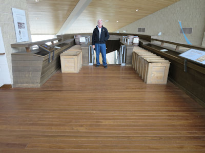
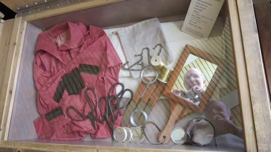
Along with a small museum, there is a keel boat suspended overhead; we walked up steps leading up underneath through the bottom to the
deck, which then lead to doors outside, with half the boat sticking out of the building. Inside were displays on what the boat carried
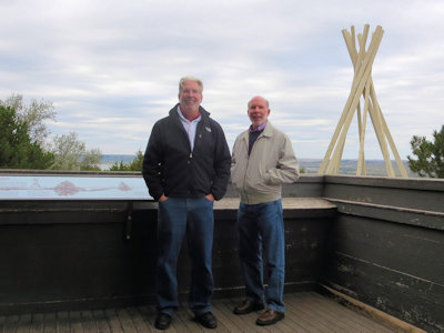
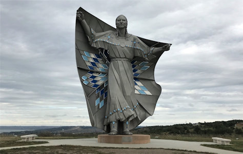
and how it was used, and outside there were nice views of the river. On the ground outside nearer the river was a huge concrete teepee
frame, as well as Dignity, a beautiful 50-foot stainless steel Native American woman sculpture.
Outside the Interpretive Center ...
|
... with NPS logos
|
Me and the keel boat
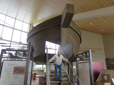
|
Ken on deck
|
Some of the stuff L&C took
|
On the outside deck
|
The teepee and river
|
The Center ...
|
... with keel boat poking through
|
Dignity
|
4/21/2021 Locust Grove NHL. The property includes a 1790 Georgian mansion that was the home of the Croghan family
and gathering place for George Rogers Clark, Lewis and Clark, and U.S. Presidents. This is a pretty little area, especially in spring,
but we mostly just photoed the attractive brick main house. We looked for signage but didn’t find any, but in any case, we also knew this
site is on the Louis and Clark NHT [KY], it being where in November, 1806, Meriwether Lewis and William Clark arrived at Locust Grove to a homecoming
where Lucy Clark Croghan and her family welcomed them back from their journey.
The mansion from the quarter ...
|
... and front
|
Some architectural detail
|
Ken and me
|
4/24/2021 Falls of the Ohio State Park
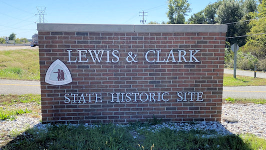
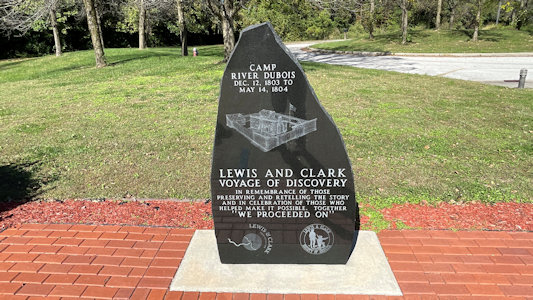
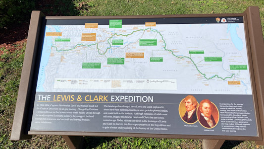
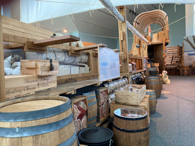
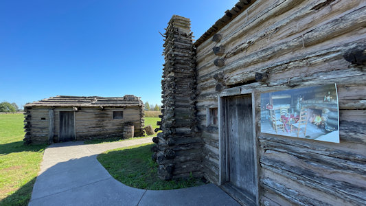
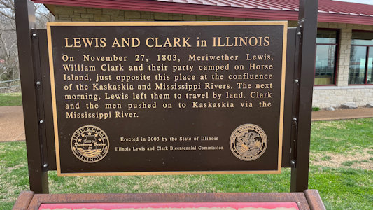
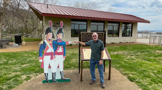
10/17/2021 First stop in Hartford was the Lewis and Clark State Historic Site[, also on the MRWT NRT]. The site commemorates Camp River Dubois, the camp
of the Lewis and Clark Expedition from December 1803 to May 1804, and on the Lewis and Clark NHT [IL]. I had been here, and Ken didn’t wish to spend too much
time. Inside, we checked out the very impressive full-sized, sliced in two keelboat. It’s pretty amazing to see how much stuff they packed aboard. We
also look at the reconstructed encampment outside.
The park sign ...
|
... and cool monument
|
NPS signage ...
|
... with emblem
|
Sign of the times
|
Full sized keelboat
|
Another starboard view
|
Looking from ...
|
... the cutaway side
|
Lots of stuff!
|
A look to ...
|
... the camp recopnstruction
|
Another fort view ...
|
... and artist concept
|
Some more ...
|
... views ...
|
... inside
|
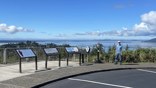
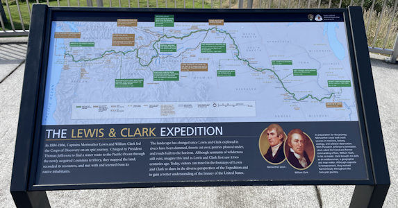
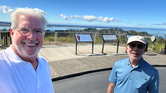
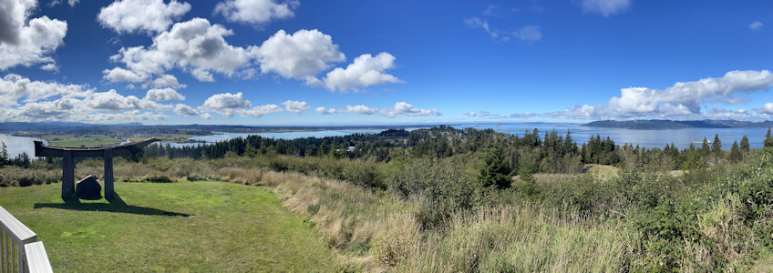
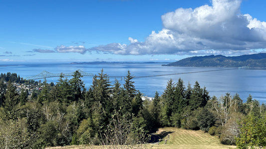
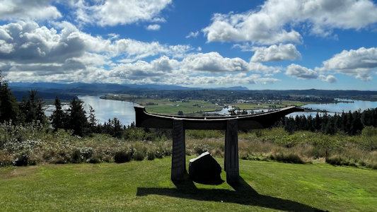
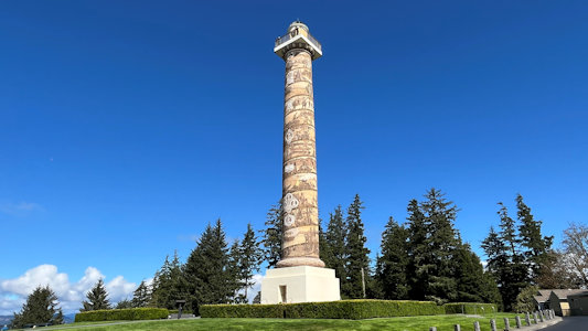
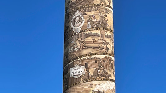
9/18/2024 Still in Astoria, we drove up a steep road to an area high over the town for the Astoria Column RA. “There's a stunning view
from the Astoria Column, a civic landmark atop Coxcomb Hill. A spiral staircase winds 164 steps to the top observation deck. The column was built in 1926 and
the beautiful mural of local history that spirals around the exterior was recently restored” The mural captures elements of Lewis & Clark, including Fort
Clatsop. Although we could have climbed up the tower for great views (and toss a souvenir balsa plane down), we knew we had a long day still ahead so did
not. Instead, we enjoyed fantastic views offered even from the ground, watching the little planes others tossed down, and the absolutely huge bubbles a guy
was making. These bubbles shimmered in the sun, drifting across the parking area, and adding even more interest to the stop. This site is on the Lewis & Clark
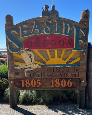
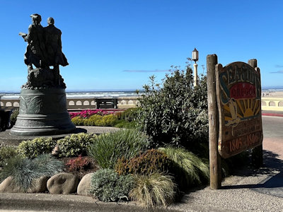
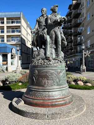
NHT, as indicated by some NPS signage. ... Lewis and Clark National Historic Park ... The very busy
quaint if touristy town [of Seaside] had lots of traffic and little parking, so Ken went around a little dead-end traffic circle at the beach and dropped
me off. I got some photos of the End of the Trail Lewis and Clark NHT monument. Replacing a 1940 sign, in 1990 a bronze statue of Lewis, Clark, and their
dog Seaman, by sculptor Stanley Wanlass was installed. After photos, I hopped back in the car when Ken circled back and we moved on.
Signage on the high bluff ...
|
... including L&C
|
Ken and me
|
Beatiful views from here ...
|
... down river ...
|
... and towards Youngs Bay
|
Astoria Column ...
|
... with L&C mural detail
|
Sign for ...
|
... End of the L&C Trail ...
|
... with monument
|
9/20/2024 Columbia River Gorge National Scenic Area
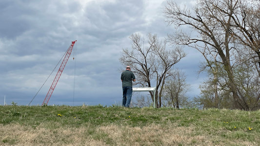
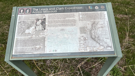
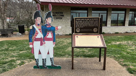
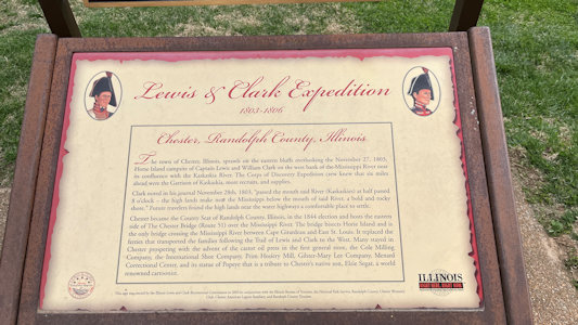
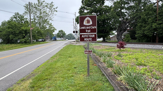
3/27/2025 Heading for Chester, IL, right over the river entering town we spotted a lone NPS L&C NHT interpretive sign amidst the road
construction. Shortly after that we stopped at a welcome center, and there we found some more info and some cut-out figures of L&C.
Pierre Menard House State Historic Site.
Fort Kaskaskia State Historic Site.
Fort Chartres State Historic Site.
Me photoing ...
|
... roadside L&C info
|
Rest area L&C kiosk ...
|
... with plenty of ...
|
... L&C info
|
Inspired by Michelangelo
|
5/28/2025 Right off the bat we spied a tactical Lewis & Clark NHT Auto Tour sign. After-the-fact research revealed
that "En route from the Ohio towards the Mississippi River, Lewis and Clark traveled westward to recruit the talent of John Shields, black
smith and gunsmith, and the brothers Joseph and Reuben Field, hunters. All three of these noteworthy members of the Corps of Discovery
hailed from West Point".
I photo ...
|
... the NHT route sign
|
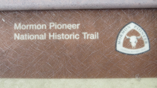
Mormon Pioneer National Historic Trail (Illinois, Iowa, Nebraska, Utah, Wyoming)
9/24/2004 Oregon National Historic Trail
9/16/2009 ... headed over to This Is The Place Park. Although there is a heritage village here, I was
just stopping to check out the monuments, including the huge TITP monument, on the Mormon Pioneer NHT (actually, the end).
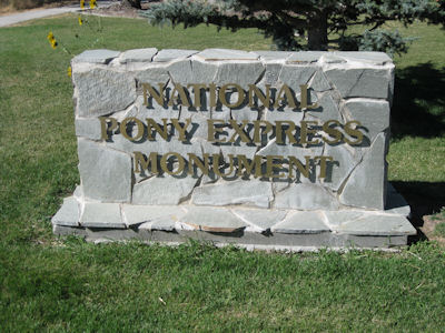
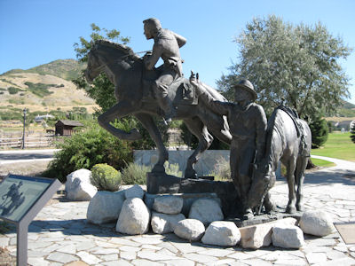
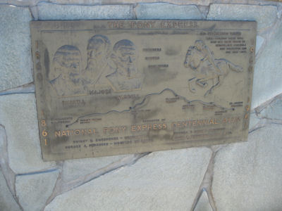
Also checked out the Pony Express monument. Weather is really great – warm, blue skies, pretty clouds. From TITP, headed
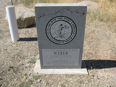
east to Echo Canyon. ... Right nearby, though, was a station marker for the Pony Express [NHT in UT]. This route was also on the MP
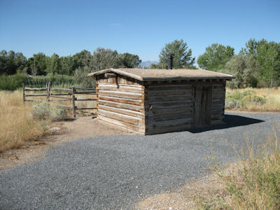
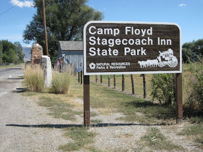
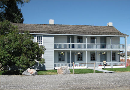
trail. South on I15 and off at Lehi to head to Fairfield. Stopped at the Camp Floyd/Stagecoach Inn State Park to see the
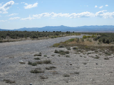
Inn and the Pony Express exhibit. Continued a few miles to where the PE trail took off on a dirt road.
This Is The Place monument
|
Mormon Trail marker
|
Pony Express Monument sign
|
Nice PE statue
|
A PE map and info
|
Reconstructed PE station
|
Weber PE station marker
|
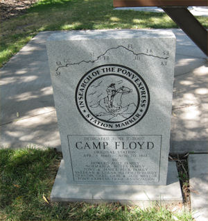
Camp Floyd sign
|
Camp Floyd PE marker
|
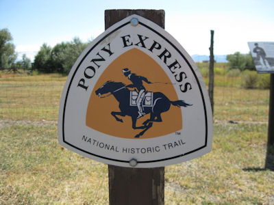
The PE blaze
|
One of the Camp Floyd buildings
|
A view on the Pony Express Trail
|
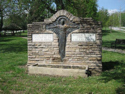
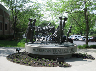
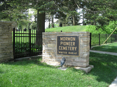
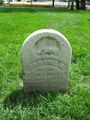
5/12/2011 North a bit more brought us to a part of the Mormon Pioneer NHT [NE]. This was the area of the
Winter Quarters. An LDS Temple is at the site of the Pioneer Cemetery where hundreds of pioneers who died over the winter
were buried. There were some bronze monuments and memorials here as well.
Winter Quarters and Cemetery sign
|
A nice statue at the sign
|
The cemetery sign
|
One of the many graves
|
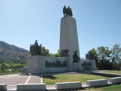
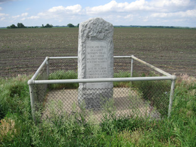
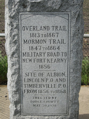
5/24/2012 [Between Fremont and Schuyler] Historic Monument (Overland and Mormon Trails).
The monument ...
|
... with detail
|
5/25/2012 Oregon National Historic Trail
5/31/2013 Oregon National Historic Trail
6/1/2013 Oregon National Historic Trail
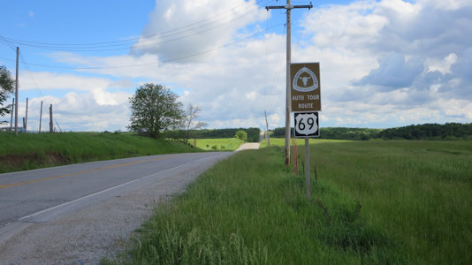
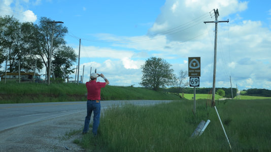
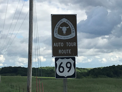
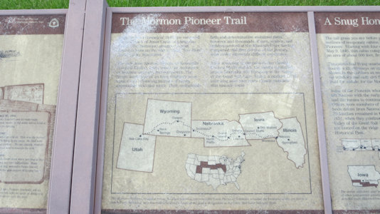
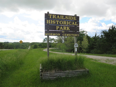
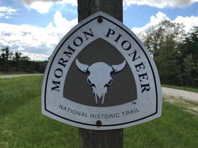
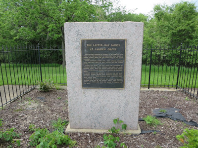
5/30/2019 Heading south out of [Osceola] we picked up the Mormon Pioneer Auto Route with the official signage. ...
Garden Grove. Here there was a wayside exhibit with signage and a memorial for the Mormon Pioneer NHT [IA]. It was a temporary way station
established near the river in April 1846 and was abandoned in 1852.
The auto route
|
Me taking a photo of ...
|
... the auto route sign
|
Ken reading Garden Grove ...
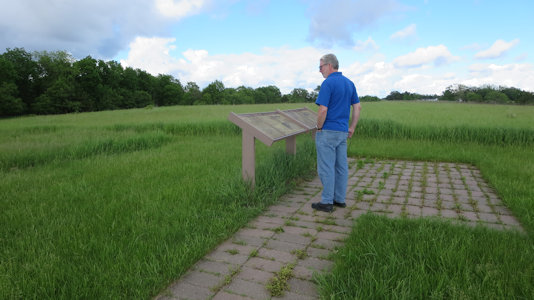
|
... interpretive panels ...
|
... about the NHT
|
Park sign ...
|
... with emblem
|
Ken and me by ...
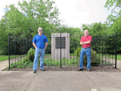
|
... the memorial
|
Nez Perce National Historic Trail (Idaho, Montana, Oregon, Wyoming)
5/30/1997 Big Hole National Battlefield
9/22/2018 Nez Perce National Historical Park