Home
Travel
NPS States
NPS Types
National Historic Trails (Non-Units) - Multi-State[A-K]
Butterfield Overland National Historic Trail (Arizona, Arkansas, California, Missouri, New Mexico, Oklahoma, Texas)
4/7/2019 Sonoran Desert National Monument ...
Yuma Crossing National Heritage Area
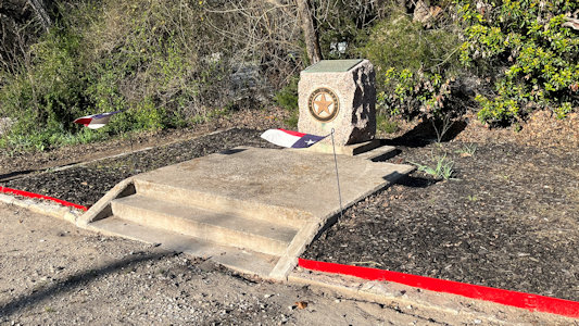
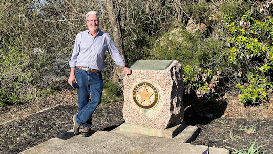
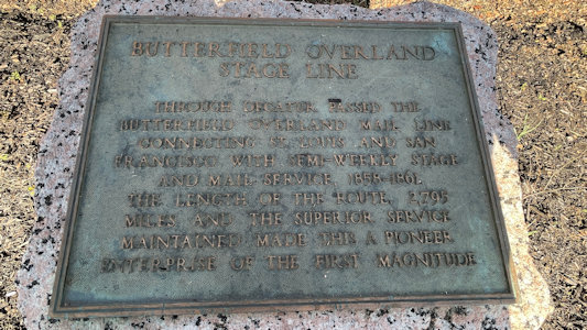
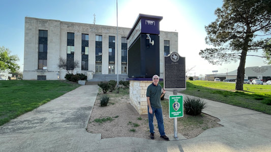
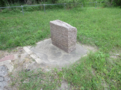
3/13/2024 From there we headed up to Decatur for a couple more stops, first, a Butterfield Overland Trail (NHT) marker. This is an historic plaque on
a little pillar, and with some little Texas flags - more than just a classic sign. In 1857 John Butterfield established an overland mail and passenger stagecoach route between
the eastern U.S. and growing settler populations in the Far West. What became known as the Butterfield Overland Trail began from two eastern termini on the Mississippi River
at St. Louis and Memphis and ended at its western terminus in San Francisco.
Nice little marker area
|
Ken by ...
|
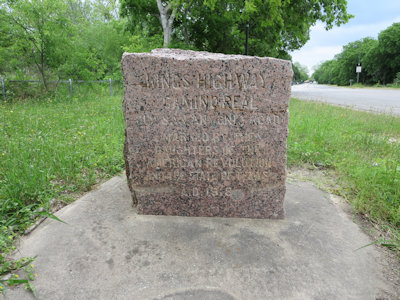
... the interpretive plaque
|
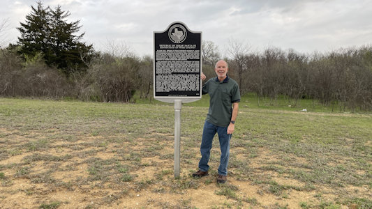
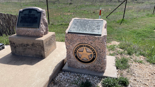
3/14/2024 Today’s travel is a long drive with about 25 stops. Many of them are brief stops for signs and markers along the BOT, which we will follow down to Fort Stockton. Signs are the basic state
information signs, all of which have some reference to the BOT. The markers are squat little pillars with the Texas star on front and a plaque on top, like we saw last
night. We also hit a number of forts, positioned along a line to defend and support the region against threats including Native American. Not surprisingly, the BOT made
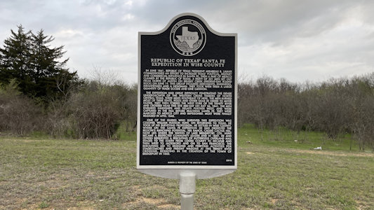
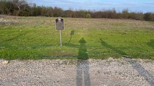
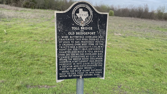
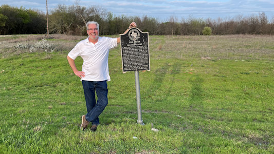
use of the forts as rest and replenishment stops. ... [Bridgeport] BOT Sign “Republic of Texas’ Santa Fe Expedition in Wise County” ... BOT Sign “Toll Bridge and Old Bridgeport” ...
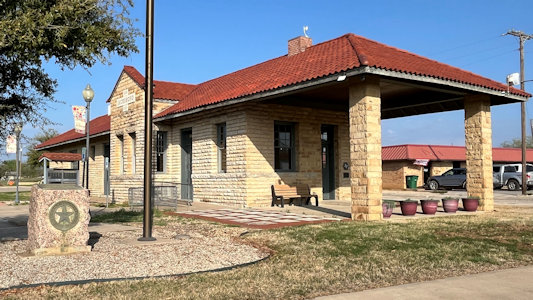
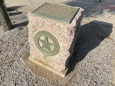
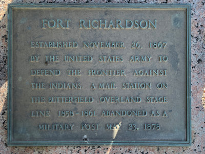
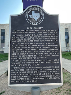
Fort Richardson ... BOT Marker “Fort Richardson” at a former “Gulf, Texas & Western Railroad
Depot” ... BOT Sign “Jack County” at Jack County Courthouse. ... Fort Belknap ... [Between Towns]
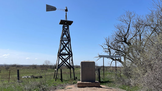
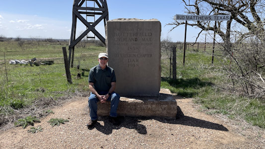
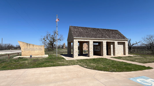
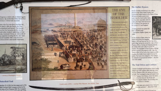
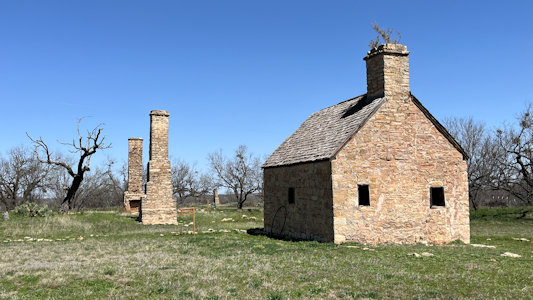
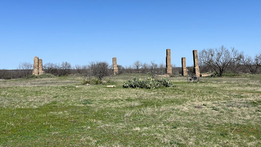
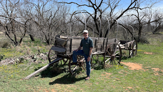
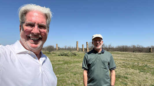
BOT DAR Monument. “The Trail of the Butterfield Overland Mail” BOT Fort Phantom Hill. The fort was
established in 1851 as part of the line of forts in Texas to protect migrants passing through the state on their way to California. This is a sprawling area with
ruins of the fort buildings (mostly just the chimneys) but there was an interpretive kiosk and we enjoyed walking the trails among the prickly pears in beautiful
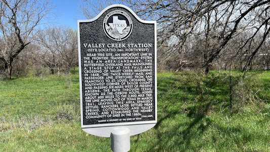
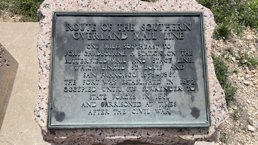
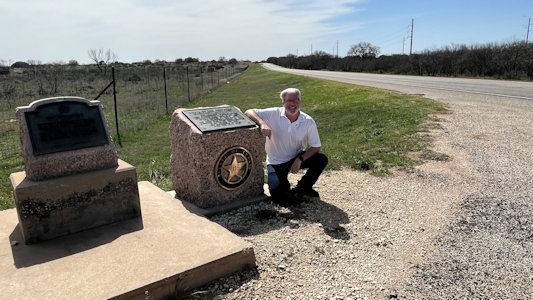
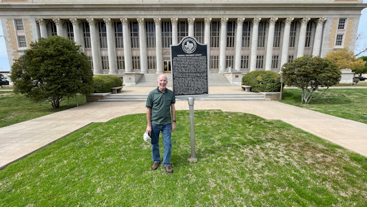
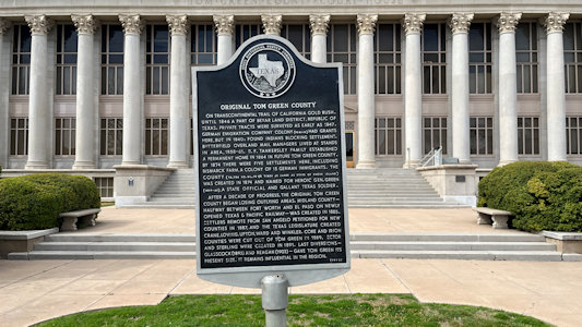
weather. ... BOT Sign “Valley Creek Station” BOT Marker “Route of the Southern Overland Mail Line” ... [San Angelo] BOT Sign “Original Tom Green County”
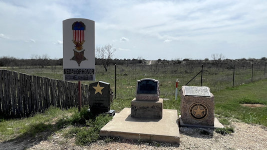
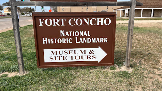
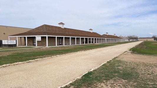
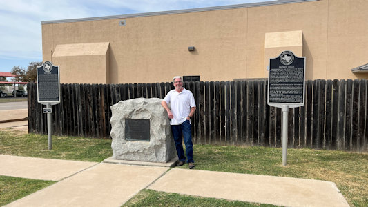
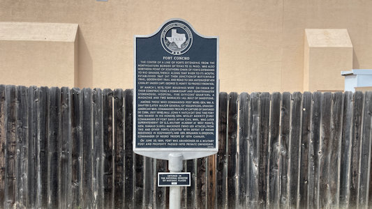
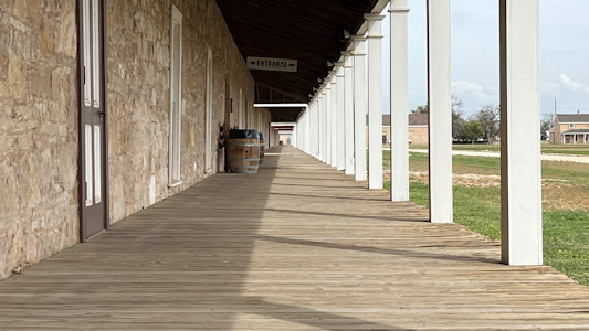
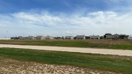
at Tome Green County Courthouse Fort Concho NHL. A U.S. Army installation established in 1867 at the confluence of the North and South Concho Rivers, on the routes of the Butterfield Overland Mail
Route and Goodnight–Loving Trail, and an active military base for the next 22 years. We were near closing time here, but still could walk around the large rectangular
fort area, with a long stretch of enlisted men’s barracks along one side of the parade ground and nicer home-like officers' quarters along the other. ... [McCamey] After
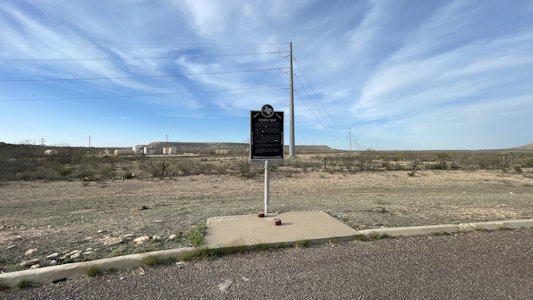
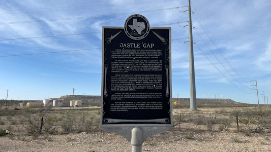
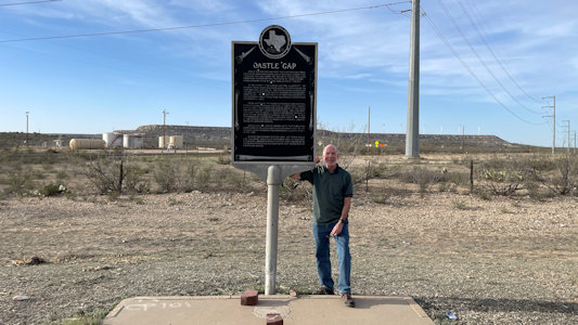
one more BOT Sign “Castle Gap” before town, we reached McCamey ...
Me by the ...
|
... "Republic of Texas ..." sign
|
Our shadows check out the sign ...
|
... "Toll Bridge and Old Bridgeport" ...
|
... and Ken poses by it
|
Former railroad depot ...
|
... with marker ...
|
... and Fort Richardson info
|
Sign "Jack County" ...
|
... with me at Jack County Courthouse
|
BOT DAR monument ...
|
... Trail of the Butterfield Overland Mail
|
Fort Phantom Hill pavilion ...
|
... with interpretive info
|
Remains of old buildings ...
|
... but mostly chimneys
|
Me by an old wagon
|
A selfie with the grounds
|
Ken by ...
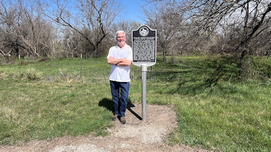
|
... "Valley Creek Station"
|
Informational area ...
|
... with marker for "Route of the ...
|
... Southern Overland Mail Line"
|
Ken by the marker
|
Tom Green County Courthouse
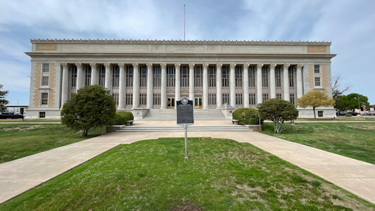
|
Me by sign for ...
|
... "Original Tom Green County"
|
The sign for ...
|
... Fort Concho
|
Ken by NHL plaque ...
|
... and "Fort Concho" sign
|
I get low for ...
|
... a barracks view
|
Parade grounds and officers' quarters
|
One last sign ...
|
... for "Castle Gap" ...
|
... with me
|
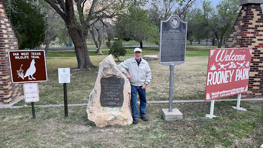
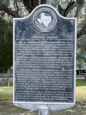
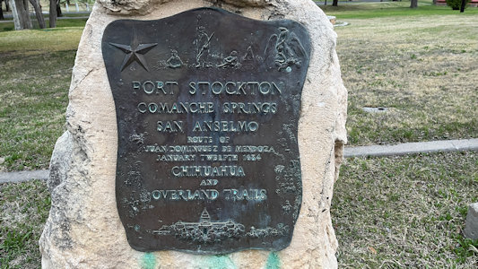
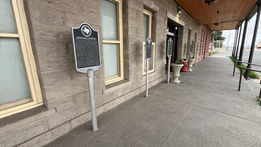
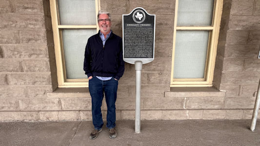
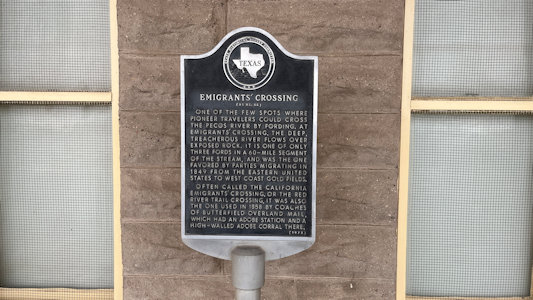
3/15/2013 [Fort Stockton] Another short juke to James Rooney Memorial Park for a couple of BOT signs, one standard interpretive-style. ... [Pecos] BOT Sign.
“Emigrants’ Crossing” This among a slew of other historic signs of similar design, all with the long text that we have experienced with these Texas signs.
Me in James Rooney Park ...
|
... and "Comanche Springs"
|
Little mention of BOT
|
The park area with signage ...
|
... about Comanche Springs and ...
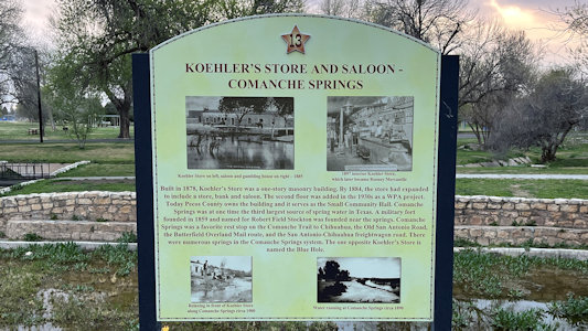
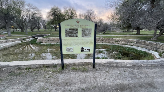
|
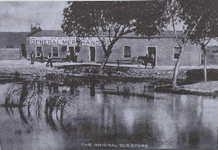
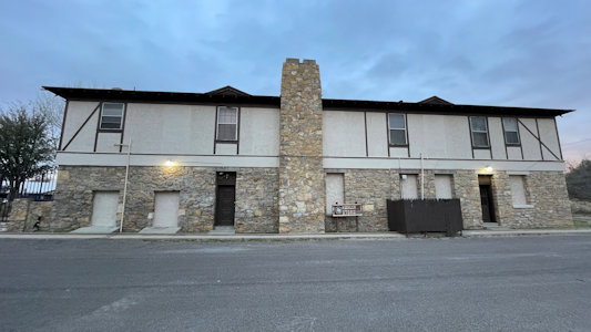
... 1878 Koeler's Store
|
The store today
|
Pecos signs ...
|
... with Ken by ...
|
... "Emigrants' Crossing"
|
California National Historic Trail (California, Colorado, Idaho, Kansas, Missouri, Nebraska, Nevada, Oregon, Utah, Wyoming)
9/24/2004 Oregon National Historic Trail
9/15/2005 City of Rocks National Reserve
5/25/2012 Oregon National Historic Trail
5/31/2013 Oregon National Historic Trail
6/1/2013 Oregon National Historic Trail
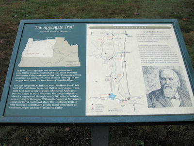
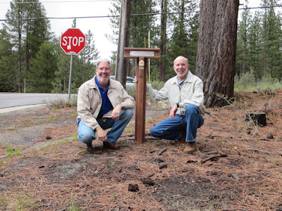
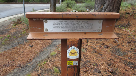
9/22/2013 ... then moved on to Guthrie Park in Dallas for a roadside kiosk on the Applegate part of the California NHT [OR].
The Trail sign
|
The little park ...
|
... with interpretive signage
|
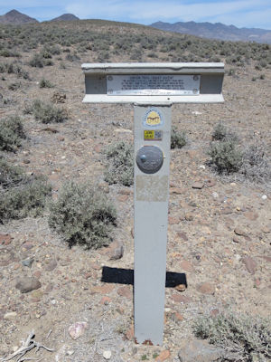
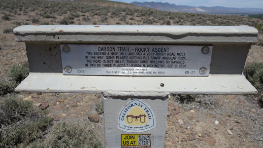
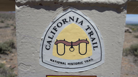
5/24/2014 ... a half hour one-way detour to Leonard Rockshelter NHL ... We also lucked out in that
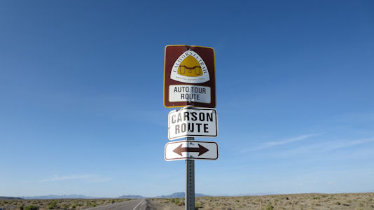
there was California NHT [NV] information here, since the trail crossed nearby, as well as a second route which crossed the road we
took here (Carson Route), part of the deadly Forty Mile Desert section of the trail.
Nice little CA Trail exhibit
|
A very faded map and trail info ...
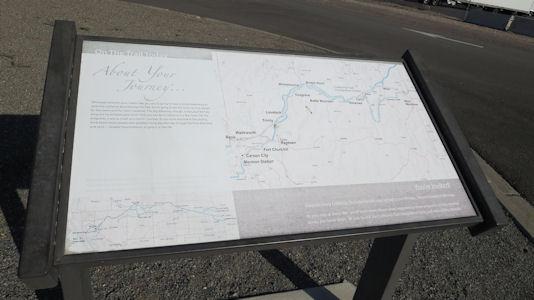
|
... with trail logo
|
Crossing the Forty Mile Desert
|
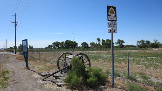
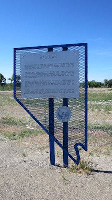
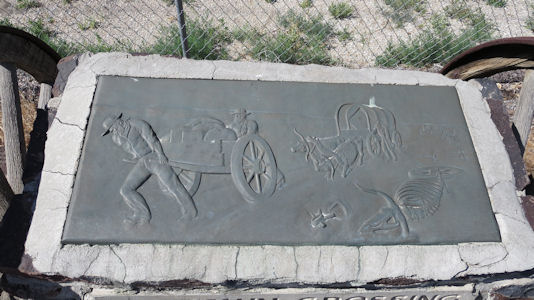
5/25/2014 On the way back from Fernley we spotted an info sign and small exhibit for Ragtown on the Carson Route of the
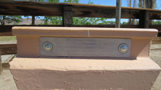
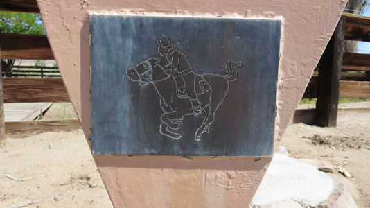
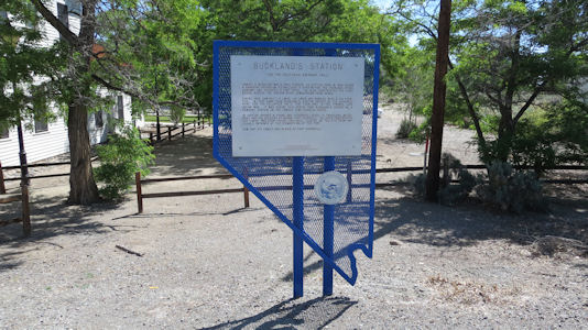
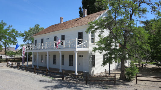
California NHT [NV]. ... to the Fort Churchill area. We first stopped at the Buckland’s PE Station in an old house that was built on the same spot
as the original cabin (also on the California NHT). After some time operating at that site the PE station stop had moved over to nearby Fort Churchill
(NHL), where we went next. ... [Dayton] After parking on pavement as far as we could go, we walked on one of two dirt
paths we could choose from looking for trail info. Not seeing it we crossed over to the other trail and headed back, when Ken spotted the
“T-bar” with official trail info - yay!
Ragtown exhibit on the Carson Route
|
Ragtown info
|
Hard to believe people got through this
|
Buckland's PE and Emigrants Trails site
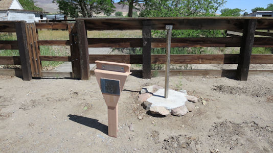
|
Details of the marker ...
|
... and PE picture
|
Buckland's informative signage
|
The old house on the trails
|
Dayton T-Bar
|
Details on the trail ...
|
... and the logo
|
Success!
|
Kinda sorta see the trail?
|
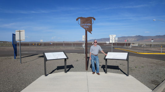
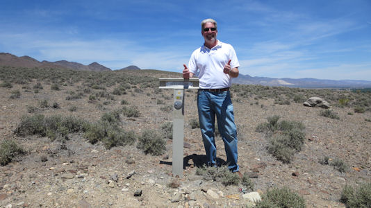
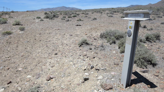
5/22/2015 Heading out of town we tried unsuccessfully to find where the California NHT crossed, then stopped
at a very cool LH stone bridge below, and next to, the modern road. As we pulled into the parking for the bridge, a few feet away
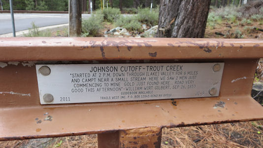
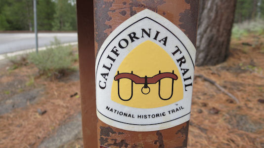
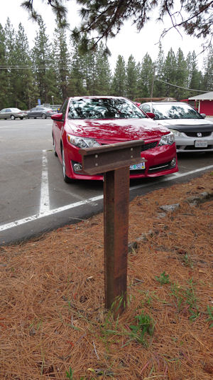
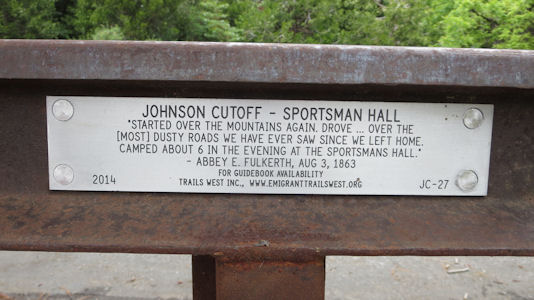
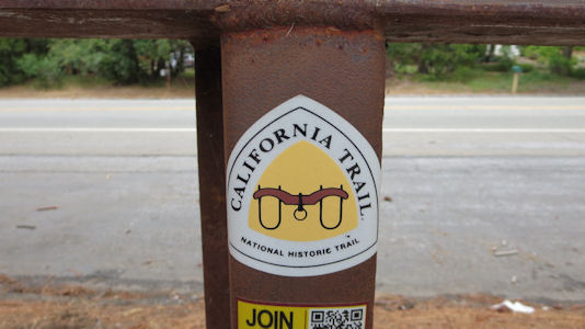
right in front of the car was - a T-bar for the California trail! ... Sportsman’s Hall PE Station. Once again, as we pulled into
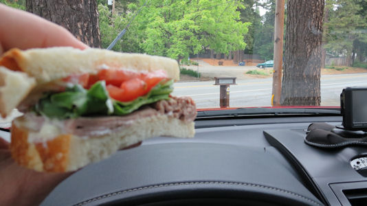
the parking spot where we would take our photos and eat our lunch, we saw a T-bar for the California NHT.
Ken and me by the T-bar ...
|
... and a close-up
|
The historical info ...
|
... and the emblem
|
Lunch on the trail!
|
The T-bar and our car
|
Historical info ...
|
... and the same emblem
|
5/31/2019 Pony Express National Historic Trail
6/1/2019 Oregon National Historic Trail
5/26/2021 Oregon National Historic Trail
9/22/2023 City of Rocks National Reserve
9/23/2023 Massacre Rocks State Park
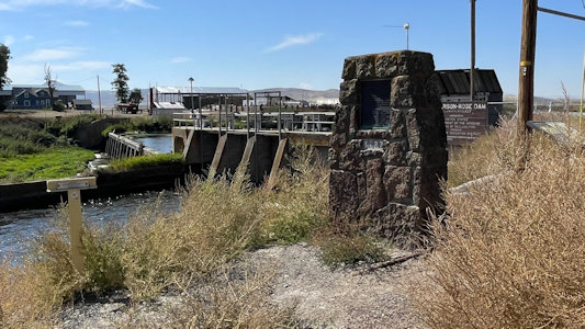
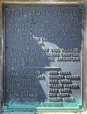
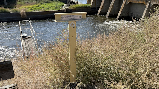
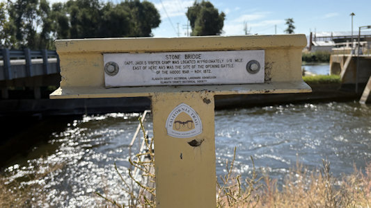
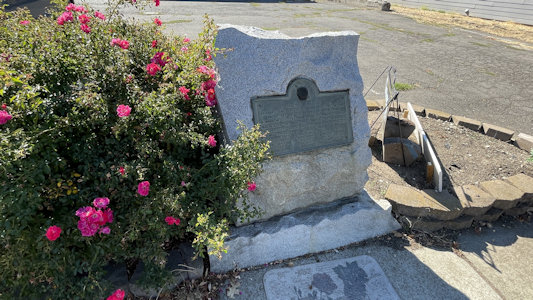
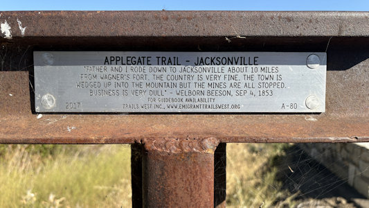
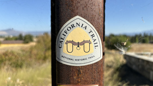
9/25/2025 DAR Stone Bridge. The Stone Bridge - On July Sixth 1846 fifteen pioneers who located the South Road from Fort
Hale to the Willamette Valley crossed Lost River on the ledge underlying this dam. Here there was also a California NHT T-bar. ... DAR Applegate
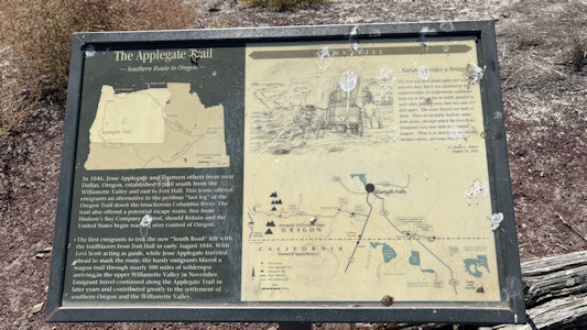
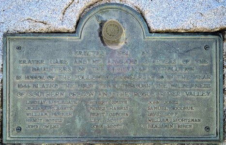
Trail Pioneers. In Honor of the Following Pioneers who in the Year 1846; blazed the First Trail Through the Wilderness of Southern Oregon and the
Rogue River Valley. The perilous last leg of the Oregon Trail down the Columbia River rapids took lives, including the sons of Jesse and Lindsay
Applegate in 1843. The Applegate brothers and others vowed to look for an all-land route into Oregon from Fort Hall (in present-day Idaho) for future
settlers. This Applegate Trail is part of the California National Historic Trail. ... DAR Old Stage Road.
The Old Stage Road - Along This Road Passed the Early Day Travel of Oregon. The Old Stage Road was previously known as the Applegate Trail utilized by
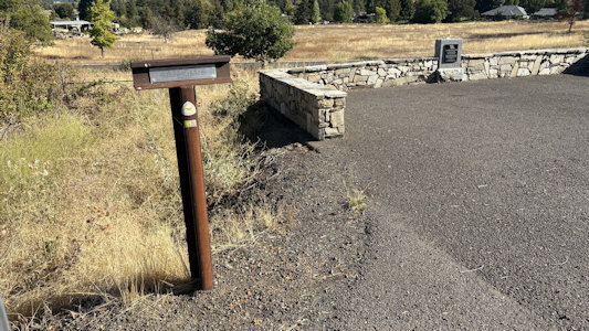
pioneer emigrants as an alternate wagon route into southern Oregon in 1846 and continued to be utilized by emigrants through 1869. the marker called
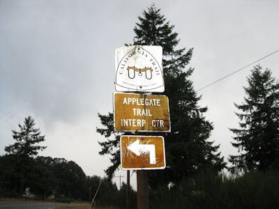
attention to early travel by stagecoach from Jacksonville to Rock Point near Gold Hill. The 13-mile road is the oldest in Jackson County. Another T-bar
here for the Applegate Trail on the California NHT. ... Wolf Creek Inn State Historic Site
The Stone Bridge DAR site ...
|
... and plaque
|
Right at the bridge ...
|
... the NHT T-bar ...
|
... with detail
|
Applegate Trail info
|
Applegate Trail Pioneers DAR site ...
|
... with plaque
|
Old Stage Road DAR site ...
|
... with T-bar ...
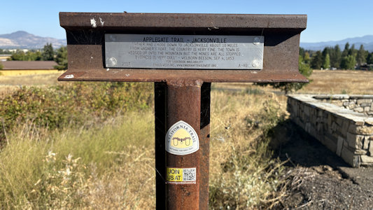
|
... details ...
|
... and emblem
|
Captain John Smith Chesapeake National Historic Trail (Virginia, Maryland, Delaware, District of Columbia, Pennsylvania, New York)
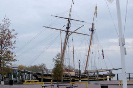
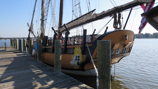
11/8/2008 Drove to Annapolis and parked by the City Dock. Did a little shopping, then walked around
the Dock area, which is in the John Smith Chesapeake NHT [MD] [and Chesapeake Bay Gateways Network and Colonial Annapolis Historic District].
A tall ship at the dock
|
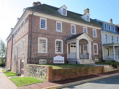
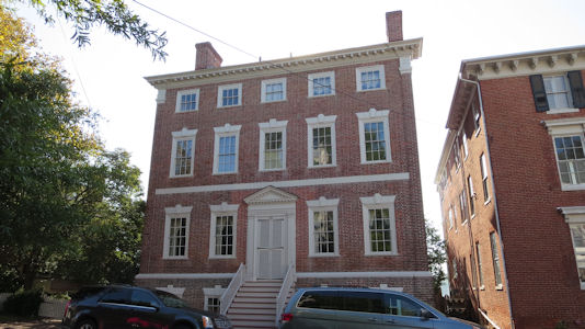
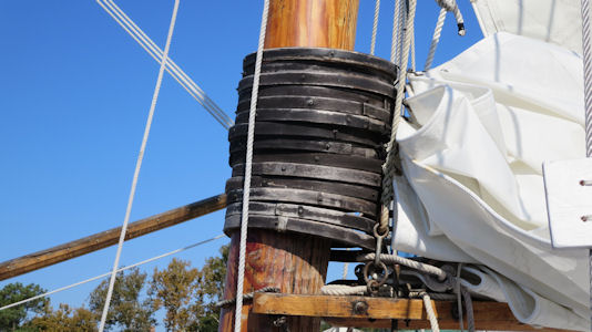
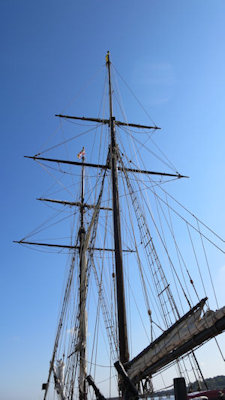
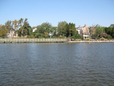
9/20/2014 On the road west into Maryland to Chestertown and parked near the Chester River. We checked out the
Custom House and a couple of homes on a very quaint street, part of the Chestertown NHLD. This was the chief port for tobacco and wheat
on the Eastern Shore of Maryland between 1750 and 1790, and has a collection of more than fifty Georgian style town houses. We walked
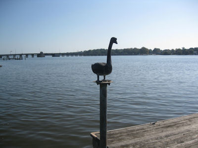
down to and along the river (on the Chester River Water Trail) on a gorgeous day and enjoyed checking out the Schooner Sultana and others.
This area is on the Captain John Smith Chesapeake NHT [MD], and in the Chesapeake Bay Gateways and Watertrails Network.
The Custom House
|
One of many pretty homes
|
A sentry by the dock
|
Inofrmative signage ...
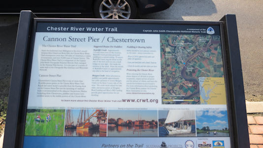
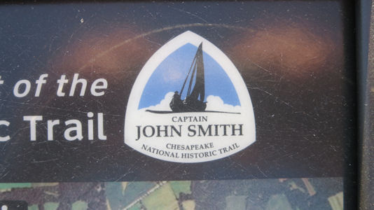
|
... with Trail logo
|
The Sultana
|
Cool details
|
Lots of rigging
|
A view of the shoreline
|
10/17/2016 Patapsco Valley State Park
10/22/2023 Susquehanna National Heritage Area
El Camino Real De Los Tejas National Historic Trail (Texas, Louisiana)
5/14/2008 Fort Jesup State Historic Site
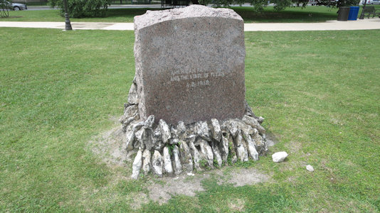
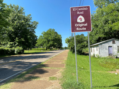
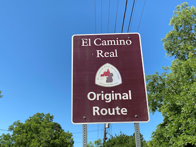
4/13/2018 El Camino Real de los Tejas NHT Marker. In the early 1900s the Daughters of the American Revolution (DAR) executed a project to
commemorate the trail by placing granite markers approximately every five miles along the trail. The
San Antonio missions are also along the NHT. ...
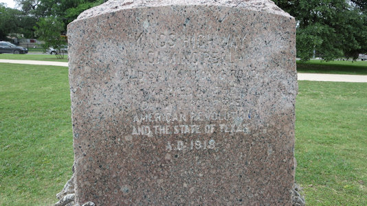
El Camino Real de los Tejas NHT. This was another of the many DAR markers, and not knowing we’d spot the earlier one, Ken had researched this one located
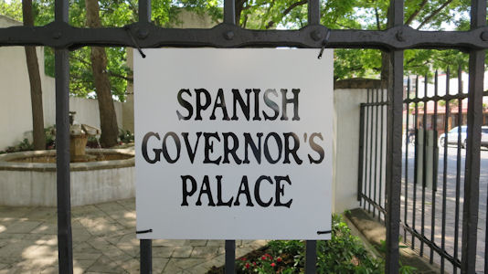
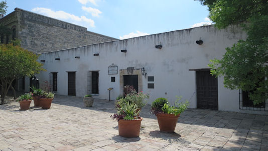
in the very nice San Pedro Springs Park. ... Spanish Governor’s Palace NHL. The last visible trace of the Presidio San Antonio de Bexar, which protected five
missions and a civil settlement, and the only remaining example in Texas of an aristocratic 18th-century Spanish Colonial town house. This is also on the Camino Real NHT [TX].
A marker ...
|
... near the mission
|
Another marker ...
|
... in San Pedro Springs Park
|
A sign for ...
|
... the NHL
|
6/5/2022
Fort Jesup State Historic Site
Los Adaes State Historic Site
Cane River National Heritage Area
On the way to Fort Jesup ...
|
... the NHT sign
|
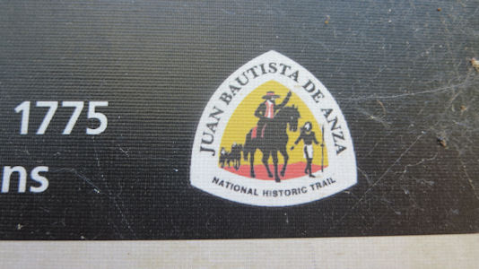
Juan Bautista de Anza National Historic Trail (Arizona, California)
5/22/1999 Tumacacori National Historical Park
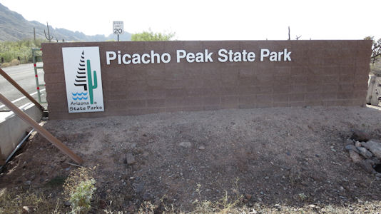
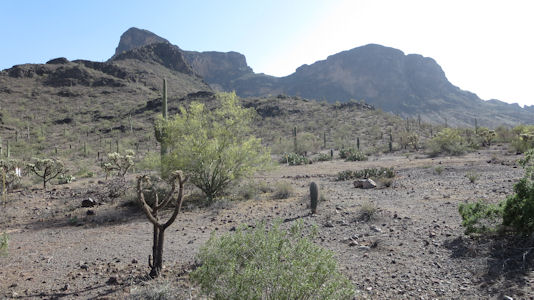
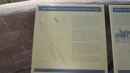
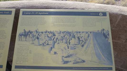
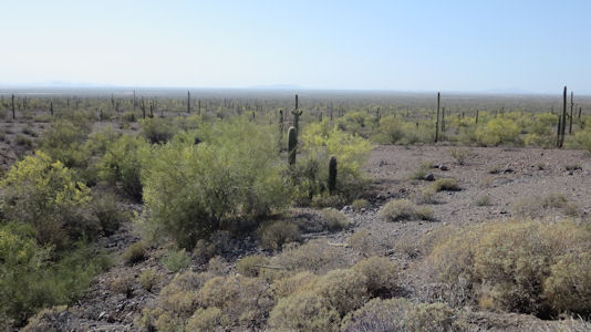
4/30/2014 Continuing south I got off into Picacho Peak State Park. This is a nice park at the base of, well,
Picacho Peak, with Saguaro and other cactus all over. I parked at the end of the park road for a site on the Juan Bautista de Anza NHT [AZ] –
Camp 21, at El Aquituni, a known watering spot.
The State Park sign
|
The eponymous Peak
|
One sign pane of Trail info ..
|
... and another
|
A look out over the trail area
|
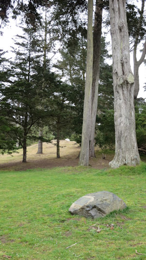
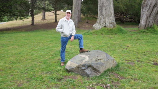
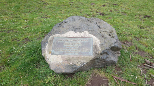
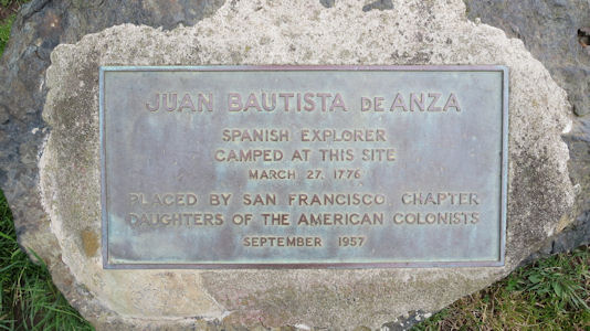
5/24/2015 Presidio of San Francisco In an effort to get something more official for the NHT,
we drove a short way and, after some creative tight parking and a short walk in a park, found a plaque about a JBdA campground.
The rock in the park
|
Me staking claim
|
The rock ...
|
... and historical info plaque
|
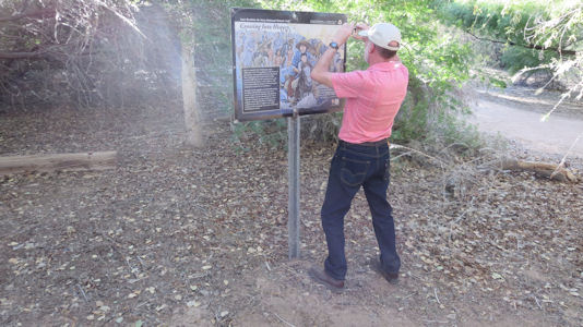
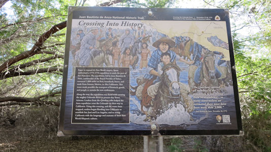
4/7/2019 Sonoran Desert National Monument ...
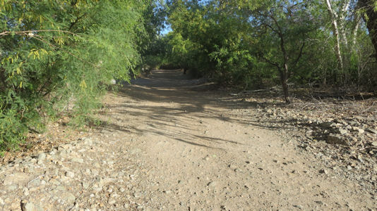
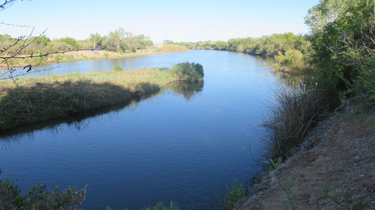
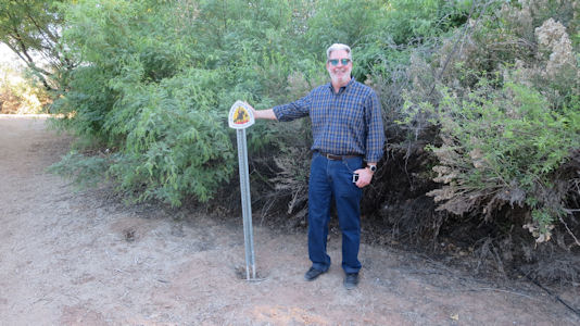
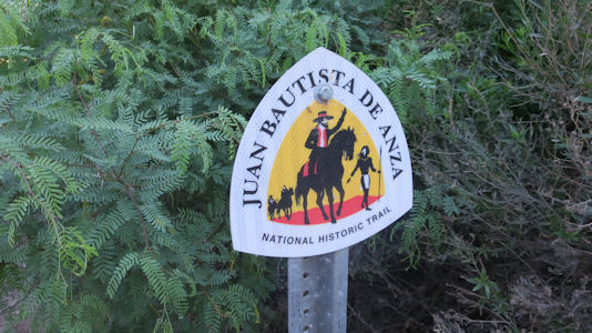
We stopped at Riverside Park and took a nice trail along the Colorado River which coincided with the Juan Bautista
de Anza NHT [AZ], including some signage from the NPS and a good official blaze.
Me photoing the ...
|
... interpretive signage ...
|
... including NPS
|
Along the trail
|
A view of the Colorado
|
Ken with ...
|
... a trail blaze
|